
Search
found 167 results
Images for university; more images...

Earthquake simulator being developed at Canterbury University
Audio, Radio New Zealand
An earthquake simulator designed to help people get over their fear of quakes is being developed at Canterbury University.
Lifeline systems interdependencies: the insurance perspective
Videos, UC QuakeStudies
A video of a presentation by Indranil Kongar of University College London on "Lifeline systems interdependencies: the insurance perspective". The presentation was delivered at the learning forum on Interdependencies of Lifeline Systems as part of the University of Canterbury's Lifeline Week.
Digital Archive of Christchurch's Earthquakes
Audio, Radio New Zealand
The University of Canterbury's CEISMIC project is building a digital archive of earthquake-related information
Modelling seismic vulnerability and resilience of interconnected infrastuc…
Videos, UC QuakeStudies
A video of a presentation by Assistant Professor Paolo Franchin of Sapienza University of Rome on "Modelling seismic vulnerability and resilience of interconnected infrastuctural systems". The presentation was delivered at the learning forum on Interdependencies of Lifeline Systems as part of the University of Canterbury's Lifeline Week.
Christchurch: The Transitional City Pt IV, pages 92-93: Kirkwood Village U…
Articles, UC QuakeStudies
A PDF copy of pages 92-93 of the book Christchurch: The Transitional City Pt IV. The pages document the transitional project 'Kirkwood Village University of Canterbury'. Photos: Heather Hayward
Organisational and Economic Resilience
Videos, UC QuakeStudies
A video of a presentation by Dr Erica Seville of the University of Canterbury's Department of Civil and Natural Resources Engineering on "Organisational and Economic Resilience". The presentation was delivered at the Learning from Lifeline Week and Planning Collaborations forum as part of the University of Canterbury's Lifeline Week.
System Resilience: Probabilistic scenario-based approach for prioritising …
Videos, UC QuakeStudies
A video of a presentation by Professor Rachel A. Davidson of the University of Delaware on "System Resilience: Probabilistic scenario-based approach for prioritising mitigation-strategies". The presentation was delivered at the Learning from Lifeline Week and Planning Collaborations forum as part of the University of Canterbury's Lifeline Week.
Learning and planning collaboration on "Inderdependencies of Lifeline Syst…
Videos, UC QuakeStudies
A video of a presentation by Associate Professor Leonardo Duenas-Osorio of Rice University in Texas on "Learning and planning collaboration on 'Inderdependencies of Lifeline Systems' workshop". The presentation was delivered at the Learning from Lifeline Week and Planning Collaborations forum as part of the University of Canterbury's Lifeline Week.
On-going and planned activities of the TCLEE Lifeline Systems Interdepende…
Videos, UC QuakeStudies
A video of a presentation by Associate Professor Leonardo Duenas-Osorio of Rice University in Texas on "On-going and planned activities of the TCLEE Lifeline Systems Interdependence Committee". The presentation was delivered at the learning forum on Interdependencies of Lifeline Systems as part of the University of Canterbury's Lifeline Week.
Christchurch: The Transitional City Pt IV, pages 368-369: Transitional Cit…
Articles, UC QuakeStudies
A PDF copy of pages 368-369 of the book Christchurch: The Transitional City Pt IV. The pages document the transitional project 'Transitional City Audio Tour (The People's Perspective)'. Photos: Ryan Reynolds
Christchurch: The Transitional City Pt IV, pages 232-233: SVA - The Clean …
Articles, UC QuakeStudies
A PDF copy of pages 232-233 of the book Christchurch: The Transitional City Pt IV. The pages document the transitional project 'SVA - The Clean Up'. Photos: Peter Walker, Three Chairs Photography. With permission from Volunteer Army Foundation.
Christchurch: The Transitional City Pt IV, pages 336-337: Green Frame Exhi…
Articles, UC QuakeStudies
A PDF copy of pages 336-337 of the book Christchurch: The Transitional City Pt IV. The pages document the transitional project 'Green Frame Exhibition'.
Andy Buchanan - timber and earthquakes
Audio, Radio New Zealand
Professor of Timber Design at the University of Canterbury, who is playing a key role in the international resurgence in the use of timber for large-scale buildings.
Christchurch: The Transitional City Pt IV, pages 240-241: UCSA Events Cent…
Articles, UC QuakeStudies
A PDF copy of pages 240-241 of the book Christchurch: The Transitional City Pt IV. The pages document the transitional project 'UCSA Events Centre'. Photos: Douglas Horrell
Crisis Leadership in an Acute Clinical Setting: Christchurch Hospital ICU …
Articles, UC QuakeStudies
A dissertation by Lev Zhuravsky submitted as partial fulfillment of the requirements for the degree of Master of Health Sciences Endorsed in Health Management, University of Otago, Dunedin, New Zealand.
'Have we really learnt the hard lessons?': address by Dr Ann Brower
Videos, UC QuakeStudies
A public talk by Dr Ann Brower, Senior Lecturer at Lincoln University. This talk, entitled 'Have we learnt the hard lessons?', formed part of the Plenary Two session, 'Clearing the decks'.
Christchurch: The Transitional City Pt IV, pages 50-51: LUXCITY
Articles, UC QuakeStudies
A PDF copy of pages 50-51 of the book Christchurch: The Transitional City Pt IV. The pages document the transitional project 'LUXCITY'. Photographs: Bridget Anderson and Douglas Horrell
Stable isotopes as indicators of nitrate attenuation across landscapes
Research papers, Lincoln University
Mitigating the cascade of environmental damage caused by the movement of excess reactive nitrogen (N) from land to sea is currently limited by difficulties in precisely and accurately measuring N fluxes due to variable rates of attenuation (denitrification) during transport. This thesis develops the use of the natural abundance isotopic composition of nitrate (δ15N and δ18O of NO₃-) to integrate the spatialtemporal variability inherent to denitrification, creating an empirical framework for evaluating attenuation during land to water NO₃- transfers. This technique is based on the knowledge that denitrifiers kinetically discriminate against 'heavy' forms of both N and oxygen (O), creating a parallel enrichment in isotopes of both species as the reaction progresses. This discrimination can be quantitatively related to NO₃- attenuation by isotopic enrichment factors (εdenit). However, while these principles are understood, use of NO₃- isotopes to quantify denitrification fluxes in non-marine environments has been limited by, 1) poor understanding of εdenit variability, and, 2) difficulty in distinguishing the extent of mixing of isotopically distinct sources from the imprint of denitrification. Through a combination of critical literature analysis, mathematical modelling, mesocosm to field scale experiments, and empirical studies on two river systems over distance and time, these short comings are parametrised and a template for future NO₃- isotope based attenuation measurements outlined. Published εdenit values (n = 169) are collated in the literature analysis presented in Chapter 2. By evaluating these values in the context of known controllers on the denitrification process, it is found that the magnitude of εdenit, for both δ15N and δ18O, is controlled by, 1) biology, 2) mode of transport through the denitrifying zone (diffusion v. advection), and, 3) nitrification (spatial-temporal distance between nitrification and denitrification). Based on the outcomes of this synthesis, the impact of the three factors identified as controlling εdenit are quantified in the context of freshwater systems by combining simple mathematical modelling and lab incubation studies (comparison of natural variation in biological versus physical expression). Biologically-defined εdenit, measured in sediments collected from four sites along a temperate stream and from three tropical submerged paddy fields, varied from -3‰ to -28‰ depending on the site’s antecedent carbon content. Following diffusive transport to aerobic surface water, εdenit was found to become more homogeneous, but also lower, with the strength of the effect controlled primarily by diffusive distance and the rate of denitrification in the sediments. I conclude that, given the variability in fractionation dynamics at all levels, applying a range of εdenit from -2‰ to -10‰ provides more accurate measurements of attenuation than attempting to establish a site-specific value. Applying this understanding of denitrification's fractionation dynamics, four field studies were conducted to measure denitrification/ NO₃- attenuation across diverse terrestrial → freshwater systems. The development of NO₃- isotopic signatures (i.e., the impact of nitrification, biological N fixation, and ammonia volatilisation on the isotopic 'imprint' of denitrification) were evaluated within two key agricultural regions: New Zealand grazed pastures (Chapter 4) and Philippine lowland submerged rice production (Chapter 5). By measuring the isotopic composition of soil ammonium, NO₃- and volatilised ammonia following the bovine urine deposition, it was determined that the isotopic composition of NO₃ - leached from grazed pastures is defined by the balance between nitrification and denitrification, not ammonia volatilisation. Consequently, NO₃- created within pasture systems was predicted to range from +10‰ (δ15N)and -0.9‰ (δ18O) for non-fertilised fields (N limited) to -3‰ (δ15N) and +2‰ (δ18O) for grazed fertilised fields (N saturated). Denitrification was also the dominant determinant of NO₃- signatures in the Philippine rice paddy. Using a site-specific εdenit for the paddy, N inputs versus attenuation were able to be calculated, revealing that >50% of available N in the top 10 cm of soil was denitrified during land preparation, and >80% of available N by two weeks post-transplanting. Intriguingly, this denitrification was driven by rapid NO₃- production via nitrification of newly mineralised N during land preparation activities. Building on the relevant range of εdenit established in Chapters 2 and 3, as well as the soil-zone confirmation that denitrification was the primary determinant of NO₃- isotopic composition, two long-term longitudinal river studies were conducted to assess attenuation during transport. In Chapter 6, impact and recovery dynamics in an urban stream were assessed over six months along a longitudinal impact gradient using measurements of NO₃- dual isotopes, biological populations, and stream chemistry. Within 10 days of the catastrophic Christchurch earthquake, dissolved oxygen in the lowest reaches was <1 mg l⁻¹, in-stream denitrification accelerated (attenuating 40-80% of sewage N), microbial biofilm communities changed, and several benthic invertebrate taxa disappeared. To test the strength of this method for tackling the diffuse, chronic N loading of streams in agricultural regions, two years of longitudinal measurements of NO₃- isotopes were collected. Attenuation was negatively correlated with NO₃- concentration, and was highly dependent on rainfall: 93% of calculated attenuation (20 kg NO₃--N ha⁻¹ y⁻¹) occurred within 48 h of rainfall. The results of these studies demonstrate the power of intense measurements of NO₃- stable isotope for distinguishing temporal and spatial trends in NO₃ - loss pathways, and potentially allow for improved catchment-scale management of agricultural intensification. Overall this work now provides a more cohesive understanding for expanding the use of NO₃- isotopes measurements to generate accurate understandings of the controls on N losses. This information is becoming increasingly important to predict ecosystem response to future changes, such the increasing agricultural intensity needed to meet global food demand, which is occurring synergistically with unpredictable global climate change.
Multi-scale influences of abiotic factors on alpine treelines
Research papers, Lincoln University
Globally, the maximum elevations at which treelines are observed to occur coincide with a 6.4 °C soil isotherm. However, when observed at finer scales, treelines display a considerable degree of spatial complexity in their patterns across the landscape and are often found occurring at lower elevations than expected relative to the global-scale pattern. There is still a lack of understanding of how the abiotic environment imposes constraints on treeline patterns, the scales at which different effects are acting, and how these effects vary over large spatial extents. In this thesis, I examined abrupt Nothofagus treelines across seven degrees of latitude in New Zealand in order to investigate two broad questions: (1) What is the nature and extent of spatial variability in Nothofagus treelines across the country? (2) How is this variation associated with abiotic variation at different spatial scales? A range of GIS, statistical, and atmospheric modelling methods were applied to address these two questions. First, I characterised Nothofagus treeline patterns at a 15x15km scale across New Zealand using a set of seven, GIS-derived, quantitative metrics that describe different aspects of treeline position, shape, spatial configuration, and relationships with adjacent vegetation. Multivariate clustering of these metrics revealed distinct treeline types that showed strong spatial aggregation across the country. This suggests a strong spatial structuring of the abiotic environment which, in turn, drives treeline patterns. About half of the multivariate treeline metric variation was explained by patterns of climate, substrate, topographic and disturbance variability; on the whole, climatic and disturbance factors were most influential. Second, I developed a conceptual model that describes how treeline elevation may vary at different scales according to three categories of effects: thermal modifying effects, physiological stressors, and disturbance effects. I tested the relevance of this model for Nothofagus treelines by investigating treeline elevation variation at five nested scales (regional to local) using a hierarchical design based on nested river catchments. Hierarchical linear modelling revealed that the majority of the variation in treeline elevation resided at the broadest, regional scale, which was best explained by the thermal modifying effects of solar radiation, mountain mass, and differences in the potential for cold air ponding. Nonetheless, at finer scales, physiological and disturbance effects were important and acted to modify the regional trend at these scales. These results suggest that variation in abrupt treeline elevations are due to both broad-scale temperature-based growth limitation processes and finer-scale stress- and disturbance-related effects on seedling establishment. Third, I explored the applicability of a meso-scale atmospheric model, The Air Pollution Model (TAPM), for generating 200 m resolution, hourly topoclimatic data for temperature, incoming and outgoing radiation, relative humidity, and wind speeds. Initial assessments of TAPM outputs against data from two climate station locations over seven years showed that the model could generate predictions with a consistent level of accuracy for both sites, and which agreed with other evaluations in the literature. TAPM was then used to generate data at 28, 7x7 km Nothofagus treeline zones across New Zealand for January (summer) and July (winter) 2002. Using mixed-effects linear models, I determined that both site-level factors (mean growing season temperature, mountain mass, precipitation, earthquake intensity) and local-level landform (slope and convexity) and topoclimatic factors (solar radiation, photoinhibition index, frost index, desiccation index) were influential in explaining variation in treeline elevation within and among these sites. Treelines were generally closer to their site-level maxima in regions with higher mean growing season temperatures, larger mountains, and lower levels of precipitation. Within sites, higher treelines were associated with higher solar radiation, and lower photoinhibition and desiccation index values, in January, and lower desiccation index values in July. Higher treelines were also significantly associated with steeper, more convex landforms. Overall, this thesis shows that investigating treelines across extensive areas at multiple study scales enables the development of a more comprehensive understanding of treeline variability and underlying environmental constraints. These results can be used to formulate new hypotheses regarding the mechanisms driving treeline formation and to guide the optimal choice of field sites at which to test these hypotheses.
The Aranui/Hampshire Paradox: Planning and the politics of street naming i…
Research papers, Lincoln University
As far as suburbs with bad reputations go, Aranui in Christchurch often seems to dominate local public perceptions. High crime, high unemployment, low incomes, run-down state houses and uncared-for neighbourhoods have been the key words and phrases used over many decades. This reputation achieved national standing over the same period and in 2001 Aranui gained the dubious distinction of becoming the pilot project for the Labour Government’s state housing Community Renewal Programme initiated in 2001. It is common to read “Don’t buy or rent here” comments on websites and blogs advising prospective immigrants on where to live. One of the dispiriting moments in Aranui’s history came in September 2009 with the discovery of two bodies under the floorboards of a Hampshire Street property and the subsequent charge of double-homicide and conviction of local resident Jason Somerville for the murder of his wife Rebecca Chamberlain and neighbour Tisha Lowry.
Law with Toni Collins
Audio, Radio New Zealand
Toni Collins is a Canterbury University PhD researcher in law, who is investigating how commercial leases could be written to better deal with the aftermath of earthquakes, and how cases of disputes could progress through the courts.
Modelling interdependencies of critical infrastructure
Videos, UC QuakeStudies
A video of a presentation by Dr Rob Buxton of GNS Science on "Modelling interdependencies of critical infrastructure". The presentation was delivered at the learning forum on Interdependencies of Lifeline Systems as part of the University of Canterbury's Lifeline Week.
Economics of Infrastructure Resilience EoRI project
Videos, UC QuakeStudies
A video of a presentation by Michelle Daly of GNS Science on the "Economics of Infrastructure Resilience EoRI project". The presentation was delivered at the learning forum on Interdependencies of Lifeline Systems as part of the University of Canterbury's Lifeline Week.
How tough should earthquake strengthening requirements be?
Audio, Radio New Zealand
With Adrian Regnault, the General Manager of Building Systems Performance at the Ministry of Business, Innovation and Employment; Stefano Pampanin, an Associate Professor in Structural Engineering at Canterbury University and the President of the NZ Society for Earthquake Engineering and John Finnegan - structural engineer, Aurecon.
The Natural Hazards Research Platform and National Science Challenge
Videos, UC QuakeStudies
A video of a presentation by Andrew King of GNS Science on "The Natural Hazards Research Platform and National Science Challenge". The presentation was delivered at the Learning from Lifeline Week and Planning Collaborations forum as part of the University of Canterbury's Lifeline Week.
Interdependency issues and on the role of prepareness and awareness and re…
Videos, UC QuakeStudies
A video of a presentation by Tony Fenwick on "Interdependency issues and on the role of prepareness and awareness and reducing them". The presentation was delivered at the learning forum on Interdependencies of Lifeline Systems as part of the University of Canterbury's Lifeline Week.
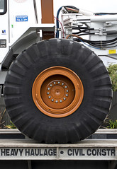
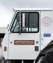
20130328_1148_EOS M-49 T-Rex may have visited
Images, eqnz.chch.2010
The seismic survey truck T-Rex (from University of Texas) was in Bexley and Pacific Park a few days ago and may have left this calling card on the front lawn of my old "red zone" house. Obviously the geotechs will know what it means.
Canta Volume 84 Issue 16, 31 July 2013
Articles, UC QuakeStudies
Canta Magazine Volume 84 Issue 16 from 31 July 2013.
Canta Volume 84 Issue 9, 8 May 2013
Articles, UC QuakeStudies
Canta Magazine Volume 84 Issue 9 from 8 May 2013.
Canta Volume 84 Issue 10, 15 May 2013
Articles, UC QuakeStudies
Canta Magazine Volume 84 Issue 10 from 15 May 2013.