
Search
found 26 results
Images for Faults (Geology)--New Zealand--Canterbury; more images...

The Porters Pass fault
Research papers, University of Canterbury Library
A zone of active tectonism occurs in mid and north Canterbury, from the Rakaia to the Waipara Rivers, which coincides with seismicity concentrations and several Quaternary surface anomalies and is here defined as the Porters Pass Tectonic Zone. Although parallel to the Marlborough faults to the north, the lack of regional definition suggests this zone is much younger in its inception reflecting a southward movement of the plate rotation vector. The objectives of this study were to map the structures associated with this zone in the segment between the Rakaia and Waimakariri Rivers with detailed analysis concentrated in the upper Kawai Valley. Quaternary offsets on the main lineament of the Porters Pass Fault were traced through the area and evidence for the rate of movement, probable magnitudes and return periods of related seismic events was sought. The basement was found to be complicated by pre-existing deformation structures in Torlesse Group rocks which have been subsequently been re-activated or rotated by recent fault movement probably beginning in the Pleistocene. This phase is dominantly thrusting and uplift has lead to the erosion of most of the overlying sedimentary cover. Remnants of the Cret-Tertiary sediments still remain as fault-bounded packets. Evidence suggests that a change to development of a regional lateral shear associated with the Porters Pass Tectonic Zone transects the thrust system with complex interaction between the older reverse and new strike-slip faults. Offset rates along the segments of the Porters Pass Fault are not well constrained but are believed to be approximately in the range of 11-13 mm/year for at least the last 130,000 years. This rate is similar to other large faults in the Marlborough region. Two earthquake events have been identified and dated at 600 and 2000 years ago, with a magnitude of greater than 6.5. Evidence suggests characteristic earthquakes along the Porters Pass Fault are greater than Magnitude 7. This result has some major ramifications for the expected seismic hazards for nearby Christchurch.
Fault rupture patterns during the Mw7.8 2016 Kaikoura Earthquake in the re…
Research papers, University of Canterbury Library
Surface rupture and slip from the Mw 7.8 2016 Kaikōura Earthquake have been mapped in the region between the Leader and Charwell rivers using field mapping and LiDAR data. The eastern Humps, north Leader and Conway-Charwell faults ruptured the ground surface in the study area. The E-NE striking ‘The Humps’ Fault runs along the base of the Mt Stewart range front, appears to dip steeply NW and intersects the NNW-NNE Leader Fault which itself terminates northwards at the NE striking Conway-Charwell Fault. The eastern Humps Fault is up to the NW and accommodates oblique slip with reverse and right lateral displacement. Net slip on ‘The Humps’ Fault is ≤4 m and produced ≤4 m uplift of the Mt Stewart range during the earthquake. The Leader Fault strikes NNW-NNE with dips ranging from ~10° west to 80° east and accommodated ≤4 m net slip comprising left-lateral and up-to-the-west vertical displacement. Like the Humps west of the study area, surface-rupture of the Leader Fault occurred on multiple strands. The complexity of rupture on the Leader Fault is in part due to the occurrence of bedding-parallel slip within the Cretaceous-Cenozoic sequence. Although the Mt Stewart range front is bounded by ‘The Humps’ Fault, in the study area neither this fault nor the Leader Fault were known to have been active before the earthquake. Fieldwork and trenching investigations are ongoing to characterise the geometry, kinematics and paleoseismic history of the mapped active faults.
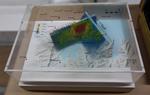
3-D Model: Greendale and Associated Faults
Images, Canterbury Museum
One oblong perspex covered 3-D model of the fault plains associated with the 4 September 2010 Darfield earthquake; top of the model also acts as a map overlay. Geologists continue to study the 4 September 2010 earthquake and consider it is likely to have been a complex event with several faults rupturing simultaneously. This model provides one ...
Preliminary geometry and kinematics of multiple surface ruptures during th…
Research papers, University of Canterbury Library
The Mw 7.8 Kaikōura earthquake ruptured ~200 km at the ground surface across the New Zealand plate boundary zone in the northern South Island. This study was conducted in an area of ~600 km2 in the epicentral region where the faults comprise two main non-coplanar sets that strike E-NE and NNE-NW with mainly steep dips (60о-80°). Analysis of the surface rupture using field and LiDAR data provides new information on the dimensions, geometries and kinematics of these faults which was not previously available from pre-earthquake active faults or bedrock structure. The more northerly striking fault set are sub-parallel to basement bedding and accommodated predominantly left-lateral reverse slip with net slips of ~1 and ~5 m for the Stone Jug and Leader faults, respectively. The E-NE striking Conway-Charwell and The Humps faults accrued right-lateral to oblique reverse with net slips of ~2 and ~3 m, respectively. The faults form a hard-linked system dominated by kinematics consistent with the ~260° trend of the relative plate motion vector and the transpressional structures recorded across the plate boundary in the NE South Island. Interaction and intersection of the main fault sets facilitated propagation of the earthquake and transfer of slip northwards across the plate boundary zone.
3-D Model: Port Hills Faults
Images, Canterbury Museum
One oblong perspex covered 3-D model of the fault plains that ruptured to cause the 22 February and 13 June 2011 earthquakes; top of the model also acts as a map overlay. This model provides a visual demonstration of the geological forces that caused the 22 February and 13 June 2011 earthquakes. These forces were so strong that parts of the Por...
Nisbet, Alistair, 1958- :"Is it my turn yet?" 7 June 2011
Images, Alexander Turnbull Library
Two huge wrestlers, one representing 'Port Hills fault' and the other 'Greendale fault' struggle together over a broken Christchurch. Another wrestler, representing 'Other faults' appears in the distance yelling 'Is it my turn yet?' Context - Christchurch has now had three major earthquakes and thousands of aftershocks. It now appears likely that the Christchurch quakes resulted from activity on a fault extending directly eastward from the Alpine fault that remained unknown until last year, says Roger Musson, a seismologist at the British Geological Survey in Edinburgh. The new fault first came to light last September (4th) when a stronger but less calamitous quake shook Darfield, 40 kilometres west of Christchurch. Musson says the latest quake (Feb 22, 2011) probably resulted from an eastward continuation of activity on the same fault. "It has probably not moved for tens of thousands of years, so lots of strain built up," says Musson. The third major quake happened on 13th June 2011. (New Scientist - February 22, 2011) Quantity: 1 digital cartoon(s).
The landscape record of blind fault earthquakes
Research papers, University of Canterbury Library
Active faults capable of generating highly damaging earthquakes may not cause surface rupture (i.e., blind faults) or cause surface ruptures that evade detection due to subsequent burial or erosion by surface processes. Fault populations and earthquake frequency-‐magnitude distributions adhere to power laws, implying that faults too small to cause surface rupture but large enough to cause localized strong ground shaking densely populate continental crust. The rupture of blind, previously undetected faults beneath Christchurch, New Zealand in a suite of earthquakes in 2010 and 2011, including the fatal 22 February 2011 moment magnitude (Mw) 6.2 Christchurch earthquake and other large aftershocks, caused a variety of environmental impacts, including major rockfall, severe liquefaction, and differential surface uplift and subsidence. All of these effects occurred where geologic evidence for penultimate effects of the same nature existed. To what extent could the geologic record have been used to infer the presence of proximal, blind and / or unidentified faults near Christchurch? In this instance, we argue that phenomena induced by high intensity shaking, such as rock fragmentation and rockfall, revealed the presence of proximal active faults in the Christchurch area prior to the recent earthquake sequence. Development of robust earthquake shaking proxy datasets should become a higher scientific priority, particularly in populated regions.
Strike-slip ground-surface rupture (Greendale Fault) associated with the 4…
Research papers, University of Canterbury Library
This paper provides a photographic tour of the ground-surface rupture features of the Greendale Fault, formed during the 4th September 2010 Darfield Earthquake. The fault, previously unknown, produced at least 29.5 km of strike-slip surface deformation of right-lateral (dextral) sense. Deformation, spread over a zone between 30 and 300 m wide, consisted mostly of horizontal flexure with subsidiary discrete shears, the latter only prominent where overall displacement across the zone exceeded about 1.5 m. A remarkable feature of this event was its location in an intensively farmed landscape, where a multitude of straight markers, such as fences, roads and ditches, allowed precise measurements of offsets, and permitted well-defined limits to be placed on the length and widths of the surface rupture deformation.
Nisbet, Alastair, 1958- :Parts of Canterbury still moving and settling...5…
Images, Alexander Turnbull Library
Under the caption, young people carrying their baggage flutter into the air, away from Canterbury and toward 'Oz'. In September GNS Earth Sciences reported that after the earthquakes, the Greendale and associated faults were still moving as they settled into a new configuration. At the same time the young were leaving Canterbury (and New Zealand) for a better future in Australia. The population of New Zealand was moving into a new configuration. Quantity: 1 digital cartoon(s).
Rethinking PSHA
Research papers, University of Canterbury Library
Since the early 1980s seismic hazard assessment in New Zealand has been based on Probabilistic Seismic Hazard Analysis (PSHA). The most recent version of the New Zealand National Seismic Hazard Model, a PSHA model, was published by Stirling et al, in 2012. This model follows standard PSHA principals and combines a nation-wide model of active faults with a gridded point-source model based on the earthquake catalogue since 1840. These models are coupled with the ground-motion prediction equation of McVerry et al (2006). Additionally, we have developed a time-dependent clustering-based PSHA model for the Canterbury region (Gerstenberger et al, 2014) in response to the Canterbury earthquake sequence. We are now in the process of revising that national model. In this process we are investigating several of the fundamental assumptions in traditional PSHA and in how we modelled hazard in the past. For this project, we have three main focuses: 1) how do we design an optimal combination of multiple sources of information to produce the best forecast of earthquake rates in the next 50 years: can we improve upon a simple hybrid of fault sources and background sources, and can we better handle the uncertainties in the data and models (e.g., fault segmentation, frequency-magnitude distributions, time-dependence & clustering, low strain-rate areas, and subduction zone modelling)? 2) developing revised and new ground-motion predictions models including better capturing of epistemic uncertainty – a key focus in this work is developing a new strong ground motion catalogue for model development; and 3) how can we best quantify if changes we have made in our modelling are truly improvements? Throughout this process we are working toward incorporating numerical modelling results from physics based synthetic seismicity and ground-motion models.
Surface rupture displacement on the Greendale Fault during the Mw 7.1 Darf…
Research papers, University of Canterbury Library
Surface rupture of the previously unrecognised Greendale Fault extended west-east for ~30 km across alluvial plains west of Christchurch, New Zealand, during the Mw 7.1 Darfield (Canterbury) earthquake of September 2010. Surface rupture displacement was predominantly dextral strike-slip, averaging ~2.5 m, with maxima of ~5 m. Vertical displacement was generally less than 0.75 m. The surface rupture deformation zone ranged in width from ~30 to 300 m, and comprised discrete shears, localised bulges and, primarily, horizontal dextral flexure. About a dozen buildings, mainly single-storey houses and farm sheds, were affected by surface rupture, but none collapsed, largely because most of the buildings were relatively flexible and resilient timber-framed structures and also because deformation was distributed over a relatively wide zone. There were, however, notable differences in the respective performances of the buildings. Houses with only lightly-reinforced concrete slab foundations suffered moderate to severe structural and non-structural damage. Three other buildings performed more favourably: one had a robust concrete slab foundation, another had a shallow-seated pile foundation that isolated ground deformation from the superstructure, and the third had a structural system that enabled the house to tilt and rotate as a rigid body. Roads, power lines, underground pipes, and fences were also deformed by surface fault rupture and suffered damage commensurate with the type of feature, its orientation to the fault, and the amount, sense and width of surface rupture deformation.
Patterns of Crustal Deformation Resulting from the 2010 Earthquake Sequenc…
Research papers, University of Canterbury Library
The Mw 7.1 Darfield earthquake generated a ~30 km long surface rupture on the Greendale Fault and significant surface deformation related to related blind faults on a previously unrecognized fault system beneath the Canterbury Plains. This earthquake provided the opportunity for research into the patterns and mechanisms of co-seismic and post-seismic crustal deformation. In this thesis I use multiple across-fault EDM surveys, logic trees, surface investigations and deformation feature mapping, seismic reflection surveying, and survey mark (cadastral) re-occupation using GPS to quantify surface displacements at a variety of temporal and spatial scales. My field mapping investigations identified shaking and crustal displacement-induced surface deformation features south and southwest of Christchurch and in the vicinity of the projected surface traces of the Hororata Blind and Charing Cross Faults. The data are consistent with the high peak ground accelerations and broad surface warping due to underlying reverse faulting on the Hororata Blind Fault and Charing Cross Fault. I measured varying amounts of post-seismic displacement at four of five locations that crossed the Greendale Fault. None of the data showed evidence for localized dextral creep on the Greendale Fault surface trace, consistent with other studies showing only minimal regional post-seismic deformation. Instead, the post-seismic deformation field suggests an apparent westward translation of northern parts of the across-fault surveys relative to the southern parts of the surveys that I attribute to post-mainshock creep on blind thrusts and/or other unidentified structures. The seismic surveys identified a deformation zone in the gravels that we attribute to the Hororata Blind Fault but the Charing Cross fault was not able to be identified on the survey. Cadastral re-surveys indicate a deformation field consistent with previously published geodetic data. We use this deformation with regional strain rates to estimate earthquake recurrence intervals of ~7000 to > 14,000 yrs on the Hororata Blind and Charing Cross Faults.
Liquefaction features produced by the 2010-2011 Canterbury earthquake sequ…
Research papers, Lincoln University
Liquefaction features and the geologic environment in which they formed were carefully studied at two sites near Lincoln in southwest Christchurch. We undertook geomorphic mapping, excavated trenches, and obtained hand cores in areas with surficial evidence for liquefaction and areas where no surficial evidence for liquefaction was present at two sites (Hardwick and Marchand). The liquefaction features identified include (1) sand blows (singular and aligned along linear fissures), (2) blisters or injections of subhorizontal dikes into the topsoil, (3) dikes related to the blows and blisters, and (4) a collapse structure. The spatial distribution of these surface liquefaction features correlates strongly with the ridges of scroll bars in meander settings. In addition, we discovered paleoliquefaction features, including several dikes and a sand blow, in excavations at the sites of modern liquefaction. The paleoliquefaction event at the Hardwick site is dated at A.D. 908-1336, and the one at the Marchand site is dated at A.D. 1017-1840 (95% confidence intervals of probability density functions obtained by Bayesian analysis). If both events are the same, given proximity of the sites, the time of the event is A.D. 1019-1337. If they are not, the one at the Marchand site could have been much younger. Taking into account a preliminary liquefaction-triggering threshold of equivalent peak ground acceleration for an Mw 7.5 event (PGA7:5) of 0:07g, existing magnitude-bounded relations for paleoliquefaction, and the timing of the paleoearthquakes and the potential PGA7:5 estimated for regional faults, we propose that the Porters Pass fault, Alpine fault, or the subduction zone faults are the most likely sources that could have triggered liquefaction at the study sites. There are other nearby regional faults that may have been the source, but there is no paleoseismic data with which to make the temporal link.
Canterbury Earthquake 7.1
Images, eqnz.chch.2010
Rolleston/Burnham, South Island, NZ It's been a busy few weeks! Was away on geology fieldtrips all the previous two weeks, then on Saturday morning 4th September 2010 at 4.35 am we got woken in Westport to a reasonable but very long earthquake. My husband was back in Christchurch at the time and texted me saying "are you ok?". I replied, "yes!"...
Structure, seismicity and tectonics of the Porter's Pass-Amberley fault zo…
Research papers, University of Canterbury Library
The Porter's Pass-Amberley Fault Zone (PPAFZ) is a complex zone of anastomosing faults and folds bounding the south-eastern edge of the transition from subducting Pacific Plate to continental collision on the Australia Plate boundary. This study combines mapping of a 2000 km2 zone from the Southern Alps northeast to the coast near Amberley, 40 km north of metropolitan Christchurch, with an analysis of seismicity and a revision of regional seismic hazard. Three structural styles: 1) a western strike-slip, and 2) a more easterly thrust and reverse domain, pass into 3) a northwest verging fold belt on the northern Canterbury Plains, reflecting the structural levels exposed and the evolving west to east propagation. Basal remnants of a Late Cretaceous-Cenozoic, largely marine sedimentary cover sequence are preserved as outliers that unconformably overlie Mesozoic basement (greywacke and argillite of the Torlesse terrain) in the mountains of the PPAFZ and are underlain by a deeply leached zone which is widely preserved. Structure contouring of the unconformity surface indicates maximum, differential uplift of c.2600 m in the southwest, decreasing to c.1200 m in the coastal fold belt to the northeast. Much lower rates (or reversal) of uplift are evident a few kilometres southeast of the PPAFZ range-front escarpment. The youngest elements of the cover sequence are basement-derived conglomerates of Plio-Pleistocene age preserved on the SE margin. The source is more distant than the intervening mountains of the PPAFZ, probably from the Southern Alps, to the west and northwest. The absence of another regional unconformity on Mesozoic basement, older than Pleistocene, indicates that this uplift is post-Pliocene. Late Pleistocene(<100 kyr) differential uplift rates of c.0.5-2.7 m/kyr from uplifted marine terraces at the east coast, and rates of 2.5-3.3 m/kyr for tectonically-induced river-down cutting further west, suggest that uplift commenced locally during the last 1 Ma, and possibly within the last 0.5 Ma, if average rates are assumed to be uniform over time. Analysis of seismicity, recorded during a 10 week regional survey of micro earthquakes in 1990, identified two seismic zones beneath North Canterbury: 1) a sub-horizontal zone of activity restricted to the upper crust (≤12 km); and 2) a seismic zone in the lower crust (below a ceiling of ≤17 km), that broadens vertically to the north and northwest to a depth of c.40 km, with a bottom edge which dips 10°N and 15°NW, respectively. No events were recorded at depths between 12 km and 17 km, which is interpreted as a relatively aseismic, mid-crustal ductile layer. Marked differences (up to 60°) in the trend of strain axes for events above and below the inferred ductile layer are observed only north of the PPAFZ. A fundamental, north-to-south increase in the Wave-length of major geological structures occurs across the PPAFZ, and is interpreted as evidence that the upper crust beneath the Canterbury Plains is coupled to the lower crust, whereas the upper crust further north is not. Most of the recorded micro earthquakes <12 km deep beneath the PPAFZ have strike-slip mechanisms. It is probable that faults splay upward into the thrusts and folds at the surface as an evolving transpression zone in response to deep shear in basement. There have been no historic surface ruptures of the PPAFZ, but the zone has been characterised historically by frequent small earthquakes. Paleoseismic data (dated landslides and surface ruptures) compiled in this study, indicate a return period of 1500-1900 years between the last two M>7-7.5 earthquakes, and 500-700 years have elapsed since the last. The magnitudes of these events are estimated at c.M7.5, which represents a probable maximum magnitude for the PPAFZ. There are insufficient data to determine whether or not the frequency of large earthquakes conforms to a recognised model of behaviour, but comparison of the paleoseismic data with the historic record of smaller earthquakes, suggests that the magnitudes of the largest earthquakes in this zone are not exponentially distributed. A seismicity model for the PPAFZ (Elder et al., 1991) is reviewed, and a b-value of 1.0 is found to be consistent with the newly acquired paleoseismic data. This b-value reduces the predicted frequency of large earthquakes (M≥7.0) in this zone by a factor of 3.5, while retaining a conservative margin that allows for temporal variations in the frequency of large events and the possibility that the geological database is incomplete, suggesting grounds for revising the hazard model for Christchurch.
Seismic velocity model development and ground motion simulation of New Zea…
Research papers, University of Canterbury Library
This dissertation addresses a diverse range of topics in the physics-based broadband ground motion simulation, with a focus on New Zealand applications. In particular the following topics are addressed: the methodology and computational implementation of a New Zealand Velocity Model for broadband ground motion simulation; generalised parametric functions and spatial correlations for seismic velocities in the Canterbury, New Zealand region from surface-wave-based site characterisation; and ground motion simulations of Hope Fault earthquakes. The paragraphs below outline each contribution in more detail. A necessary component in physics-based ground motion simulation is a 3D model which details the seismic velocities in the region of interest. Here a velocity model construction methodology, its computational implementation, and application in the construction of a New Zealand velocity model for use in physics-based broadband ground motion simulation are presented. The methodology utilises multiple datasets spanning different length scales, which is enabled via the use of modular sub-regions, geologic surfaces, and parametric representations of crustal velocity. A number of efficiency-related workflows to decrease the overall computational construction time are employed, while maintaining the flexibility and extensibility to incorporate additional datasets and re- fined velocity parameterizations as they become available. The model comprises explicit representations of the Canterbury, Wellington, Nelson-Tasman, Kaikoura, Marlborough, Waiau, Hanmer and Cheviot sedimentary basins embedded within a regional travel-time tomography-based velocity model for the shallow crust and provides the means to conduct ground motion simulations throughout New Zealand for the first time. Recently developed deep shear-wave velocity profiles in Canterbury enabled models that better characterise the velocity structure within geologic layers of the Canterbury sedimentary basin to be developed. Here the development of depth- and Vs30-dependent para-metric velocity and spatial correlation models to characterise shear-wave velocities within the geologic layers of the Canterbury sedimentary basin are presented. The models utilise data from 22 shear-wave velocity profiles of up to 2.5km depth (derived from surface wave analysis) juxtaposed with models which detail the three-dimensional structure of the geologic formations in the Canterbury sedimentary basin. Parametric velocity equations are presented for Fine Grained Sediments, Gravels, and Tertiary layer groupings. Spatial correlations were developed and applied to generate three-dimensional stochastic velocity perturbations. Collectively, these models enable seismic velocities to be realistically represented for applications such as 3D ground motion and site response simulations. Lastly the New Zealand velocity model is applied to simulate ground motions for a Mw7.51 rupture of the Hope Fault using a physics-based simulation methodology and a 3D crustal velocity model of New Zealand. The simulation methodology was validated for use in the region through comparison with observations for a suite of historic small magnitude earthquakes located proximal to the Hope Fault. Simulations are compared with conventionally utilised empirical ground motion models, with simulated peak ground velocities being notably higher in regions with modelled sedimentary basins. A sensitivity analysis was undertaken where the source characteristics of magnitude, stress parameter, hypocentre location and kinematic slip distribution were varied and an analysis of their effect on ground motion intensities is presented. It was found that the magnitude and stress parameter strongly influenced long and short period ground motion amplitudes, respectively. Ground motion intensities for the Hope Fault scenario are compared with the 2016 Kaikoura Mw7.8 earthquake, it was found that the Kaikoura earthquake produced stronger motions along the eastern South Island, while the Hope Fault scenario resulted in stronger motions immediately West of the near-fault region. The simulated ground motions for this scenario complement prior empirically-based estimates and are informative for mitigation and emergency planning purposes.
Geometry and kinematics of the south leader fault: insights from the 2016 …
Research papers, University of Canterbury Library
The Leader Fault was one of at least 17 faults that ruptured the ground surface across the northeastern South Island of New Zealand during the Mw 7.8 2016 Kaikōura Earthquake. The southern ~6 km of the Leader Fault, here referred to as the South Leader Fault (SLF), ruptured the North Canterbury (tectonic) Domain and is the primary focus of this study. The main objective of the thesis is to understand the key factors that contributed to the geometry and kinematics of the 2016 SLF rupture and its intersection with The Humps Fault (HF). This thesis employs a combination of techniques to achieve the primary objective, including detailed mapping of the bedrock geology, geomorphology and 2016 rupture, measurement of 2016 ground surface displacements, kinematic analysis of slip vectors from the earthquake, and logging of a single natural exposure across a 2016 rupture that was treated as a paleoseismic trench. The resulting datasets were collected in the field, from terrestrial LiDAR and InSAR imagery, and from historical (pre-earthquake) aerial photographs for a ~11 km2 study area. Surface ruptures in the study area are a miniature version of the entire rupture from the earthquake; they are geometrically and kinematically complex, with many individual and discontinuous segments of varying orientations and slip senses which are distributed across a zone up to ~3.5 km wide. Despite this variability, three main groups of ruptures have been identified. These are: 1) NE-SW striking, shallow to moderate dipping (25-45°W) faults that are approximately parallel to Cenozoic bedding with mainly reverse dip-slip and, and for the purposes of this thesis, are considered to be part of the SLF. 2) N-S striking, steeply dipping (~85°E) oblique sinistral faults that are up to the west and part of the SLF. 3) E-NE striking, moderate to steeply dipping (45-68°N) dextral reverse faults which are part of the HF. Bedding-parallel faults are interpreted to be flexural slip structures formed during folding of the near-surface Cenozoic strata, while the steeply dipping SLF ruptured a pre-existing bedrock fault which has little topographic expression. Groups 1 and 2 faults were both locally used for gravitational failure during the earthquake. Despite this non-tectonic fault movement, the slip vectors for faults that ruptured during the earthquake are broadly consistent with NCD tectonics and the regional ~100-120° trend of the principal horizontal stress/strain axes. Previous earthquake activity on the SLF is required by its displacement of Cenozoic formations but Late Quaternary slip on the fault prior to 2016 is neither supported by pre-existing fault scarps nor by changes in topography across the fault. By contrast, at least two earthquakes (including 2016) appear to have ruptured the HF from the mid Holocene, consistent with recurrence intervals of no more than ~7 kyr, and with preliminary observations from trenches on the fault farther to the west. The disparity in paleoearthquake records of the two faults suggests that they typically do not rupture together, thus it is concluded that the HF-SLF rupture pattern observed in the Kaikōura Earthquake rarely occurs in a single earthquake.
Development of Multichannel Analysis of Surface Waves (MASW) for Character…
Research papers, University of Canterbury Library
Bulk rock strength is greatly dependent on fracture density, so that reductions in rock strength associated with faulting and fracturing should be reflected by reduced shear coupling and hence S-wave velocity. This study is carried out along the Canterbury rangefront and in Otago. Both lie within the broader plate boundary deformation zone in the South Island of New Zealand. Therefore built structures are often, , located in areas where there are undetected or poorly defined faults with associated rock strength reduction. Where structures are sited near to, or across, such faults or fault-zones, they may sustain both shaking and ground deformation damage during an earthquake. Within this zone, management of seismic hazards needs to be based on accurate identification of the potential fault damage zone including the likely width of off-plane deformation. Lateral S-wave velocity variability provides one method of imaging and locating damage zones and off-plane deformation. This research demonstrates the utility of Multi-Channel Analysis of Surface Waves (MASW) to aid land-use planning in such fault-prone settings. Fundamentally, MASW uses surface wave dispersive characteristics to model a near surface profile of S-wave velocity variability as a proxy for bulk rock strength. The technique can aid fault-zone planning not only by locating and defining the extent of fault-zones, but also by defining within-zone variability that is readily correlated with measurable rock properties applicable to both foundation design and the distribution of surface deformation. The calibration sites presented here have well defined field relationships and known fault-zone exposure close to potential MASW survey sites. They were selected to represent a range of progressively softer lithologies from intact and fractured Torlesse Group basement hard rock (Dalethorpe) through softer Tertiary cover sediments (Boby’s Creek) and Quaternary gravels. This facilitated initial calibration of fracture intensity at a high-velocity-contrast site followed by exploration of the limits of shear zone resolution at lower velocity contrasts. Site models were constructed in AutoCAD in order to demonstrate spatial correlations between S-wave velocity and fault zone features. Site geology was incorporated in the models, along with geomorphology, river profiles, scanline locations and crosshole velocity measurement locations. Spatial data were recorded using a total-station survey. The interpreted MASW survey results are presented as two dimensional snapshot cross-sections of the three dimensional calibration-site models. These show strong correlations between MASW survey velocities and site geology, geomorphology, fluvial profiles and geotechnical parameters and observations. Correlations are particularly pronounced where high velocity contrasts exist, whilst weaker correlations are demonstrated in softer lithologies. Geomorphic correlations suggest that off-plane deformation can be imaged and interpreted in the presence of suitable topographic survey data. A promising new approach to in situ and laboratory soft-rock material and mass characterisation is also presented using a Ramset nail gun. Geotechnical investigations typically involve outcrop and laboratory scale determination of rock mass and material properties such as fracture density and unconfined compressive strength (UCS). This multi-scale approach is espoused by this study, with geotechnical and S-wave velocity data presented at multiple scales, from survey scale sonic velocity measurements, through outcrop scale scanline and crosshole sonic velocity measurements to laboratory scale property determination and sonic velocity measurements. S-wave velocities invariably increased with decreasing scale. These scaling relationships and strategies for dealing with them are investigated and presented. Finally, the MASW technique is applied to a concealed fault on the Taieri Ridge in Macraes Flat, Central Otago. Here, high velocity Otago Schist is faulted against low velocity sheared Tertiary and Quaternary sediments. This site highlights the structural sensitivity of the technique by apparently constraining the location of the principal fault, which had been ambiguous after standard processing of the seismic reflection data. Processing of the Taieri Ridge dataset has further led to the proposal of a novel surface wave imaging technique termed Swept Frequency Imaging (SFI). This inchoate technique apparently images the detailed structure of the fault-zone, and is in agreement with the conventionally-determined fault location and an existing partial trench. Overall, the results are promising and are expected to be supported by further trenching in the near future.
The Structural and Geomorphic Development of Active Collisional Orogens, f…
Research papers, University of Canterbury Library
The structure and geomorphology of active orogens evolves on time scales ranging from a single earthquake to millions of years of tectonic deformation. Analysis of crustal deformation using new and established remote sensing techniques, and integration of these data with field mapping, geochronology and the sedimentary record, create new opportunities to understand orogenic evolution over these timescales. Timor Leste (East Timor) lies on the northern collisional boundary between continental crust from the Australian Plate and the Banda volcanic arc. GPS studies have indicated that the island of Timor is actively shortening. Field mapping and fault kinematic analysis of an emergent Pliocene marine sequence identifies gentle folding, overprinted by a predominance of NW-SE oriented dextral-normal faults and NE-SW oriented sinistral-normal faults that collectively bound large (5-20km2) bedrock massifs throughout the island. These fault systems intersect at non-Andersonian conjugate angles of approximately 120° and accommodate an estimated 20 km of orogen-parallel extension. Folding of Pliocene rocks in Timor may represent an early episode of contraction but the overall pattern of deformation is one of lateral crustal extrusion sub-parallel to the Banda Arc. Stratigraphic relationships suggest that extrusion began prior to 5.5 Ma, during and after initial uplift of the orogen. Sedimentological, geochemical and Nd isotope data indicate that the island of Timor was emergent and shedding terrigenous sediment into carbonate basins prior to 4.5 Ma. Synorogenic tectonic and sedimentary phases initiated almost synchronously across much of Timor Leste and <2 Myr before similar events in West Timor. An increase in plate coupling along this obliquely converging boundary, due to subduction of an outlying continental plateau at the Banda Trench, is proposed as a mechanism for uplift that accounts for orogen-parallel extension and early uplift of Timor Leste. Rapid bathymetric changes around Timor are likely to have played an important role in evolution of the Indonesian Seaway. The 2010 Mw 7.1 Darfield (Canterbury) earthquake in New Zealand was complex, involving multiple faults with strike-slip, reverse and normal displacements. Multi-temporal cadastral surveying and airborne light detection and ranging (LiDAR) surveys allowed surface deformation at the junction of three faults to be analyzed in this study in unprecedented detail. A nested, localized restraining stepover with contractional bulging was identified in an area with the overall fault structure of a releasing bend, highlighting the surface complexities that may develop in fault interaction zones during a single earthquake sequence. The earthquake also caused river avulsion and flooding in this area. Geomorphic investigations of these rivers prior to the earthquake identify plausible precursory patterns, including channel migration and narrowing. Comparison of the pre and post-earthquake geomorphology of the fault rupture also suggests that a subtle scarp or groove was present along much of the trace prior to the Darfield earthquake. Hydrogeology and well logs support a hypothesis of extended slip history and suggests that that the Selwyn River fan may be infilling a graben that has accumulated late Quaternary vertical slip of <30 m. Investigating fault behavior, geomorphic and sedimentary responses over a multitude of time-scales and at different study sites provides insights into fault interactions and orogenesis during single earthquakes and over millions of years of plate boundary deformation.
Surface rupture morphology and paleoseismology of the western Hope Fault a…
Research papers, University of Canterbury Library
Documenting earthquake-induced ground deformation is significant to assess the characteristics of past and contemporary earthquakes and provide insight into seismic hazard. This study uses airborne light detection and ranging (LiDAR) and conducts multi-disciplinary field techniques to document the surface rupture morphology and evaluate the paleoseismicity and seismic hazard parameters of the Hurunui segment of the Hope Fault in the northern South Island of New Zealand. It also documents and evaluates seismically induced features and ground motion characteristics of the 2010 Darfield and 2011 Christchurch earthquakes in the Port Hills, south of Christchurch. These two studies are linked in that they investigate the near-field coseismic features of large (Mw ~7.1) earthquakes in New Zealand and produce data for evaluating seismic hazards of future earthquakes. In the northern South Island of New Zealand, the Australian-Pacific plate boundary is characterised by strike-slip deformation across the Marlborough Fault System (MFS). The ENE-striking Hope Fault (length: ~230 km) is the youngest and southernmost fault in the MFS, and the second fastest slipping fault in New Zealand. The Hope Fault is a major source of seismic hazard in New Zealand and has ruptured (in-part) historically in the Mw 7.1 1888 Amuri earthquake. In the west, the Hurunui segment of the Hope Fault is covered by beech forest. Hence, its seismic hazard parameters and paleoearthquake chronology were poorly constrained and it was unknown whether the 1888 earthquake ruptured this segment or not and if so, to what extent. Utilising LiDAR and field data, a 29 km-long section of the Hurunui segment of the Hope Fault is mapped. LiDAR-mapping clearly reveals the principal slip zone (PSZ) of the fault and a suite of previously unrecognised structures that form the fault deformation zone (FDZ). FDZ width measurements from 415 locations reveal a spatially-variable, active FDZ up to ~500 m wide with an average width of 200 m. Kinematic analysis of the fault structures shows that the Hurunui segment strikes between 070° and 075° and is optimally oriented for dextral strike-slip within the regional stress field. This implies that the wide FDZ observed is unlikely to result from large-scale fault mis-orientation with respect to regional stresses. The analysis of FDZ width indicates that it increases with increased hanging wall topography and increased topographic relief suggesting that along-strike topographic perturbations to fault geometry and stress states increase fault zone complexity and width. FDZ width also increases where the tips of adjacent PSZ strands locally vary in strike, and where the thickness of alluvial deposits overlying bedrock increases. LiDAR- and photogrammetrically-derived topographic mapping indicates that the boundary between the Hurunui and Hope River segments is characterised by a ~850-m-wide right stepover and a 9º-14° fault bend. Paleoseismic trenching at Hope Shelter site reveals that 6 earthquakes occurred at A.D. 1888, 1740-1840, 1479-1623, 819-1092, 439-551, and 373- 419. These rupture events have a mean recurrence interval of ~298 ± 88 yr and inter-event times ranging from 98 to 595 yrs. The variation in the inter-event times is explained by (1) coalescing rupture overlap from the adjacent Hope River segment on to the Hurunui segment at the study site, (2) temporal clustering of large earthquakes on the Hurunui segment, and/or (3) ‘missing’ rupture events. It appears that the first two options are more plausible to explain the earthquake chronologies and rupture behaviour on the Hurunui segment, given the detailed nature of the geologic and chronologic investigations. This study provides first evidence for coseismic multi-segment ruptures on the Hope Fault by identifying a rupture length of 44-70 km for the 1888 earthquake, which was not confined to the Hope River segment (primary source for the 1888 earthquake). LiDAR data is also used to identify and measure dextral displacements and scarp heights from the PSZ and structures within the FDZ along the Hurunui segment. Reconstruction of large dextrally-offset geomorphic features shows that the vertical component of slip accounts for only ~1% of the horizontal displacements and confirms that the fault is predominantly strike-slip. A strong correlation exists between the dextral displacements and elevations of geomorphic features suggesting the possibility of age correlation between the geomorphic features. A mean single event displacement (SED) of 3.6 ± 0.7 m is determined from interpretation of sets of dextral displacements of ≤ 25 m. Using the available surface age data and the cumulative dextral displacements from Matagouri Flat, McKenzie Fan, Macs Knob and Hope River sites, and the mean SED, a mean slip rate of 12.2 ± 2.4 mm/yr, and a mean recurrence interval of ~320 ± 120 yr, and a potential earthquake magnitude of Mw 7.2 are determined for the Hurunui segment. This study suggests that the fault slip rate has been constant over the last ~15000 yr. Strong ground motions from the 2010 Darfield (Canterbury) earthquake displaced boulders and caused ground damage on some ridge crests in the Port Hills. However, the 2011 Christchurch earthquake neither displaced boulders nor caused ground damage at the same ridge crests. Documentation of locations (~400 m a.s.l.), lateral displacements (8-970 cm), displacement direction (250° ± 20°) of displaced boulders, in addition to their hosting socket geometries (< 1 cm to 50 cm depth), the orientation of the ridges (000°-015°) indicate that boulders have been displaced in the direction of instrumentally recorded transient peak ground horizontal displacements nearby and that the seismic waves have been amplified at the study sites. The co-existence of displaced and non-displaced boulders at proximal sites suggests small-scale ground motion variability and/or varying boulder-ground dynamic interactions relating to shallow phenomena such as variability in soil depth, bedrock fracture density and/or microtopography on the bedrock-soil interface. Shorter shaking duration of the 2011 Christchurch event, differing frequency contents and different source characteristics were all factors that may have contributed to generating circumstances less favourable to boulder displacement in this earthquake. Investigating seismically induced features, fault behaviour, site effects on the rupture behaviour, and site response to the seismic waves provides insights into fault rupture hazards.
Ambient noise cross-correlation observations of fundamental and higher-mod…
Research papers, Victoria University of Wellington
Measurement of basement seismic resonance frequencies can elucidate shallow velocity structure, an important factor in earthquake hazard estimation. Ambient noise cross correlation, which is well-suited to studying shallow earth structure, is commonly used to analyze fundamental-mode Rayleigh waves and, increasingly, Love waves. Here we show via multicomponent ambient noise cross correlation that the basement resonance frequency in the Canterbury region of New Zealand can be straightforwardly determined based on the horizontal to vertical amplitude ratio (H/V ratio) of the first higher-mode Rayleigh waves. At periods of 1-3 s, the first higher-mode is evident on the radial-radial cross-correlation functions but almost absent in the vertical-vertical cross-correlation functions, implying longitudinal motion and a high H/V ratio. A one-dimensional regional velocity model incorporating a ~ 1.5 km-thick sedimentary layer fits both the observed H/V ratio and Rayleigh wave group velocity. Similar analysis may enable resonance characteristics of other sedimentary basins to be determined. © 2013. American Geophysical Union. All Rights Reserved.
Organisational resilience following the Darfield earthquake of 2010
Research papers, University of Canterbury Library
This paper presents the preliminary findings of a study on the resilience and recovery of organisations following the Darfield earthquake in New Zealand on 4 September 2010. Sampling included organisations proximal and distal to the fault trace, organisations located within central business districts, and organisations from seven diverse industry sectors. The research captured information on the challenges to, the impacts on, and the reflections of the organisations in the first months of recovery. Organisations in central business districts and in the hospitality sector were most likely to close while organisations that had perishable stock and livestock were more heavily reliant on critical services. Staff well-being, cash flow, and customer loss were major concerns for organisations across all sectors. For all organisations, the most helpful factors in mitigating the effects of the earthquake to be their relationship with staff, the design and type of buildings, and critical service continuity or swift reinstatement of services.
Disestablishing “Glacial Lake Speight”, New Zealand? An example for the va…
Research papers, University of Canterbury Library
Detailed studies on the sediment budget may reveal valuable insights into the successive build-up of the Canterbury Plains and their modification by Holocene fluvialaction connected to major braided rivers. Additionally, they bear implications beyond these fluvial aspects. Palaeoseismological studies claim to have detected signals of major Alpine Fault earthquakes in coastal environments along the eastern seaboard of the South Island (McFadgen and Goff, 2005). This requires high connectivity between the lower reaches of major braided rivers and their mountain catchments to generate immediate significant sediment pulses. It would be contradictory to the above mentioned hypothesis though. Obtaining better control on sediment budgets of braided rivers like the Waimakariri River will finally add significant value to multiple scientific and applied topics like regional resource management. An essential first step of sediment budget studies Is to systematically map the geomorphology, conventionally in the field and/or using remote-sensing applications, to localise, genetically identify, and classify landforms or entire toposequences of the area being investigated. In formerly glaciated mountain environments it is also indispensable to obtain all available chronological information supporting subsequent investigations.
Liquefaction and Paleo-liquefaction in Christchurch, New Zealand
Research papers, University of Canterbury Library
Liquefaction during the 4th September 2010 Mw 7.1 Darfield earthquake and large aftershocks in 2011 (Canterbury earthquake sequence, CES) caused severe damage to land and infrastructure within Christchurch, New Zealand. Approximately one third of the total CES-induced financial losses were directly attributable to liq- uefaction and thus highlights the need for local and regional authorities to assess liquefaction hazards for present and future developments. This thesis is the first to conduct paleo-liquefaction studies in eastern Christchurch for the purpose of de- termining approximate return times of liquefaction-inducing earthquakes within the region. The research uncovered evidence for pre-CES liquefaction dated by radiocarbon and cross-cutting relationships as post-1660 to pre-1905. Additional paleo-liquefaction investigations within the eastern Christchurch suburb of Avon- dale, and the northern township of Kaiapoi, revealed further evidence for pre-CES liquefaction. Pre-CES liquefaction in Avondale is dated as post-1321 and pre-1901, while the Kaiapoi features likely formed during three distinct episodes: post-1458 and possibly during the 1901 Cheviot earthquake, post-1297 to pre-1901, and pre-1458. Evaluation of the liquefaction potential of active faults within the Can- terbury region indicates that many faults have the potential to cause widespread liquefaction within Avondale and Kaiapoi. The identification of pre-CES liquefac- tion confirms that these areas have previously liquefied, and indicates that residen- tial development in eastern Christchurch between 1860 and 2005 occurred in areas containing geologic evidence for pre-CES liquefaction. Additionally, on the basis of detailed field and GIS-based mapping and geospatial-statistical analysis, the distribution and severity of liquefaction and lateral spreading within the eastern Christchurch suburb of Avonside is shown in this study to be strongly in uenced by geomorphic and topographic variability. This variability is not currently ac- counted for in site-specific liquefaction assessments nor the simplified horizontal displacement models, and accounts for some of the variability between the pre- dicted horizontal displacements and those observed during the CES. This thesis highlights the potential applications of paleo-liquefaction investigations and ge- omorphic mapping to seismic and liquefaction hazard assessments and may aid future land-use planning decisions.
Lessons learned from liquefaction of the Canterbury Earthquake Sequence (2…
Research papers, Lincoln University
Liquefaction affects late Holocene, loose packed and water saturated sediment subjected to cyclical shear stress. Liquefaction features in the geological record are important off-fault markers that inform about the occurrence of moderate to large earthquakes (> 5 Mw). The study of contemporary liquefaction features provides a better understanding of where to find past (paleo) liquefaction features, which, if identified and dated, can provide information on the occurrence, magnitude and timing of past earthquakes. This is particularly important in areas with blind active faults. The extensive liquefaction caused by the 2010-2011 Canterbury Earthquake Sequence (CES) gave the geoscience community the opportunity to study the liquefaction process in different settings (alluvial, coastal and estuarine), investigating different aspects (e.g. geospatial correlation with landforms, thresholds for peak ground acceleration, resilience of infrastructures), and to collect a wealth geospatial dataset in the broad region of the Canterbury Plains. The research presented in this dissertation examines the sedimentary architecture of two environments, the alluvial and coastal settings, affected by liquefaction during the CES. The novel aim of this study is to investigate how landform and subsurface sedimentary architecture influence liquefaction and its surface manifestation, to provide knowledge for locating studies of paleoliquefaction in future. Two study cases documented in the alluvial setting showed that liquefaction features affected a crevasse splay and point bar ridges. However, the liquefaction source layer was linked to paleochannel floor deposits below the crevasse splay in the first case, and to the point bar deposits themselves in the second case. This research documents liquefaction features in the coastal dune system of the Canterbury Plains in detail for the first time. In the coastal dune setting the liquefiable layer is near the surface. The pore water pressure is vented easily because the coastal dune soil profile is entirely composed of non-cohesive, very well sorted sandy sediment that weakly resists disturbance from fluidised sediment under pressure. As a consequence, the liquefied flow does not need to find a specific crack through which the sediment is vented at the surface; instead, the liquefied sand finds many closely spaced conduits to vent its excess of pore water pressure. Therefore, in the coastal dune setting it is rare to observe discrete dikes (as they are defined in the alluvial setting), instead A horizon delamination (splitting) and blistering (near surface sills) are more common. The differences in styles of surface venting lead to contrasts in patterns of ejecta in the two environments. Whereas the alluvial environment is characterised by coalesced sand blows forming lineations, the coastal dune environment hosts apparently randomly distributed isolated sand blows often associated with collapse features. Amongst the techniques tested for the first time to investigate liquefaction features are: 3D GPR, which improved the accuracy of the trenching even six years after the liquefaction events; thin section analysis to investigate sediment fabric, which helped to discriminate liquefied sediment from its host sediment, and modern from paleoliquefaction features; a Random Forest classification based on the CES liquefaction map, which was used to test relationships between surface manifestation of liquefaction and topographic parameters. The results from this research will be used to target new study sites for future paleoliquefaction research and thus will improve the earthquake hazard assessment across New Zealand.
Geotechnical Aspects of the 22 February 2011 Christchurch earthquake
Research papers, University of Canterbury Library
The 22 February 2011, Mw6.2-6.3 Christchurch earthquake is the most costly earthquake to affect New Zealand, causing 181 fatalities and severely damaging thousands of residential and commercial buildings, and most of the city lifelines and infrastructure. This manuscript presents an overview of observed geotechnical aspects of this earthquake as well as some of the completed and on-going research investigations. A unique aspect, which is particularly emphasized, is the severity and spatial extent of liquefaction occurring in native soils. Overall, both the spatial extent and severity of liquefaction in the city was greater than in the preceding 4th September 2010 Darfield earthquake, including numerous areas that liquefied in both events. Liquefaction and lateral spreading, variable over both large and short spatial scales, affected commercial structures in the Central Business District (CBD) in a variety of ways including: total and differential settlements and tilting; punching settlements of structures with shallow foundations; differential movements of components of complex structures; and interaction of adjacent structures via common foundation soils. Liquefaction was most severe in residential areas located to the east of the CBD as a result of stronger ground shaking due to the proximity to the causative fault, a high water table approximately 1m from the surface, and soils with composition and states of high susceptibility and potential for liquefaction. Total and differential settlements, and lateral movements, due to liquefaction and lateral spreading is estimated to have severely compromised 15,000 residential structures, the majority of which otherwise sustained only minor to moderate damage directly due to inertial loading from ground shaking. Liquefaction also had a profound effect on lifelines and other infrastructure, particularly bridge structures, and underground services. Minor damage was also observed at flood stop banks to the north of the city, which were more severely impacted in the 4th September 2010 Darfield earthquake. Due to the large high-frequency ground motion in the Port hills numerous rock falls and landslides also occurred, resulting in several fatalities and rendering some residential areas uninhabitable.
- 1