Search
found 368 results
Images for tectonics; more images...

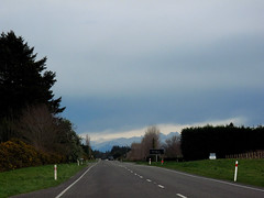
IMG_2466
Images, eqnz.chch.2010
This shop caught fire when power restored caused sparks that ignited leaking gas, in the aftermath of the magnitude 7.1 earthquake that struck Christchurch on Saturday 4 September 2010.
IMG_2165
Images, eqnz.chch.2010
Colombo Street was eerily quiet and deserted during the Tuesday evening rush hour, in the aftermath of the magnitude 7,1 earthquake that struck Christchurch on 4 September 2010.
IMG_2175
Images, eqnz.chch.2010
Red stickered building means no access, and the building may be condemned if it cannot be repaired; aftermath of the magnitude 7.1 earthquake that hit Christchurch on 4 September 2010.
IMG_2161
Images, eqnz.chch.2010
The belfry of the St John the Baptist Church at Latimer Square was reduced to rubble by the magnitude 7,1 earthquake that struck Christchurch on 4 September 2010.
IMG_2177
Images, eqnz.chch.2010
Cracks in the parapet of this beautiful Madras Street building that I walk past to / from work everyday; aftermath of the magnitude 7.1 earthquake that hit Christchurch on Saturday 4 September 2010.
IMG_2176
Images, eqnz.chch.2010
Cracks in the parapet of this beautiful Madras Street building that I walk past to / from work everyday; aftermath of the magnitude 7.1 earthquake that hit Christchurch on Saturday 4 September 2010.
IMG_2178
Images, eqnz.chch.2010
Cracks in the beam of this beautiful Madras Street building that I walk past to / from work everyday; aftermath of the magnitude 7.1 earthquake that hit Christchurch on Saturday 4 September 2010.
IMG_2183
Images, eqnz.chch.2010
Red stickered door means that this pub on Madras Street is no-go due to structural damage suffered in the magnitude 7.1 earthquake that hit Christchurch on Saturday 4 September 2010.
IMG_2190
Images, eqnz.chch.2010
The Dick Smith Electronics shops at St Asaph Street / Colombo Street was extensively damaged in the magnitude 7.1 earthquake that struck Christchurch on Saturday 4 September 2010.
IMG_2189
Images, eqnz.chch.2010
The Dick Smith Electronics shops at St Asaph Street / Colombo Street was extensively damaged in the magnitude 7.1 earthquake that struck Christchurch on Saturday 4 September 2010.
IMG_2168
Images, eqnz.chch.2010
Yellow stickered building means restricted access, and the building will need to be repaired and certified fit for use; aftermath of the magnitude 7.1 earthquake that hit Christchurch on 4 September 2010.
IMG_2192
Images, eqnz.chch.2010
The Dick Smith Electronics shops at St Asaph Street / Colombo Street was extensively damaged in the magnitude 7.1 earthquake that struck Christchurch on Saturday 4 September 2010.
IMG_2180
Images, eqnz.chch.2010
Deserted Tuam Street which is always busy during Tuesday evening rush hour, in the aftermath of the magnitude 7.1 earthquake that hit Christchurch on Saturday 4 September 2010.
IMG_2162
Images, eqnz.chch.2010
The belfry of the St John the Baptist Church at Latimer Square was reduced to rubble by the magnitude 7,1 earthquake that struck Christchurch on 4 September 2010.
IMG_2181
Images, eqnz.chch.2010
Deserted Tuam Street which is always busy during Tuesday evening rush hour, in the aftermath of the magnitude 7.1 earthquake that hit Christchurch on Saturday 4 September 2010.
IMG_2191
Images, eqnz.chch.2010
The Dick Smith Electronics shops at St Asaph Street / Colombo Street was extensively damaged in the magnitude 7.1 earthquake that struck Christchurch on Saturday 4 September 2010.
IMG_2164
Images, eqnz.chch.2010
There will be some very upset kids this Christmas, as Santa will not be able to deliver their presents; aftermath of the magnitude 7,1 earthquake that struck Christchurch on 4 September 2010.
IMG_2160
Images, eqnz.chch.2010
The belfry of the St John the Baptist Church at Latimer Square was reduced to rubble by the magnitude 7,1 earthquake that struck Christchurch on 4 September 2010.
IMG_2217
Images, eqnz.chch.2010
Part of the parapet fell off from this Burger King outlet on Bealey Ave during the magnitude 7.1 earthquake that struck Christchurch on Saturday 4 September 2010.
Tectonic Geomorphology and Paleoseismicity of the Northern Esk Fault, Nort…
Research papers, University of Canterbury Library
Geomorphic, structural and chronological data are used to establish the late Quaternary paleoseismicity of the active dextral-oblique Northern Esk Fault in North Canterbury, New Zealand. Detailed field mapping of the preserved c. 35 km of surface traces between the Hurunui River and Ashley Head reveals variations in strike ranging from 005° to 057°. Along with kinematic data collected from fault plane striae and offset geomorphic markers along the length of the fault these variations are used to distinguish six structural subsections of the main trace, four dextral-reverse and two dextral-normal. Displacements of geomorphic markers such as minor streams and ridges are measured using differential GPS and rangefinder equipment to reveal lateral offsets ranging from 3.4 to 23.7 m and vertical offsets ranging from < 1 to 13.5 m. Characteristic single event displacements of c. 5 m and c. 2 m have been calculated for strike-slip and reverse sections respectively. The use of fault scaling relationships reveals an anomalously high displacement to surface rupture length ratio when compared to global data sets. Fault scaling relationships based on width limited ruptures and magnitude probabilities from point measurements of displacement imply earthquake magnitudes of Mw 7.0 to 7.5. Optically Stimulated Luminescence (OSL) ages from displaced Holocene alluvial terraces at the northern extent of the active trace along with OSL and radiocarbon samples of the central sections constrain the timing of the last two surface rupturing events (11.15 ±1.65 and 3.5 ± 2.8 ka) and suggest a recurrence interval of c. 5612 ± 445 years and late Quaternary reverse and dextral slip rates of c. 0.31 mm/yr and 0.82 mm/yr respectively. The results of this study show that the Northern Esk Fault accommodates an important component of the c. 0.7 – 2 mm/yr of unresolved strain across the plate boundary within the North Canterbury region and affirm the Esk Fault as a source of potentially damaging ground shaking in the Canterbury region.
IMG_2222
Images, eqnz.chch.2010
Toppled grain silos on the outskirts of Darfield near the epicentre of the magnitude 7,1 earthquake that struck on Saturday 4 September 2010.
IMG_2230
Images, eqnz.chch.2010
Toppled grain silos on the outskirts of Darfield near the epicentre of the magnitude 7,1 earthquake that struck on Saturday 4 September 2010.
IMG_2400
Images, eqnz.chch.2010
Damaged rose window of the St John the Baptist Church at Latimer Square; aftermath of the magnitude 7.1 earthquake that struck Christchurch on Saturday 4 September 2010.
IMG_2224
Images, eqnz.chch.2010
Toppled grain silos on the outskirts of Darfield near the epicentre of the magnitude 7,1 earthquake that struck on Saturday 4 September 2010.
IMG_2226
Images, eqnz.chch.2010
Toppled grain silos on the outskirts of Darfield near the epicentre of the magnitude 7,1 earthquake that struck on Saturday 4 September 2010.
MVI_2430
Videos, eqnz.chch.2010
At Greendale Faultline on Highfield Road in mid-Canterbury, where the magnitude 7.1 earthquake on 4 September 2010 originated.
IMG_2465
Images, eqnz.chch.2010
Repairs being carried out on this restaurant (converted from a church) at the Hereford Street / Manchester Street intersection;aftermath of the magnitude 7.1 earthquake that struck Christchurch on Saturday 4 September 2010.
IMG_2233
Images, eqnz.chch.2010
Heaving and subsidence on the faultline left scars where the magnitude 7.1 earthquake on Saturday 4 September 2010 originated.
IMG_2223
Images, eqnz.chch.2010
Toppled grain silos on the outskirts of Darfield near the epicentre of the magnitude 7,1 earthquake that struck on Saturday 4 September 2010.
IMG_2221
Images, eqnz.chch.2010
Toppled grain silos on the outskirts of Darfield near the epicentre of the magnitude 7,1 earthquake that struck on Saturday 4 September 2010.