
Search
found 2972 results
Images for February 2011; more images...
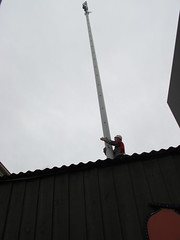


WEMO ERT Set 1 - February 2011 - Photograph 35
Images, UC QuakeStudies
A photograph of USAR and emergency management personnel eating lunch in Latimer Square.
WEMO ERT Set 1 - February 2011 - Photograph 78
Images, UC QuakeStudies
A photograph of emergency management personnel in a marquee outside the Christchurch Art Gallery.
WEMO ERT Set 3 - February 2011 - Photograph 039
Images, UC QuakeStudies
A photograph of road cones partially submerged in liquefaction on St Asaph Street.
WEMO ERT Set 1 - February 2011 - Photograph 82
Images, UC QuakeStudies
A photograph of emergency management personnel in a marquee outside the Christchurch Art Gallery.
WEMO ERT Set 1 - February 2011 - Photograph 80
Images, UC QuakeStudies
A photograph of emergency management personnel working in the Christchurch Art Gallery.
WEMO ERT Set 3 - February 2011 - Photograph 147
Images, UC QuakeStudies
A photograph of USAR tools and supplies laid out and organised in Latimer Square.
WEMO ERT Set 3 - February 2011 - Photograph 148
Images, UC QuakeStudies
A photograph of USAR tools and supplies laid out and organised in Latimer Square.
WEMO ERT Set 3 - February 2011 - Photograph 163
Images, UC QuakeStudies
A photograph of collapsed scaffolding on Liverpool Street, blocking off the entrance to Cashel Street
WEMO ERT Set 3 - February 2011 - Photograph 146
Images, UC QuakeStudies
A photograph of USAR tools and supplies laid out and organised in Latimer Square.
WEMO ERT Set 1 - February 2011 - Photograph 79
Images, UC QuakeStudies
A photograph of emergency management personnel working in the Christchurch Art Gallery.
Umut Akguzel Photograph 075
Images, UC QuakeStudies
A photograph of the earthquake damage to Poplar Street taken from Tuam Street shortly after the 22 February 2011 earthquake. The road is completely covered by loose bricks and a car has been crushed. To the left, the corner of a building has collapsed, rubble falling into the street.
QuakeStory Photo 562
Images, UC QuakeStudies
A photograph submitted by Andrew Panckhurst to the QuakeStories website. The description reads, "Peter Symms being cared for shortly after being rescued by Mike Ryan (with blooddy jacket) from the Regent Building in Cathedral Square on 22 February 2011. Originally posted on the CHCH EQ Photos Facebook page".
Photograph by Neil Macbeth 630
Images, UC QuakeStudies
Felled trees near the Park Terrace bridge in Hagley Park. A lamp post in the background is on a noticeable lean and a damaged shipping container can be seen to the left. The shipping container was damaged when the tree fell during the 22 February 2011 earthquake.
Observatory Tower Photograph 29
Images, UC QuakeStudies
A photograph of an earthquake-damaged suitcase in the South Quad of the Christchurch Arts Centre. The suitcase is resting on a pile of scaffolding which had been constructed around the Observatory tower. The scaffolding collapsed along with the tower during the 22 February 2011 earthquake.
WEMO ERT Team Set 1 - April 2011 - Photograph 6
Images, UC QuakeStudies
A photograph of a map used by emergency management personnel to inspect buildings after the 22 February 2011 earthquake. The map is of the block bordered by Barbadoes Street, Worcester Street, Gloucester Street, and Fitzgerald Avenue. Many of the buildings have been highlighted in blue, with some smaller buildings highlighted in orange. Numbers and messages have been written on the map with biro.
WEMO ERT Team Set 1 - April 2011 - Photograph 1
Images, UC QuakeStudies
A photograph of a map used by emergency management personnel to inspect buildings after the 22 February 2011 earthquake. The block between St Asaph, Antigua, Montreal, and Acton Street has been outlined with a red felt-tip pen. Some of the buildings in the block and below Acton Streets have been coloured orange. A few other buildings have been coloured blue.
UC Civil and Natural Resources Engineering Photograph 211
Images, UC QuakeStudies
A photograph of a projector set up in the Avonhead Baptist Church. The room is to be used as a temporary lecture theatre for the Department of Civil and Natural Resources Engineering, as lecture theatres on campus are inaccessible following the 22 February 2011 earthquake.
New Zealand Defence Force photograph 674
Images, UC QuakeStudies
A member of the Los Angeles County Fire Department Search and Rescue Team with an Australian Police Officer outside the US Aid tent in Latimer Square. After the 22 February 2011 earthquake, emergency service agencies set up their headquarters in Latimer Square.
US Embassy Photograph 25
Images, UC QuakeStudies
Members of the USAID Disaster Assistance Response Team (DART) setting up a tent in Latimer Square after their early-morning arrival in Christchurch. Latimer Square was set up as a temporary headquarters for emergency management personnel after the 22 February 2011 earthquake.
All Right? Out and About with All Right: 22 February 2011 Memorial Youthli…
Images, UC QuakeStudies
An image commemorating the 22 February earthquake, which reads, "Three years on... It's all right to remember". The image includes the All Right? and Youthline logos, and Youthline contact numbers.
Christchurch Earthquake 22/02/11
Images, eqnz.chch.2010
Toppled statue of polar explorer Robert Falcon Scott, Worcester Street near Oxford Terrace.
Christchurch Earthquake 22/02/11
Images, eqnz.chch.2010
The Iconic Bar, near the corner of Manchester Street and Gloucester Street.
Christchurch Earthquake 22/02/11
Images, eqnz.chch.2010
813 Colombo Street looking south-ish, near the corner of Peterborough Street.
Christchurch Earthquake 22/02/11
Images, eqnz.chch.2010
YHA Christchurch City Central, 273 Manchester Street, between Armagh Street and Gloucester Street.
Christchurch Earthquake 22/02/11
Images, eqnz.chch.2010
Manchester Street looking north-ish, taken from the Gloucester Street intersection.
Christchurch Earthquake 22/02/11
Images, eqnz.chch.2010
Montreal Street looking north, near the corner of Hereford Street, Christchurch.
Elizabeth Ackermann Photograph 266
Images, UC QuakeStudies
A photograph of a wreath and flowers tied to a lamppost on Colombo Street. They were placed there by Red Bus in memory of the bus driver and passengers who died in one of their busses during the 22 February 2011 earthquake. A sign behind the wreath reads, "In remembrance of the tragic events during the 22 February 2011 earthquake in Colombo Street where our bus driver and his passengers Jayden Andrews-Howland, Phillip Coppeard, Joseph Routledge, Pelesa Sanft, Beverly May Stick and Earl Niche died, and Ann Brower was seriously injured".
BeckerFraserPhotos February 2012 photograph 0354
Images, UC QuakeStudies
A photograph of the ChristChurch Cathedral showing the damage to the west wall and steel bracing. In the foreground is the plinth where a statue of John Robert Godley stood prior to the February 2011 earthquake.
Story time at the welfare centre
Images, eqnz.chch.2010
Photos of Christchurch City LIbraries Outreach staff working in welfare centres following the February 22 earthquake. File ref: CCL-2011-02-27-OperationStoryTime-lynette-and-boys-on-bikes From the collection of Christchurch City Libraries
New Zealand Defence Force photograph 072
Images, UC QuakeStudies
Damage to Lyttelton following the 22 February 2011 earthquake. The fish and chip shop on London Street (centre) has a collapsed gable and awning. Bricks, plaster and wood are lying where they fell on the footpath, as well as the broken sign. To the left is the Lava Bar which suffered severe structural damage after the earthquake. To the right, the Coastal Living store can be seen which was open after the September earthquake but pulled down after February.