
Search
found 2972 results
Images for February 2011; more images...
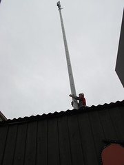


Photograph by Paul Corliss 0505
Images, UC QuakeStudies
A photograph of Portabuild cabins being used as temporary studios by One News. The photograph is captioned by Paul Corliss, "Carlton corner, post 22 February earthquake".
Readout of the President's Call to Prime Minister Key of New Zealand
Articles, UC QuakeStudies
A press release from the Office of the Press Secretary in the US White House about President Obama's call to Prime Minister John Key to express his condolences over the 22 February 2011 earthquake in Christchurch and to offer American assistance.
WEMO ERT Set 3 - February 2011 - Photograph 269
Images, UC QuakeStudies
A photograph of workers in Latimer Square preparing food for emergency management personnel.
WEMO ERT Set 1 - February 2011 - Photograph 81
Images, UC QuakeStudies
A photograph of emergency management personnel in the Christchurch Art Gallery.
WEMO ERT Set 3 - February 2011 - Photograph 047
Images, UC QuakeStudies
A photograph of a pile of rubble and scaffolding on Manchester Street.
Story time at the welfare centre
Images, eqnz.chch.2010
Photos of Christchurch City LIbraries Outreach staff working in welfare centres following the February 22 earthquake. File ref: CCL-2011-02-27-OperationStoryTime-boys-with-book From the collection of Christchurch City Libraries
Umut Akguzel Photograph 314
Images, UC QuakeStudies
A photograph of the podium in Cathedral Square where the statue of John Robert Godley stood before it fell during the 22 February earthquake.
Christchurch Earthquake 22/02/11
Images, eqnz.chch.2010
Manchester and Gloucester Street corner
New Zealand Defence Force photograph 007
Images, UC QuakeStudies
A member of No. 40 Squadron, a transport squadron in the Royal New Zealand Air Force, installing seats onboard the C-130 Hercules. The Hercules assisted with the movement of people out Christchurch after the 22 February 2011 earthquake.
Umut Akguzel Photograph 067
Images, UC QuakeStudies
A photograph of the Excelsior Sports Bar building shortly after the 22 February 2011 earthquake. Bricks from the walls above have crumbled and fallen to the street, taking the awning with it. People can be seen below, examining the building and attempting to leave the central city.
Umut Akguzel Photograph 097
Images, UC QuakeStudies
A photograph of a woman walking past rubble from the earthquake damaged Cycle Trading store on Manchester Street shortly after the 22 February 2011 earthquake. A cars headlights can be seen through the rubble. The store's main window has been broken and the doors left open.
Observatory Tower Photograph 11
Images, UC QuakeStudies
A photograph of the largest section of the Townsend Telescope recovered from the rubble of the Observatory tower. The telescope was housed in the tower at the Christchurch Arts Centre. It was severely damaged when the tower collapsed during the 22 February 2011 earthquake.
Rebekah Rogers WEMO Photograph 104
Images, UC QuakeStudies
A photograph of a portable shower unit set up in Hagley Park for the emergency management personnel who travelled to Christchurch after the 22 February 2011 earthquake. A clothes line has been set up by tying ropes to the shower unit and a digger.
Christchurch Earthquake 22/02/11
Images, eqnz.chch.2010
Montreal Street and Armagh Street, Cranmer Square.
Christchurch Earthquake 22/02/11
Images, eqnz.chch.2010
Montreal Street and Armagh Street, Cranmer Square.
Christchurch Earthquake 22/02/11
Images, eqnz.chch.2010
Montreal Street and Armagh Street, Cranmer Square.
Christchurch Earthquake 22/02/11
Images, eqnz.chch.2010
Montreal Street and Armagh Street, Cranmer Square.
Christchurch Earthquake 22/02/11
Images, eqnz.chch.2010
Gloucester Street looking west, near the corner of Manchester Street.
Christchurch Earthquake 22/02/11
Images, eqnz.chch.2010
Colombo Street looking north, taken from the Gloucester Street intersection.
Christchurch Earthquake 22/02/11
Images, eqnz.chch.2010
Montreal Street and Armagh Street, Cranmer Square.
Christchurch Earthquake 22/02/11
Images, eqnz.chch.2010
Saint Asaph Street between Madras & Manchester Streets
Christchurch Earthquake 22/02/11
Images, eqnz.chch.2010
Robert Jones Building - corner of Colombo & Armagh Street
BeckerFraserPhotos April 2011 photograph 397
Images, UC QuakeStudies
A plaque on the ground in front of the 'Passing Time' sculpture on the corner of Madras Street and St Asaph Street. The 'Passing Time' sculpture was installed outside the CPIT Building for the 6th SCAPE (a contemporary public art programme in Christchurch) a few days prior to the 22 February 2011 earthquake. The work features twisting boxes depicting each year between 1906 (the founding of CPIT) and 2010 (the date of the sculpture's production).
New Zealand Defence Force photograph 670
Images, UC QuakeStudies
A map of Christchurch with the earthquakes marked by magnitude, at the entrance to 'Camp Hollywood', the American Civil Defence Force headquarters in Latimer Square. After the 22 February 2011 earthquake, emergency service agencies set up their headquarters in Latimer Square.
BeckerFraserPhotos February 2012 photograph 0927
Images, UC QuakeStudies
An aerial photograph captioned by BeckerFraserPhotos, "Latimer Square". Seats set up in Latimer Square in preparation for the commemoration of the anniversary of the 22 February 2011 earthquake can be seen on the right.
BeckerFraserPhotos February 2012 photograph 1001
Images, UC QuakeStudies
A photograph captioned by BeckerFraserPhotos, "A passer-by looks at some of the many the tributes left on Colombo Street between St Asaph and Tuam Streets where 13 people died on 22 February 2011".
Review of transect of Christchurch CBD following 22 February 2011 earthqua…
Research papers, The University of Auckland Library
Two days after the 22 February 2011 M6.3 earthquake in Christchurch, New Zealand, three of the authors conducted a transect of the central city, with the goal of deriving an estimate of building damage levels. Although smaller in magnitude than the M7.1 4 September 2010 Darfield earthquake, the ground accelerations, ground deformation and damage levels in Christchurch central city were more severe in February 2011, and the central city was closed down to the general public. Written and photographic notes of 295 buildings were taken, including construction type, damage level, and whether the building would likely need to be demolished. The results of the transect compared favourably to Civil Defence rapid assessments made over the following month. Now, more than one year and two major aftershocks after the February 2011 earthquake these initial estimates are compared to the current demolition status to provide an updated understanding of the state of central Christchurch.
WEMO ERT Set 1 - February 2011 - Photograph 04
Images, UC QuakeStudies
A photograph of crates of supplies outside the USAID tent in Latimer Square.
WEMO ERT Set 1 - February 2011 - Photograph 77
Images, UC QuakeStudies
A photograph of emergency management personnel in a marquee outside the Christchurch Art Gallery.
WEMO ERT Set 3 - February 2011 - Photograph 023
Images, UC QuakeStudies
A photograph of emergency management personnel lining up for breakfast in Latimer Square.