Search
found 203 results
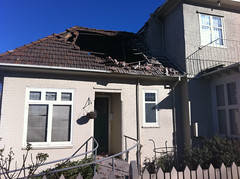
Images for hole; more images...
Jim Baltaxe WEMO Photograph 064
Images, UC QuakeStudies
A photograph of an office on the side of a Christchurch road. "Danger keep out" has been spray-painted on the front wall. The road in front has been dug up in places and piles of gravel have been placed on the footpath. Road cones and cordon tape have been used to cordon off a large hole in the road.
Photograph by Paul Corliss 1567
Images, UC QuakeStudies
A photograph of the earthquake damage to a house on Major Hornbrook Drive. The chimney has collapsed and many of the tiles have been lifted on the roof. Tarpaulins have been laid over the holes in the roof as waterproofing, but the closest has shredded. Gaps can be seen between the bricks in the wall and the wall to the left has crumbled.
Photograph by Paul Corliss 1565
Images, UC QuakeStudies
A photograph of the earthquake damage to a house on Major Hornbrook Drive. The chimney has collapsed and many of the tiles have been lifted on the roof. Tarpaulins have been laid over the holes in the roof as waterproofing, but the closest has shredded. Gaps can be seen between the bricks in the wall and the wall to the left has crumbled.
Natalie Kerschner WEMO Photograph 105
Images, UC QuakeStudies
A photograph of a house on Glenarm Terrace in Dallington. The chimney fell off the roof during the September earthquake and the bricks are still lying on the ground. A tarpaulin has been placed over the top of the hole to prevent water damage inside the house. Ironically, it has been weighed down with bricks.
Progress made on 'dirty 30' derelict Christchurch CBD buildings
Audio, Radio New Zealand
Four years ago Christchurch City Council vowed to get tough on the owners of 30 central city buildings left derelict since the 2011 earthquake. A wander through central Christchurch shows many of the buildings, nicknamed the dirty 30, still look unchanged. There are boarded up windows, tarps covering gaping holes, and containers keeping bricks from falling on passers by. But council says progress is finally being made on most Rachel Graham has more.
Digital Photograph: Earthquake damage to the Lyttelton Timeball Station
Images, Canterbury Museum
One landscape colour digital photograph taken on 25 February 2011 showing earthquake damage to the Lyttelton Timeball Station. Also visible is damage to some of the houses in the foreground such as temporarily patched holes in roofs where chimneys have fallen. Architect The Lyttelton Timeball Station was completed in 1876. Its function was to p...
Natalie Kerschner WEMO Photograph 109
Images, UC QuakeStudies
A photograph of a house on Glenarm Terrace in Dallington. The chimney fell off the roof during the September earthquake and the bricks are still lying on the ground. A tarpaulin has been placed over the top of the hole to prevent water damage inside the house. Ironically, it has been weighed down with bricks. Spring flowers can be seen in the garden.
Kim Wright WEMO Photograph 022
Images, UC QuakeStudies
A photograph of the earthquake damage to the Cranmer Courts on the corner of Montreal and Kilmore Streets. A chimney has fallen from the roof, damaging many of the roof tiles. A tarpaulin has been placed over a hole to protect the interior of the building from weather damage. Wire fencing has been placed around the building as a cordon.
Walker, Malcolm, 1950- :Shhh! Urban planner at work... 8 July 2011
Images, Alexander Turnbull Library
The 11 frame cartoon strip tells a story about planning for a new Christchurch city post-earthquake. After filling the plan with every possible thing he can think of the planner puts the artist in an empty corner and the whole thing is delivered into a black hole that represents 'The real world'. Quantity: 1 digital cartoon(s).
The Face of a Quake
Images, UC QuakeStudies
A damaged brick building on Tuam Street. Bricks have fallen from the wall exposing the interior, where a wooden structure can be seen to have collapsed. The photographer comments, "This is the damage caused by the numerous earthquakes in Christchurch, New Zealand. It closely resembles a face and the round blob in the square hole at the top of the nose is a pigeon".
Nisbet, Alistair, 1958- :'Your land's safe to re-build on...Geo-Tech are j…
Images, Alexander Turnbull Library
The cartoon shows a scene of rubble in central Christchurch, a workman appears to have fallen down a deep hole whilst another workman says to a man in a suit 'Your land's safe to re-build on...Geo-Tech are just finishing their in-depth report!'. Context: Refers to sceptism about rebuilding central Christchurch after earthquake damage in 2011. Quantity: 1 digital cartoon(s).
Taupo Times Image: Sarah Bol 2010:09:10 13:55:20
Images, UC QuakeStudies
Photograph captioned by Fairfax, "Teeing off: Storeman Wayne Smith at the 12th hole of the Contact Wairakei Charity Golf Tournament for the Canterbury Earthquake Relief Fund. Held earlier this month, the tournament raised more than $8000 for the Canterbury Earthquake Relief Fund. In total more than $30,000 was raised for three charities at this year's annual tournament held at the Taupo Golf Club. As well as the $8200 raised for the Canterbury Earthquake Recovery Fund, two local charities Taupo Big Brother Big Sister and the Taupo Therapy Centre, each received $11,000 each from this year's fundraising effort".
Creating Modern History
Images, UC QuakeStudies
Part of Mike Hewson's installation 'Homage To Lost Spaces' in the Cramner Courts building, photographs of people riding bicycles have been inserted into a gap in the building. The photographer comments, "Cranmer Courts was very badly damaged in the quakes that unexpectedly hit Christchurch. Originally big photographs were put into the holes where the doors and windows were, but now these massive pictures have been put across the boarded up ends of the buildings to keep them alive in the minds of the people of Christchurch. The project was thought up by Mike Hewson".
Nisbet, Alistair, 1958- :"At least snow covers up ugly quake damage dear..…
Images, Alexander Turnbull Library
A woman walks through the snow in Christchurch and comments 'At least snow covers up ugly quake damage dear... Dear?' Her husband has disappeared into a hole that was covered in snow. Context: Heavy snow blanketed Christchurch today (Saturday 9 August) as the winter cold continued to be felt across both the North and South Islands. Snow began falling in Christchurch about 7am today and covered most of the city. (NZHerald: Aug 9 2011) Quantity: 1 digital cartoon(s).
22 February Earthquake - Photograph 01
Images, UC QuakeStudies
Damage to River Road in Richmond. The road is badly cracked and slumped, and is closed off with a row of road cones tied with warning tape. The word "closed" has been spray painted on the road surface. The photographer comments, "These photos show our old house in River Rd and recovery work around Richmond and St Albans. River Rd was again subject to severe lateral spreading. The river is still grey with silt, the road is ripped and sunken, and power poles lean at random angles. The red car belonged to a postie, who had to come back with a tow truck to extricate the car from the hole that had opened underneath it. Looking along River Road to the north-east. Taken outside 79 Medway St".
WEMO ERT Set 4 - March 2011 - Photograph 11
Images, UC QuakeStudies
A photograph of a sign taped to a window. The sign includes a bullet pointed list of humorous observations about Christchurch following the February 2011 earthquake. The sign reads, "You know you're from Christchurch when: you use the term 'liquefaction' and 'seismic design' in casual conversation; digging a hole and shitting in your garden is no longer weird; your mayor describes the city as munted. If he means FUBARed, you agree; weaving through car size potholes on the street is no longer weird; a shower is heaven; you have a preference of which kind of silt you'd rather shovel, dry or wet; you see tanks...driving around town; you are always noting what you are under; due to frequent aftershocks during the night, you sleep like a baby - every 10 minutes you wake up and shit yourself".
Brockie, Robert Ellison, 1932-:[The New Zealand ship of state] 4 March 2011
Images, Alexander Turnbull Library
A ship named 'NZ Ship of State' lies high and dry on rocks; the great jagged holes in her represent 'the recession', 'Pike River', 'Chch 1' and 'Chch 2'. A man standing nearby asks 'How will we refloat her?' and a second man answers '...by cutting Working for Families & interest-free student loans' Someone outside the frame says 'Where's the No. 8 wire?' Context - The New Zealand economy was stagnating before the impact of the Christchurch earthquakes of 4 September 2010 and 22 February 2011 and the Pike River Mine disaster before that. The government was already considering cutting Working for Families & interest-free student loans before the earthquakes struck and it seems that now they are trying to push through these policy changes using the earthquakes as an excuse. Quantity: 1 digital cartoon(s).
Seismic performance of concrete wall-steel beam connections
Research papers, The University of Auckland Library
The increasing prevalence of mixed-material buildings that combine concrete walls and steel frames in New Zealand, coupled with a lack of specific design and detailing guidelines for concrete wall-steel beam connections, underscores the need for comprehensive research to ensure that these structures behave as intended during earthquakes. Bolted web plate connections, commonly found in steel framing systems, are typically used to connect steel beams to concrete walls. These connections are idealised as pinned during design. However, research on steel framing systems has shown that these connections can develop significant stiffness and moment resistance when subjected to large rotations during seismic loading, potentially leading to brittle failure when used in concrete wall to steel beam applications. This thesis was written to understand the seismic performance of concrete wall-steel beam bolted web plate connections, providing experimental evidence, numerical modelling insights, and design recommendations to address critical gaps in current design practices. The study is divided into three phases. First, a review of 50 concrete wall-steel frame buildings in Auckland and Christchurch was conducted to understand current design practices and typical connection details. The findings revealed significant variation in design and detailing practices and a lack of specific guidelines for concrete wall-steel beam connections. Second, an experimental programme was conducted on four full-scale concrete wall-steel beam sub-assemblages, each incorporating variations in connection detailing. The tests were designed to quantify the rotation capacity of concrete wall-steel beam connections, identify failure modes and investigate the effectiveness of potential connection improvements. Results demonstrated that concrete wall-steel beam bolted web plate connections designed using current design standards and following existing practices are vulnerable to non-ductile failure characterised by concrete breakout. However, using slotted holes in the web plate and bent reinforcing bar anchors instead of headed stud anchors improved connection rotation capacity. Third, a numerical model of a case study building was developed on OpenSeesPy, with different connection conditions assumed based on the experimental results. Pushover and time history analyses were conducted to evaluate the implications of different connection conditions (pinned vs non-pinned) on global building response and local member demands. The findings revealed that using non-pinned connection conditions does not significantly affect the global building response and shear and bending moment demands on lateral load-resisting elements. However, doing so generates overstrength moments on the connections that induce different actions on out-of-plane concrete walls connected to steel beams. Synthesising findings from all three phases, this thesis concludes with a proposed design procedure for concrete wall-steel beam connections based on a capacity design approach to ensure ductile failure modes and suppress brittle ones. Key recommendations include selecting appropriate bolt hole geometry and anchorage, providing sufficient rotation capacity, and accounting for connection overstrength in global analyses
Greening the rubble in Christchurch: Civic ecological reclamation efforts …
Research papers, Lincoln University
Within four weeks of the September 4 2010 Canterbury Earthquake a new, loosely-knit community group appeared in Christchurch under the banner of “Greening the Rubble.” The general aim of those who attended the first few meetings was to do something to help plug the holes that had already appeared or were likely to appear over the coming weeks in the city fabric with some temporary landscaping and planting projects. This article charts the first eighteen months of Greening the Rubble and places the initiative in a broader context to argue that although seismic events in Christchurch acted as a “call to palms,” so to speak, the city was already in need of some remedial greening. It concludes with a reflection on lessons learned to date by GTR and commentary on the likely issues ahead for this new mini-social-environmental movement in the context of a quake-affected and still quake-prone major New Zealand city. One of the key lessons for GTR and all of those involved in Christchurch recovery activities to date is that the city is still very much in the middle of the event and is to some extent a laboratory for seismic and agency management studies alike.
Vulnerability and Resilience Assessment of the New Zealand Telecommunicati…
Research papers, University of Canterbury Library
Nowadays the telecommunication systems’ performance has a substantial impact on our lifestyle. Their operationality becomes even more substantial in a post-disaster scenario when these services are used in civil protection and emergency plans, as well as for the restoration of all the other critical infrastructure. Despite the relevance of loss of functionality of telecommunication networks on seismic resilience, studies on their performance assessment are few in the literature. The telecommunication system is a distributed network made up of several components (i.e. ducts, utility holes, cabinets, major and local exchanges). Given that these networks cover a large geographical area, they can be easily subjected to the effects of a seismic event, either the ground shaking itself, or co-seismic events such as liquefaction and landslides. In this paper, an analysis of the data collected after the 2010-2011 Canterbury Earthquake Sequence (CES) and the 2016 Kaikoura Earthquake in New Zealand is conducted. Analysing these data, information gaps are critically identified regarding physical and functional failures of the telecommunication components, the timeline of repair/reconstruction activities and service recovery, geotechnical tests and land planning maps. Indeed, if these missing data were presented, they could aid the assessment of the seismic resilience. Thus, practical improvements in the post-disaster collection from both a network and organisational viewpoints are proposed through consultation of national and international researchers and highly experienced asset managers from Chorus. Finally, an outline of future studies which could guide towards a more resilient seismic performance of the telecommunication network is presented.
A geology-based 3D seismic velocity model of Canterbury, New Zealand
Research papers, University of Canterbury Library
This paper presents a seismic velocity model of Canterbury, New Zealand based on 3D geologic surfaces and velocities from a range of data sources. The model provides the 3D crustal structure in the region at multiple length scales for seismic wave propagation simulations, such as broadband ground motion and shallow site response analyses related to understanding the ground motions and site responses during the 2010- 2011 Canterbury earthquakes. Pre-Quaternary geologic horizons are calculated based on the reinterpretation of a comprehensive network of seismic reflection surveys from seven different campaigns over the past 50 years, as well as point constraints across an array of petroleum industry drill holes. Particular attention is given to a detailed representation of Quaternary stratigraphy, representing shallow (z<250m) near-surface layers in the model. Seismic velocities are obtained from seismic reflection processing (for Vp) and also recently performed active and passive surface wave analyses (for Vs). Over 1,700 water wells in the region are used to constrain the complex inter-bedded Quaternary stratigraphy (gravels, sands, silts, organics etc.) near the coastline, including beneath urban Christchurch, which has resulted from fluvial deposition and marine regression and transgression. For the near-surface Springston and Christchurch Formations in the Christchurch urban area (z<50m), high-spatial resolution seismic velocities (including Vs30 ) were obtained from over 13,000 cone penetration tests combined with a recently developed CPT-Vs correlation.
Performance of precast cladding panels with rocking connections under late…
Research papers, University of Canterbury Library
Several concrete cladding panels were damaged during the 2011 Christchurch Earthquakes in New Zealand. Damage included partial collapse of panels, rupture of joint sealants, cracking and corner crushing. Installation errors, faulty connections and inadequate detailing were also contributing factors to the damage. In New Zealand, two main issues are considered in order to accommodate story drifts in the design of precast cladding panels: 1) drift compatibility of tieback or push-pull connections and 2) drift compatibility of corner joints. Tieback connections restrain the panels in the out-of-plane direction while allowing in-plane translation with respect to the building frame. Tieback connections are either in the form of slots or oversized holes or ductile rods usually located at the top of the panels. Bearing connections are also provided at the bottom of panels to transfer gravity loads. At the corners of a building, a vertical joint gap, usually filled with sealants, is provided between the two panels on the two orthogonal sides to accommodate the relative movement. In cases where the joint gap is not sufficient to accommodate the relative movements, panels can collide, generating large forces and the likely failure of the connections. On the other hand, large gaps are aesthetically unpleasing. The current design standards appear to recognize these issues but then leave most of the design and detailing to the discretion of the designers. In the installation phase, the alignment of panels is one of the main challenges faced by installers (and/or contractors). Many prefer temporary props to guide, adjust and hold the panels in place whilst the bearing connections are welded. Moreover, heat generated from extensive welding can twist the steel components inducing undesirable local stresses in the panels. Therefore, the installation phase itself is time-consuming, costly and prone to errors. This paper investigates the performance of a novel panel system that is designed to accommodate lateral inter-story drift through a ‘rocking’ motion. In order to gauge the feasibility of the system, six 2m high precast concrete panels within a single-story steel frame structure have been tested under increasing levels of lateral cyclic drift at the University of Canterbury, New Zealand. Three different panel configurations are tested: 1) a panel with return cover and a flat panel at a corner under unidirectional loading, 2) Two adjacent flat panels under unidirectional loading, and 3) Two flat panels at another oblique corner under bidirectional loading. A vertical seismic joint of 25 mm, filled with one-stage joint sealant, is provided between two of the panels. The test results show the ability of the panels with ‘rocking’ connection details to accommodate larger lateral drifts whilst allowing for smaller vertical joints between panels at corners, quick alignment and easy placement of panels without involving extensive welding on site.
An engineering geological evaluation of non-engineered loess fill and airf…
Research papers, University of Canterbury Library
Following the 22nd February 2011, Mw 6.2 earthquake located along a previously unknown fault beneath the Port Hills of Christchurch, surface cracking was identified in contour parallel locations within fill material at Quarry Road on the lower slopes of Mount Pleasant. GNS Science, in the role of advisor to the Christchurch City Council, concluded that these cracks were a part of a potential rotational mass movement (named zone 11A) within the fill and airfall loess material present. However, a lack of field evidence for slope instability and an absence of laboratory geotechnical data on which slope stability analysis was based, suggested this conclusion is potentially incorrect. It was hypothesised that ground cracking was in fact due to earthquake shaking, and not mass movement within the slope, thus forming the basis of this study. Three soil units were identified during surface and subsurface investigations at Quarry Road: fill derived from quarry operations in the adjacent St. Andrews Quarry (between 1893 and 1913), a buried topsoil, and underlying in-situ airfall loess. The fill material was identified by the presence of organic-rich topsoil “clods” that were irregular in both size (∼10 – 200 mm) and shape, with variable thicknesses of 1 – 10 m. Maximum thickness, as indicated by drill holes and geophysical survey lines, was identified below 6 Quarry Road and 7 The Brae where it is thought to infill a pre-existing gully formed in the underlying airfall loess. Bearing strength of the fill consistently exceeded 300 kPa ultimate below ∼500 mm depth. The buried topsoil was 200 – 300 mm thick, and normally displayed a lower bearing strength when encountered, but not below 300 kPa ultimate (3 – 11 blows per 100mm or ≥100 kPa allowable). In-situ airfall loess stood vertically in outcrop due to its characteristic high dry strength and also showed Scala penetrometer values of 6 – 20+ blows per 100 mm (450 – ≥1000 kPa ultimate). All soils were described as being moist to dry during subsurface investigations, with no groundwater table identified during any investigation into volcanic bedrock. In-situ moisture contents were established using bulk disturbed samples from hand augers and test pitting. Average moisture contents were low at 9% within the fill, 11 % within the buried topsoil, and 8% within the airfall loess: all were below the associated average plastic limit of 17, 15, and 16, respectively, determined during Atterberg limit analysis. Particle size distributions, identified using the sieve and pipette method, were similar between the three soil units with 11 – 20 % clay, 62 – 78 % silt, and 11 – 20 % fine sand. Using these results and the NZGS soil classification, the loess derived fill and in-situ airfall loess are termed SILT with some clay and sand, and the buried topsoil is SILT with minor clay and sand. Dispersivity of the units was found using the Emerson crumb test, which established that the fill can be non- to completely dispersive (score 0 – 4). The buried topsoil was always non-dispersive (score 0), and airfall loess completely dispersive (score 4). Values for cohesion (c) and internal friction angle (φ) of the three soil units were established using the direct shear box at field moisture contents. Results showed all soil units had high shear strengths at the moisture contents tested (c = 18 – 24 kPa and φ = 42 – 50°), with samples behaving in a brittle fashion. Moisture content was artificially increased to 16% within the buried topsoil, which reduced the shear strength (c = 10 kPa, φ = 18°) and allowed it to behave plastically. Observational information indicating stability at Quarry Road included: shallow, discontinuous, cracks that do not display vertical offset; no scarp features or compressional zones typical of landsliding; no tilted or deformed structures; no movement in inclinometers; no basal shear zone identified in logged core to 20 m depth; low field moisture contents; no groundwater table; and high soil strength using Scala penetrometers. Limit equilibrium analysis of the slope was conducted using Rocscience software Slide 5.0 to verify the slope stability identified by observational methods. Friction, cohesion, and density values determined during laboratory were input into the two slope models investigated. Results gave minimum static factor of safety values for translational (along buried topsoil) and rotational (in the fill) slides of 2.4 – 4.2. Sensitivity of the slope to reduced shear strength parameters was analysed using c = 10 kPa and φ = 18° for the translational buried topsoil plane, and a cohesion of 0 kPa within the fill for the rotational plane. The only situation that gave a factor of safety <1.0 was in nonengineered fill at 0.5 m depth. Pseudostatic analysis based on previous peak ground acceleration (PGA) values for the Canterbury Earthquake Sequence, and predicted PGAs for future Alpine Fault and Hope Fault earthquakes established minimum factor of safety values between 1.2 and 3.3. Yield acceleration PGAs were computed to be between 0.8g and 1.6g. Based on all information gathered, the cracking at Quarry Road is considered to be shallow deformation in response to earthquake shaking, and not due to deep-seated landsliding. It is recommended that the currently bare site be managed by smoothing the land, installing contour drainage, and bioremediation of the surface soils to reduce surface water infiltration and runoff. Extensive earthworks, including removal of the fill, are considered unnecessary. Any future replacement of housing would be subject to site-specific investigations, and careful foundation design based on those results.