
Search
found 239 results
Images for earthquakes; more images...


More than a Band Aid : how the use of popular music helped a city recover …
Research papers, University of Canterbury Library
The combination of music and disaster has been the subject of much study, especially starstudded telethons and songs that commemorate tragedy. However, there are many other ways that music can be used after disaster that provide benefits far greater than money or memorials but are not necessarily as prominent in the worldwide media landscape. Beginning in September 2010, the city of Christchurch, New Zealand, has been struck by several major earthquakes and over 11,000 aftershocks, the most destructive of which caused 185 deaths. As with many other disasters, music has been used as a method of fundraising and commemoration, but personal experience suggests many other ways that music can be used as a coping mechanism and aid to personal and community recovery. Therefore, in order to uncover the connections, context, and strategies behind its use, this thesis addresses the question: Since the earthquakes began, how has popular music been beneficial for the city and people of Christchurch? As well as documenting a wide variety of musical ‘earthquake relief’ events and charitable releases, this research also explores some of the more intangible aspects of the music-aid relationship. Two central themes are presented – fundraising and psychosocial uses – utilising individual voices and case studies to illustrate the benefits of music use after disaster at a community or city-wide level. Together the disparate threads and story fragments weave a detailed picture of the ways in which music as shared experience, as text, as commodity, and as a tool for memory and movement has been incorporated into the fabric of the city during the recovery phase.
From Cold War to Canterbury: The New Zealand Experience in Emergency Manag…
Research papers, University of Canterbury Library
In this dissertation it is argued that the Canterbury Earthquake Recovery Act 2011 and the Canterbury Earthquake Recovery Authority were both necessary and inevitable given the trends and traditions of civil defence emergency management (CDEM) in New Zealand. The trends and traditions of civil defence are such that principles come before practice, form before function, and change is primarily brought about through crisis and criticism. The guiding question of the research was why were a new governance system and law made after the Canterbury earthquakes in 2010 and 2011? Why did this outcome occur despite the establishment of a modern emergency management system in 2002 which included a recovery framework that had been praised by international scholars as leading edge and a model for other countries? The official reason was the unprecedented scale and demands of the recovery – but a disaster of such scale is the principle reason for having a national emergency management system. Another explanation is the lack of cooperation among local authorities – but that raises the question of whether the CDEM recovery framework would have been successful in another locality. Consequentially, the focus of this dissertation is on the CDEM recovery framework and how New Zealand came to find itself making disaster law during a disaster. Recommendations include a review of emergency powers for recovery, a review of the capabilities needed to fulfil the mandate of Recovery Managers, and the establishment of a National Recovery Office with a cadre of Recovery Managers that attend every recovery to observe, advise, or assume control as needed. CDEM Group Recovery Managers would be seconded to the National Recovery Office which would allow for experience in recovery management to be developed and institutionalised through regular practice.
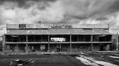
20160307_6607_7D2-110 Interior removal
Images, eqnz.chch.2010
The Forsyth Barr building has stood silent and empty (except the occasional intruder and pigeons) since the February 2011 earthquake. It was sold "as is" and I understand that it is now going to be fitted out as a hotel. This is the building that had severe stairwell damage during the quake necessitating people being lowered via ropes etc on t...
Characterizing GeoNet strong motion sites: Site metadata update for the 20…
Research papers, University of Canterbury Library
The 2015 New Zealand strong-motion database provides a wealth of new strong motion data for engineering applications. An important component of this database is the compilation of new site metadata, describing the soil conditions and site response at GeoNet strong motion stations. We have assessed and compiled four key site parameters for the ~460 GeoNet stations that recorded significant historical ground motions. Parameters include: site classification (NZS1170.5), Vs30, fundamental site period (Tsite) and depth to bedrock (Z1.0, i.e. depth to material with Vs > 1000 m/s). In addition, we have assigned a quality estimate (Quality 1 – 3) to these parameters to provide a qualitative estimate of the uncertainty. New highquality Tsite estimates have largely been obtained from newly available HVSR amplification curves and spectral ratios from inversion of regional strong motion data that has been reconciled with available geological information. Good quality Vs30 estimates, typically in urban centres, have also been incorporated following recent studies. Where site-specific measurements of Vs30 are not available, Vs30 is estimated based on surface geology following national Vs30 maps. New Z1.0 values have been provided from 3D subsurface models for Canterbury and Wellington. This database will be used in efforts to guide development and testing of new and existing ground motion prediction models in New Zealand. In particular, it will allow reexamination of the most important site parameters that control and predict site response in a New Zealand setting. Furthermore, it can be used to provide information about suitable rock reference sites for seismological research, and as a guide to site-specific references in the literature. We discuss compilation of the database, preliminary insights so far, and future directions.
Tagata o te Moana for 30 April 2016
Audio, Radio New Zealand
Australia's controversial offshore detention regime hits a massive stumbling block; Fiji's parliament votes against reinstating the Great Council of Chiefs; Stalemate over probe into high profile PNG fraud case; Pacific thinking about collective action over long line fishing; Lessons from the Christchurch earthquakes used to heal in Fiji; CNMI school group to challenge court gun ruling; Secret to Pacific growth in its growing working age population; Fiji disappointed after Radradra picked for Australia.
The Panel with Ali Jones and Gary McCormick (Part 1)
Audio, Radio New Zealand
Ang Jury of Womens' Refuge talks about the announced changes to family violence law and if the government's got it right. Labour's Andrew Little "rejected" yesterday's One News Colmar Brunton Poll so the party released its own results today. Bruce Springsteen has announced dates for a New Zealand tour including a concert in Christchurch for the anniversary of the February 2011 earthquake. Your feedback about the long hours hospital doctors work.
Expanding the conversational terrain: Using a choice experiment to assess …
Research papers, Lincoln University
The Canterbury region of New Zealand was shaken by major earthquakes on the 4th September 2010 and 22nd February 2011. The quakes caused 185 fatalities and extensive land, infrastructure and building damage, particularly in the Eastern suburbs of Christchurch city. Almost 450 ha of residential and public land was designated as a ‘Red Zone’ unsuitable for residential redevelopment because land damage was so significant, engineering solutions were uncertain, and repairs would be protracted. Subsequent demolition of all housing and infrastructure in the area has left a blank canvas of land stretching along the Avon River corridor from the CBD to the sea. Initially the Government’s official – but enormously controversial – position was that this land would be cleared and lie fallow until engineering solutions could be found that enabled residential redevelopment. This paper presents an application of a choice experiment (CE) that identified and assessed Christchurch residents’ preferences for different land use options of this Red Zone. Results demonstrated strong public support for the development of a recreational reserve comprising a unique natural environment with native fauna and flora, healthy wetlands and rivers, and recreational opportunities that align with this vision. By highlighting the value of a range of alternatives, the CE provided a platform for public participation and expanded the conversational terrain upon which redevelopment policy took place. We conclude the method has value for land use decision-making beyond the disaster recovery context.
People in Disasters Conference - Organisational Resilience is more than ju…
Videos, UC QuakeStudies
A video of a presentation by Associate Professor John Vargo during the fifth plenary of the 2016 People in Disasters Conference. Vargo is a senior researcher and co-leader of the Resilient Organisations Research Programme at the University of Canterbury. The presentation is titled, "Organisational Resilience is more than just Business Continuity".The abstract for this presentation reads as follows: Business Continuity Management is well-established process in many larger organisations and a key element in their emergency planning. Research carried out by resilient organisations follow the 2010 and 2011 Canterbury Earthquakes show that most small organisations did not have a business continuity plan (BCP), yet many of these organisations did survive the massive disruptions following the earthquakes. They were resilient to these catastrophic events, but in the absence of a BCP. This research also found that many of the organisations with BCP's, struggled to use them effectively when facing real events that did not align with the BCP. Although the BCPs did a good job of preparing organisations to deal with technology and operational disruptions, there was virtually no coverage for the continuity of people. Issues surrounding staff welfare and engagement were amongst the most crucial issues faced by Canterbury organisations, yet impacts of societal and personal disruption did not feature in BCPs. Resilience is a systematic way of looking at how an organization can survive a crisis and thrive in an uncertain world. Business continuity is an important aspect for surviving the crisis, but it is only part of the bigger picture addressed by organisational resilience. This presentation will show how organizational experiences in the Canterbury earthquakes support the need to move to a 'Business Continuity' for the '21st Century', one that incorporates more aspects of resilience, especially the 'people' areas of leadership, culture, staff welfare, and engagement.
Question Time for 10 May 2016
Audio, Radio New Zealand
ANDREW LITTLE to the Prime Minister: Does he stand by his statement, "There's actually quite legitimate business in New Zealand for servicing foreign trusts"? JAMES SHAW to the Prime Minister: Does he stand by all his statements? ALASTAIR SCOTT to the Minister of Finance: What recent reports has he received on the state of the Crown accounts ahead of Budget 2016? RON MARK to the Prime Minister: Does he stand by all his statements? ALFRED NGARO to the Minister for Social Housing: What support will Budget 2016 provide for people in need of emergency housing? Hon ANNETTE KING to the Minister of Health: What is the total amount of efficiencies since 2011/12 made by the 20 district health boards and how much have they made for the February year to date? JULIE ANNE GENTER to the Minister of Revenue: Does he stand by his statement, "these are the facts: there is no tax avoidance or evasion in New Zealand in respect of foreign trusts … There is no wealth hidden in New Zealand with these foreign trusts"? MAUREEN PUGH to the Minister for Communications: What recent announcements has she made on progress of the Government's Ultra-Fast Broadband programme? GRANT ROBERTSON to the Minister of Finance: Does he stand by his statement made in Budget 2015 that "the unemployment rate is expected to fall below 5% in 2016"? BARBARA KURIGER to the Minister of Education: What recent announcements has she made on Communities of Learning? Dr MEGAN WOODS to the Minister responsible for the Earthquake Commission: Has EQC's position that it will reinstate earthquake damage to a condition substantially the same as "when new" been applied to every home repaired in the Canterbury Home Repair Programme; if so, why does the EQC customer guide state that customers' homes will be returned to a "pre-earthquake state"? MAHESH BINDRA to the Minister of Corrections: Does she have confidence in the Department of Corrections' ability to keep both staff and prisoners safe?
Seismics in the City 2016 - Reinventing the Organisation
Videos, UC QuakeStudies
A video of a presentation by Kay Giles, Chief Executive of CPIT Aoraki, at the 2016 Seismics in the City Conference. The presentation is titled, "Reinventing the Organisation".The abstract for the presentation reads, "How my organisation has done things differently after the earthquakes as a response to the new needs of the city and region and how it is taking the opportunity to re-examine and reinvent itself."
The Panel with David Farrar and Tony Doe (Part 2)
Audio, Radio New Zealand
How do we choose who we admire? Sports commentator Lavina Good talks about the latest Australian rugby league player to be caught being lewd. What the Panelists David Farrar and Tony Doe have been thinking about. Lawyer Duncan Webb discusses the criteria for charitable trusts after one set up by the Head Hunters was eventually deregistered. And the Christchurch couple told they can't use part of their property because the Canterbury Earthquake Recovery Authority (CERA) might need access to it.
This Way Up: GPS for rubbish bins
Audio, Radio New Zealand
If you've used your eftpos card, caught a bus or taxi, taken a photo on your smartphone or mapped a run or walk then you've probably used GPS - the global positioning system developed by the US military. Christchurch city council is using location technology to keep tabs on the city's rubbish bins. With nearly half a million wheelie bins in circulation, it's hoping to track down 16.000 wheelie bins that are missing following the February 2011 earthquake.
20161018_9063_7D2-70 Restricted Area (292/366)
Images, eqnz.chch.2010
20161018_9063_7D2-70 Restricted Area (292/366) In the suburban red zone on Avonside Drive. #7826
Seismics in the City 2016 - Panel (Part 6)
Videos, UC QuakeStudies
A video of a presentation by Hugh Cowan, General Manager of Reinsurance, Research and Education at EQC, during a panel at the 2016 Seismics in the City Conference. The panel has three themes:A City on the Move: Collaboration and Regeneration: "'Christchurch is now moving rapidly from the recovery phase into a regeneration stage with Central and Local Government working with the wider community, including the business community to ensure we get optimal outcomes for greater Christchurch' (CECC)."Looking Back: Remembering and Learning: "What are the milestones? What are the millstones? What have we learnt? What have we applied?"Looking Forward: Visioning and Building: "What do we aspire to? What are the roadblocks? What is the way forward?"
Christchurch Now: The Arts
Audio, UC QuakeStudies
A recorded conversation about the arts in Christchurch, facilitated by Rosalee Jenkin (UC CEISMIC) and featuring Sophie Davis (UC Masters student and co-director of North Projects), Lara Strongman (Senior Curator at Christchurch Art Gallery), Gaby Montejo (visual art practitioner and teacher) and Wongi Wilson (street artist and professional graffiti artist). The podcast is the first in a series of conversations hosted by UC CEISMIC about Christchurch, five years on from the February 22 earthquake.
The case of the vulnerable persons interagency emergency response team: Le…
Research papers, University of Canterbury Library
Interagency Emergency Response Teams (IERTs) play acrucial role in times of disasters. Therefore it is crucial to understand more thoroughly the communication roles and responsibilities of interagency team members and to examine how individual members communicate within a complex, evolving, and unstable environment. It is also important to understand how different organisational identities and their spatial geographies contribute to the interactional dynamics. Earthquakes hit the Canterbury region on September, 2010 and then on February 2011 a more devastating shallow earthquake struck resulting in severe damage to the Aged Residential Care (ARC) sector. Over 600 ARC beds were lost and 500 elderly and disabled people were displaced. Canterbury District Health Board (CDHB) set up an interagency emergency response team to address the issues of vulnerable people with significant health and disability needs who were unable to access their normal supports due to the effects of the earthquake. The purpose of this qualitative interpretive study is to focus on the case study of the response and evacuation of vulnerable people by interagencies responding to the event. Staff within these agencies were interviewed with a focus on the critical incidents that either stabilised or negatively influenced the outcome of the response. The findings included the complexity of navigating multiple agencies communication channels; understanding the different hierarchies and communication methods within each agency; data communication challenges when infrastructures were severely damaged; the importance of having the right skills, personal attributes and understanding of the organisations in the response; and the significance of having a liaison in situ representing and communicating through to agencies geographically dispersed from Canterbury. It is hoped that this research will assist in determining a future framework for interagency communication best practice and policy.
People in Disasters Conference - The Mental Health Impacts of the Canterbu…
Videos, UC QuakeStudies
A video of a keynote presentation by Professor Jonathan Davidson during the fifth plenary of the 2016 People in Disasters Conference. The presentation is titled, "Resilience in People".The abstract for this presentation reads as follows: Resilience is the ability to bounce back or adapt successfully in the face of change, and is present to varying degrees in everybody. For at least 50 years resilience has been a topic of study in medical research, with a marked increase occurring in the past decade. In this presentation the essential features of resilience will be defined. Among the determining or mediating factors are neurobiological pathways, genetic characteristics, temperament, and environment events, all of which will be summarized. Adversity, assets, and adjustment need to be taken into account when assessing resilience. Different approaches to measuring the construct include self-rating scales which evaluate: traits and copying, responses to stress, symptom ratings after exposure to actual adversity, behavioural measures in response to a stress, e.g. Trier Test, and biological measures in response to stress. Examples will be provided. Resilience can be a determinant of health outcome, e.g. for coronary heart disease, acute coronary syndrome, diabetes, Human Immunodeficiency Virus (HIV) positive status and successful aging. Total score and individual item levels of resilience predict response to dug and psychotherapy in post-traumatic stress disorder and depression. Studies have repeatedly demonstrated that resilience is modifiable. Different treatments and interventions can increase resilience in a matter of weeks, and with an effect size larger than the effect size found for the same treatments on symptoms of illness. There are many ways to enhance resilience, ranging from 'Outward Bound' to mindfulness-based meditation/stress reduction to wellbeing therapy and antidepressant drugs. Treatments that reduce symptoms of depression and anxiety recruit resiliency processes at the same time. Examples will be given.
Multi-Hazard Flooding Interactions in the Ōpāwaho Heathcote Catchment,Chri…
Research papers, University of Canterbury Library
This report provides an initial overview and gap analysis of the multi-hazards interactions that might affect fluvial and pluvial flooding (FPF) hazard in the Ōpāwaho Heathcote catchment. As per the terms of reference, this report focuses on a one-way analysis of the potential effects of multi-hazards on FPF hazard, as opposed to a more complex multi-way analysis of interactions between all hazards. We examined the relationship between FPF hazard and hazards associated with the phenomena of tsunamis; coastal erosion; coastal inundation; groundwater; earthquakes; and mass movements. Tsunamis: Modelling research indicates the worst-case tsunami scenarios potentially affecting the Ōpāwaho Heathcote catchment are far field. Under low probability, high impact tsunami scenarios waves could travel into Pegasus Bay and the Avon-Heathcote Estuary Ihutai, reaching the mouth and lower reaches of the Heathcote catchment and river, potentially inundating and eroding shorelines in sub-catchments 1 to 5, and temporarily blocking fluvial drainage more extensively. Any flooding infrastructure or management actions implemented in the area of tsunami inundation would ideally be resilient to tsunami-induced inundation and erosion. Model results currently available are a first estimate of potential tsunami inundation under contemporary sea and land level conditions. In terms of future large tsunami events, these models likely underestimate effects in riverside sub-catchments, as well as effects under future sea level, shoreline and other conditions. Also of significance when considering different FPF management structures, it is important to be mindful that certain types of flood structures can ‘trap’ inundating water coming from ocean directions, leading to longer flood durations and salinization issues. Coastal erosion: Model predictions indicate that sub-catchments 1 to 3 could potentially be affected by coastal erosion by the timescale of 2065, with sub-catchments 1-6 predicted to be potentially affected by coastal erosion by the time scale of 2115. In addition, the predicted open coast effects of this hazard should not be ignored since any significant changes in the New Brighton Spit open coast would affect erosion rates and exposure of the landward estuary margins, including the shorelines of the Ōpāwaho Heathcote catchment. Any FPF flooding infrastructure or management activities planned for the potentially affected sub-catchments needs to recognise the possibility of coastal erosion, and to have a planned response to the predicted potential shoreline translation. Coastal inundation: Model predictions indicate coastal inundation hazards could potentially affect sub-catchments 1 to 8 by 2065, with a greater area and depth of inundation possible for these same sub-catchments by 2115. Low-lying areas of the Ōpāwaho Heathcote catchment and river channel that discharge into the estuary are highly vulnerable to coastal inundation since elevated ocean and estuary water levels can block the drainage of inland systems, compounding FPF hazards. Coastal inundation can overwhelm stormwater and other drainage network components, and render river dredging options ineffective at best, flood enhancing at worst. A distinction can be made between coastal inundation and coastal erosion in terms of the potential impacts on affected land and assets, including flood infrastructure, and the implications for acceptance, adaptation, mitigation, and/or modification options. That is, responding to inundation could include structural and/or building elevation solutions, since unlike erosion, inundation does not necessarily mean the loss of land. Groundwater: Groundwater levels are of significant but variable concern when examining flooding hazards and management options in the Ōpāwaho Heathcote catchment due to variability in soils, topographies, elevations and proximities to riverine and estuarine surface waterbodies. Much of the Canterbury Plains part of the Ōpāwaho Heathcote catchment has a water table that is at a median depth of <1m from the surface (with actual depth below surface varying seasonally, inter-annually and during extreme meteorological events), though the water table depth rapidly shifts to >6m below the surface in the upper Plains part of the catchment (sub-catchments 13 to 15). Parts of Waltham/Linwood (sub-catchments 5 & 6) and Spreydon (sub-catchment 10) have extensive areas with a particularly high water table, as do sub-catchments 18, 19 and 20 south of the river. In all of the sub-catchments where groundwater depth below surface is shallow, it is necessary to be mindful of cascading effects on liquefaction hazard during earthquake events, including earthquake-induced drainage network and stormwater infrastructure damage. In turn, subsidence induced by liquefaction and other earthquake processes during the CES directly affected groundwater depth below surface across large parts of the central Ōpāwaho Heathcote catchment. The estuary margin of the catchment also faces increasing future challenges with sea level rise, which has the potential to elevate groundwater levels in these areas, compounding existing liquefaction and other earthquake associated multi-hazards. Any increases in subsurface runoff due to drainage system, development or climate changes are also of concern for the loess covered hill slopes due to the potential to enhance mass movement hazards. Earthquakes: Earthquake associated vertical ground displacement and liquefaction have historically affected, or are in future predicted to affect, all Ōpāwaho Heathcote sub-catchments. During the CES, these phenomena induced a significant cascades of changes in the city’s drainage systems, including: extensive vertical displacement and liquefaction induced damage to stormwater ‘greyware’, reducing functionality of the stormwater system; damage to the wastewater system which temporarily lowered groundwater levels and increased stormwater drainage via the wastewater network on the one hand, creating a pollution multi-hazard for FPF on the other hand; liquefaction and vertical displacement induced river channel changes affected drainage capacities; subsidence induced losses in soakage and infiltration capacities; changes occurred in topographic drainage conductivity; estuary subsidence (mainly around the Ōtākaro Avon rivermouth) increased both FPF and coastal inundation hazards; estuary bed uplift (severe around the Ōpāwaho Heathcote margins), reduced tidal prisms and increased bed friction, producing an overall reduction the waterbody’s capacity to efficiently flush catchment floodwaters to sea; and changes in estuarine and riverine ecosystems. All such possible effects need to be considered when evaluating present and future capacities of the Ōpāwaho Heathcote catchment FPF management systems. These phenomena are particularly of concern in the Ōpāwaho Heathcote catchment since stormwater networks must deal with constraints imposed by stream and river channels (past and present), estuarine shorelines and complex hill topography. Mass movements: Mass movements are primarily a risk in the Port Hills areas of the Ōpāwaho Heathcote catchment (sub-catchments 1, 2, 7, 9, 11, 16, 21), though there are one or two small but susceptible areas on the banks of the Ōpāwaho Heathcote River. Mass movements in the form of rockfalls and debris flows occurred on the Port Hills during the CES, resulting in building damage, fatalities and evacuations. Evidence has also been found of earthquake-triggered tunnel gully collapsesin all Port Hill Valleys. Follow-on effects of these mass movements are likely to occur in major future FPF and other hazard events. Of note, elevated groundwater levels, coastal inundation, earthquakes (including liquefaction and other effects), and mass movement exhibit the most extensive levels of multi-hazard interaction with FPF hazard. Further, all of the analysed multi-hazard interactions except earthquakes were found to consistently produce increases in the FPF hazard. The implications of these analyses are that multihazard interactions generally enhance the FPF hazard in the Ōpāwaho Heathcote catchment. Hence, management plans which exclude adjustments for multi-hazard interactions are likely to underestimate the FPF hazard in numerous different ways. In conclusion, although only a one-way analysis of the potential effects of selected multi-hazards on FPF hazard, this review highlights that the Ōpāwaho Heathcote catchment is an inherently multi- hazard prone environment. The implications of the interactions and process linkages revealed in this report are that several significant multi-hazard influences and process interactions must be taken into account in order to design a resilient FPF hazard management strategy.
Seismics in the City 2016 - Working Together Strengthens Understanding
Videos, UC QuakeStudies
A video of a presentation by Hugh Cowan, General Manager of Reinsurance, Research and Education at EQC, at the 2016 Seismics in the City Conference. The presentation is titled, "Working Together Strengthens Understanding".The abstract for the presentation reads, "Hear how EQC led a collaborative research project in Canterbury that involved diverse stakeholders from government, council officials and insurers to homeowners, and why collaboration means that Canterbury's geotechnical data is now helping to inform research locally, nationally and around the world."
The Panel with Tim Watkin and Selwyn Manning (Part 2)
Audio, Radio New Zealand
Academics have done some number crunching and decided where 10, 000 words sit on a happiness index. What the Panelists Tim Watkin and Selwyn Manning have been thinking about. Ros Rowe of the Leg Up Trust talks about funding cuts which are affecting her horse therapy business which helps disadvantaged young people. The Cathedral has been in a state of limbo since the Christchurch earthquakes. Now roosting pigeons are adding to the damage. Are you keen on the Pokemon Go craze? Pakistani social media celebrity Qandeel Baloch has been killed by her brother in a so-called honour killing.
The Panel with Finlay MacDonald and Peter Fa'afiu (Part 1)
Audio, Radio New Zealand
What the Panelists Finlay MacDonald and Peter Fa'afiu have been up to. The Reserve Bank has cut the Official Cash Rate to a record low 2%. Another book about retired All Blacks captain Richie McCaw has come out. The NZ Sevens rugby team is now officially out of medal contention. Are people all that interested in the Olympic games? Fairfax and Sky TV are in court over copyright issues. Christchurch City Councillor Ali Jones talks about what the cull of EQC staff will mean for life in the post-earthquake city.
Back on track in North Canterbury
Audio, Radio New Zealand
Resilience and community spirit have shone through in North Canterbury in the aftermath of the earthquake. With no active civil defence post in operation in Cheviot in the days after the 7.8 quake, a group of locals mobilised a task force to support those in need. Further north at Mendip Hills Station farm manager Simon Lee has been repairing broken water pipes and clearing slips in time for weaning, while on Ben Lissington's dairy farm near Waiau, milk tankers are having to go off the beaten track to get to the rotary shed after a six metre section of the road was destroyed.
A Case Study of Successful Performance of Retrofitted Masonry Substations
Research papers, University of Canterbury Library
Since the mid 1990s, the Christchurch inventory of substation buildings was seismically retrofitted as part of the Risk and Realities improvement programme. • The substation buildings were retrofitted using a system of simple and cost-effective steel elements. • The 2010/2011 Canterbury earthquakes caused significant immediate disruption to power distribution network in Christchurch. • It took a single day in September 2010 and ten days in February 2011 to restore power to 90% customers. Tostudytheseismicperformanceofmasonrysubstationbuildingsfromamulti-disciplinary perspective on structural,economic and social aspects.
People in Disasters Conference - Land Use Recovery Plan: How an impact ass…
Videos, UC QuakeStudies
A video of a presentation by Jane Murray and Stephen Timms during the Social Recovery Stream of the 2016 People in Disasters Conference. The presentation is titled, "Land Use Recovery Plan: How an impact assessment process engaged communities in recovery planning".The abstract for this presentation reads as follows: In response to the Canterbury earthquakes, the Minister for Canterbury Earthquake Recovery directed Environment Canterbury (Canterbury's regional council) to prepare a Land Use Recovery Plan that would provide a spatial planning framework for Greater Christchurch and aid recovery from the Canterbury earthquakes. The Land Use Recovery Plan sets a policy and planning framework necessary to rebuild existing communities and develop new communities. As part of preparing the plan, an integrated assessment was undertaken to address wellbeing and sustainability concerns. This ensured that social impacts of the plan were likely to achieve better outcomes for communities. The process enabled a wide range of community and sector stakeholders to provide input at the very early stages of drafting the document. The integrated assessment considered the treatment of major land use issues in the plan, e.g. overall distribution of activities across the city, integrated transport routes, housing typography, social housing, employment and urban design, all of which have a key impact on health and wellbeing. Representatives from the Canterbury Health in All Policies Partnership were involved in designing a three-part assessment process that would provide a framework for the Land Use Recovery Plan writers to assess and improve the plan in terms of wellbeing and sustainability concerns. The detail of these assessment stages, and the influence that they had on the draft plan, will be outlined in the presentation. In summary, the three stages involved: developing key wellbeing and sustainability concerns that could form a set of criteria, analysing the preliminary draft of the Land Use Recovery Plan against the criteria in a broad sector workshop, and analysing the content and recommendations of the Draft Plan. This demonstrates the importance of integrated assessment influencing the Land Use Recovery Plan that in turn influences other key planning documents such as the District Plan. This process enabled a very complex document with wide-ranging implications to be broken down, enabling many groups, individuals and organisations to have their say in the recovery process. There is also a range of important lessons for recovery that can be applied to other projects and actions in a disaster recovery situation.
Six years on
Images, eqnz.chch.2010
20161211_0216_1D3-24 Six years on A view that was impossible six years ago. There was a group of buildings including another high-rise in the vacant area in the middle ground. #7986
Sam Crofskey and Joseph Hullen: thriving in Christchurch
Audio, Radio New Zealand
Kim Hill talks to Sam Crofskey, the owner of C1 Espresso in the Christchurch CBD, which reopened in 2012 after the Canterbury earthquakes and will celebrate its twentieth anniversary this year. He spoke on the WORD Christchurch panel, How Are We Doing, Christchurch?, and this week launched Let's Take a Walk, a pop-up book for children about the quakes that he created with his wife Fleur and illustrator Hannah Beehre. He is joined by Joseph Hullen (Ngai Tuahuriri, Ngai Tahu), a hunter gatherer, fisherman, explorer, kaitiaki and storyteller who has spent a lifetime gathering traditional kai and listening to stories about his hapu. He is a whakapapa researcher for Te Runanga o Ngai Tahu, and is leading three sold-out walking tours during WORD Christchurch along the banks of the Otakaro (Avon River), uncovering the city's history.
Methods for Incorporating Soil Nonlinearity in Ground Motion Simulation
Research papers, University of Canterbury Library
This poster discusses several possible approaches by which the nonlinear response of surficial soils can be explicitly modelled in physics-based ground motion simulations, focusing on the relative advantages and limitations of the various methodologies. These methods include fully-coupled 3D simulation models that directly allow soil nonlinearity in surficial soils, the domain reduction method for decomposing the physical domain into multiple subdomains for separate simulation, conventional site response analysis uncoupled from the simulations, and finally, the use of simple empirically based site amplification factors We provide the methodology for an ongoing study to explicitly incorporate soil nonlinearity into hybrid broadband simulations of the 2010-2011 Canterbury, New Zealand earthquakes.
Seismics in the City 2016 - Panel (Part 8)
Videos, UC QuakeStudies
A video of André Lovatt, Chair of Regenerate Christchurch, Hugh Cowan, General Manager of Reinsurance, Research and Education at EQC, and developer Antony Gough responding to questions from the floor during a panel at the 2016 Seismics in the City Conference. The panel has three themes:A City on the Move: Collaboration and Regeneration: "'Christchurch is now moving rapidly from the recovery phase into a regeneration stage with Central and Local Government working with the wider community, including the business community to ensure we get optimal outcomes for greater Christchurch' (CECC)."Looking Back: Remembering and Learning: "What are the milestones? What are the millstones? What have we learnt? What have we applied?"Looking Forward: Visioning and Building: "What do we aspire to? What are the roadblocks? What is the way forward?"
Development of a fine-scale salinity model for the Avon Heathcote Estuary …
Research papers, University of Canterbury Library
The Resilient Shorelines study at University of Canterbury (UC) is using the Avon Heathcote Estuary Ihutai to investigate ecosystem-based approaches to conservation planning and adaptation in response to environmental change. In particular, the study is using a novel opportunity to understand effects of the Canterbury earthquakes that may be similar to impacts of sea level rise. These result from topographic and bathymetry changes in and around the estuary and associated waterways (Beaven et al., 2012; Cochran et al., 2014) that have driven changes in hydrodynamics (Measures et al., 2011). Therefore the wider context for the work reported here is to develop methodologies for modelling the impacts of sea level rise on estuaries and coastal river mouths using the Avon-Heathcote Estuary/Ihutai as a case study. Initial objectives have included establishing the magnitude of earthquake-induced changes. Subsequent steps will include establishing the relationships between strong physical drivers such as water levels and salinity, and the spatial pattern of estuarine ecosystems. There is particular focus on understanding salinity changes in the upper estuarine ecosystem in the vicinity of the freshwater-saltwater interface. In these areas, species, habitats and ecosystems that are adapted to brackish conditions are expected to migrate in response to the inland penetration of salt water under sea level rise. An example is the location of īnanga spawning habitat that is associated with the inland extent of salt water intrusion on spring tides (Taylor, 2002). It is expected to be strongly affected by sea level rise. To facilitate the development of ecosystem-based scenario models for sea level rise, a salinity model with resolution at ecological meaningful scales was required. An existing fine scale hydrodynamic model was available using Delft3D software (Deltares, 2012) that had been developed for ECan and MBIE following the earthquakes (Measures & Bind, 2013). However, it had not been calibrated for salinity. A collaborative project was designed between UC and NIWA to calibrate the model and develop a scenario modelling approach for sea level rise at a level of resolution sufficient for understanding sea level rise impacts on īnanga (whitebait) spawning habitat. The project was allocated funding from Brian Mason Scientific and Technical Trust and commenced in late 2015. The purpose of this report is to provide a description of the model development process and an illustration of model outputs from an initial set of modelled scenarios for sea level rise.
Ground Motion Simulation Validation using Small-to-Moderate Magnitude Even…
Research papers, University of Canterbury Library
This poster presents work to date on ground motion simulation validation and inversion for the Canterbury, New Zealand region. Recent developments have focused on the collection of different earthquake sources and the verification of the SPECFEM3D software package in forward and inverse simulations. SPECFEM3D is an open source software package which simulates seismic wave propagation and performs adjoint tomography based upon the spectral-element method. Figure 2: Fence diagrams of shear wave velocities highlighting the salient features of the (a) 1D Canterbury velocity model, and (b) 3D Canterbury velocity model. Figure 5: Seismic sources and strong motion stations in the South Island of New Zealand, and corresponding ray paths of observed ground motions. Figure 3: Domain used for the 19th October 2010 Mw 4.8 case study event including the location of the seismic source and strong motion stations. By understanding the predictive and inversion capabilities of SPECFEM3D, the current 3D Canterbury Velocity Model can be iteratively improved to better predict the observed ground motions. This is achieved by minimizing the misfit between observed and simulated ground motions using the built-in optimization algorithm. Figure 1 shows the Canterbury Velocity Model domain considered including the locations of small-to-moderate Mw events [3-4.5], strong motion stations, and ray paths of observed ground motions. The area covered by the ray paths essentially indicates the area of the model which will be most affected by the waveform inversion. The seismic sources used in the ground motion simulations are centroid moment tensor solutions obtained from GeoNet. All earthquake ruptures are modelled as point sources with a Gaussian source time function. The minimum Mw limit is enforced to ensure good signal-to-noise ratio and well constrained source parameters. The maximum Mw limit is enforced to ensure the point source approximation is valid and to minimize off-fault nonlinear effects.