Search
found 251 results
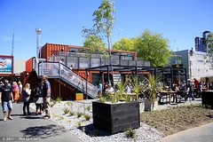
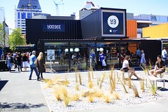
Images for Christchurch CBD; more images...


The Demise of the URM Building Stock in Christchurch during the 2010–2011 …
Research papers, The University of Auckland Library
The progressive damage and subsequent demolition of unreinforced masonry (URM) buildings arising from the Canterbury earthquake sequence is reported. A dataset was compiled of all URM buildings located within the Christchurch CBD, including information on location, building characteristics, and damage levels after each major earthquake in this sequence. A general description of the overall damage and the hazard to both building occupants and to nearby pedestrians due to debris falling from URM buildings is presented with several case study buildings used to describe the accumulation of damage over the earthquake sequence. The benefit of seismic improvement techniques that had been installed to URM buildings is shown by the reduced damage ratios reported for increased levels of retrofit. Demolition statistics for URM buildings in the Christchurch CBD are also reported and discussed. VoR - Version of Record
A Window to the Past
Images, UC QuakeStudies
A bollard covered in tattered posters. The photographer comments, "After the Christchurch February 2011 earthquake no more adverts were pasted onto this advertising pillar. Over a year later the posters are starting to peel off and reveal older ones. It seems that the constant addition of new posters was keeping everything in equilibrium, but with no new posters everything is literally falling apart".
20130511_1538_EOS M-22 The Last National Bank?
Images, eqnz.chch.2010
I think all the National Banks in the country have been either closed or rebranded ANZ, but this one on the corner of Colombo and Armagh Streets is still inside the CBD red zone and has yet to be touched. I have heard that this building is staying so whether it becomes an ANZ or not time will tell. This was one of the top five busiest pedest...
Open Plan Living and Good Indoor/Outdoor Flow
Images, UC QuakeStudies
A brick wall has fallen from this house, exposing the rooms within and leaving a pile of rubble in front. The ceiling has slumped and is held up with jacks. The photographer comments, "This was probably the result of the shallower February Christchurch earthquake rather than the bigger September one".
Christchurch Press Image: Stacy Squires 2010:12:13 10:26:47
Images, UC QuakeStudies
Photograph captioned by Fairfax, "Christchurch CBD was 'yarn-bombed' during the weekend using yarn and fabric pieces to brighten public areas and earthquake-affected spaces. Visitor Ann Rees and her husband Bernard from South Wales said when looking at the yarn-bombed busts at the Arts Centre (from left: Diana Isaac, Elisie Locke, Charles Luney and Margaret Mahy) that it didn't appear like the work of vandals, but looked quite homely and warm".
Seismic Performance of Reinforced Concrete Buildings in the 22 February Ch…
Research papers, University of Canterbury Library
Six months after the 4 September 2010 Mw 7.1 Darfield (Canterbury) earthquake, a Mw 6.2 Christchurch (Lyttelton) aftershock struck Christchurch on the 22 February 2011. This earthquake was centred approximately 10km south-east of the Christchurch CBD at a shallow depth of 5km, resulting in intense seismic shaking within the Christchurch central business district (CBD). Unlike the 4 Sept earthquake when limited-to-moderate damage was observed in engineered reinforced concrete (RC) buildings [35], in the 22 February event a high number of RC Buildings in the Christchurch CBD (16.2 % out of 833) were severely damaged. There were 182 fatalities, 135 of which were the unfortunate consequences of the complete collapse of two mid-rise RC buildings. This paper describes immediate observations of damage to RC buildings in the 22 February 2011 Christchurch earthquake. Some preliminary lessons are highlighted and discussed in light of the observed performance of the RC building stock. Damage statistics and typical damage patterns are presented for various configurations and lateral resisting systems. Data was collated predominantly from first-hand post-earthquake reconnaissance observations by the authors, complemented with detailed assessment of the structural drawings of critical buildings and the observed behaviour. Overall, the 22 February 2011 Mw 6.2 Christchurch earthquake was a particularly severe test for both modern seismically-designed and existing non-ductile RC buildings. The sequence of earthquakes since the 4 Sept 2010, particularly the 22 Feb event has confirmed old lessons and brought to life new critical ones, highlighting some urgent action required to remedy structural deficiencies in both existing and “modern” buildings. Given the major social and economic impact of the earthquakes to a country with strong seismic engineering tradition, no doubt some aspects of the seismic design will be improved based on the lessons from Christchurch. The bar needs to and can be raised, starting with a strong endorsement of new damage-resisting, whilst cost-efficient, technologies as well as the strict enforcement, including financial incentives, of active policies for the seismic retrofit of existing buildings at a national scale.
Urban Disaster Recovery in Christchurch: The Central Business District Cor…
Research papers, University of Canterbury Library
The Canterbury earthquakes, which involved widespread damage in the February 2011 event and ongoing aftershocks near the Christchurch central business district (CBD), presented decision-makers with many recovery challenges. This paper identifies major government decisions, challenges, and lessons in the early recovery of Christchurch based on 23 key-informant interviews conducted 15 months after the February 2011 earthquake. It then focuses on one of the most important decisions – maintaining the cordon around the heavily damaged CBD – and investigates its impacts. The cordon displaced 50,000 central city jobs, raised questions about (and provided new opportunities for) the long-term viability of downtown, influenced the number and practice of building demolitions, and affected debris management; despite being associated with substantial losses, the cordon was commonly viewed as necessary, and provided some benefits in facilitating recovery. Management of the cordon poses important lessons for planning for catastrophic urban earthquakes around the world.
Here Today Gone Tomorrow
Images, UC QuakeStudies
The entrance to the West Avon building on Montreal Street. The photographer comments, "This very wonderful Art Deco heritage building in Christchurch had residents living in it until another visit from the building engineers re-re-checking for earthquake damage. Now it is fenced off and on the list for possible demolition".
Christchurch earthquake anniversary: Broken buildings remain 10 years later
Audio, Radio New Zealand
Cantabrians are still surrounded broken buildings and empty spaces on the 10th anniversary of the devastating 22 February 2011 Christchurch earthquake. The disaster forced 70 percent of the CBD to be demolished. The Government launched an ambitious recovery plan to help it recover in 2012. The Christchurch Central Recovery Plan, dubbed the "blueprint" would dictate the rebuild of the central city. To support it, the Government would complete a series of "anchor projects", to encourage investment in the city and make it a more attractive place to live in. As Anan Zaki reports, the anchor projects appeared to weigh down the progress of the rebuild.
The Way
Images, UC QuakeStudies
An elaborate graffiti tag sprayed on a wall beside a demolition site on Tuam Street. A collection of abandoned objects lie on the site. The photographer comments, "Graffiti spotted in the Christchurch earthquake red zone. What I liked was the odd mixture of bits and bobs around it".
Key factors in the liquefaction-induced damage to buildings and infrastruc…
Research papers, University of Canterbury Library
The paper presents preliminary findings from comprehensive research studies on the liquefaction-induced damage to buildings and infrastructure in Christchurch during the 2010-2011 Canterbury earthquakes. It identifies key factors and mechanisms of damage to road bridges, shallow foundations of CBD buildings and buried pipelines, and highlights the implications of the findings for the seismic analysis and design of these structures.
Looking at Chrstchurch's heritage buildings
Audio, Radio New Zealand
Instead of concentrating on the buildings destroyed in and after the earthquakes in Christchurch's CBD, a new event is enticing people back to explore the heritage buildings that have survived. A new organisation, Te Putahi, is behind the Open Christchurch programme that celebrates the city's surviving architecture, starting with inner-city schools throwing open their doors to the public. Architectural historian and co-founder of Te Putahi, Dr Jessica Halliday tells Lynn Freeman they hope to encourage discussion around well-designed spaces and their impacts on peoples' lives. Open Christchurch starts next Sunday with a tour of The Cathedral Grammar Junior School.
Two Coffees and a Muffin to Takeaway
Images, UC QuakeStudies
Two cardboard coffee cups in a takeaway tray sit on a wooden counter. The photographer comments, "What is the story of these coffees and that sad muffin? Were these an order when the earthquake struck Christchurch on 22 February 2011? Were these a workman's and a colleague's having a quick coffee break when a later aftershock caused them to leave everything behind when they fled the red zoned building, or were they just forgotten when the building was cleared out and abandoned?".
Sam Crofskey and Joseph Hullen: thriving in Christchurch
Audio, Radio New Zealand
Kim Hill talks to Sam Crofskey, the owner of C1 Espresso in the Christchurch CBD, which reopened in 2012 after the Canterbury earthquakes and will celebrate its twentieth anniversary this year. He spoke on the WORD Christchurch panel, How Are We Doing, Christchurch?, and this week launched Let's Take a Walk, a pop-up book for children about the quakes that he created with his wife Fleur and illustrator Hannah Beehre. He is joined by Joseph Hullen (Ngai Tuahuriri, Ngai Tahu), a hunter gatherer, fisherman, explorer, kaitiaki and storyteller who has spent a lifetime gathering traditional kai and listening to stories about his hapu. He is a whakapapa researcher for Te Runanga o Ngai Tahu, and is leading three sold-out walking tours during WORD Christchurch along the banks of the Otakaro (Avon River), uncovering the city's history.
2011 Festival of Flowers
Images, UC QuakeStudies
A laminated sign for the 2011 Festival of Flowers attached to a wooden planter. The plants in the planter are dry and dead. The photographer comments, "The theme for the 2011 Festival of Flowers was 'burst! of water'. The Christchurch February earthquake came and water and sand called liquefaction burst out of the ground all around the area. Ironically the plants for the festival were left unattended in the cordoned off red zone and they would have loved a little burst of water".
The Cathedral has Developed a Bald Spot
Images, UC QuakeStudies
The Cathedral of the Blessed Sacrament after the dome was removed. Large cracks are visible in the walls and in the dome's supporting structure, and the facade is supported by haybales and shipping containers. The photographer comments, "The main dome of the Cathedral of the Blessed Sacrament became unsafe after the February Christchurch earthquake - workmen have slowly been dismantling it. Now we are just left with the cracked and twisted walls that supported the beautiful dome".
wairoa street red zone
Images, eqnz.chch.2010
one of Christchurch's abandoned suburbs. The land moved - bricks and block walls everywhere collapsed - two multi story buildings folded - 184 people died. Wooden framed houses largely stayed up, many concrete slabs cracked, power poles leaned in liquid ground, surface bubbled, services ruptured .... damage to the cbd still gets the most cover...
What now? The post disaster experiences of small inner city retail busines…
Research Papers, Lincoln University
The Christchurch earthquakes brought to an abrupt halt a process of adaptive reuse and gentrification that was underway in the south eastern corner of the central business district. The retail uses that were a key to the success of this area pre-earthquake could be characterised as small, owner operated, quirky, bohemian, chaotic and relatively low rent. This research reports on the progress of a long term, comprehensive case study that follows the progress of these retailers both before and after the earthquakes. Findings include the immediate post-earthquake intentions to resume business in the same location as soon as possible were thwarted by government imposed cordons of the CBD that were only lifted nearly three years later. But, businesses were resilient and generally reinvented themselves quickly in alternative suburban locations where government “rebuild” restrictions were absent. It remains to be seen if this type of retail will ever return to the CBD as government imposed plans and the rents demanded for retail space in new buildings appear to preclude small owner-operated businesses.
Building and bridge pounding damage observed in 2011 Christchurch earthqua…
Research papers, University of Canterbury Library
This paper describes pounding damage sustained by buildings and bridges in the February 2011 Christchurch earthquake. Approximately 6% of buildings in Christchurch CBD were observed to have suffered some form of serious pounding damage. Almost all of this pounding damage occurred in masonry buildings, further highlighting their vulnerability to this phenomenon. Modern buildings were found to be vulnerable to pounding damage where overly stiff and strong ‘flashing’ components were installed in existing building separations. Soil variability is identified as a key aspect that amplifies the relative movement of buildings, and hence increases the likelihood of pounding damage. Pounding damage in bridges was found to be relatively minor and infrequent in the Christchurch earthquake.
Big Red
Images, UC QuakeStudies
A digitally manipulated image of an excavator. The photographer comments, "This is a huge excavator in the Christchurch CBD. It is being used to clear away the enormous amount of rubble from the buildings being demolished. It seems that nearly all the big machinery from all other the world has been needed in the clean up of the earthquake damaged buildings and utilities".
Ōtautahi’s great inner-city cultural revitalisation
Audio, Radio New Zealand
A panel with Michael Bell, Steph Walker and Kiri Jarden. It’s almost 13 years since the devastating earthquake of 22 February 2011, which forced 70 percent of the Ōtautahi Christchurch CBD to be demolished. While the rebuild has been a slow and often difficult process in visions meeting reality, there is also much to celebrate in the city taking up the opportunity, through art and design, to remake it as a place for all.
Creating Modern History
Images, UC QuakeStudies
Part of Mike Hewson's installation 'Homage To Lost Spaces' in the Cramner Courts building, photographs of people riding bicycles have been inserted into a gap in the building. The photographer comments, "Cranmer Courts was very badly damaged in the quakes that unexpectedly hit Christchurch. Originally big photographs were put into the holes where the doors and windows were, but now these massive pictures have been put across the boarded up ends of the buildings to keep them alive in the minds of the people of Christchurch. The project was thought up by Mike Hewson".
Building pounding damage observed in the 2011 Christchurch earthquake
Research papers, University of Canterbury Library
This paper describes the pounding damage sustained by buildings in the February 2011 Christchurch earthquake. Approximately 6% of buildings in Christchurch CBD were observed to have suffered some form of serious pounding damage. Typical and exceptional examples of building pounding damage are presented and discussed. Almost all building pounding damage occurred in unreinforced masonry buildings, highlighting their vulnerability to this phenomenon. Modern buildings were found to be vulnerable to pounding damage where overly stiff and strong ‘flashing’ components were installed in existing building separations. Soil variability is identified as a key aspect that amplifies the relative movement of buildings, and hence increases the likelihood of pounding damage. Building pounding damage is compared to the predicted critical pounding weaknesses that have been identified in previous analytical research.
Nisbet, Alistair, 1958- :The REAL Christchurch buskers... 19 January 2012
Images, Alexander Turnbull Library
Aspects of Christchurch life after the earthquakes of 2010 and 2011, modelled on acts performed at the Buskers' Festival being held in Christchurch. Include `Silt walking'through liquefaction; 'Orange zone', representing the paralysis of homeowners whose properties were classified as 'orange', or of undecided status; 'Jugglers "Marryatt" and "Red Zone"': the Christchurch CEO, Tony Marryatt, juggles with money, his large pay rise, while the red-zoned householder juggles with unattractive options; 'The boy [CBD] with red tape all over him', referring to the cordon which was strangling the Central Business District; the columnist Joe Bennett with his dog, refusing to move from his house in Lyttelton, a cause celebre of resistance to the earthquake authorities in those days. Quantity: 1 digital cartoon(s).
A Giant Sized Game of Monopoly
Images, UC QuakeStudies
A digitally manipulated image of the Gap Filler Monopoly board square on Manchester Street. The photographer comments, "On the site of a demolished earthquake damaged building in Christchurch, New Zealand is a Monopoly game square for giants. The Gap Filler Project makes the bare land where once a building once stood into something both interesting and unique and this time they created a massive Monopoly board square. In the game of Monopoly you move your player with a dog, shoe or maybe the hat, but as the most common thing in the City are diggers they have the placed one on the square. There are also two houses on Manchester Street, which is priced at $240".
Effect of permeability on the cyclic generation and dissipation of pore pr…
Research papers, The University of Auckland Library
A dramatic consequence of the Christchurch, New Zealand, earthquakes of 2010 and 2011 was the widespread liquefaction in the city. Part of the central business district (CBD) was badly affected by liquefaction but elsewhere large volumes of ejecta were not evident for those parts of the CBD where the upper layers in the soil profile are sandy gravel and gravelly sand. The purpose of the paper is to investigate the effect of the gravel permeability on the rise and dissipation of excess pore water pressure during cyclic loading of a soil profile idealised from Christchurch data. The Cyclic1D software, which performs one-dimensional non-linear effective stress site response analysis, was used. Permeability values associated with gravel were found to suppress the cyclic accumulation of excess pore water pressure in gravel layers. Given that there has not been any systematic measurement of the in situ permeability of the gravels in Christchurch, the modelling in the paper suggests that likely values for the bulk permeability of the gravel layers are within the range suggested in the geotechnical literature. However, the work reported is of wider application than Christchurch and emphasises the controlling influence of permeability on the accumulation and dissipation of cyclic pore pressures. VoR - Version of Record
Geotechnical Aspects of the 22 February 2011 Christchurch earthquake
Research papers, University of Canterbury Library
The 22 February 2011, Mw6.2-6.3 Christchurch earthquake is the most costly earthquake to affect New Zealand, causing 181 fatalities and severely damaging thousands of residential and commercial buildings, and most of the city lifelines and infrastructure. This manuscript presents an overview of observed geotechnical aspects of this earthquake as well as some of the completed and on-going research investigations. A unique aspect, which is particularly emphasized, is the severity and spatial extent of liquefaction occurring in native soils. Overall, both the spatial extent and severity of liquefaction in the city was greater than in the preceding 4th September 2010 Darfield earthquake, including numerous areas that liquefied in both events. Liquefaction and lateral spreading, variable over both large and short spatial scales, affected commercial structures in the Central Business District (CBD) in a variety of ways including: total and differential settlements and tilting; punching settlements of structures with shallow foundations; differential movements of components of complex structures; and interaction of adjacent structures via common foundation soils. Liquefaction was most severe in residential areas located to the east of the CBD as a result of stronger ground shaking due to the proximity to the causative fault, a high water table approximately 1m from the surface, and soils with composition and states of high susceptibility and potential for liquefaction. Total and differential settlements, and lateral movements, due to liquefaction and lateral spreading is estimated to have severely compromised 15,000 residential structures, the majority of which otherwise sustained only minor to moderate damage directly due to inertial loading from ground shaking. Liquefaction also had a profound effect on lifelines and other infrastructure, particularly bridge structures, and underground services. Minor damage was also observed at flood stop banks to the north of the city, which were more severely impacted in the 4th September 2010 Darfield earthquake. Due to the large high-frequency ground motion in the Port hills numerous rock falls and landslides also occurred, resulting in several fatalities and rendering some residential areas uninhabitable.
Bob Brown's Hi-Fi
Images, UC QuakeStudies
Broken windows on the Orion building on Manchester Street. The photographer comments, "Bob Brown's Hi-Fi was damaged, as you can see, in the Christchurch earthquake on the 22 February 2011. At lot of buildings in the area have been demolished, but this art deco style structure might have not have been put on the demolition list yet".
The Week in Review - week ending 12 August 2011
Audio, Radio New Zealand
The Week In Review for week ending 12 August 2011... featuring a new rebuild plan for Christchurch's earthquake ravaged CBD, problems at the Waikato-Tainui Tribal Parliament, a pricing fiasco surrounding the Adidas All Blacks Rugby World Cup jersey, the Mana party confirms it will contest all seven Maori seats and some general seats in November's general election, the renaming of Mt Cook's South Ridge to The Hillary Ridge and the White Mouse passes away.