
Search
found 1546 results
Images for Earthquake Services; more images...


Digital Photograph: Sunflower Atop a Road Works Cone
Images, Canterbury Museum
One landscape colour digital photograph taken 22 February 2017 showing a sunflower sitting atop a road works cone as part of the Canterbury Earthquake Memorial Service.
Outcomes of the Canterbury Earthquake Sequence for Tourism Businesses
Research papers, University of Canterbury Library
The Christchurch earthquake sequence has been on-going since September 4th 2010. The largest two earthquakes, magnitude (M) 7.1 on September 4th and the M 6.3 on February 22nd 2011 caused immediate and significant damage to the city of Christchurch. As a consequence of the earthquakes, the tourism sector in the Canterbury region has been heavily impacted, with broader impacts being felt throughout the South Island. Resilient Organisations and the University of Canterbury began a series of quantitative investigations into the recovery and response of key business sectors to the earthquakes. The purpose of this study was to build on this work by exploring the outcomes of the earthquakes on the tourism sector, a critical economic driver in the region. Two postal surveys were sent to 719 tourism business managers; the first to businesses in the ‘Impact Zone’ defined as areas that experienced Modified Mercalli intensities greater than 6. The second survey was sent to the remaining businesses throughout the Canterbury region (‘Rest of Canterbury’). Response rates were 46% response for the Impact Zone, and 29% for the Rest of Canterbury. Key findings:
The effects of the Christchurch earthquakes of 2010 and 2011 on the qualit…
Research papers, University of Canterbury Library
This study explored the effects of the Canterbury earthquakes of 2010 and 2011 on different areas of quality of life (QOL) for children and adolescents with disabilities. Using a survey developed from the Quality of Life Instrument for People with Developmental Disabilities – Short Version (QOL-PDD-SV) (Brown, Raphael & Renwick, 1997) and The World Health Organisation Quality of Life - (WHOQOL)-BREF, parents or caregivers were asked to identify what level of importance and satisfaction their child or adolescent placed on areas of QOL including physical health, psychological health - stress levels and coping ability, attachment to their neighbourhood, friends, family, leisure activities, community access and schooling. They were also asked to determine what level of impact the earthquakes had had on each area of their child or adolescent’s life and overall quality of life in the aftermath of the earthquakes. A total of 31 parents of 22 males and 9 females between the ages of 2.5 years to 19 years of age (mean age: 12.6 years) responded. The results were collated and analysis was run to measure for the effect of age, gender and geographical location. The results found that the earthquakes affected nearly every area of QOL for the children and adolescents. The biggest impact on the children’s psychological health and their ability to cope It was observed that younger children (<13) were more likely to record improved or lessened effects from the earthquakes in psychological health areas. However, the areas of social belonging and friendships were the least affected by the earthquakes. Female children were more likely to indicate higher scores for social belonging after the earthquakes. Many parents observed that their children developed improved coping skills over the earthquake period. The findings in this study offer a better understanding of how earthquakes can affect the quality of life children and adolescents with disabilities.
The preparedness and response of the population of Lyttelton, New Zealand,…
Research papers, University of Canterbury Library
Small, tight-knit communities, are complex to manage from outside during a disaster. The township of Lyttelton, New Zealand, and the communities of Corsair Bay, Cass Bay, and Rapaki to the east, are especially more so difficult due to the terrain that encloses them, which caused them to be cut-off from Christchurch, the largest city in the South Island, barely 10 km away, after the Mw 7.1 Darfield Earthquake and subsequent Canterbury Earthquake Sequence. Lyttelton has a very strong and deep-rooted community spirit that draws people to want to be a part of Lyttelton life. It is predominantly residential on the slopes, with retail space, service and light industry nestled near the harbour. It has heritage buildings stretching back to the very foundation of Canterbury yet hosts the largest, modern deep-water port for the region. This study contains two surveys: one circulated shortly before the Darfield Earthquake and one circulated in July 2011, after the Christchurch and Sumner Earthquakes. An analytical comparison of the participants’ household preparedness for disaster before the Darfield Earthquake and after the Christchurch and Sumner Earthquakes was performed. A population spatiotemporal distribution map was produced that shows the population in three-hourly increments over a week to inform exposure to vulnerability to natural hazards. The study went on to analyse the responses of the participants in the immediate period following the Chrsitchurch and Sumner Earthquakes, including their homeward and subsequent journeys, and the decision to evacuate or stay in their homes. Possible predictors to a decision to evacuate some or all members of the household were tested. The study also asked participants’ views on the events since September 2010 for analysis.
Contemporary and paleo-rockfalls as proxies for strong ground motions
Research papers, University of Canterbury Library
A major hazard accompanying earthquake shaking in areas of steep topography is the detachment of rocks from bedrock outcrops that subsequently slide, roll, or bounce downslope (i.e. rockfalls). The 2010-2011 Canterbury earthquake sequence caused recurrent and severe rockfall in parts of southern Christchurch. Coseismic rockfall caused five fatalities and significant infrastructural damage during the 2011 Mw 6.2 Christchurch earthquake. Here we examine a rockfall site in southern Christchurch in detail using geomorphic mapping, lidar analysis, geochronology (cosmogenic 3He dating, radiocarbon dating, optically stimulated luminescence (OSL) from quartz, infrared stimulated luminescence from K-feldspar), numerical modeling of rockfall boulder trajectories, and ground motion prediction equations (GMPEs). Rocks fell from the source cliff only in earthquakes with interpolated peak ground velocities exceeding ~10 cm/s; hundreds of smaller earthquakes did not produce rockfall. On the basis of empirical observations, GMPEs and age chronologies we attribute paleo-rockfalls to strong shaking in prehistoric earthquakes. We conclude that earthquake shaking of comparable intensity to the strongest contemporary earthquakes in Christchurch last occurred at this site approximately 5000 to 7000 years ago, and that in some settings, rockfall deposits provide useful proxies for past strong ground motions.
Transport infrastructure performance and management in the South Island of…
Research papers, University of Canterbury Library
At 00:02 on 14th November 2016, a Mw 7.8 earthquake occurred in and offshore of the northeast of the South Island of New Zealand. Fault rupture, ground shaking, liquefaction, and co-seismic landslides caused severe damage to distributed infrastructure, and particularly transportation networks; large segments of the country’s main highway, State Highway 1 (SH1), and the Main North Line (MNL) railway line, were damaged between Picton and Christchurch. The damage caused direct local impacts, including isolation of communities, and wider regional impacts, including disruption of supply chains. Adaptive measures have ensured immediate continued regional transport of goods and people. Air and sea transport increased quickly, both for emergency response and to ensure routine transport of goods. Road diversions have also allowed critical connections to remain operable. This effective response to regional transport challenges allowed Civil Defence Emergency Management to quickly prioritise access to isolated settlements, all of which had road access 23 days after the earthquake. However, 100 days after the earthquake, critical segments of SH1 and the MNL remain closed and their ongoing repairs are a serious national strategic, as well as local, concern. This paper presents the impacts on South Island transport infrastructure, and subsequent management through the emergency response and early recovery phases, during the first 100 days following the initial earthquake, and highlights lessons for transportation system resilience.
Geotechnical Aspects of the 2010 Darfield (Canterbury) Earthquake
Research papers, University of Canterbury Library
On 4 September 2010, a magnitude Mw 7.1 earthquake struck the Canterbury region on the South Island of New Zealand. The epicentre of the earthquake was located in the Darfield area about 40 km west of the city of Christchurch. Extensive damage was inflicted to lifelines and residential houses due to widespread liquefaction and lateral spreading in areas close to major streams, rivers and wetlands throughout Christchurch and Kaiapoi. Unreinforced masonry buildings also suffered extensive damage throughout the region. Despite the severe damage to infrastructure and residential houses, fortunately, no deaths occurred and only two injuries were reported in this earthquake. From an engineering viewpoint, one may argue that the most significant aspects of the 2010 Darfield Earthquake were geotechnical in nature, with liquefaction and lateral spreading being the principal culprits for the inflicted damage. Following the earthquake, an intensive geotechnical reconnaissance was conducted to capture evidence and perishable data from this event. This paper summarizes the observations and preliminary findings from this early reconnaissance work.
Photograph number UC 11-0055-04
Images, UC QuakeStudies
Spice Traders is open again following the February earthquake.
Photograph number UC 10-0498-057
Images, UC QuakeStudies
Exterior of the Engineering library following the September earthquake.
Representative ground motion ensembles for several major earthquake scenar…
Research papers, University of Canterbury Library
This paper develops representative ground motion ensembles for several major earthquake scenarios in New Zealand. Cases considered include representative ground motions for the occurrence of Alpine, Hope, and Porters Pass earthquakes in Christchurch, and the occurrence of Wellington, Wairarapa, and Ohariu, fault ruptures in Wellington. Challenges in the development of ground motion ensembles for subduction zone earthquakes are also highlighted. The ground motions are selected based on the generalized conditional intensity measure (GCIM) approach, ensuring that the ground motion ensembles represent both the mean, and distribution of ground motion intensity which such scenarios could impose. These scenario-based ground motion sets can be used to complement ground motions which are often selected in conjunction with probabilistic seismic hazard analysis, in order to understand the performance of structures for the question “what if this fault ruptures?”
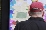
Christchurch Press Infographic: 22 February 2012 (7)
Images, UC QuakeStudies
A graphic giving information about memorial services marking the anniversary of the 22 February 2011 earthquake.
Christchurch Press Image: John Kirk-Anderson 2010:09:06 17:34:19
Images, UC QuakeStudies
Photograph captioned by Fairfax, "Rob Saunders, NZ Fire Service, during a press conference following Canterbury's earthquake".
A preliminary analysis of the ‘recovery machine’ in post-earthquake Christ…
Research papers, Lincoln University
After 160 years of colonial settlement, Christchurch has recently experienced a sequence of devastating earthquakes and seen the need for a widespread de- and re-construction of the central city, as well as, many of the surrounding neighbourhoods and peri-urban satellite settlements. This paper will offer a view of the opportunities and restrictions to the post-earthquake re-development of Christchurch as informed by ‘growth machine’ theory. A case study investigating an illegal dump in central Christchurch will be used to assess the applicability of growth machine theory to the current disaster response.
Building and bridge pounding damage observed in 2011 Christchurch earthqua…
Research papers, University of Canterbury Library
This paper describes pounding damage sustained by buildings and bridges in the February 2011 Christchurch earthquake. Approximately 6% of buildings in Christchurch CBD were observed to have suffered some form of serious pounding damage. Almost all of this pounding damage occurred in masonry buildings, further highlighting their vulnerability to this phenomenon. Modern buildings were found to be vulnerable to pounding damage where overly stiff and strong ‘flashing’ components were installed in existing building separations. Soil variability is identified as a key aspect that amplifies the relative movement of buildings, and hence increases the likelihood of pounding damage. Pounding damage in bridges was found to be relatively minor and infrequent in the Christchurch earthquake.
Performance of ceilings in the February 2011 Christchurch earthquake
Research papers, University of Canterbury Library
This paper describes the performance of (or damage to) ceilings in buildings during the 22nd February 2011 Christchurch earthquake and the subsequent aftershocks. In buildings that suffered severe structural damage, ceilings and other non-structural components (rather expectedly) failed, but even in buildings with little damage to their structural systems, ceilings were found to be severely damaged. The extent of ceiling damage, where the ceilings were subject to severe shaking, depended on the type of the ceiling system, the size and weight of the ceilings and the interaction of ceilings with other elements. The varieties and extent of observed ceiling damage are discussed in this paper with the help of photographs taken after the earthquake.
Empirical vulnerability assessment of reinforced concrete frame with mason…
Research papers, The University of Auckland Library
During the 2010/2011 Canterbury earthquakes, Reinforced Concrete Frame with Masonry Infill (RCFMI) buildings were subjected to significant lateral loads. A survey conducted by Christchurch City Council (CCC) and the Canterbury Earthquake Recovery Authority (CERA) documented 10,777 damaged buildings, which included building characteristics (building address, the number of storeys, the year of construction, and building use) and post-earthquake damage observations (building safety information, observed damage, level of damage, and current state of the buildings). This data was merged into the Canterbury Earthquake Building Assessment (CEBA) database and was utilised to generate empirical fragility curves using the lognormal distribution method. The proposed fragility curves were expected to provide a reliable estimation of the mean vulnerability for commercial RCFMI buildings in the region http://www.13thcms.com/wp-content/uploads/2017/05/Symposium-Info-and-Presentation-Schedule.pdf VoR - Version of Record
Observed performance of residential masonry veneer construction in the 201…
Research papers, The University of Auckland Library
Following the 2010/2011 Canterbury, New Zealand earthquakes, a detailed door-to-door survey was conducted in the Christchurch region to establish the earthquake performance of lightweight timber-framed residential dwellings with a masonry veneer external cladding system. The post-earthquake survey involved documenting the condition of dwellings in areas that had experienced different levels of earthquake shaking, allowing comparison between the performance of different veneer systems and different shaking intensities. In total, just fewer than 1,100 residential dwellings were inspected throughout the wider Christchurch area. The survey included parameters such as level of veneer damage, type of veneer damage, observed crack widths, and level of repair required. It is concluded that based on observed earthquake performance at the shaking intensities matching or exceeding ultimate limit state loading, the post-1996 veneer fixing details performed satisfactorily and continued use of the detail is recommended without further modification AM - Accepted Manuscript
An inventory of community-led and non-governmental organisations and initi…
Research papers, Lincoln University
The impact of the Canterbury earthquake sequence of 2010-12 and its aftermath has been enormous. This inventory lists some of the thousands of community-led groups and initiatives across the region that have developed or evolved as a result of the quake. This inventory is the third such inventory to have been produced. The Christchurch Earthquake Activity Inventory was released by Landcare Research in May 2011, three months after the devastating 22 February 2011 earthquake. The second inventory, entitled An Inventory of Community-led Recovery Initiatives in Canterbury, was collated by Bailey Peryman and Dr Suzanne Vallance (Lincoln University) approximately one year after the February earthquake. The research for this third inventory was undertaken over a four month period from June to September 2013, and was conducted primarily through online searches.This research was undertaken with funding support from the Natural Hazards Platform and GNS, New Zealand.
Fairfax Video, February 2012 (4)
Videos, UC QuakeStudies
A video of interviews with four Christchurch residents about their experiences during the 22 February 2011 earthquake. The residents include David Sandeman, who was in the PGC Building when the earthquake struck, Tristan Roberts, a member of the New Zealand Fire Service who assisted after the earthquake, Claudia McFie, who was in Cashel Street when the earthquake struck, and Belinda Van Gruting, a doctor in Christchurch. This video was part of The Press's 'Christchurch, one year after February 22, 2011' series.
Dealing with post-earthquake disruption - perspectives from accommodation …
Research papers, Lincoln University
Summary report prepared for Christchurch and Canterbury Tourism which presented overall research findings with a focus on those relaing to the provision and effectiveness of visitor information after the February 2011 earthquake
Investigation of systematic ground motion effects through ground motion si…
Research papers, University of Canterbury Library
Photograph number UC 11-0087-01
Images, UC QuakeStudies
The earthquake size detecting penguins all lined up and waiting.
Photograph number UC 10-0498-013
Images, UC QuakeStudies
Staff working at the Emergency House after the September earthquakes.
Photograph number UC 10-0498-124
Images, UC QuakeStudies
Staff working at the Emergency House after the September earthquakes.
Photograph number UC 10-0498-007
Images, UC QuakeStudies
Staff working at the Emergency House after the September earthquakes.
Photograph number UC 10-0498-006
Images, UC QuakeStudies
Staff working at the Emergency House after the September earthquakes.
Photograph number UC 10-0498-003
Images, UC QuakeStudies
Staff working at the Emergency House after the September earthquakes.
Photograph number UC 10-0498-002
Images, UC QuakeStudies
Staff working at the Emergency House after the September earthquakes.
Photograph number UC 10-0498-016
Images, UC QuakeStudies
Staff working at the Emergency House after the September earthquakes.
Photograph number UC 10-0498-009
Images, UC QuakeStudies
Staff working at the Emergency House after the September earthquakes.