Search
found 251 results
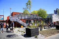
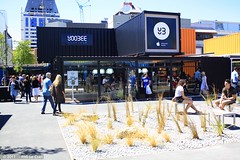
Images for Christchurch CBD; more images...


Considerations on the seismic performance of pre-1970s RC buildings in the…
Research papers, University of Canterbury Library
The 4th of September 2010 Mw 7.1 Darfield (Canterbury) earthquake had generated significant ground shaking within the Christchurch Central Business District (CBD). Despite the apparently significant shaking, the observed structural damage for pre-1970s reinforced concrete (RC) buildings was indeed limited and lower than what was expected for such typology of buildings. This paper explores analytically and qualitatively the different aspects of the "apparent‟ good seismic performance of the pre-1970s RC buildings in the Christchurch CBD, following the earthquake reconnaissance survey by the authors. Damage and building parameters survey result, based on a previously established inventory of building stock of these non-ductile RC buildings, is briefly reported. From an inventory of 75 buildings, one building was selected as a numerical case-study to correlate the observed damage with the non-linear analyses. The result shows that the pre-1970s RC frame buildings performed as expected given the intensity of the ground motion shaking during the Canterbury earthquake. Given the brittle nature of this type of structure, it was demonstrated that more significant structural damage and higher probability of collapse could occur when the buildings were subjected to alternative input signals with different frequency content and duration characteristics and still compatible to the seismicity hazard for Christchurch CBD.
CBD plan could be boon for business but bad for democracy
Audio, Radio New Zealand
The Christchurch City Council's control of the earthquake recovery plan has been taken out of its hands, to the delight of business leaders, but to the chagrin of some local councilors.
APEC project on SME Resilience, Resilient Organisations monthly reports Re…
Research papers, University of Canterbury Library
The earthquake sequence has resulted in significant physical and reputational damage to the Canterbury tourism industry. Eighteen months after the earthquakes inbound tourism data is still below pre-earthquake levels, with Canterbury operators reporting that the industry has not bounced back to where it was before September 2010. Outcomes of the earthquakes on business performance highlight there were winners and losers in the aftermath. Recovery of inbound tourism markets is closely tied to the timeframe to rebuild the CBD of Christchurch. Reinstating critical tourism infrastructure will drive future tourism investment, and allow tourism businesses to regenerate and thrive into the future. A blueprint for rebuilding the CBD of Christchurch was released by the Christchurch City Council in July 2012, and has been well received by tourism stakeholders in the region. The challenge now is for city officials to fund the development projects outlined in the blueprint, and to rebuild the CBD as quickly as possible in order to help regenerate the tourism industry in Christchurch, Canterbury and the rest of the South Island
Stone By Precious Stone
Images, UC QuakeStudies
A protest sign painted on a fence shows an image of the cathedral spire and the words "Save + restore, stone by precious stone!" The photographer comments, "The Christchurch Cathedral got very badly damaged in the earthquake. It was being demolished down to a safe level before a major protest managed to stop it going too far. There is still an ongoing debate on what to do with the Cathedral. In the meantime a cardboard cathedral made out of a steel framework and massive toilet roll tubes is being constructed close by. This is to the right of the protest about the closure of Christchurch schools".
Christchurch, NZ - Post Feb Earthquake, 2011
Images, eqnz.chch.2010
The current state of the Christchurch Cathedral can be seen in the middle. The spire collapsed as a result of the earthquake. Taken during a scenic flight over Christchurch, New Zealand, 3 months after the deadly earthquake of 22 February, 2011. Much of the inner city CBD is still cordoned off and will be for some time. About 900 buildings are ...
Southern Story for 21 February 2013 - Earthquake Anniversary
Audio, Radio New Zealand
Christchurch prepares for a challenging anniversary - two years on from the devastating earthquake that killed 185 people. Our correspondent there, Katy Gosset, hears the stories of local baristas who were in the CBD that day.
Manawatu Standard Image: Stacy Squires 2010:12:13 10:10:00
Images, UC QuakeStudies
Photograph captioned by Fairfax, "Christchurch CBD was 'yarn-bombed' during the weekend using yarn and fabric pieces to brighten public areas and earthquake-affected spaces. Hope sign at Hereford and Manchester Streets".
The Southland Times Image: Stacy Squires 2010:12:13 10:03:28
Images, UC QuakeStudies
Photograph captioned by Fairfax, "Christchurch CBD was 'yarn-bombed' during the weekend using yarn and fabric pieces to brighten public areas and earthquake-affected spaces. Hope sign at Hereford and Manchester Streets".
The Southland Times Image: Stacy Squires 2010:12:13 10:04:02
Images, UC QuakeStudies
Photograph captioned by Fairfax, "Christchurch CBD was 'yarn-bombed' during the weekend using yarn and fabric pieces to brighten public areas and earthquake-affected spaces. Hope sign at Hereford and Manchester Streets".
Modern Art or Old Fashioned Disaster
Images, UC QuakeStudies
Boarded-up broken windows on the old Christchurch City Council building in Tuam Street. The photographer comments, "What can happen to a building when the land is no longer solid as a rock".
Nisbet, Alastair, 1958- :'See! with some simple surgery things can still f…
Images, Alexander Turnbull Library
Shows a patched wind up heart labelled 'ChCh Central' with several tubes attached. Context: On 18 April 2012 Earthquake Minister Gerry Brownlee annnounced the establishment of Christchurch Central Development Unit focussing on the rebuilding of the Christchurch Central Business District (CBD) (Scoop website 18 April 2012). Quantity: 1 digital cartoon(s).
Evans, Malcolm Paul, 1945- :'Kwark'. 8 May 2012
Images, Alexander Turnbull Library
Shows Property Investor Bob Jones with a shotgun on top of Christchurch cathedral on an island surrounded by ducks. The lake is labelled 'Lake Bob Parker'. Context: Bob Jones suggested the Christchurch CBD be replaced with a lake (The Listener 12-18 May 2012). Colour and black and white versions available Quantity: 2 digital cartoon(s).
The Boulevard of Broken Dreams
Images, UC QuakeStudies
A digitally manipulated photograph of the sign for the Boulevarde restaurant. The photographer comments, "The title is very appropriate as this restaurant was closed after the February Christchurch earthquake. The area has been cordoned off for ages now and everything will probably be demolished.
Characterisation of ground conditions in the Christchurch Central Business…
Research papers, University of Canterbury Library
The magnitude Mw 6.2 earthquake of February 22nd 2011 that struck beneath the city of Christchurch, New Zealand, caused widespread damage and was particularly destructive to the Central Business District (CBD). The shaking caused major damage, including collapses of structures, and initiated ground failure in the form of soil liquefaction and consequent effects such as sand boils, surface flooding, large differential settlements of buildings and lateral spreading of ground towards rivers were observed. A research project underway at the University of Canterbury to characterise the engineering behaviour of the soils in the region was influenced by this event to focus on the performance of the highly variable ground conditions in the CBD. This paper outlines the methodology of this research to characterise the key soil horizons that underlie the CBD that influenced the performance of important structures during the recent earthquakes, and will influence the performance of the rebuilt city centre under future events. The methodology follows post-earthquake reconnaissance in the central city, a desk study on ground conditions, site selection, mobilisation of a post-earthquake ground investigation incorporating the cone penetration test (CPT), borehole drilling, shear wave velocity profiling and Gel-push sampling followed by a programme of laboratory testing including monotonic and cyclic testing of the soils obtained in the investigation. The research is timely and aims to inform the impending rebuild, with appropriate information on the soils response to dynamic loading, and the influence this has on the performance of structures with various foundation forms.
Lux City
Images, UC QuakeStudies
A digitally manipulated image of light sculptures on Gloucester Street during the LuxCity event. The photographer comments, "This was part of the LuxCity event in Christchurch, New Zealand. It was a way of creating a city of lights on the sites of demolished buildings in the earthquake devastated red zone. 350 architecture and design students from all around New Zealand created and constructed 16 pop up spaces".
Polson's Paint Wall Sign
Images, UC QuakeStudies
An old advertising sign exposed by the demolition of an adjoining building. The photographer comments, "'Protect your investment. Paint your property regularly - and save money. Polson's decorators and sign writers.' The building that was adjacent to this one was demolished after the Christchurch earthquake and revealed this fabulous old wall sign.
What Light Through Yonder Window Breaks?
Images, UC QuakeStudies
Broken stained glass in a window of the ChristChurch Cathedral. The photographer comments, "I only managed to get one picture of the badly earthquake damaged Christchurch Cathedral and I did not want to get the buttresses holding it up like some Medieval siege engine, so I thought this one was perfect. Looking through the window notice that the adjacent wall has gone and the blue windows belong to an office block across the road".
Willburn Furniture and Restoration Needs Restoring
Images, UC QuakeStudies
A digitally manipulated image of furniture and machinery. The photographer comments, "This furniture restoration company got caught in the middle of the Christchurch earthquake and lost a whole wall. After constant exposure to the elements everything now needs a bit of restoration. They are now working in a different part of Christchurch, but their past can still be seen".
I'll Kiss It Better
Images, UC QuakeStudies
Digitally manipulated image of graffiti on a brick building on St Asaph Street. The graffiti depicts a sticking plaster over a broken section of the wall, with the words "I'll kiss it better". The photographer comments, "After the 22 February 2011 earthquake in Christchurch band aid plasters starting to appear in different parts of the city on damaged buildings. A year later most can still be seen. This one was once a whole plaster, but it has slowly broken up where it crossed the gap. The red bricks seen to symbolise the terrible wounds caused to the City and it's people".
The Week in Review- week ending 11 March 2011
Audio, Radio New Zealand
A review of the week's news including: national earthquake memorial service announced, former defence chief to be new Governor General, Reserve Bank slashes official cash rate, Christchurch businesses say OCR cut alone won't save them, mounting concern over Christchurch World Cup prospects, government says 10,000 Christchurch homes will be demolished, alarm over possibility of mass demolition in CBD, international crews head home, petrol prices at three year high, Pike River mine receivers take control from police and boulder sold for thousands in aid of Christchurch
Christchurch Press Image: Stacy Squires 2010:12:13 10:26:05
Images, UC QuakeStudies
Photograph captioned by Fairfax, "Christchurch CBD was 'yarn-bombed' during the weekend using yarn and fabric pieces to brighten public areas and earthquake-affected spaces. Visitor Ann Rees and her husband Bernard from South Wales said when looking at the yarn-bombed busts at the Arts Centre that it didn't appear like the work of vandals, but looked quite homely and warm".
Christchurch Press Image: Stacy Squires 2010:12:13 10:25:56
Images, UC QuakeStudies
Photograph captioned by Fairfax, "Christchurch CBD was 'yarn-bombed' during the weekend using yarn and fabric pieces to brighten public areas and earthquake-affected spaces. Visitor Ann Rees and her husband Bernard from South Wales said when looking at the yarn-bombed busts at the Arts Centre that it didn't appear like the work of vandals, but looked quite homely and warm".
Christchurch Press Image: Stacy Squires 2010:12:13 10:25:36
Images, UC QuakeStudies
Photograph captioned by Fairfax, "Christchurch CBD was 'yarn-bombed' during the weekend using yarn and fabric pieces to brighten public areas and earthquake-affected spaces. Visitor Ann Rees and her husband Bernard from South Wales said when looking at the yarn-bombed busts at the Arts Centre that it didn't appear like the work of vandals, but looked quite homely and warm".
Parking in the Red Zone
Images, UC QuakeStudies
A digitally manipulated photograph of the car parking building on the corner of Manchester and Gloucester Streets. The photographer comments, "Whilst on a tour of the Christchurch earthquake red zone we passed this car park, which I always liked due to its American outgoing feel
GIS based assessment of seismic risk for the Christchurch CBD and Mount Pl…
Research papers, University of Canterbury Library
This research employs a deterministic seismic risk assessment methodology to assess the potential damage and loss at meshblock level in the Christchurch CBD and Mount Pleasant primarily due to building damage caused by earthquake ground shaking. Expected losses in terms of dollar value and casualties are calculated for two earthquake scenarios. Findings are based on: (1) data describing the earthquake ground shaking and microzonation effects; (2) an inventory of buildings by value, floor area, replacement value, occupancy and age; (3) damage ratios defining the performance of buildings as a function of earthquake intensity; (4) daytime and night-time population distribution data and (5) casualty functions defining casualty risk as a function of building damage. A GIS serves as a platform for collecting, storing and analyzing the original and the derived data. It also allows for easy display of input and output data, providing a critical functionality for communication of outcomes. The results of this study suggest that economic losses due to building damage in the Christchurch CBD and Mount Pleasant will possibly be in the order of $5.6 and $35.3 million in a magnitude 8.0 Alpine fault earthquake and a magnitude 7.0 Ashley fault earthquake respectively. Damage to non-residential buildings constitutes the vast majority of the economic loss. Casualty numbers are expected to be between 0 and 10.
Nisbet, Alistair, 1958-:Satellite to plunge to earth..."People should see …
Images, Alexander Turnbull Library
The title reads 'Satellite to plunge to earth "People should see quite a show." A 'NASA' satellite heads towards New Zealand; someone inside says 'Beep! Beep! Christchurch CBD here we come! Woo-hoo!' Context: A great deal of the CBD (Central Business District) in Christchurch is being demolished, considered to dangerous or too expensive to restore. A defunct 6.5 ton NASA satellite falls to earth this week... 26 pieces, with a combined mass of 500kg will survive the fiery re-entry and hurtle towards us. NASA doesn't have much idea of where it will land so it may demolish some of Christchurch. Quantity: 1 digital cartoon(s).
Christchurch earthquake anniversary: Government slowed down recovery from …
Audio, Radio New Zealand
A prominent Christchurch property investor says the Government's anchor projects meant to help rebuild the city faster, has instead slowed it down. After the 2011 earthquake, the Government launched a recovery plan for the CBD, which had 16 anchor projects designed to spur on the rebuild. However, many have been plagued by delays and are still unfinished. Property investor Antony Gough told RNZ reporter Anan Zaki that unlike the Government, it was the private sector which ploughed ahead with the rebuild.
Before/after : the governance of urban tourist spaces in the context of th…
Research papers, University of Canterbury Library
Research in the governance of urban tourist spaces is characterized by a lack of argumentative inquiry and scant use of critical theory. This is evident, particularly, in the study of tourism and post-disaster urban recovery, with very few contributions assessing the phenomenon from a social theory perspective. This thesis examines the complex phenomenon of planning and governance for urban tourism spaces in contexts facing physical recovery from natural disasters. It does so by looking at the governance dynamics and the mechanism of decision- making put in place before and after triggering events like earthquakes and tsunamis. This thesis provides evidence from Christchurch, New Zealand, by focusing on the policies and strategies for the regeneration of the city centre put in place before and after the disruptive earthquakes of 2010 and 2011. The thesis looks at power relations, structures and ideologies through a Lukesian appraisal of pre-and-post disaster governance from two relevant urban tourist spaces located in the Christchurch central city area: the Arts Centre of Christchurch and the Town Hall and Performing Arts Precinct. The research strategy adopted for the study combined archival research, interviews with key stakeholders and fieldwork notes over a period of two years. The research deployed a comparative case study methodology that focuses on projects taking place within a spatially defined area of the city centre where special legislation was enacted as result of the earthquakes. The findings from the interviews and their triangulation with documents retrieved from national and local authorities suggest that the earthquakes affected the engagement among stakeholders and the mechanisms of decision-making. Also, the findings show patterns of disaster capitalism in post-earthquake governance for urban tourist spaces in the Christchurch CBD, with episodes of exclusion, lobbying and amendment of rules and legislation that directly benefited the interests of a narrow group of privileged stakeholders. Overall, the study shows that the earthquakes of 2010 and 2011 accelerated neoliberal practices of site development in Christchurch, with the seismic events used as a pretext to implement market-oriented site projects in the CBD area.
Steel Structures Damage from the Christchurch Earthquake Series of 2010 an…
Research papers, The University of Auckland Library
This paper presents preliminary field observations on the performance of selected steel structures in Christchurch during the earthquake series of 2010 to 2011. This comprises 6 damaging earthquakes, on 4 September and 26 December 2010, February 22, June 6 and two on June 13, 2011. Most notable of these was the 4 September event, at Ms7.1 and MM7 (MM as observed in the Christchurch CBD) and most intense was the 22 February event at Ms6.3 and MM9-10 within the CBD. Focus is on performance of concentrically braced frames, eccentrically braced frames, moment resisting frames and industrial storage racks. With a few notable exceptions, steel structures performed well during this earthquake series, to the extent that inelastic deformations were less than what would have been expected given the severity of the recorded strong motions. Some hypotheses are formulated to explain this satisfactory performance. http://db.nzsee.org.nz/SpecialIssue/44%284%290297.pdf
The Bandsmen's Memorial
Images, UC QuakeStudies
A digitally manipulated image of the Bandsmen's Memorial in Hagley Park. The photographer comments, "This memorial in Hagley Park in Christchurch can no longer be used due to large cracks at the base of most columns. This was mostly caused by the earthquake in February 2011, but later earthquakes have made the memorial even more dangerous".