
Search
found 2093 results
Images for February 2011; more images...


BeckerFraserPhotos February 2012 photograph 1001
Images, UC QuakeStudies
A photograph captioned by BeckerFraserPhotos, "A passer-by looks at some of the many the tributes left on Colombo Street between St Asaph and Tuam Streets where 13 people died on 22 February 2011".
WEMO ERT Set 1 - February 2011 - Photograph 04
Images, UC QuakeStudies
A photograph of crates of supplies outside the USAID tent in Latimer Square.
WEMO ERT Set 1 - February 2011 - Photograph 77
Images, UC QuakeStudies
A photograph of emergency management personnel in a marquee outside the Christchurch Art Gallery.
WEMO ERT Set 3 - February 2011 - Photograph 023
Images, UC QuakeStudies
A photograph of emergency management personnel lining up for breakfast in Latimer Square.
WEMO ERT Set 1 - February 2011 - Photograph 35
Images, UC QuakeStudies
A photograph of USAR and emergency management personnel eating lunch in Latimer Square.
WEMO ERT Set 1 - February 2011 - Photograph 78
Images, UC QuakeStudies
A photograph of emergency management personnel in a marquee outside the Christchurch Art Gallery.
WEMO ERT Set 3 - February 2011 - Photograph 039
Images, UC QuakeStudies
A photograph of road cones partially submerged in liquefaction on St Asaph Street.
WEMO ERT Set 1 - February 2011 - Photograph 82
Images, UC QuakeStudies
A photograph of emergency management personnel in a marquee outside the Christchurch Art Gallery.
WEMO ERT Set 1 - February 2011 - Photograph 80
Images, UC QuakeStudies
A photograph of emergency management personnel working in the Christchurch Art Gallery.
WEMO ERT Set 3 - February 2011 - Photograph 147
Images, UC QuakeStudies
A photograph of USAR tools and supplies laid out and organised in Latimer Square.
WEMO ERT Set 3 - February 2011 - Photograph 148
Images, UC QuakeStudies
A photograph of USAR tools and supplies laid out and organised in Latimer Square.
WEMO ERT Set 3 - February 2011 - Photograph 163
Images, UC QuakeStudies
A photograph of collapsed scaffolding on Liverpool Street, blocking off the entrance to Cashel Street
WEMO ERT Set 3 - February 2011 - Photograph 146
Images, UC QuakeStudies
A photograph of USAR tools and supplies laid out and organised in Latimer Square.
WEMO ERT Set 1 - February 2011 - Photograph 79
Images, UC QuakeStudies
A photograph of emergency management personnel working in the Christchurch Art Gallery.
QuakeStory Photo 562
Images, UC QuakeStudies
A photograph submitted by Andrew Panckhurst to the QuakeStories website. The description reads, "Peter Symms being cared for shortly after being rescued by Mike Ryan (with blooddy jacket) from the Regent Building in Cathedral Square on 22 February 2011. Originally posted on the CHCH EQ Photos Facebook page".
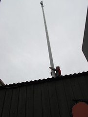
Observatory Tower Photograph 29
Images, UC QuakeStudies
A photograph of an earthquake-damaged suitcase in the South Quad of the Christchurch Arts Centre. The suitcase is resting on a pile of scaffolding which had been constructed around the Observatory tower. The scaffolding collapsed along with the tower during the 22 February 2011 earthquake.
WEMO ERT Team Set 1 - April 2011 - Photograph 6
Images, UC QuakeStudies
A photograph of a map used by emergency management personnel to inspect buildings after the 22 February 2011 earthquake. The map is of the block bordered by Barbadoes Street, Worcester Street, Gloucester Street, and Fitzgerald Avenue. Many of the buildings have been highlighted in blue, with some smaller buildings highlighted in orange. Numbers and messages have been written on the map with biro.
WEMO ERT Team Set 1 - April 2011 - Photograph 1
Images, UC QuakeStudies
A photograph of a map used by emergency management personnel to inspect buildings after the 22 February 2011 earthquake. The block between St Asaph, Antigua, Montreal, and Acton Street has been outlined with a red felt-tip pen. Some of the buildings in the block and below Acton Streets have been coloured orange. A few other buildings have been coloured blue.
BeckerFraserPhotos February 2012 photograph 0354
Images, UC QuakeStudies
A photograph of the ChristChurch Cathedral showing the damage to the west wall and steel bracing. In the foreground is the plinth where a statue of John Robert Godley stood prior to the February 2011 earthquake.
Story time at the welfare centre
Images, eqnz.chch.2010
Photos of Christchurch City LIbraries Outreach staff working in welfare centres following the February 22 earthquake. File ref: CCL-2011-02-27-OperationStoryTime-lynette-and-boys-on-bikes From the collection of Christchurch City Libraries
WEMO ERT Set 3 - February 2011 - Photograph 260
Images, UC QuakeStudies
A photograph of building rubble on the footpath outside the Caffe Roma restaurant on Oxford Terrace.
WEMO ERT Set 1 - February 2011 - Photograph 34
Images, UC QuakeStudies
A photograph of USAR and emergency management personnel lining up for lunch in Latimer Square.
WEMO ERT Set 3 - February 2011 - Photograph 001
Images, UC QuakeStudies
A photograph of a WRFF Helitack Rappel Crew emergency response vehicle in Wellington.
WEMO ERT Set 1 - February 2011 - Photograph 33
Images, UC QuakeStudies
A photograph of USAR and emergency management personnel lining up for lunch in Latimer Square.
WEMO ERT Set 3 - February 2011 - Photograph 041
Images, UC QuakeStudies
A photograph of a camouflaged armoured vehicle on St Asaph Street.
WEMO ERT Set 3 - February 2011 - Photograph 042
Images, UC QuakeStudies
A photograph of a camouflaged armoured vehicle on St Asaph Street.
WEMO ERT Set 3 - February 2011 - Photograph 088
Images, UC QuakeStudies
A photograph of a wooden frame covered by a tarpaulin on Worcester Street, near Latimer Square.
WEMO ERT Set 3 - February 2011 - Photograph 113
Images, UC QuakeStudies
A photograph of emergency management personnel inside the Canterbury Television Building on Gloucester Street.
WEMO ERT Set 3 - February 2011 - Photograph 246
Images, UC QuakeStudies
A photograph of the collapsed PGC Building, taken from Oxford Terrace across the Avon River.
WEMO ERT Set 3 - February 2011 - Photograph 226
Images, UC QuakeStudies
A photograph of USAR codes spray-painted on the front doors of several businesses on Armagh Street.