
Search
found 153 results
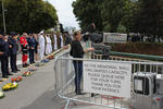
Images for Canterbury earthquake; more images...


Geotechnical aspects of the 2016 Kaikōura Earthquake on the South Island o…
Research papers, University of Canterbury Library
The magnitude Mw7.8 ‘Kaikōura’ earthquake occurred shortly after midnight on 14 November 2016. This paper presents an overview of the geotechnical impacts on the South Island of New Zealand recorded during the postevent reconnaissance. Despite the large moment magnitude of this earthquake, relatively little liquefaction was observed across the South Island, with the only severe manifestation occurring in the young, loose alluvial deposits in the floodplains of the Wairau and Opaoa Rivers near Blenheim. The spatial extent and volume of liquefaction ejecta across South Island is significantly less than that observed in Christchurch during the 2010-2011 Canterbury Earthquake Sequence, and the impact of its occurrence to the built environment was largely negligible on account of the severe manifestations occurring away from the areas of major development. Large localised lateral displacements occurred in Kaikōura around Lyell Creek. The soft fine-grained material in the upper portions of the soil profile and the free face at the creek channel were responsible for the accumulation of displacement during the ground shaking. These movements had severely impacted the houses which were built close (within the zone of large displacement) to Lyell Creek. The wastewater treatment facility located just north of Kaikōura also suffered tears in the liners of the oxidation ponds and distortions in the aeration system due to ground movements. Ground failures on the Amuri and Emu Plains (within the Waiau Valley) were small considering the large peak accelerations (in excess of 1g) experienced in the area. Minor to moderate lateral spreading and ejecta was observed at some bridge crossings in the area. However, most of the structural damage sustained by the bridges was a result of the inertial loading, and the damage resulting from geotechnical issues were secondary.
Shadowy futures : the effect of turbidity on yellow-eyed mullet (Aldrichet…
Research papers, University of Canterbury Library
Worldwide turbidity is a huge concern for the health of aquatic ecosystems. Human activities on the land such as construction, deforestation, agriculture, and mining all have impacts on the amount of particulate solids that enter the world’s waterways. These particulate solids can pose a number of risks to aquatic life, but primary among them is the turbidity that they create in the water column. The way suspended solids interact with light creates cloudiness in the water which interferes with the vision, and visually mediated behaviours of aquatic organisms, particularly fish. The Avon-Heathcote estuary of Christchurch, New Zealand, is one such body of water that is subject to tremendous variation in turbidity, no doubt exacerbated by the destruction of Christchurch in the 2010 and 2011 earthquakes, as well as the subsequent ongoing rebuild. The yellow eyed mullet, Aldrichetta Forsteri, is one species that is common with the estuary, and uses it as a habitat for breeding. Though very common throughout New Zealand, and even a part of the catch of commercial fisheries, the yellow eyed mullet is a largely unstudied organism, with virtually no published scientific enquiry based on the species. The present work assesses how several behaviours of the yellow eyed mullet are effected by acute turbidity at 10, 50, 90, 130 and 170 NTU, finding that: 1) The optomotor response of mullet to 2.5 mm stripes drops to insignificant levels between 10 and 50 NTU, 2) The swimming activity of the yellow eyed mullet is highest at 10 NTU and drops to a significantly lower level at higher turbidities, 3) The grouping behaviour of small groups of yellow eyed mullet are unchanged by increasing turbidity levels, 4) that yellow eyed mullet do not exhibit significantly different behavioural response to a simulated predator at any of the tested turbidities, and 5) that yellow eyed mullet to do significantly alter their oxygen consumption during exposure to the turbidities in an increasing series. The results presented in these studies indicate that turbidites above 50 NTU pose a significant risk to the lifestyle of the yellow eyed mullet, potentially impacting their ability to perceive their surroundings, feed, school, and avoid predation. Future work has a lot of ground to cover to more precisely determine the relationship between yellow eyed mullet behaviour and physiology, and the turbidity of their environment. In particular, future work should focus more closely on the turbidities between 10 and 50 NTU, as well as looking to field work to see what the predominant predators of the mullet are, and specifically whether turbidity increases or decreases the risk of mullet being subject to avian predation. There is also considerable scope for studies on the effects of chronic turbidity upon mullet, which will add understand to the predicament of escalating turbidity and its effects upon this common and yet mysterious native fish.
Previsione degli effetti di liquefazione su scala urbana
Research papers, University of Canterbury Library
Nel presente articolo si illustra una procedura per il processamento automatizzato di prove CPT, il calcolo di vari indici di liquefazione e la rappresentazione dei dati su mappa. La procedura è applicata al caso studio del terremoto di Christchurch, Nuova Zelanda, del 22 febbraio 2011 (magnitudo momento, Mw = 6.2). Dall’analisi spaziale dei risultati emerge una buona correlazione tra le mappe ottenute per l’indicatore degli effetti al suolo e i danni osservati (su terreni e strutture). Tuttavia, per confermare la validità di tale procedura, sarà necessario esaminare ulteriori casi studio nel mondo.
Experimental validation of a non-contact, non-line of sight displacement s…
Research papers, University of Canterbury Library
This work investigates the possibility of developing a non-contact, non-line of sight sensor to measure interstorey drift through simulation and experimental validation. • The method uses frequency-modulated continuous wave (FMCW) radar to measure displacement. This method is commonly in use in a number of modern applications, including aircraft altimeters and automotive parking sensors. • The technique avoids numerous problems found in contemporary structural health monitoring methods, namely integral drift errors and structural modification requirements. • The smallest achievable detection error in displacement was found to be as low as 0.26%, through simulated against the displacement response of a single degree of freedom structure subject to ground motion excitation. • This was verified during experimentation, when a corner-style reflector was placed on a shake table running ground motion data taken from the 4th September 2010 earthquake in Christchurch. These results confirmed the conclusions drawn from simulation.
Christchurch 'superhero' seeks funding to boost work
Audio, Radio New Zealand
Christchurch has its own social superhero and he's gone cap in hand to the council for funding. The self-styled lycra-clad superhero, known only at 'Flat Man', has been dropping care packages to people since the 2011 Canterbury earthquake. He also wants to be able to help schoolkids and anxious and stressed residents through their troubles. And to do this, he's now asking the Christchurch City Council for funding. He joins us now, and says "a cape is a must".
Modeling nonlinear site effects in physics-based ground motion simulation
Research papers, University of Canterbury Library
This study examines the performance of nonlinear total-stress wave-propagation site response analysis for modelling site effects in physics-based ground motion simulations of the 2010-2011 Canterbury, New Zealand earthquake sequence. This approach allows for explicit modeling of 3-dimensional ground motion phenomena at the regional scale, as well as detailed site effects and soil nonlinearity at the local scale. The approach is compared to a more commonly used empirical VS30 (30 m time-averaged shear wave velocity)-based method for computing site amplification as proposed by Graves and Pitarka (2010, 2015).
From darkness comes light: music as a reflection of the lived experience o…
Research papers, University of Canterbury Library
Context of the project: On 4 September 2010, 22 February 2011, 13 June 2011 and 23 December 2011 Christchurch suffered major earthquakes and aftershocks (well over 10,000) that have left the central city in ruins and many of the eastern suburbs barely habitable even now. The earthquakes on 22 February caused catastrophic loss of life with 185 people killed. The toll this has taken on the residents of Christchurch has been considerable, not least of all for the significant psychological impact and disruption it has had on the children. As the process of rebuilding the city commenced, it became clear that the arts would play a key role in maintaining our quality of life during difficult times. For me, this started with the children and the most expressive of all the art forms – music.
Top Stories for Thursday 14 December 2017
Audio, Radio New Zealand
Nearly two-thirds of MPs have voted in support of a bill that would legalise euthanasia. The Government says it will consider moves to rein in rapidly rising salaries for top public servants. It's been far from smooth sailing for the new government in its first eight weeks in office, but it appears to be largely on track to deliver its hundred day plan. More than a year after North Canterbury's 7.8 magnitude earthquake forced its closure, State Highway 1 north of Kaikoura will re-open to the public on Friday.
Using the Macroelement Method to Seismically Assess Complex URM Buildings
Research papers, University of Canterbury Library
Existing unreinforced masonry (URM) buildings are often composed of traditional construction techniques, with poor connections between walls and diaphragms that results in poor performance when subjected to seismic actions. In these cases the application of the common equivalent static procedure is not applicable because it is not possible to assure “box like” behaviour of the structure. In such conditions the ultimate strength of the structure relies on the behaviour of the macro-elements that compose the deformation mechanisms of the whole structure. These macroelements are a single or combination of structural elements of the structure which are bonded one to each other. The Canterbury earthquake sequence was taken as a reference to estimate the most commonly occurring collapse mechanisms found in New Zealand URM buildings in order to define the most appropriate macroelements.
BWB Books
Audio, Radio New Zealand
Dire predictions about the death of books and of publishing in this country with the advent of e-books and the amalgamation of big publishing houses have proved to be way off the mark. One of the standout publishers to have emerged is Wellington's BWB - Bridget Williams' Books - with its focus on New Zealand non-fiction and championing of the topical essay. Titles in their popular BWB text series include The New Zealand Project by Max Harris, Holly Walker's The Whole Intimate Mess, and Antibiotic Resistance by Dr Siouxsie Wiles. Their latest publications include The Expatriates by expat Martin Edmond, and Paul Gorman's take on the Canterbury Earthquakes - Portacom City.
Floodplain restoration principles for the Avon Ōtākaro Red Zone. Case stud…
Research papers, University of Canterbury Library
The Canterbury region of New Zealand experienced a sequence of strong earthquakes during 2010-2011. Responses included government acquisition of many thousands of residential properties in the city of Christchurch in areas with severe earthquake effects. A large and contiguous tract of this ‘red zoned’ land lies in close proximity to the Ōtākaro / Avon River and is known as the Avon-Ōtākaro Red Zone (AORZ). The focus of this study was to provide an overview of the floodplain characteristics of the AORZ and review of international experience in ecological restoration of similar river margin and floodplain ecosystems to extract restoration principles and associated learnings. Compared to pre-earthquake ground levels, the dominant trend in the AORZ is subsidence, together with lateral movement especially in the vicinity of waterway. An important consequence of land subsidence in the lower Ōtākaro / Avon River is greater exposure to flooding and the effects of sea level rise. Scenario modelling for sea level rise indicates that much of the AORZ is exposed to inundation within a 100 year planning horizon based on a 1 m sea level rise. As with decisions on built infrastructure, investments in nature-based ‘green infrastructure’ also require a sound business case including attention to risks posed by climate change. Future-proofing of the expected benefits of ecological restoration must therefore be secured by design. Understanding and managing the hydrology and floodplain dynamics are vital to the future of the AORZ. However, these characteristics are shared by other floodplain and river restoration projects worldwide. Identifying successful approaches provides a useful a source of useful information for floodplain planning in the AORZ. This report presents results from a comparative case study of three international examples to identify relevant principles for large-scale floodplain management at coastal lowland sites.
The Central finally arrives at Christchurch's Arts Centre
Audio, Radio New Zealand
It's been a long, long wait but Christchurch's Arts Centre finally has a contemporary art gallery space again - and it's just opened. It's the latest 'reveal' in the Arts Centre post-earthquake rebuild. The new gallery's called The Central and is housed in the original Canterbury College Library. Four Christchurch families and gallerist Jonathan Smart have made it happen and artists including local sculptor Neil Dawson, photographer Peter Peryer, glitter specialist Reuben Patterson and painter Dick Frizzell are in the mix for the opening group show. There are some new names there too. Lynn Freeman speaks to The Central's Jonathan Smart and Ngai Tahu artist Lonnie Hutchinson who has work in the opening show.
Quin Tang - Half a Walnut Tree
Audio, Radio New Zealand
As a three-year-old in China, Quin Tang's mother was shot in front of her and her father taken away. After moving to Christchurch 25 years ago, she walked out of an abusive marriage with two young children, no money and speaking little English. Tang then attended Canterbury University, teaching herself to read English from the text books there. She attained four degrees with an A+ average, and began working as a psychiatrist and counsellor. Quin was working in the CTV building when it collapsed. She took two weeks off work to recover, then came back and began counselling other victims of the Christchurch earthquakes. She has written and self-published the story of her life, called Half a Walnut Tree.
Heroes come in many forms
Audio, Radio New Zealand
The Logie Collection of Canterbury University is one of the small miracles of this country - treasures of the Ancient World from classical Greece and Rome, right back to the Bronze Age - 7000 BC. And when the first big earthquake struck Christchurch in September 2010, there were fears that the priceless collection - described as "one of Australasia's finest collections of classical art" would be utterly destroyed. Well it was and it wasn't. The Logie Collection has a brand-new home - the Teece Museum of Classical Antiquities - and last week it was proudly displayed in an exhibition called We Could Be Heroes. But it certainly didn't look like it at the time. Simon Morris is joined by Terri Elder and Penny Minchin-Garvin, the co-curators of the museum.
Top Stories for Friday 1 September 2017
Audio, Radio New Zealand
Tax, water and housing concerns were all debated at length by Bill English and Jacinda Ardern in last night's TVNZ leaders debate. The debate came just an hour after shock 1 News Colmar Brunton poll put Labour out in front. There have been fires and explosions at a flood damaged chemical plant near Houston forcing the evacuation of people in nearby homes. A block of flats in Aro Street has been evacuated after a large slip has come down behind it. After heavy rains and flooding a Mumbai building has collapsed, killing at least 23 people. Biosecurity officials say they expect to decide by the end of the year whether they will need to order the destruction of dairy herds to wipe out a cow disease that's broken out in the South Island. It's been revealed that not a single one of New Zealand's 315 police buildings constructed before 2011 have had a full earthquake safety check. People who've bought houses in Canterbury since the September 2010 earthquake and are still battling with insurance companies over repairs, have been told that if they want to take the matter to court, today is their last chance. The Government has begun urgent talks with Australia over the Queensland's state government's "discriminatory" trade policy which takes effect today. Trade Minister Todd McClay joins us.
3D Ground Motion Simulations for the Christchurch Area Including the Surfa…
Research papers, University of Canterbury Library
We present initial results from a set of three-dimensional (3D) deterministic earthquake ground motion simulations for the northern Canterbury plains, Christchurch and the Banks Peninsula region, which explicitly incorporate the effects of the surface topography. The simu-lations are done using Hercules, an octree-based finite-element parallel software for solving 3D seismic wave propagation problems in heterogeneous media under kinematic faulting. We describe the efforts undertaken to couple Hercules with the South Island Velocity Model (SIVM), which included changes to the SIVM code in order to allow for single repetitive que-ries and thus achieve a seamless finite-element meshing process within the end-to-end ap-proach adopted in Hercules. We present our selection of the region of interest, which corre-sponds to an area of about 120 km × 120 km, with the 3D model reaching a depth of 60 km. Initial simulation parameters are set for relatively high minimum shear wave velocity and a low maximum frequency, which we are progressively scaling up as computing resources permit. While the effects of topography are typically more important at higher frequencies and low seismic velocities, even at this initial stage of our efforts (with a maximum of 2 Hz and a mini-mum of 500 m/s), it is possible to observe the importance of the topography in the response of some key locations within our model. To highlight these effects we compare the results of the 3D topographic model with respect to those of a flat (squashed) 3D model. We draw rele-vant conclusions from the study of topographic effects during earthquakes for this region and describe our plans for future work.
Liquefaction Evaluation in Stratified Soils
Research papers, University of Canterbury Library
The Canterbury Earthquake Sequence 2010-2011 (CES) induced widespread liquefaction in many parts of Christchurch city. Liquefaction was more commonly observed in the eastern suburbs and along the Avon River where the soils were characterised by thick sandy deposits with a shallow water table. On the other hand, suburbs to the north, west and south of the CBD (e.g. Riccarton, Papanui) exhibited less severe to no liquefaction. These soils were more commonly characterised by inter-layered liquefiable and non-liquefiable deposits. As part of a related large-scale study of the performance of Christchurch soils during the CES, detailed borehole data including CPT, Vs and Vp have been collected for 55 sites in Christchurch. For this subset of Christchurch sites, predictions of liquefaction triggering using the simplified method (Boulanger & Idriss, 2014) indicated that liquefaction was over-predicted for 94% of sites that did not manifest liquefaction during the CES, and under-predicted for 50% of sites that did manifest liquefaction. The focus of this study was to investigate these discrepancies between prediction and observation. To assess if these discrepancies were due to soil-layer interaction and to determine the effect that soil stratification has on the develop-ment of liquefaction and the system response of soil deposits.
The Panel with Lisa Scott and David Cormack (Part 1)
Audio, Radio New Zealand
A fault line on Dunedin's doorstep could cause an earthquake as destructive as 2010's Canterbury quake. Microbiologist Siouxsie Wiles explains why the new superbug CPE is a serious threat. A New Zealand Medical Journal article warns a group of bacteria known as Carbapenem-resistant Enterobacteriaceae pose an enormous risk to people in intensive care, or having bone marrow or lung or liver transplants. Mercedes-Benz has successfully trialled a new app called Croove, CROOVE, which will let Mercedes owners rent out their cars. Now it's being officially rolled out. The panellists discuss the sign outside a pub in New Brighton reading "Vegan buffet. Just kidding now get away from our sign - you pansy." Is this just a joke or is it deeply offensive? The Kentucky doctor dragged off a United Airlines flight from Chicago earlier this month has received a financial settlement from the airline.
Anna Leask - Behind bars
Audio, Radio New Zealand
Anna Leask has worked for the New Zealand Herald since 2008 and is currently a senior reporter, covering crime and justice for the daily newspaper as well as for the Weekend Herald and Herald on Sunday. Notably she's reported on the re-investigation of Arthur Allan Thomas, 43 years after the double murders for which he served nine years in prison before being pardoned, and the Christchurch 'House of Horrors' murderer Jason Somerville, who killed his wife and buried her under his East Christchurch house a year after doing the same to his neighbour Tisha Lowery. Leask covered the Pike River Mine disaster in 2010, the 2011 Canterbury earthquakes, Fiji's Cyclone Winston in early 2016 and travelled to Gallipoli in 2015 to cover the centenary of the Anzac landings. She won a Canon Media Award for crime and justice reporting in 2014. Her first book, Behind Bars: Real-life stories from inside New Zealand prisons has just been released.
Top Stories for Friday 25 August 2017
Audio, Radio New Zealand
Police have arrested Rollie James Heke after a two-week nationwide manhunt. The government's come up with a radical new plan to tackle Auckland's critical teacher shortage offering thousands of dollars to any new graduate prepared to stay at any city school for at least three years. The All Blacks and the Wallabies will observe a minute's silence at Saturday's Bledisloe Cup match in Dunedin. The government has confirmed speed limits on some of the main expressways will be lifted to 110km/h. National's MP for Kaikoura, Stuart Smith, has leaked when State Highway 1 north of Kaikoura will be re-opened - on December 15. The country's building regulator admits it needs a major overhaul after years scrambling just to react to leaky homes and the Canterbury and Kaikoura earthquakes. Peter Dunne's shock exit this week has forced both National and Labour to completely re-evaluate their strategies in the contest for the Ohariu electorate.
The Week In Review for week ending Friday June 23 2017
Audio, Radio New Zealand
A review of the week's news including... National MP Todd Barclay falls on his sword while Labour is in damage control, the decision to not prosecute the Pike River Mine CEO is to be contested in the Supreme Court, the lawyer for Akshay Chand says she sought bail on his behalf believing his mother and aunt would monitor his every movement, The Education Ministry is forced to apologise for its flawed handling of school closures and mergers after the 2011 Canterbury earthquake, The Health Minister is forced to defend his embattled Ministry following a major budget blunder, employment lawyers aren't surprised another health sector group is taking a pay equity claim, Ministry for Primary Industries officials come under fire at a packed Stewart Island public meeting on the cull of the island's farmed oysters, it's Plan B for a crowd funded initiative that wants to take control of Dunedin's Cadbury factory and All Black great Sir Colin 'pinetree' Meads has been immortalised in bronze.
Are athletes on the right track? The effect of availability of an all-weat…
Research papers, University of Canterbury Library
In February of 2011, an earthquake destroyed the only all-weather athletics track in the city of Christchurch (New Zealand). The track has yet to be replaced, and so since the loss of the track, local Christchurch athletes have only had a grass track for training and preparation for championship events. This paper considers what effect the loss of the training facility has had on the performance of athletes from Christchurch at national championship events. Not surprisingly, the paper finds that there has been a deterioration in the performance in events that are heavily dependent upon the all-weather surface. However, somewhat more surprisingly, the loss of the track appears to have caused a significant improvement in the performance of Christchurch athletes in events that, while on the standard athletics program, are not heavily track dependent.
The Week In Review for week ending Fri Feb 3 2017
Audio, Radio New Zealand
A review of the week's news including... a major health alert in Pukekohe after two and a half thousand children were exposed to contaminated water, the Prime Minister kicks off election year with a pledge to spend more than half a billion dollar on crime-fighting, is New Zealand citizenship for sale? several former employees of the Canterbury Earthquake Recovery Authority are being investigated, international Indian students to be deported, more alleged mistreatment of animals revealed at another New Zealand rodeo event, a women's sexual abuse group says the judge got it wrong when he ruled in favour of a man who posted photos of his half naked wife on Facebook, people increasingly find ways to get around petrol prices that they think are too high, should an unofficial white chair memorial to the victims of the 2011 Christchurch quake be moved? the scientific test results which reveal exactly how Havelock North's drinking water supply was contaminated, the Maori Party backs calls from a group of local councils campaigning to keep their regions free from genetic modification, a film producer is caught out by a recent law change banning anyone travelling from America from entering New Zealand with medicinal cannabis and an update on a seriously unwell albatross chick.
Dynamics of territorial production in situated and community projects
Research papers, The University of Auckland Library
This section considers forms of collaboration in situated and community projects embedded in important spatial transformation processes in New Zealand cities. It aims to shed light on specific combinations of material and semantic aspects characterising the relation between people and their environment. Contributions focus on participative urban transformations. The essays that follow concentrate on the dynamics of territorial production of associations between multiple actors belonging both to civil society and constituted authority. Their authors were directly engaged in the processes that are reported and conceptualised, thereby offering evidence gained through direct hands-on experience. Some of the investigations use case studies that are conspicuous examples of the recent post-traumatic urban development stemming from the Canterbury earthquakes of 2010-2011. More precisely, these cases belong to the early phases of the programmes of the Christchurch recovery or the Wellington seismic prevention. The relevance of these experiences for the scope of this study lies in the unprecedented height of public engagement at local, national and international levels, a commitment reached also due to the high impact, both emotional and concrete, that affected the entire society
Simulation and Validation of Topographic Effectds on Mt Pleasant, Christch…
Research papers, University of Canterbury Library
Damage distribution maps from strong earthquakes and recorded data from field experiments have repeatedly shown that the ground surface topography and subsurface stratigraphy play a decisive role in shaping the ground motion characteristics at a site. Published theoretical studies qualitatively agree with observations from past seismic events and experiments; quantitatively, however, they systematically underestimate the absolute level of topographic amplification up to an order of magnitude or more in some cases. We have hypothesized in previous work that this discrepancy stems from idealizations of the geometry, material properties, and incident motion characteristics that most theoretical studies make. In this study, we perform numerical simulations of seismic wave propagation in heterogeneous media with arbitrary ground surface geometry, and compare results with high quality field recordings from a site with strong surface topography. Our goal is to explore whether high-fidelity simulations and realistic numerical models can – contrary to theoretical models – capture quantitatively the frequency and amplitude characteristics of topographic effects. For validation, we use field data from a linear array of nine portable seismometers that we deployed on Mount Pleasant and Heathcote Valley, Christchurch, New Zealand, and we compute empirical standard spectral ratios (SSR) and single-station horizontal-to-vertical spectral ratios (HVSR). The instruments recorded ambient vibrations and remote earthquakes for a period of two months (March-April 2017). We next perform two-dimensional wave propagation simulations using the explicit finite difference code FLAC. We construct our numerical model using a high-resolution (8m) Digital Elevation Map (DEM) available for the site, an estimated subsurface stratigraphy consistent with the geomorphology of the site, and soil properties estimated from in-situ and non-destructive tests. We subject the model to in-plane and out-of-plane incident motions that span a broadband frequency range (0.1-20Hz). Numerical and empirical spectral ratios from our blind prediction are found in very good quantitative agreement for stations on the slope of Mount Pleasant and on the surface of Heathcote Valley, across a wide range of frequencies that reveal the role of topography, soil amplification and basin edge focusing on the distribution of ground surface motion.
Multi-Hazard Analysis: Gap Analysis ReportLDRP97 Multi-Hazard Analysis: Ga…
Research papers, University of Canterbury Library
Christchurch City Council (Council) is undertaking the Land Drainage Recovery Programme in order to assess the effects of the earthquakes on flood risk to Christchurch. In the course of these investigations it has become better understood that floodplain management should be considered in a multi natural hazards context. Council have therefore engaged the Jacobs, Beca, University of Canterbury, and HR Wallingford project team to investigate the multihazards in eastern areas of Christchurch and develop flood management options which also consider other natural hazards in that context (i.e. how other hazards contribute to flooding both through temporal and spatial coincidence). The study has three stages: Stage 1 Gap Analysis – assessment of information known, identification of gaps and studies required to fill the gaps. Stage 2 Hazard Studies – a gap filling stage with the studies identified in Stage 1. Stage 3 Collating, Optioneering and Reporting – development of options to manage flood risk. This present report is to document findings of Stage 1 and recommends the studies that should be completed for Stage 2. It has also been important to consider how Stage 3 would be delivered and the gaps are prioritised to provide for this. The level of information available and hazards to consider is extensive; requiring this report to be made up of five parts each identifying individual gaps. A process of identifying information for individual hazards in Christchurch has been undertaken and documented (Part 1) followed by assessing the spatial co-location (Part 2) and probabilistic presence of multi hazards using available information. Part 3 considers multi hazard presence both as a temporal coincidence (e.g. an earthquake and flood occurring at one time) and as a cascade sequence (e.g. earthquake followed by a flood at some point in the future). Council have already undertaken a number of options studies for managing flood risk and these are documented in Part 4. Finally Part 5 provides the Gap Analysis Summary and Recommendations to Council. The key findings of Stage 1 gap analysis are: - The spatial analysis showed eastern Christchurch has a large number of hazards present with only 20% of the study area not being affected by any of the hazards mapped. Over 20% of the study area is exposed to four or more hazards at the frequencies and data available. - The majority of the Residential Red Zone is strongly exposed to multiple hazards, with 86% of the area being exposed to 4 or more hazards, and 24% being exposed to 6 or more hazards. - A wide number of gaps are present; however, prioritisation needs to consider the level of benefit and risks associated with not undertaking the studies. In light of this 10 studies ranging in scale are recommended to be done for the project team to complete the present scope of Stage 3. - Stage 3 will need to consider a number of engineering options to address hazards and compare with policy options; however, Council have not established a consistent policy on managed retreat that can be applied for equal comparison; without which substantial assumptions are required. We recommend Council undertake a study to define a managed retreat framework as an option for the city. - In undertaking Stage 1 with floodplain management as the focal point in a multi hazards context we have identified that Stage 3 requires consideration of options in the context of economics, implementation and residual risk. Presently the scope of work will provide a level of definition for floodplain options; however, this will not be at equal levels of detail for other hazard management options. Therefore, we recommend Council considers undertaking other studies with those key hazards (e.g. Coastal Hazards) as a focal point and identifies the engineering options to address such hazards. Doing so will provide equal levels of information for Council to make an informed and defendable decision on which options are progressed following Stage 3.
Question Time for 27 July 2017
Audio, Radio New Zealand
SARAH DOWIE to the Minister of Finance: What reports has he received on New Zealand’s trade exports? EUGENIE SAGE to the Minister for Land Information: Has he asked Land Information New Zealand to withdraw the 997-hectare Riversdale Flats from the proposed sale of Mt White Station pastoral lease; if not, why not? PHIL TWYFORD to the Minister for Social Housing: Will she confirm that as of 30 June the Government has only delivered 323 of the additional 1,400 emergency beds they promised at the start of November last year? STUART SMITH to the Minister of Transport: What update can he provide on the reinstatement of State Highway 1 following the Kaikōura earthquakes? STEFFAN BROWNING to the Minister for the Environment: Does he have confidence in the Environmental Protection Authority’s review of glyphosate? Dr DAVID CLARK to the Minister of Health: Does he support the establishment of a cross-agency working group with Canterbury District Health Board on their finances, funding, and facilities? DAVID SEYMOUR to the Minister of Health: Does he stand by all his answers to Oral Question No. 6 on 6 June regarding intraoperative radiotherapy for breast cancer? BARBARA KURIGER to the Minister of Immigration: What recent announcements has he made in relation to immigration settings? Hon NANAIA MAHUTA to the Minister for Treaty of Waitangi Negotiations: Does he believe that the signing of the Pare Hauraki Collective Settlement with the inclusion of redress disputed by Tauranga Moana iwi is a breach of Te Tiriti o Waitangi? CHRIS BISHOP to the Associate Minister of Education: What recent announcements have the Government made on school property in the Wellington region? PITA PARAONE to the Minister for Māori Development: Does he stand by all his statements; if so, why? JENNY SALESA to the Minister of Education: Is she satisfied that the Government is doing all that it can to ensure an adequate supply of teachers, particularly in Auckland?
The influence of housing typologies on livability and community resilience…
Research papers, University of Canterbury Library
This research attempts to understand whether community resilience and perceived livability are influenced by housing typologies in Christchurch, New Zealand. Using recent resident surveys undertaken by the Christchurch City Council, two indexes were created to reflect livability and community resilience. Indicators used to create both indexes included (1) enjoyment living in neighbourhood (2) satisfaction with local facilities (3) safety walking and (4) safety using public transport, (5) sense of community (6) neighbour interactions, (7) home ownership and (8) civic engagement. Scores were attributed to 72 neighbourhoods across Christchurch –and each neighbourhood was classified in one of the following housing typologies; (1) earthquake damaged, (2) relatively undamaged, (3) medium density and (4) greenfield developments. Spatial analysis of index scores and housing classifications suggest housing typologies do influence resident’s perceived livability and community bonds to an extent. It was found that deprivation also had a considerable influence on these indexes as well as residential stability. These additional influences help explain why neighbourhoods within the same housing classification differ in their index scores. Based on these results, several recommendations have been made to the CCC in relation to future research, urban development strategies and suburb specific renewal projects. Of chief importance, medium density neighbourhoods and deprived neighbourhoods require conscious efforts to foster community resilience. Results indicate that community resilience might be more important than livability in having a positive influence on the lived experience of residents. While thoughtful design and planning are important, this research suggests geospatial research tools could enable better community engagement outcomes and planning outcomes, and this could be interwoven into proactive and inclusive planning approaches like placemaking.
Restoration opportunities assessment for the Avon Ōtākaro Red Zone using a…
Research papers, University of Canterbury Library
Following the Canterbury earthquake sequence of 2010-11, a large and contiguous tract of vacated ‘red zoned’ land lies alongside the lower Ōtākaro / Avon River and is known as the Avon-Ōtākaro Red Zone (AORZ). This is the second report in the Ecological Regeneration Options (ERO) project that addresses future land uses in the AORZ. The purpose of this report is to present results from an assessment of restoration opportunities conducted in April 2017. The objectives of the assessment were to identify potential benefits of ecological restoration activities across both land and water systems in the AORZ and characterise the key options for their implementation. The focus of this report is not to provide specific advice on the methods for achieving specific restoration endpoints per se. This will vary at different sites and scales with a large number of combinations possible. Rather, the emphasis is on providing an overview of the many restoration and regeneration options in their totality across the AORZ. An additional objective is to support their adequate assessment in the identification of optimum land uses and adaptive management practices for the AORZ. Participatory processes may play a useful role in assessment and stakeholder engagement by providing opportunities for social learning and the co-creation of new knowledge. We used a facilitated local knowledge based approach that generated a large quantity of reliable and site specific data in a short period of time. By inviting participation from a wide knowledge-holder network inclusivity is improved in comparison to small-group expert panel approaches. Similar approaches could be applied to other information gathering and assessment needs in the regeneration planning process. Findings from this study represent the most comprehensive set of concepts available to date to address the potential benefits of ecological regeneration in the AORZ. This is a core topic for planning to avoid missed opportunities and opportunity costs. The results identify a wide range of activities that may be applied to generate benefits for Christchurch and beyond, all involving aspects of a potential new ecology in the AORZ. These may be combined at a range of scales to create scenarios, quantify benefits, and explore the potential for synergies between different land use options. A particular challenge is acquiring the information needed within relatively short time frames. Early attention to gathering baseline data, addressing technical knowledge gaps, and developing conceptual frameworks to account for the many spatio-temporal aspects are all key activities that will assist in delivering the best outcomes. Methodologies by which these many facets can be pulled together in quantitative and comparative assessments are the focus of the final report in the ERO series.
Question Time for 30 November 2017
Audio, Radio New Zealand
Hon STEVEN JOYCE to the Minister of Finance: Can he confirm he plans to increase net core Crown debt from $59.5 billion as at 30 June 2017 to $67.6 billion by 2022; and can he confirm debt will not increase by any more than that? MARAMA DAVIDSON to the Minister of Conservation: What has been the Department of Conservation’s biggest recent success in predator control to better protect our native plants and wildlife? Hon Dr JONATHAN COLEMAN to the Minister of Health: What measurable outcomes, if any, will his policies deliver? SIMON O'CONNOR to the Minister of Corrections: Does he stand by his Government’s intention to reduce the prison population by 30 percent over the next 15 years; if so, how? KIERAN McANULTY to the Minister of Transport: Has he received any reports commissioned under the previous Government that show the value of investment in rail? Hon JACQUI DEAN to the Minister of Tourism: Does he stand by all his statements? Hon GERRY BROWNLEE to the Prime Minister: Does she stand by all her statements? Dr DUNCAN WEBB to the Minister for Greater Christchurch Regeneration: What was the expected date, prior to the General Election, that the Residential Advisory Service would cease operations, and what steps has she taken since becoming Minister to ensure the service continues for people affected by the Canterbury and Kaikōura earthquakes? BRETT HUDSON to the Associate Minister of State Services (Open Government): Does she stand by her statement in Parliament yesterday that this will be “the most open, most transparent Government that New Zealand has ever had”; if so, how? Hon LOUISE UPSTON to the Minister for Children: Is she committed to implementing the United Nations Convention on the Rights of the Child in full? TAMATI COFFEY to the Associate Minister of Finance: How is the Government preserving the right of New Zealanders to own land in New Zealand? JAMI-LEE ROSS to the Minister of Local Government: What steps will she take to support the local government sector to achieve greater efficiency and control spending?