
Search
found 272 results
Images for 100% Canon; more images...


20100917_3451_1D3-58 Castle Rock - Christchurch earthquake
Images, eqnz.chch.2010
Castle Rock above Heathcote, showing damage (and two very large pieces in the foreground) that came down during the 7.1 quake on 4th September.
20100917_3452_1D3-105 Castle Rock boulders - Christchurch earthquake
Images, eqnz.chch.2010
Two of the large boulders (larger than a house or two) that came down from Castle Rock (see the fence in front of the boulders).
20100917_3455_1D3-65 Valley Inn demolition - Christchurch earthquake
Images, eqnz.chch.2010
Nearly two weeks after the 7.1 earthquake, and a week after demolition started, this is the end of The Valley Inn in Heathcote.
20121018_9144_1D3-60 Tunnel building
Images, eqnz.chch.2010
Built in the early 1960s for the Lyttelton Road Tunnel, it was severley damaged in the February 2011 earthquake and is not currently used.
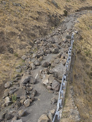
20160307_6634_7D2-82 Really Wild!
Images, eqnz.chch.2010
A section of retaining wall that tilted in the Christchurch 2011 earthquake. At the Edmunds Band Rotunda sight. Still not repaired,
Liquefaction [EQNZ]
Images, eqnz.chch.2010
20110304_1866_1D3-24 Liquefaction [EQNZ] The last pile of liquefied silt to be cleaned up, from our lawn. #876
20120118_7814_1D3-17F East on Cashel.
Images, eqnz.chch.2010
17mm M42 Takumar Fisheye on a Canon 1D MkIII (1.3x crop factor) via an adaptor ring.
20120131_8129_1D3-400 Eathquake damage
Images, eqnz.chch.2010
Houses teeter over the edge above Redcliffs School.
Eathquake damage
Images, eqnz.chch.2010
20120131_8174_1D3-400 Eathquake damage Houses above Main Road, Sumner. #2153
20120131_8198_1D3-400 Eathquake damage
Images, eqnz.chch.2010
Damaged houses above Shag Rock.
20130524_7204_1D3-105 Too many orange cones in Christchurch.
Images, eqnz.chch.2010
These have been thrown in the Avon River
20130524_7209_1D3-65 Table thrown away in Culver Place.
Images, eqnz.chch.2010
All red zoned and it looked like no one is living anywhere in Culver Place. All awaiting demolition.
20130627_8868_1D3-32 Container support
Images, eqnz.chch.2010
Cathedral of the Blessed Sacrameny aka Christchurch Basilica
New Brighton bridge
Images, eqnz.chch.2010
20130808_2293_1D3-40 New Brighton bridge Still awaiting a repair, but with so many bridges closed or partially closed we are lucky this one had what maybe minor damage. #4074
20130524_7208_1D3-50 Earthquake damage to a Hulverstone Drive "red zone" h…
Images, eqnz.chch.2010
Awaiting demolition. Blue pipes are water supply to anyone still living on Hulverstone Drive.
New Brighton bridge
Images, eqnz.chch.2010
20130808_2296_1D3-40 New Brighton bridge Prior to the earthquakes the stone wall at right was near road level. Now it is about 1.5m (4-5ft) lower. #4075
Awaiting demoloition
Images, eqnz.chch.2010
20130808_2288_1D3-40 Awaiting demoloition Two relatively new town houses in the Bexley "Red Zone". Awaiting demolition due to severe land problems. Have been vandalised. #4073
20121117_0342_1D3-85 Fuze Cafe
Images, eqnz.chch.2010
Went into this cafe a few times in years gone by (all on camera club field trips or photowalks). It was a nice two-storey building then. Not now after the earthquakes of 2010 and 2011.
South New Brighton bridge mevement - Christchurch earthquake
Images, eqnz.chch.2010
20100905_3349_1D3-24 South New Brighton bridge mevement - Christchurch earthquake The South Brighton bridge abutment (city side). Bridge looks fine, just both approaches have moved A LOT! #380
Bridge Street bridge, Christchurch earthquake
Images, eqnz.chch.2010
20100904_3322_1D3-200 Bridge Street bridge, Christchurch earthquake South Brighton Bridge. See the gap between the abutment and the bridge itself (just to right of lower person). #377
20130827_2674_1D3-35 Where Scott was
Images, eqnz.chch.2010
The site of the Robert Falcon Scott statue. Here is what it looked like before (lining up ICE from POLICE on the Police building) www.flickr.com/photos/johnstewartnz/5921425414/in/set-721...
20130627_8871_1D3-60 Container support
Images, eqnz.chch.2010
Cathedral of the Blessed Sacrameny aka Christchurch Basilica
20120805_7441_1D3-600 Newstalk ZB building starting to go down 06
Images, eqnz.chch.2010
20120805_7441_1D3-600 Newstalk ZB building starting to go down 06 #2642
20130130_1909_1D3-28 Closed!
Images, eqnz.chch.2010
Closed due to earthquake damage. But it looks in better condition than the building I work in!
Pumping Station - Christchurch earthquake
Images, eqnz.chch.2010
20100918_3507_1D3-47 Pumping Station - Christchurch earthquake The pumping station at the corner of New Brighton Road and Palmers Road. New Brighon Road is still closed (2 weeks after quake) at this point. #403
20110319_2357_1D3-90 Shattered! [EQNZ]
Images, eqnz.chch.2010
A historic plate smashed in the February Christchurch earthquake. Ashley Gorge Scenic Reserve was established by my Great-Grandmother (maternal) many years ago.
20120131_8169_1D3-400 Conatiner wall
Images, eqnz.chch.2010
Part of a house that fell can be seen on the rocks above right hand containers.
20130424_6256_1D3-400 South New Brighton Jetty - 1
Images, eqnz.chch.2010
The jetty in the South New Brighton Domain was rebuilt a few years ago. It was straight and level till the earthquakes. Has been closed for 2½ years now.
20120131_8153_1D3-400 Conatiner wall
Images, eqnz.chch.2010
Part of the container wall to stop rock falls on Main Road, Sumner.
20130424_6254_1D3-400 South New Brighton Jetty - 2
Images, eqnz.chch.2010
The jetty in the South New Brighton Domain was rebuilt a few years ago. It was straight and level till the earthquakes. Has been closed for 2½ years now.