
Search
found 173 results
Images for Earthquake Christchurch; more images...


Six years after quake, stress remains part of daily life
Audio, Radio New Zealand
Six years on from the Christchurch earthquakes, one in five residents of the city say the disaster is still taking its toll. The latest wellbeing survey by the Canterbury DHB found people living in north-east and east Christchurch were the most likely to be suffering from issues such as anxiety, from ongoing aftershocks, being in a damaged environment, and surrounded by construction.
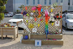
From darkness comes light: music as a reflection of the lived experience o…
Research papers, University of Canterbury Library
Context of the project: On 4 September 2010, 22 February 2011, 13 June 2011 and 23 December 2011 Christchurch suffered major earthquakes and aftershocks (well over 10,000) that have left the central city in ruins and many of the eastern suburbs barely habitable even now. The earthquakes on 22 February caused catastrophic loss of life with 185 people killed. The toll this has taken on the residents of Christchurch has been considerable, not least of all for the significant psychological impact and disruption it has had on the children. As the process of rebuilding the city commenced, it became clear that the arts would play a key role in maintaining our quality of life during difficult times. For me, this started with the children and the most expressive of all the art forms – music.
Phoenix Rising
Audio, Radio New Zealand
The Christchurch earthquakes caused devastating damage to many of the city’s creative spaces. But rising from the rubble has been the Isaac Theatre Royal under the watchful eye of Neil Cox. He’s directed the resurrection of one of the premiere performance spaces in the country.
Fans of The Boss ready themselves for Chch concert tonight
Audio, Radio New Zealand
The sounds of Bruce Springsteen will ring out around Christchurch tonight, ahead of the sixth anniversary of the deadly February 2011 earthquake in the region. Long time fans join us to discuss what they're expecting from tonight's gig.
Psychologist: More support needed for young quake victims
Audio, Radio New Zealand
Children not even born when the city was devastated by the 2011 earthquake are showing signs of quake-related stress. A Christchurch-based clinical psychologist Catherine Gallagher says the children are living with the ongoing impact of the quakes.
Children struggling in quake-hit Hurunui
Audio, Radio New Zealand
Nearly a year on from November's 7.8 magnitude earthquake, schools in the Hurunui District say children are struggling to cope. And if the experience of Christchurch is anything to go by, it's likely to get worse before it gets better.
20171103_5586_1D3-66 Phoenix Palm in the Red Zone
Images, eqnz.chch.2010
A Phoenis Palm (Phoenix canariensis) that was in someone's back yard prior to the demolition of houses post the 2011 earthquake.
The Central finally arrives at Christchurch's Arts Centre
Audio, Radio New Zealand
It's been a long, long wait but Christchurch's Arts Centre finally has a contemporary art gallery space again - and it's just opened. It's the latest 'reveal' in the Arts Centre post-earthquake rebuild. The new gallery's called The Central and is housed in the original Canterbury College Library. Four Christchurch families and gallerist Jonathan Smart have made it happen and artists including local sculptor Neil Dawson, photographer Peter Peryer, glitter specialist Reuben Patterson and painter Dick Frizzell are in the mix for the opening group show. There are some new names there too. Lynn Freeman speaks to The Central's Jonathan Smart and Ngai Tahu artist Lonnie Hutchinson who has work in the opening show.
20171103_5588_1D3-70 Cabbage Tree in the Red Zone
Images, eqnz.chch.2010
An impressive Cabbage Tree (Cordyline australis) that was in someone's back yard prior to the demolition of houses post the 2011 earthquake.
Building resilience in transient rural communities – a post-earthquake reg…
Research papers, Lincoln University
The Kaikoura earthquake in November 2016 highlighted the vulnerability of New Zealand’s rural communities to locally-specific hazard events, which generate regional and national scale impacts. Kaikoura was isolated with significant damage to both the east coast road (SH1) and rail corridor, and the Inland Road (Route 70). Sea bed uplift along the coast was significant – affecting marine resources and ocean access for marine operators engaged in tourism and harvesting, and recreational users. While communities closest to the earthquake epicentre (e.g., Kaikoura, Waiau, Rotherham and Cheviot) suffered the most immediate earthquake damage, the damage to the transport network, and the establishment of an alternative transport route between Christchurch and Picton, has significantly impacted on more distant communities (e.g., Murchison, St Arnaud and Blenheim). There was also considerable damage to vineyard infrastructure across the Marlborough region and damage to buildings and infrastructure in rural settlements in Southern Marlborough (e.g., Ward and Seddon).
Repairs underway for quake-damaged statue of Antarctica's Scott
Audio, Radio New Zealand
The statue of the Antarctic explorer, Robert Falcon Scott, that toppled from its plinth and snapped at its ankles in the Christchurch earthquake is being repaired. all going well it will be reinstated later this year, just in time for the Antarctic summer.
ACC court decision could set a major precedent - lawyer
Audio, Radio New Zealand
A lawyer says a District Court ruling could set a precedent for hundreds of people with PTSD. The ruling directs ACC to cover the medical costs of a Christchurch builder who volunteered in the earthquake rescue effort, but was later hit with PTSD.
The continued response of the New Zealand Government to the Canterbury ear…
Research papers, University of Canterbury Library
The Canterbury earthquakes of 2010 and 2011 caused significant damage and disruption to the city of Christchurch, New Zealand. A Royal Commission was established to report on the causes of building failure as a result of the earthquakes as well as look at the legal and best-practice requirements for buildings in New Zealand Central Business Districts. The Royal Commission made 189 recommendations on a variety of matters including managing damaged buildings after an earthquake, the adequacy of building codes and standards, and the processes of seismic assessments of existing buildings to determine their earthquake vulnerability. In response the Ministry of Business, Innovation and Employment, the agency responsible for administering building regulation in New Zealand, established a work programme to assist with the Canterbury rebuild and to implement the lessons learned throughout New Zealand. The five primary work streams in the programme are: • Facilitating the Canterbury Rebuild • Structural Performance and Design Standards • Geotechnical and structural guidance • Existing Building Resilience • Post Disaster Building Management This paper provides more detail on each of the work streams. There has been significant collaboration between the New Zealand Government and the research community, technical societies, and engineering consultants, both within New Zealand and internationally, to deliver the programme and improve the resilience of the New Zealand built environment. This has presented major challenges for an extremely busy industry in the aftermath of the Canterbury earthquakes. The paper identifies the items of work that have been completed and the work that is still in progress at the time of writing.
Fragility functions for buried pipelines in liquefiable soils based on New…
Research papers, University of Canterbury Library
This poster aims to present fragility functions for pipelines buried in liquefaction-prone soils. Existing fragility models used to quantify losses can be based on old data or use complex metrics. Addressing these issues, the proposed functions are based on the Christchurch network and soil and utilizes the Canterbury earthquake sequence (CES) data, partially represented in Figure 1. Figure 1 (a) presents the pipe failure dataset, which describes the date, location and pipe on which failures occurred. Figure 1 (b) shows the simulated ground motion intensity median of the 22nd February 2011 earthquake. To develop the model, the network and soil characteristics have also been utilized
Fragility functions for buried pipelines in liquefaction-prone areas based…
Research papers, University of Canterbury Library
Motivation This poster aims to present fragility functions for pipelines buried in liquefaction-prone soils. Existing fragility models used to quantify losses can be based on old data or use complex metrics. Addressing these issues, the proposed functions are based on the Christchurch network and soil and utilizes the Canterbury earthquake sequence (CES) data, partially represented in Figure 1. Figure 1 (a) presents the pipe failure dataset, which describes the date, location and pipe on which failures occurred. Figure 1 (b) shows the simulated ground motion intensity median of the 22nd February 2011 earthquake. To develop the model, the network and soil characteristics have also been utilized.
The Panel with Ali Jones and Michael Moynahan (Part 2)
Audio, Radio New Zealand
David Rockefeller has died. He was a believer in great responsibility coming with great wealth. What the Panelists Ali Jones and Michael Moynahan want to talk about. Kim Button of the Neighbourhood Trust talks about the emotional scars Christchurch children are bearing after the earthquakes.
Post-earthquake decision-making on sewer recovery and the roles of damage …
Research papers, University of Canterbury Library
Decision making on the reinstatement of the Christchurch sewer system after the Canterbury (New Zealand) earthquake sequence in 2010–2011 relied strongly on damage data, in particular closed circuit television (CCTV). This paper documents that process and considers how data can influence decision making. Data are analyzed on 33,000 pipes and 13,000 repairs and renewals. The primary findings are that (1) there should be a threshold of damage per pipe set to make efficient use of CCTV; (2) for those who are estimating potential damage, care must be taken in direct use of repair data without an understanding of the actual damage modes; and (3) a strong correlation was found between the ratio of faults to repairs per pipe and the estimated peak ground velocity. Taken together, the results provide evidence of the extra benefit that damage data can provide over repair data for wastewater networks and may help guide others in the development of appropriate strategies for data collection and wastewater pipe decisions after disasters.
Scrutinising The Prediction of Liquefaction Through New Zealand Case Histo…
Research papers, University of Canterbury Library
Background Liquefaction induced land damage has been identified in more than 13 notable New Zealand earthquakes within the past 150 years, as presented on the timeline below. Following the 2010-2011 Canterbury Earthquake Sequence (CES), the consequences of liquefaction were witnessed first-hand in the city of Christchurch and as a result the demand for understanding this phenomenon was heightened. Government, local councils, insurers and many other stakeholders are now looking to research and understand their exposure to this natural hazard.
A Teaspoon of Light with Peter and Cait O'Connor
Audio, Radio New Zealand
Father and daughter Peter and Cait O'Connor set up the Teaspoon of Light theatre company in Christchurch after the earthquakes, working with young children in the most quake-affected schools. Lynn Freeman speaks with Peter and Cait ahead of a trip to Mexico for similar work.
Transport infrastructure performance and management in the South Island of…
Research papers, University of Canterbury Library
At 00:02 on 14th November 2016, a Mw 7.8 earthquake occurred in and offshore of the northeast of the South Island of New Zealand. Fault rupture, ground shaking, liquefaction, and co-seismic landslides caused severe damage to distributed infrastructure, and particularly transportation networks; large segments of the country’s main highway, State Highway 1 (SH1), and the Main North Line (MNL) railway line, were damaged between Picton and Christchurch. The damage caused direct local impacts, including isolation of communities, and wider regional impacts, including disruption of supply chains. Adaptive measures have ensured immediate continued regional transport of goods and people. Air and sea transport increased quickly, both for emergency response and to ensure routine transport of goods. Road diversions have also allowed critical connections to remain operable. This effective response to regional transport challenges allowed Civil Defence Emergency Management to quickly prioritise access to isolated settlements, all of which had road access 23 days after the earthquake. However, 100 days after the earthquake, critical segments of SH1 and the MNL remain closed and their ongoing repairs are a serious national strategic, as well as local, concern. This paper presents the impacts on South Island transport infrastructure, and subsequent management through the emergency response and early recovery phases, during the first 100 days following the initial earthquake, and highlights lessons for transportation system resilience.
Soil-Foundation-Structure Interaction in the Earthquake Performance of Mul…
Research papers, The University of Auckland Library
The influence of nonlinear soil-foundation-structure interaction (SFSI) on the performance of multi-storey buildings during earthquake events has become increasingly important in earthquake resistant design. For buildings on shallow foundations, SFSI refers to nonlinear geometric effects associated with uplift of the foundation from the supporting soil as well as nonlinear soil deformation effects. These effects can potentially be beneficial for structural performance, reducing forces transmitted from ground shaking to the structure. However, there is also the potential consequence of residual settlement and rotation of the foundation. This Thesis investigates the influence of SFSI in the performance of multi-storey buildings on shallow foundations through earthquake observations, experimental testing, and development of spring-bed numerical models that can be incorporated into integrated earthquake resistant design procedures. Observations were made following the 22 February 2011 Christchurch Earthquake in New Zealand of a number of multi-storey buildings on shallow foundations that performed satisfactorily. This was predominantly the case in areas where shallow foundations, typically large raft foundations, were founded on competent gravel and where there was no significant manifestation of liquefaction at the ground surface. The properties of these buildings and the soils they are founded on directed experimental work that was conducted to investigate the mechanisms by which SFSI may have influenced the behaviour of these types of structure-foundation systems. Centrifuge experiments were undertaken at the University of Dundee, Scotland using a range of structure-foundation models and a layer of dense cohesionless soil to simulate the situation in Christchurch where multi-storey buildings on shallow foundations performed well. Three equivalent single degree of freedom (SDOF) models representing 3, 5, and 7 storey buildings with identical large raft foundations were subjected to a range of dynamic Ricker wavelet excitations and Christchurch Earthquake records to investigate the influence of SFSI on the response of the equivalent buildings. The experimental results show that nonlinear SFSI has a significant influence on structural response and overall foundation deformations, even though the large raft foundations on competent soil meant that there was a significant reserve of bearing capacity available and nonlinear deformations may have been considered to have had minimal effect. Uplift of the foundation from the supporting soil was observed across a wide range of input motion amplitudes and was particularly significant as the amplitude of motion increased. Permanent soil deformation represented by foundation settlement and residual rotation was also observed but mainly for the larger input motions. However, the absolute extent of uplift and permanent soil deformation was very small compared to the size of the foundation meaning the serviceability of the building would still likely be maintained during large earthquake events. Even so, the small extent of SFSI resulted in attenuation of the response of the structure as the equivalent period of vibration was lengthened and the equivalent damping in the system increased. The experimental work undertaken was used to validate and enhance numerical modelling techniques that are simple yet sophisticated and promote interaction between geotechnical and structural specialists involved in the design of multi-storey buildings. Spring-bed modelling techniques were utilised as they provide a balance between ease of use, and thus ease of interaction with structural specialists who have these techniques readily available in practice, and theoretically rigorous solutions. Fixed base and elastic spring-bed models showed they were unable to capture the behaviour of the structure-foundation models tested in the centrifuge experiments. SFSI spring-bed models were able to more accurately capture the behaviour but recommendations were proposed for the parameters used to define the springs so that the numerical models closely matched experimental results. From the spring-bed modelling and results of centrifuge experiments, an equivalent linear design procedure was proposed along with a procedure and recommendations for the implementation of nonlinear SFSI spring-bed models in practice. The combination of earthquake observations, experimental testing, and simplified numerical analysis has shown how SFSI is influential in the earthquake performance of multi-storey buildings on shallow foundations and should be incorporated into earthquake resistant design of these structures
The Breathe Urban Village competition: Why did it fail to deliver?
Research papers, Lincoln University
Successful urban regeneration projects generate benefits that are realised over a much longer timeframe than normal market developments and benefits well beyond those that can be uplifted by a market developer. Consequently there is substantial evidence in the literature that successful place-making and urban regeneration projects are usually public-private partnerships and involve a funder, usually local or central government, willing to contribute ‘patient’ capital. Following the 2010 and 2011 earthquakes that devastated the centre of Christchurch, there was an urgent need to rebuild and revitalise the heart of the city, and increasing the number of people living in or near the city centre was seen as a key ingredient of that. In October 2010, an international competition was launched to design and build an Urban Village, a project intended to stimulate renewed residential development in the city. The competition attracted 58 entrants from around world, and in October 2013 the winning team was chosen from four finalists. However the team failed to secure sufficient finance, and in November 2015 the Government announced that the development would not proceed. The Government was unwilling or unable to recognise that an insistence on a pure market approach would not deliver the innovative sustainable village asked for in the competition brief, and failed to factor in the opportunity cost to government, local government, local businesses and the wider Christchurch community of delaying by many years the residential development of the eastern side of the city. As a result, the early vision of the vitality that a thriving residential neighbourhood would bring to the city has not yet been realised.
Previsione degli effetti di liquefazione su scala urbana
Research papers, University of Canterbury Library
Nel presente articolo si illustra una procedura per il processamento automatizzato di prove CPT, il calcolo di vari indici di liquefazione e la rappresentazione dei dati su mappa. La procedura è applicata al caso studio del terremoto di Christchurch, Nuova Zelanda, del 22 febbraio 2011 (magnitudo momento, Mw = 6.2). Dall’analisi spaziale dei risultati emerge una buona correlazione tra le mappe ottenute per l’indicatore degli effetti al suolo e i danni osservati (su terreni e strutture). Tuttavia, per confermare la validità di tale procedura, sarà necessario esaminare ulteriori casi studio nel mondo.
Kaikoura: Tourist travel behaviour and recovery framework
Research papers, Lincoln University
Initial recovery focus is on road access (especially the inland SH70) although attention also needs to be focussed on the timelines for reopening SH1 to the south. Information on progress and projected timelines is updated daily via NZTA (www.nzta.govt.nz/eq-travel ). Network analyses indicate potential day trip access and re-establishment of the Alpine Pacific triangle route. When verified against ‘capacity to host’ (Part 2 (15th December) there appears to potential for the reestablishment of overnight visits. Establishing secure road access is the key constraint to recovery. In terms of the economic recovery the Kaikoura District has traditionallyattracted a large number of visitors which can be grouped as: second home (and caravan) owners, domestic New Zealand and international travellers. These have been seen through a behaviour lens as “short stop”, ‘day” (where Kaikoura is the specific focal destination) and overnight visitors. At the present restricted access appears to make the latter group less amenable to visiting Kaikoura, not the least because the two large marine mammal operators have a strong focus on international visitors. For the present the domestic market provides a greater initial pathway to recovery. Our experiences in and reflections on Christchurch suggest Kaikoura will not go back to what it once was. A unique opportunity exists to reframe the Kaikoura experience around earthquake geology and its effects on human and natural elements. To capitalise on this opportunity there appears to be a need to move quickly on programming and presenting such experiences as part of a pathway to re-enabling domestic tourists while international visitor bookings and flows can be re-established. The framework developed for this study appears to be robust for rapid post disaster assessment. It needs to be regularly updated and linked with emerging governance and recovery processes.
Recycling: Tim McGurk
Audio, Radio New Zealand
Over the summer on The Weekend we've been talking to recyclers and upcyclers, people who like the Wombles, are making good use of the things that they find, things that the everyday folks leave behind. This is true of Christchurch builder, artist and furniture maker, Tim McGurk. He says he works with whatever junk and materials he can find. Tim crafted several items from the materials salvaged from an earthquake damaged Christchurch house, as part of the Whole House Reuse project. He also made the news when he made a Star Wars inspired X-wing sculpture/lamp out of salvaged rimu.
Identification of cost-effective retrofit and/or rehabilitation strategies…
Research papers, University of Canterbury Library
Recently developed performance-based earthquake engineering framework, such as one provided by PEER (Deierlein et al. 2003), assist in the quantification in terms of performance such as casualty, monetary losses and downtime. This opens up the opportunity to identify cost-effective retrofit/rehabilitation strategies by comparing upfront costs associated with retrofit with the repair costs that can be expected over time. This loss assessment can be strengthened by learning from recent earthquakes, such as the 2010 Canterbury and 2016 Kaikoura earthquakes. In order to investigate which types of retrofit/rehabilitation strategies may be most cost-effective, a case study building was chosen for this research. The Pacific Tower, a 22-storey EBF apartment located within the Christchurch central business district (CBD), was damaged and repaired during the 2010 Canterbury earthquake series. As such, by taking hazard levels accordingly (i.e. to correspond to the Christchurch CBD), modelling and analysing the structure, and considering the vulnerability and repair costs of its different components, it is possible to predict the expected losses of the aforementioned building. Using this information, cost-effective retrofit/rehabilitation strategy can be determined. This research found that more often than not, it would be beneficial to improve the performance of valuable non-structural components, such as partitions. Although it is true that improving such elements will increase the initial costs, over time, the benefits gained from reduced losses should be expected to overcome the initial costs. Aftershocks do increase the predicted losses of a building even in lower intensities due to the fact that non-structural components can get damaged at such low intensities. By comparing losses computed with and without consideration of aftershocks for a range of historical earthquakes, it was found that the ratio between losses due to main shock with aftershocks to the losses due to the main shock only tended to increase with increasing main shock magnitude. This may be due to the fact that larger magnitude earthquakes tend to generate larger magnitude aftershocks and as those aftershocks happen within a region around the main shock, they are more likely to cause intense shaking and additional damage. In addition to this observation, it was observed that the most significant component of loss of the case study building was the non-structural partition walls.
3D Ground Motion Simulations for the Christchurch Area Including the Surfa…
Research papers, University of Canterbury Library
We present initial results from a set of three-dimensional (3D) deterministic earthquake ground motion simulations for the northern Canterbury plains, Christchurch and the Banks Peninsula region, which explicitly incorporate the effects of the surface topography. The simu-lations are done using Hercules, an octree-based finite-element parallel software for solving 3D seismic wave propagation problems in heterogeneous media under kinematic faulting. We describe the efforts undertaken to couple Hercules with the South Island Velocity Model (SIVM), which included changes to the SIVM code in order to allow for single repetitive que-ries and thus achieve a seamless finite-element meshing process within the end-to-end ap-proach adopted in Hercules. We present our selection of the region of interest, which corre-sponds to an area of about 120 km × 120 km, with the 3D model reaching a depth of 60 km. Initial simulation parameters are set for relatively high minimum shear wave velocity and a low maximum frequency, which we are progressively scaling up as computing resources permit. While the effects of topography are typically more important at higher frequencies and low seismic velocities, even at this initial stage of our efforts (with a maximum of 2 Hz and a mini-mum of 500 m/s), it is possible to observe the importance of the topography in the response of some key locations within our model. To highlight these effects we compare the results of the 3D topographic model with respect to those of a flat (squashed) 3D model. We draw rele-vant conclusions from the study of topographic effects during earthquakes for this region and describe our plans for future work.
Healing quake-torn Kaikoura with music
Audio, Radio New Zealand
Music we know is a great healer, and members of the Christchurch Symphony Orchestra have just been to quake-hit Kaikoura to play for children and for people who're struggling. Kaikoura Earthquake Recovery Team invited five CSO musicians to perform for local schools, for residents in the Kaikoura Health Facility, and the wider community during the week. CSO first violin Cathy Irons talks to Lynn Freeman about the experience.
Tenants struggle to determine quake resilience
Audio, Radio New Zealand
The capital has a tight rental accommodation market, and the peak demand season is just a few weeks from beginning. One prospective Wellington flat hunter, who'd experienced the Christchurch earthquake - including knowledge of the collapse, or partial collapse, of 3 buildings he'd previously lived in - has contacted us, frustrated at the lack of information available from landlords or letting agencies. What rights to information do tenants have?