
Search
found 239 results
Images for Christchurch; more images...


Resilience through Building Back Better: Assessing Christchurch Recovery f…
Research papers, The University of Auckland Library
Disasters, either man-made or natural, are characterised by a multiplicity of factors including loss of property, life, environmental degradation, and psychosocial malfunction of the affected community. Although much research has been undertaken on proactive disaster management to help reduce the impacts of natural and man-made disasters, many challenges still remain. In particular, the desire to re-house the affected as quickly as possible can affect long-term recovery if a considered approach is not adopted. Promoting recovery activities, coordination, and information sharing at national and international levels are crucial to avoid duplication. Mannakkara and Wilkinson’s (2014) modified “Build Back Better” (BBB) concept aims for better resilience by incorporating key resilience elements in post-disaster restoration. This research conducted an investigation into the effectiveness of BBB in the recovery process after the 2010–2011 earthquakes in greater Christchurch, New Zealand. The BBB’s impact was assessed in terms of its five key components: built environment, natural environment, social environment, economic environment, and implementation process. This research identified how the modified BBB propositions can assist in disaster risk reduction in the future, and used both qualitative and quantitative data from both the Christchurch and Waimakariri recovery processes. Semi-structured interviews were conducted with key officials from the Christchurch Earthquake Recovery Authority, and city councils, and supplemented by reviewing of the relevant literature. Collecting data from both qualitative and quantitative sources enabled triangulation of the data. The interviewees had directly participated in all phases of the recovery, which helped the researcher gain a clear understanding of the recovery process. The findings led to the identification of best practices from the Christchurch and Waimakariri recovery processes and underlined the effectiveness of the BBB approach for all recovery efforts. This study contributed an assessment tool to aid the measurement of resilience achieved through BBB indicators. This tool provides systematic and structured approach to measure the performance of ongoing recovery
3D Ground Motion Simulations for the Christchurch Area Including the Surfa…
Research papers, University of Canterbury Library
We present initial results from a set of three-dimensional (3D) deterministic earthquake ground motion simulations for the northern Canterbury plains, Christchurch and the Banks Peninsula region, which explicitly incorporate the effects of the surface topography. The simu-lations are done using Hercules, an octree-based finite-element parallel software for solving 3D seismic wave propagation problems in heterogeneous media under kinematic faulting. We describe the efforts undertaken to couple Hercules with the South Island Velocity Model (SIVM), which included changes to the SIVM code in order to allow for single repetitive que-ries and thus achieve a seamless finite-element meshing process within the end-to-end ap-proach adopted in Hercules. We present our selection of the region of interest, which corre-sponds to an area of about 120 km × 120 km, with the 3D model reaching a depth of 60 km. Initial simulation parameters are set for relatively high minimum shear wave velocity and a low maximum frequency, which we are progressively scaling up as computing resources permit. While the effects of topography are typically more important at higher frequencies and low seismic velocities, even at this initial stage of our efforts (with a maximum of 2 Hz and a mini-mum of 500 m/s), it is possible to observe the importance of the topography in the response of some key locations within our model. To highlight these effects we compare the results of the 3D topographic model with respect to those of a flat (squashed) 3D model. We draw rele-vant conclusions from the study of topographic effects during earthquakes for this region and describe our plans for future work.
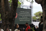
Memorial for quake victims to be revealed on 6th anniversary
Audio, Radio New Zealand
A memorial for the 185 people who died in the 2011 Christchurch earthquake will be blessed tonight, ahead of the unveiling tomorrow, on the sixth anniversary.
Quakes, fires, insurance claims - and then a parking ticket
Audio, Radio New Zealand
Christchurch woman Pam Sharpe has endured earthquakes, fires and dealing with insurance companies, but then she received a parking ticket. She tells Checkpoint what happened next.
Truck drivers quit over safety fears
Audio, Radio New Zealand
More than five people have died on crashes on SH1 between Picton and Christchurch since it became a main arterial route following the Kaikoura earthquake.
Liquefaction Evaluation in Stratified Soils
Research papers, University of Canterbury Library
The Canterbury Earthquake Sequence 2010-2011 (CES) induced widespread liquefaction in many parts of Christchurch city. Liquefaction was more commonly observed in the eastern suburbs and along the Avon River where the soils were characterised by thick sandy deposits with a shallow water table. On the other hand, suburbs to the north, west and south of the CBD (e.g. Riccarton, Papanui) exhibited less severe to no liquefaction. These soils were more commonly characterised by inter-layered liquefiable and non-liquefiable deposits. As part of a related large-scale study of the performance of Christchurch soils during the CES, detailed borehole data including CPT, Vs and Vp have been collected for 55 sites in Christchurch. For this subset of Christchurch sites, predictions of liquefaction triggering using the simplified method (Boulanger & Idriss, 2014) indicated that liquefaction was over-predicted for 94% of sites that did not manifest liquefaction during the CES, and under-predicted for 50% of sites that did manifest liquefaction. The focus of this study was to investigate these discrepancies between prediction and observation. To assess if these discrepancies were due to soil-layer interaction and to determine the effect that soil stratification has on the develop-ment of liquefaction and the system response of soil deposits.
SCIRT work holds back the tides
Articles, UC QuakeStudies
A document which describes how the new Beachville Road seawall was built.
Numbers add up in communication and engagement
Articles, UC QuakeStudies
A document which describes SCIRT's approach to quantifying the impact of its communications and community engagement activities.
Having a blast in the past
Articles, UC QuakeStudies
A document which describes SCIRT's discoveries and processes regarding archaeological finds on worksites.
Tramway, Tuam Street: A Report on Archaeological Investigations
Articles, UC QuakeStudies
A report which details the archaeological investigations carried out during the course of SCIRT project 10952, wastewater renewal work on Tuam Street.
Catalyst for life-saving change in safety
Articles, UC QuakeStudies
A document which describes SCIRT's approach to ensuring zero harm during its five and a half year programme of work.
Real asset in innovative damage assessment
Articles, UC QuakeStudies
A document which outlines SCIRT's post-earthquake asset assessment process.
Project prioritisation - right thing, right time, right place
Articles, UC QuakeStudies
A document which outlines how SCIRT prioritised the 634 construction projects within its programme of work.
Rebuild actual start date map
Articles, UC QuakeStudies
A map showing the actual construction start dates.
Early involvement builds successful framework
Articles, UC QuakeStudies
A document which discusses the importance of the ECI process at SCIRT.
Setting national standards for utilities coordination and protection - SCI…
Articles, UC QuakeStudies
A document which describes how SCIRT led the co-ordination of its huge repair programme with those of other utilities.
SCIRT safety on a page
Articles, UC QuakeStudies
A document which illustrates the impetus for SCIRT's zero harm programme, the parties involved, initiatives undertaken and outcomes achieved.
'REAL' response to resource roles
Articles, UC QuakeStudies
A document which outlines SCIRT's best practice approach to recruitment and training.
Peak performance coaching at SCIRT
Articles, UC QuakeStudies
A document which outlines SCIRT's use of peak performance coaches.
Mind the gap: more workers wanted
Articles, UC QuakeStudies
A document which describes the process that SCIRT took to fill its operational workforce gap.
The governance of SCIRT - the exercise of control
Articles, UC QuakeStudies
A document which describes how SCIRT's governance structure was set up and developed in response to the many challenges of the horizontal infrastructure rebuild.
The genesis of SCIRT - new era in disaster recovery
Articles, UC QuakeStudies
A document which describes the formation of SCIRT.
Well-grounded solution to soggy sites
Articles, UC QuakeStudies
A document which describes best practice for dewatering guidelines.
Far-sighted and comprehensive - Alliance Objectives steer the SCIRT journey
Articles, UC QuakeStudies
A document which discusses the importance of the Alliance Objectives to the operation of SCIRT.
Lest we forget - SCIRT restores Memorial Arch
Articles, UC QuakeStudies
A document which describes the process that SCIRT took to restore the Bridge of Remembrance and Memorial Arch.
What is SCIRT?
Articles, UC QuakeStudies
An article that explains the innovative work of SCIRT in a post-disaster environment.
SCIRT's awards roll call
Articles, UC QuakeStudies
A document which lists the awards won by SCIRT.
Civil Contractors' Environmental Guide
Articles, UC QuakeStudies
A document which provides simple, easy to understand environmental advice and guidance for civil construction contractors.
Business systems power rebuild
Articles, UC QuakeStudies
A document which describes SCIRT's approach to creating business systems to aid the rebuild of horizontal infrastructure.
Tic TOC: Time is money for SCIRT estimates
Articles, UC QuakeStudies
A document which describes the SCIRT estimates process and outcomes.