
Search
found 153 results
Images for Canterbury earthquake; more images...


CERA officials used positions for financial gain
Audio, Radio New Zealand
Two former Canterbury Earthquake Recovery Authority officials attempted to use their positions for their own financial gain and their actions will now be referred to the Serious Fraud Office.
Generalised parametric functions and spatial correlations for seismic velo…
Research papers, University of Canterbury Library
Science to Emergency Management Response: Kaikoura Earthquakes 2016
Research papers, University of Canterbury Library
The M7.8 Kaikoura Earthquake in 2016 presented a number of challenges to science agencies and institutions throughout New Zealand. The earthquake was complex, with 21 faults rupturing throughout the North Canterbury and Marlborough landscape, generating a localised seven metre tsunami and triggering thousands of landslides. With many areas isolated as a result, it presented science teams with logistical challenges as well as the need to coordinate efforts across institutional and disciplinary boundaries. Many research disciplines, from engineering and geophysics to social science, were heavily involved in the response. Coordinating these disciplines and institutions required significant effort to assist New Zealand during its most complex earthquake yet recorded. This paper explores that effort and acknowledges the successes and lessons learned by the teams involved.
An empirical analysis of the Christchurch residential mortgage market: pos…
Research papers, Lincoln University
The housing and mortgage market in Christchurch experienced significant changes since the 2011 earthquake, especially after the reconstruction of the city. The increasing speed of Christchurch average house price exceed the average house price of the whole country, as well as the number of new dwellings. By this regard, this study surveyed the households in Christchurch to analyze the effect of the earthquake on housing and mortgage market. This includes factors such as housing price, interest rate, government policy and socioeconomic factors in terms of age, gender, educational attainment, income, marital status and family life cycle. Logistic regression model is used to analyze the data. The study provides an overview of the housing market and mortgage market in Christchurch. The logistic regression, results show changes on sensitivity between the socio-economic factors and house purchase, as well as mortgage borrowing pre- and post-earthquake. The result indicates that the earthquake in Christchurch has affected households’ decision on house purchase and mortgage borrowing.
Phil Pennington: Surviving 7.8
Audio, Radio New Zealand
After being rocked awake by the massive 7.8 earthquake that hit North Canterbury last November, RNZ reporter Phil Pennington was among the first reporters to be sent to Kaikoura to assess the damage.
Preliminary geometry and kinematics of multiple surface ruptures during th…
Research papers, University of Canterbury Library
The Mw 7.8 Kaikōura earthquake ruptured ~200 km at the ground surface across the New Zealand plate boundary zone in the northern South Island. This study was conducted in an area of ~600 km2 in the epicentral region where the faults comprise two main non-coplanar sets that strike E-NE and NNE-NW with mainly steep dips (60о-80°). Analysis of the surface rupture using field and LiDAR data provides new information on the dimensions, geometries and kinematics of these faults which was not previously available from pre-earthquake active faults or bedrock structure. The more northerly striking fault set are sub-parallel to basement bedding and accommodated predominantly left-lateral reverse slip with net slips of ~1 and ~5 m for the Stone Jug and Leader faults, respectively. The E-NE striking Conway-Charwell and The Humps faults accrued right-lateral to oblique reverse with net slips of ~2 and ~3 m, respectively. The faults form a hard-linked system dominated by kinematics consistent with the ~260° trend of the relative plate motion vector and the transpressional structures recorded across the plate boundary in the NE South Island. Interaction and intersection of the main fault sets facilitated propagation of the earthquake and transfer of slip northwards across the plate boundary zone.
A System Dynamic Model of Post-Earthquake Reconstruction pathways
Research papers, University of Canterbury Library
Objectives • To develop a system dynamics model of Christchurch post-quake reconstruction process that captures all the critical dynamics influencing its pathway • To investigate the implications of current rebuild pathway • To build a reconstruction module to be integrated in MERIT (Measuring the Economics of Resilient Infrastructure Tool)
The Simple Lateral Mechanism Analysis (SLaMA) for the seismic performance …
Research papers, University of Canterbury Library
Research report N. 2016-2 This report presents the simplified seismic assessment of a case study reinforced concrete (RC) building following the newly developed and refined NZSEE/MBIE guidelines on seismic assessment (NZSEE/MBIE, semi-final draft 26 October 2016). After an overview of the step-by-step ‘diagnostic’ process, including an holistic and qualitative description of the expected vulnerabilities and of the assessment strategy/methodology, focus is given, whilst not limited, to the implementation of a Detailed Seismic Assessment (DSA) (NZSEE/MBIE, 2016c). The DSA is intended to provide a more reliable and consistent outcome than what can be provided by an initial seismic assessment (ISA). In fact, while the Initial Seismic Assessment (ISA), of which the Initial Evaluation Procedure is only a part of, is the more natural and still recommended first step in the overall assessment process, it is mostly intended to be a coarse evaluation involving as few resources as reasonably possible. It is thus expected that an ISA will be followed by a Detailed Seismic Assessment (DSA) not only where the threshold of 33%NBS is not achieved but also where important decisions are intended that are reliant on the seismic status of the building. The use of %NBS (% New Building Standard) as a capacity/demand ratio to describe the result of the seismic assessment at all levels of assessment procedure (ISA through to DSA) is deliberate by the NZSEE/MBIE guidelines (Part A) (NZSEE/MBIE 2016a). The rating for the building needs only be based on the lowest level of assessment that is warranted for the particular circumstances. Discussion on how the %NBS rating is to be determined can be found in Section A3.3 (NZSEE/MBIE 2016a), and, more specifically, in Part B for the ISA (NZSEE/MBIE 2016b) and Part C for the DSA (NZSEE/MBIE 2016c). As per other international approaches, the DSA can be based on several analysis procedures to assess the structural behaviour (linear, nonlinear, static or dynamic, force or displacement-based). The significantly revamped NZSEE 2016 Seismic Assessment Guidelines strongly recommend the use of an analytical (basically ‘by hand’) method, referred to the Simple Lateral Mechanism Analysis (SLaMA) as a first phase of any other numerically-based analysis method. Significant effort has thus been dedicated to provide within the NZSEE 2016 guidelines (NZSEE/MBIE 2016c) a step-by-step description of the procedure, either in general terms (Chapter 2) or with specific reference to Reinforced Concrete Buildings (Chapter 5). More specifically, extract from the guidelines, NZSEE “recommend using the Simple Lateral Mechanism Analysis (SLaMA) procedure as a first step in any assessment. While SLaMA is essentially an analysis technique, it enables assessors to investigate (and present in a simple form) the potential contribution and interaction of a number of structural elements and their likely effect on the building’s global capacity. In some cases, the results of a SLaMA will only be indicative. However, it is expected that its use should help assessors achieve a more reliable outcome than if they only carried out a detailed analysis, especially if that analysis is limited to the elastic range For complex structural systems, a 3D dynamic analysis may be necessary to supplement the simplified nonlinear Simple Lateral Mechanism Analysis (SLaMA).” This report presents the development of a full design example for the the implementation of the SLaMA method on a case study buildings and a validation/comparison with a non-linear static (pushover) analysis. The step-by-step-procedure, summarized in Figure 1, will be herein demonstrated from a component level (beams, columns, wall elements) to a subassembly level (hierarchy of strength in a beam-column joint) and to a system level (frame, C-Wall) assuming initially a 2D behaviour of the key structural system, and then incorporating a by-hand 3D behaviour (torsional effects).
Post-catastrophe insurance supply and demand: theory and evidence
Research papers, University of Canterbury Library
In September 2010 and February 2011, the Canterbury region experienced devastating earthquakes with an estimated economic cost of over NZ$40 billion (Parker and Steenkamp, 2012; Timar et al., 2014; Potter et al., 2015). The insurance market played an important role in rebuilding the Canterbury region after the earthquakes. Homeowners, insurance and reinsurance markets and New Zealand government agencies faced a difficult task to manage the rebuild process. From an empirical and theoretic research viewpoint, the Christchurch disaster calls for an assessment of how the insurance market deals with such disasters in the future. Previous studies have investigated market responses to losses in global catastrophes by focusing on the insurance supply-side. This study investigates both demand-side and supply-side insurance market responses to the Christchurch earthquakes. Despite the fact that New Zealand is prone to seismic activities, there are scant previous studies in the area of earthquake insurance. This study does offer a unique opportunity to examine and document the New Zealand insurance market response to catastrophe risk, providing results critical for understanding market responses after major loss events in general. A review of previous studies shows higher premiums suppress demand, but how higher premiums and a higher probability of risk affect demand is still largely unknown. According to previous studies, the supply of disaster coverage is curtailed unless the market is subsidised, however, there is still unsettled discussion on why demand decreases with time from the previous disaster even when the supply of coverage is subsidised by the government. Natural disaster risks pose a set of challenges for insurance market players because of substantial ambiguity associated with the probability of such events occurring and high spatial correlation of catastrophe losses. Private insurance market inefficiencies due to high premiums and spatially concentrated risks calls for government intervention in the provision of natural disaster insurance to avert situations of noninsurance and underinsurance. Political economy considerations make it more likely for government support to be called for if many people are uninsured than if few people are uninsured. However, emergency assistance for property owners after catastrophe events can encourage most property owners to not buy insurance against natural disaster and develop adverse selection behaviour, generating larger future risks for homeowners and governments. On the demand-side, this study has developed an intertemporal model to examine how demand for insurance changes post-catastrophe, and how to model it theoretically. In this intertemporal model, insurance can be sought in two sequential periods of time, and at the second period, it is known whether or not a loss event happened in period one. The results show that period one demand for insurance increases relative to the standard single period model when the second period is taken into consideration, period two insurance demand is higher post-loss, higher than both the period one demand and the period two demand without a period one loss. To investigate policyholders experience from the demand-side perspective, a total of 1600 survey questionnaires were administered, and responses from 254 participants received representing a 16 percent response rate. Survey data was gathered from four institutions in Canterbury and is probably not representative of the entire population. The results of the survey show that the change from full replacement value policy to nominated replacement value policy is a key determinant of the direction of change in the level of insurance coverage after the earthquakes. The earthquakes also highlighted the plight of those who were underinsured, prompting policyholders to update their insurance coverage to reflect the estimated cost of re-building their property. The survey has added further evidence to the existing literature, such as those who have had a recent experience with disaster loss report increased risk perception if a similar event happens in future with females reporting a higher risk perception than males. Of the demographic variables, only gender has a relationship with changes in household cover. On the supply-side, this study has built a risk-based pricing model suitable to generate a competitive premium rate for natural disaster insurance cover. Using illustrative data from the Christchurch Red-zone suburbs, the model generates competitive premium rates for catastrophe risk. When the proposed model incorporates the new RMS high-definition New Zealand Earthquake Model, for example, insurers can find the model useful to identify losses at a granular level so as to calculate the competitive premium. This study observes that the key to the success of the New Zealand dual insurance system despite the high prevalence of catastrophe losses are; firstly the EQC’s flat-rate pricing structure keeps private insurance premiums affordable and very high nationwide homeowner take-up rates of natural disaster insurance. Secondly, private insurers and the EQC have an elaborate reinsurance arrangement in place. By efficiently transferring risk to the reinsurer, the cost of writing primary insurance is considerably reduced ultimately expanding primary insurance capacity and supply of insurance coverage.
Creating healthy urban communities: lessons from Christchurch’s earthquake…
Research papers, University of Canterbury Library
Resilience through Building Back Better: Assessing Christchurch Recovery f…
Research papers, The University of Auckland Library
Disasters, either man-made or natural, are characterised by a multiplicity of factors including loss of property, life, environmental degradation, and psychosocial malfunction of the affected community. Although much research has been undertaken on proactive disaster management to help reduce the impacts of natural and man-made disasters, many challenges still remain. In particular, the desire to re-house the affected as quickly as possible can affect long-term recovery if a considered approach is not adopted. Promoting recovery activities, coordination, and information sharing at national and international levels are crucial to avoid duplication. Mannakkara and Wilkinson’s (2014) modified “Build Back Better” (BBB) concept aims for better resilience by incorporating key resilience elements in post-disaster restoration. This research conducted an investigation into the effectiveness of BBB in the recovery process after the 2010–2011 earthquakes in greater Christchurch, New Zealand. The BBB’s impact was assessed in terms of its five key components: built environment, natural environment, social environment, economic environment, and implementation process. This research identified how the modified BBB propositions can assist in disaster risk reduction in the future, and used both qualitative and quantitative data from both the Christchurch and Waimakariri recovery processes. Semi-structured interviews were conducted with key officials from the Christchurch Earthquake Recovery Authority, and city councils, and supplemented by reviewing of the relevant literature. Collecting data from both qualitative and quantitative sources enabled triangulation of the data. The interviewees had directly participated in all phases of the recovery, which helped the researcher gain a clear understanding of the recovery process. The findings led to the identification of best practices from the Christchurch and Waimakariri recovery processes and underlined the effectiveness of the BBB approach for all recovery efforts. This study contributed an assessment tool to aid the measurement of resilience achieved through BBB indicators. This tool provides systematic and structured approach to measure the performance of ongoing recovery
Fragility functions for buried pipelines in liquefiable soils based on New…
Research papers, University of Canterbury Library
This poster aims to present fragility functions for pipelines buried in liquefaction-prone soils. Existing fragility models used to quantify losses can be based on old data or use complex metrics. Addressing these issues, the proposed functions are based on the Christchurch network and soil and utilizes the Canterbury earthquake sequence (CES) data, partially represented in Figure 1. Figure 1 (a) presents the pipe failure dataset, which describes the date, location and pipe on which failures occurred. Figure 1 (b) shows the simulated ground motion intensity median of the 22nd February 2011 earthquake. To develop the model, the network and soil characteristics have also been utilized
Landslides caused by the mw7.8 Kaikōura earthquake and the immediate respo…
Research papers, University of Canterbury Library
Tens of thousands of landslides were generated over 10, 000 km2 of North Canterbury and Marlborough as a consequence of the 14 November 2016, MW7.8 Kaikōura Earthquake. The most intense landslide damage was concentrated in 3500 km2 around the areas of fault rupture. Given the sparsely populated area affected by landslides, only a few homes were impacted and there were no recorded deaths due to landslides. Landslides caused major disruption with all road and rail links with Kaikōura being severed. The landslides affecting State Highway 1 (the main road link in the South Island of New Zealand) and the South Island main trunk railway extended from Ward in Marlborough all the way to the south of Oaro in North Canterbury. The majority of landslides occurred in two geological and geotechnically distinct materials reflective of the dominant rock types in the affected area. In the Neogene sedimentary rocks (sandstones, limestones and siltstones) of the Hurunui District, North Canterbury and around Cape Campbell in Marlborough, first-time and reactivated rock-slides and rock-block slides were the dominant landslide type. These rocks also tend to have rock material strength values in the range of 5-20 MPa. In the Torlesse 'basement' rocks (greywacke sandstones and argillite) of the Kaikōura Ranges, first-time rock and debris avalanches were the dominant landslide type. These rocks tend to have material strength values in the range of 20-50 MPa. A feature of this earthquake is the large number (more than 200) of valley blocking landslides it generated. This was partly due to the steep and confined slopes in the area and the widely distributed strong ground shaking. The largest landslide dam has an approximate volume of 12(±2) M m3 and the debris from this travelled about 2.7 km2 downslope where it formed a dam blocking the Hapuku River. The long-term stability of cracked slopes and landslide dams from future strong earthquakes and large rainstorms are an ongoing concern to central and local government agencies responsible for rebuilding homes and infrastructure. A particular concern is the potential for debris floods to affect downstream assets and infrastructure should some of the landslide dams breach catastrophically. At least twenty-one faults ruptured to the ground surface or sea floor, with these surface ruptures extending from the Emu Plain in North Canterbury to offshore of Cape Campbell in Marlborough. The mapped landslide distribution reflects the complexity of the earthquake rupture. Landslides are distributed across a broad area of intense ground shaking reflective of the elongate area affected by fault rupture, and are not clustered around the earthquake epicentre. The largest landslides triggered by the earthquake are located either on or adjacent to faults that ruptured to the ground surface. Surface faults may provide a plane of weakness or hydrological discontinuity and adversely oriented surface faults may be indicative of the location of future large landslides. Their location appears to have a strong structural geological control. Initial results from our landslide investigations suggest predictive models relying only on ground-shaking estimates underestimate the number and size of the largest landslides that occurred.
Scrutinising The Prediction of Liquefaction Through New Zealand Case Histo…
Research papers, University of Canterbury Library
Background Liquefaction induced land damage has been identified in more than 13 notable New Zealand earthquakes within the past 150 years, as presented on the timeline below. Following the 2010-2011 Canterbury Earthquake Sequence (CES), the consequences of liquefaction were witnessed first-hand in the city of Christchurch and as a result the demand for understanding this phenomenon was heightened. Government, local councils, insurers and many other stakeholders are now looking to research and understand their exposure to this natural hazard.
Fault rupture patterns during the Mw7.8 2016 Kaikoura Earthquake in the re…
Research papers, University of Canterbury Library
Surface rupture and slip from the Mw 7.8 2016 Kaikōura Earthquake have been mapped in the region between the Leader and Charwell rivers using field mapping and LiDAR data. The eastern Humps, north Leader and Conway-Charwell faults ruptured the ground surface in the study area. The E-NE striking ‘The Humps’ Fault runs along the base of the Mt Stewart range front, appears to dip steeply NW and intersects the NNW-NNE Leader Fault which itself terminates northwards at the NE striking Conway-Charwell Fault. The eastern Humps Fault is up to the NW and accommodates oblique slip with reverse and right lateral displacement. Net slip on ‘The Humps’ Fault is ≤4 m and produced ≤4 m uplift of the Mt Stewart range during the earthquake. The Leader Fault strikes NNW-NNE with dips ranging from ~10° west to 80° east and accommodated ≤4 m net slip comprising left-lateral and up-to-the-west vertical displacement. Like the Humps west of the study area, surface-rupture of the Leader Fault occurred on multiple strands. The complexity of rupture on the Leader Fault is in part due to the occurrence of bedding-parallel slip within the Cretaceous-Cenozoic sequence. Although the Mt Stewart range front is bounded by ‘The Humps’ Fault, in the study area neither this fault nor the Leader Fault were known to have been active before the earthquake. Fieldwork and trenching investigations are ongoing to characterise the geometry, kinematics and paleoseismic history of the mapped active faults.
Predicting Liquefaction in Near-Real-Time (NRT) : An Assessment of Geospat…
Research papers, University of Canterbury Library
Semi-empirical models based on in-situ geotechnical tests have become the standard of practice for predicting soil liquefaction. Since the inception of the “simplified” cyclic-stress model in 1971, variants based on various in-situ tests have been developed, including the Cone Penetration Test (CPT). More recently, prediction models based soley on remotely-sensed data were developed. Similar to systems that provide automated content on earthquake impacts, these “geospatial” models aim to predict liquefaction for rapid response and loss estimation using readily-available data. This data includes (i) common ground-motion intensity measures (e.g., PGA), which can either be provided in near-real-time following an earthquake, or predicted for a future event; and (ii) geospatial parameters derived from digital elevation models, which are used to infer characteristics of the subsurface relevent to liquefaction. However, the predictive capabilities of geospatial and geotechnical models have not been directly compared, which could elucidate techniques for improving the geospatial models, and which would provide a baseline for measuring improvements. Accordingly, this study assesses the realtive efficacy of liquefaction models based on geospatial vs. CPT data using 9,908 case-studies from the 2010-2016 Canterbury earthquakes. While the top-performing models are CPT-based, the geospatial models perform relatively well given their simplicity and low cost. Although further research is needed (e.g., to improve upon the performance of current models), the findings of this study suggest that geospatial models have the potential to provide valuable first-order predictions of liquefaction occurence and consequence. Towards this end, performance assessments of geospatial vs. geotechnical models are ongoing for more than 20 additional global earthquakes.
Lessons learned from liquefaction of the Canterbury Earthquake Sequence (2…
Research papers, Lincoln University
Liquefaction affects late Holocene, loose packed and water saturated sediment subjected to cyclical shear stress. Liquefaction features in the geological record are important off-fault markers that inform about the occurrence of moderate to large earthquakes (> 5 Mw). The study of contemporary liquefaction features provides a better understanding of where to find past (paleo) liquefaction features, which, if identified and dated, can provide information on the occurrence, magnitude and timing of past earthquakes. This is particularly important in areas with blind active faults. The extensive liquefaction caused by the 2010-2011 Canterbury Earthquake Sequence (CES) gave the geoscience community the opportunity to study the liquefaction process in different settings (alluvial, coastal and estuarine), investigating different aspects (e.g. geospatial correlation with landforms, thresholds for peak ground acceleration, resilience of infrastructures), and to collect a wealth geospatial dataset in the broad region of the Canterbury Plains. The research presented in this dissertation examines the sedimentary architecture of two environments, the alluvial and coastal settings, affected by liquefaction during the CES. The novel aim of this study is to investigate how landform and subsurface sedimentary architecture influence liquefaction and its surface manifestation, to provide knowledge for locating studies of paleoliquefaction in future. Two study cases documented in the alluvial setting showed that liquefaction features affected a crevasse splay and point bar ridges. However, the liquefaction source layer was linked to paleochannel floor deposits below the crevasse splay in the first case, and to the point bar deposits themselves in the second case. This research documents liquefaction features in the coastal dune system of the Canterbury Plains in detail for the first time. In the coastal dune setting the liquefiable layer is near the surface. The pore water pressure is vented easily because the coastal dune soil profile is entirely composed of non-cohesive, very well sorted sandy sediment that weakly resists disturbance from fluidised sediment under pressure. As a consequence, the liquefied flow does not need to find a specific crack through which the sediment is vented at the surface; instead, the liquefied sand finds many closely spaced conduits to vent its excess of pore water pressure. Therefore, in the coastal dune setting it is rare to observe discrete dikes (as they are defined in the alluvial setting), instead A horizon delamination (splitting) and blistering (near surface sills) are more common. The differences in styles of surface venting lead to contrasts in patterns of ejecta in the two environments. Whereas the alluvial environment is characterised by coalesced sand blows forming lineations, the coastal dune environment hosts apparently randomly distributed isolated sand blows often associated with collapse features. Amongst the techniques tested for the first time to investigate liquefaction features are: 3D GPR, which improved the accuracy of the trenching even six years after the liquefaction events; thin section analysis to investigate sediment fabric, which helped to discriminate liquefied sediment from its host sediment, and modern from paleoliquefaction features; a Random Forest classification based on the CES liquefaction map, which was used to test relationships between surface manifestation of liquefaction and topographic parameters. The results from this research will be used to target new study sites for future paleoliquefaction research and thus will improve the earthquake hazard assessment across New Zealand.
North Canterbury relieved to see SH1 re-opening
Audio, Radio New Zealand
More than a year after North Canterbury's 7.8 magnitude earthquake forced its closure, State Highway 1 north of Kaikoura will re-open to the public on Friday. Thousands of cars and trucks have been diverted inland since one million tonnes of rubble, in the form of 85 landslides, came down on the road, which was the main route between Picton and Christchurch. It's meant a tough year for some of those based along the highway. Reporter Maja Burry checked in with locals and filed this report.
Development of a 3D Canterbury seismic velocity model and investigation of…
Research papers, University of Canterbury Library
This dissertation addresses a diverse range of topics in the area of physics-based ground motion simulation with particular focus on the Canterbury, New Zealand region. The objectives achieved provide the means to perform hybrid broadband ground motion simulation and subsequently validates the simulation methodology employed. In particu- lar, the following topics are addressed: the development of a 3D seismic velocity model of the Canterbury region for broadband ground motion simulation; the development of a 3D geologic model of the interbedded Quaternary formations to provide insight on observed ground motions; and the investigation of systematic effects through ground motion sim- ulation of small-to-moderate magnitude earthquakes. The paragraphs below outline each contribution in more detail. As a means to perform hybrid broadband ground motion simulation, a 3D model of the geologic structure and associated seismic velocities in the Canterbury region is devel- oped utilising data from depth-converted seismic reflection lines, petroleum and water well logs, cone penetration tests, and implicitly guided by existing contour maps and geologic cross sections in data sparse subregions. The model explicitly characterises five significant and regionally recognisable geologic surfaces that mark the boundaries between geologic units with distinct lithology and age, including the Banks Peninsula volcanics, which are noted to strongly influence seismic wave propagation. The Basement surface represents the base of the Canterbury sedimentary basin, where a large impedance contrast exists re- sulting in basin-generated waves. Seismic velocities for the lithological units between the geologic surfaces are derived from well logs, seismic reflection surveys, root mean square stacking velocities, empirical correlations, and benchmarked against a regional crustal model, thus providing the necessary information for a Canterbury velocity model for use in broadband seismic wave propagation. A 3D high-resolution model of the Quaternary geologic stratigraphic sequence in the Canterbury region is also developed utilising datasets of 527 high-quality water well logs, and 377 near-surface cone penetration test records. The model, developed using geostatistical Kriging, represents the complex interbedded regional Quaternary geology by characterising the boundaries between significant interbedded geologic formations as 3D surfaces including explicit modelling of the formation unconformities resulting from the Banks Peninsula volcanics. The stratigraphic layering present can result in complex wave propagation. The most prevalent trend observed in the surfaces was the downward dip from inland to the eastern coastline as a result of the dominant fluvial depositional environment of the terrestrial gravel formations. The developed model provides a benefi- cial contribution towards developing a comprehensive understanding of recorded ground motions in the region and also providing the necessary information for future site char- acterisation and site response analyses. To highlight the practicality of the model, an example illustrating the role of the model in constraining surface wave analysis-based shear wave velocity profiling is illustrated along with the calculation of transfer functions to quantify the effect of the interbedded geology on wave propagation. Lastly, an investigation of systematic biases in the (Graves and Pitarka, 2010, 2015) ground motion simulation methodology and the specific inputs used for the Canterbury region is presented considering 144 small-to-moderate magnitude earthquakes. In the simulation of these earthquakes, the 3D Canterbury Velocity Model, developed as a part of this dissertation, is used for the low-frequency simulation, and a regional 1D velocity model for the high-frequency simulation. Representative results for individual earthquake sources are first presented to highlight the characteristics of the small-to-moderate mag- nitude earthquake simulations through waveforms, intensity measure scaling with source- to-site distance, and spectral bias of the individual events. Subsequently, a residual de- composition is performed to examine the between- and within-event residuals between observed data, and simulated and empirical predictions. By decomposing the residuals into between- and within-event residuals, the biases in source, path and site effects, and their causes, can be inferred. The residuals are comprehensively examined considering their aggregated characteristics, dependence on predictor variables, spatial distribution, and site-specific effects. The results of the simulation are also benchmarked against empir- ical ground motion models, where their similarities manifest from common components in their prediction. Ultimately, suggestions to improve the predictive capability of the simulations are presented as a result of the analysis.
Alternative Radio : exhibiting radio and music heritage after the Christch…
Research papers, University of Canterbury Library
This article examines the representation of Christchurch, New Zealand, student radio station RDU in the exhibition Alternative Radio at the Canterbury Museum in 2016. With the intention of ‘making visible what is invisible’ about radio broadcasting, the exhibition articulated RDU as a point of interconnection between the technical elements of broadcasting, the social and musical culture of station staff and volunteers, and the broader local and national music scenes. This paper is grounded in observations of the exhibitions and associated public programmes, and interviews with the key participants in the exhibition including the museum's exhibition designer and staff from RDU, who acted as independent practitioners in collaboration with the museum. Alternative Radio also addressed the aftermath of the major earthquake of 22 February 2011, when RDU moved into a customised horse truck after losing its broadcast studio. The exhibition came about because of the cultural resonance of the post-quake story, but also emphasised the long history of the station before that event, and located this small student radio station in the broader heritage discourse of the Canterbury museum, activating the historical, cultural, and personal memories of the station's participants and audiences.
Amplification of strong ground motions at Heathcote Valley during the 2010…
Research papers, University of Canterbury Library
This article presents a quantitative case study on the site amplification effect observed at Heathcote Valley, New Zealand, during the 2010-2011 Canterbury earthquake sequence for 10 events that produced notable ground acceleration amplitudes up to 1.4g and 2.2g in the horizontal and vertical directions, respectively. We performed finite element analyses of the dynamic response of the valley, accounting for the realistic basin geometry and the soil non-linear response. The site-specific simulations performed significantly better than both empirical ground motion models and physics based regional-scale ground motion simulations (which empirically accounts for the site effects), reducing the spectral acceleration prediction bias by a factor of two in short vibration periods. However, our validation exercise demonstrated that it was necessary to quantify the level of uncertainty in the estimated bedrock motion using multiple recorded events, to understand how much the simplistic model can over- or under-estimate the ground motion intensities. Inferences from the analyses suggest that the Rayleigh waves generated near the basin edge contributed significantly to the observed high frequency (f>3Hz) amplification, in addition to the amplification caused by the strong soil-rock impedance contrast at the site fundamental frequency. Models with and without considering soil non-linear response illustrate, as expected, that the linear elastic assumption severely overestimates ground motions in high frequencies for strong earthquakes, especially when the contribution of basin edge-generated Rayleigh waves becomes significant. Our analyses also demonstrate that the effect of pressure-dependent soil velocities on the high frequency ground motions is as significant as the amplification caused by the basin edge-generated Rayleigh waves.
Christchurch Earthquake Recovery - An Example of Resilience and Sustainabi…
Research papers, University of Canterbury Library
The term resilience‘’is increasingly being used in a multitude of contexts. Seemingly the latest buzz‘’word, it can mean many things to many people, in many different situations. In a natural hazard context, the terms sustainable planning‘’, and resilience‘planning are now’being used, often interchangeably. This poster provides an overview of resilience and sustainability within a land use planning and natural hazard context, and discusses how they are interrelated in the situation of the earthquake impacted city of Christchurch, New Zealand.
Relative efficacy of CPT- versus Vs-based simplified liquefaction evaluati…
Research papers, University of Canterbury Library
The focus of the study presented herein is an assessment of the relative efficacy of recent Cone Penetration Test (CPT) and small strain shear wave velocity (Vs) based variants of the simplified procedure. Towards this end Receiver Operating Characteristic (ROC) analyses were performed on the CPT- and Vs-based procedures using the field case history databases from which the respective procedures were developed. The ROC analyses show that Factors of Safety (FS) against liquefaction computed using the most recent Vs-based simplified procedure is better able to separate the “liquefaction” from the “no liquefaction” case histories in the Vs liquefaction database than the CPT-based procedure is able to separate the “liquefaction” from the “no liquefaction” case histories in the CPT liquefaction database. However, this finding somewhat contradicts the assessed predictive capabilities of the CPT- and Vs-based procedures as quantified using select, high quality liquefaction case histories from the 20102011 Canterbury, New Zealand, Earthquake Sequence (CES), wherein the CPT-based procedure was found to yield more accurate predictions. The dichotomy of these findings may result from the fact that different liquefaction field case history databases were used in the respective ROC analyses for Vs and CPT, while the same case histories were used to evaluate both the CPT- and Vs-based procedures.
Unreinforced Masonry Churches in New Zealand Towards a Holistic Framework …
Research papers, University of Canterbury Library
Unreinforced masonry churches in New Zealand, similarly to everywhere else in the word have proven to be highly vulnerable to earthquakes, because of their particular construction features. The Canterbury (New Zealand) earthquake sequence, 2010-2011 caused an invaluable loss of local architectural heritage and of churches, as regrettably, some of them were demolished instead of being repaired. It is critical for New Zealand to advance the data collection, research and understanding pertaining to the seismic performance and protection of church buildings, with the aim to:
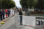
The once and future cathedral
Research papers, University of Canterbury Library
This is an ethnographic case study, tracking the course of arguments about the future of a city’s central iconic building, damaged following a major earthquake sequence. The thesis plots this as a social drama and examines the central discourses of the controversy. The focus of the drama is the Anglican neo-Gothic Christ Church Cathedral, which stands in the central square of Christchurch, New Zealand. A series of major earthquakes in 2010/2011 devastated much of the inner city, destroying many heritage-listed buildings. The Cathedral was severely damaged and was declared by Government officials in 2011 to be a dangerous building, which needed to be demolished. The owners are the Church Property Trustees, chaired by Bishop Victoria Matthews, a Canadian appointed in 2008. In March 2012 Matthews announced that the Cathedral, because of safety and economic factors, would be deconstructed. Important artefacts were to be salvaged and a new Cathedral built, incorporating the old and new. This decision provoked a major controversy, led by those who claimed that the building could and should be restored. Discourses of history and heritage, memory, place and identity, ownership, economics and power are all identified, along with the various actors, because of their significance. However, the thesis is primarily concerned with the differing meanings given to the Cathedral. The major argument centres on the symbolic interaction between material objects and human subjects and the various ways these are interpreted. At the end of the research period, December 2015, the Christ Church Cathedral stands as a deteriorating wreck, inhabited by pigeons and rats and shielded by protective, colourfully decorated wooden fences. The decision about its future remains unresolved at the time of writing.
Seismic performance of suspended ceilings
Research papers, University of Canterbury Library
Non-structural elements (NSEs) have frequently proven to contribute to significant losses sustained from earthquakes in the form of damage, downtime, injury and death. In New Zealand (NZ), the 2010 and 2011 Canterbury Earthquake Sequence (CES), the 2013 Seddon and Cook Strait earthquake sequence and the 2016 Kaikoura earthquake were major milestones in this regard as significant damage to building NSEs both highlighted and further reinforced the importance of NSE seismic performance to the resilience of urban centres. Extensive damage in suspended ceilings, partition walls, façades and building services following the CES was reported to be partly due to erroneous seismic design or installation or caused by intervening elements. Moreover, the low-damage solutions developed for structural systems sometimes allow for relatively large inter-story drifts -compared to conventional designs- which may not have been considered in the seismic design of NSEs. Having observed these shortcomings, this study on suspended ceilings was carried out with five main goals: i) Understanding the seismic performance of the system commonly used in NZ; ii) Understanding the transfer of seismic design actions through different suspended ceiling components, iii) Investigating potential low-damage solutions; iii) Evaluating the compatibility of the current ceiling system with other low-damage NSEs; and iv) Investigating the application of numerical analysis to simulate the response of ceiling systems. The first phase of the study followed a joint research work between the University of Canterbury (UC) in NZ, and the Politecnico Di Milano, in Italy. The experimental ceiling component fragility curves obtained in this existing study were employed to produce analytical fragility curves for a perimeter-fixed ceiling of a given size and weight, with grid acceleration as the intensity measure. The validity of the method was proven through comparisons between this proposed analytical approach with the recommended procedures in proprietary products design guidelines, as well as experimental fragility curves from other studies. For application to engineering design practice, and using fragility curves for a range of ceiling lengths and weights, design curves were produced for estimating the allowable grid lengths for a given demand level. In the second phase of this study, three specimens of perimeter-fixed ceilings were tested on a shake table under both sinusoidal and random floor motion input. The experiments considered the relationship between the floor acceleration, acceleration of the ceiling grid, the axial force induced in the grid members, and the effect of boundary conditions on the transfer of these axial forces. A direct correlation was observed between the axial force (recorded via load cells) and the horizontal acceleration measured on the ceiling grid. Moreover, the amplification of floor acceleration, as transferred through ceiling components, was examined and found (in several tests) to be greater than the recommended factor for the design of ceilings provided in the NZ earthquake loadings standard NZS1170.5. However, this amplification was found to be influenced by the pounding interactions between the ceiling grid members and the tiles, and this amplification diminished considerably when the high frequency content was filtered out from the output time histories. The experiments ended with damage in the ceiling grid connection at an axial force similar to the capacity of these joints previously measured through static tests in phase one. The observation of common forms of damage in ceilings in earthquakes triggered the monotonic experiments carried out in the third phase of this research with the objective of investigating a simple and easily applicable mitigation strategy for existing or new suspended ceilings. The tests focused on the possibility of using proprietary cross-shaped clip elements ordinarily used to provide seismic gap as a strengthening solution for the weak components of a ceiling. The results showed that the solution was effective under both tension and compression loads through increasing load bearing capacity and ductility in grid connections. The feasibility of a novel type of suspended ceiling called fully-floating ceiling system was investigated through shaking table tests in the next phase of this study with the main goal of isolating the ceiling from the surrounding structure; thereby arresting the transfer of associated seismic forces from the structure to the ceiling. The fully-floating ceiling specimen was freely hung from the floor above lacking any lateral bracing and connections with the perimeter. Throughout different tests, a satisfactory agreement between the fully-floating ceiling response and simple pendulum theory was demonstrated. The addition of isolation material in perimeter gaps was found effective in inducing extra damping and protecting the ceiling from pounding impact; resulting in much reduced ceiling displacements and accelerations. The only form of damage observed throughout the random floor motion tests and the sinusoidal tests was a panel dislodgement observed in a test due to successive poundings between the ceiling specimen and the surrounding beams at resonant frequencies. Partition walls as the first effective NSE in direct interaction with ceilings were the topic of the final experimental phase. Low-damage drywall partitions proposed in a previous study in the UC were tested with two common forms of suspended ceiling: braced and perimeter-fixed. The experiments investigated the in-plane and out-of-plane performance of the low-damage drywall partitions, as well as displacement compatibility between these walls and the suspended ceilings. In the braced ceiling experiment, where no connection was made between ceiling grids and surrounding walls no damage in the grid system or partitions was observed. However, at high drift values panel dislodgement was observed on corners of the ceiling where the free ends of grids were not restrained against spreading. This could be prevented by framing the grid ends using a perimeter angle that is riveted only to the grid members while keeping sufficient clearance from the perimeter walls. In the next set of tests with the perimeter-fixed ceiling, no damage was observed in the ceiling system or the drywalls. Based on the results of the experiments it was concluded that the tested ceiling had enough flexibility to accommodate the relative displacement between two perpendicular walls up to the inter-storey drifts achieved. The experiments on perimeter-fixed ceilings were followed by numerical simulations of the performance of these ceilings in a finite element model developed in the structural analysis software, SAP2000. This model was relatively simple and easy to develop and was able to replicate the experimental results to a reasonable degree. Filtering was applied to the experimental output to exclude the effect of high frequency noise and tile-grid impact. The developed model generally simulated the acceleration responses well but underestimated the peak ceiling grid accelerations. This was possibly because the peak values in time histories were affected by impact occurring at very short periods. The model overestimated the axial forces in ceiling grids which was assumed to be caused by the initial assumptions made about the tributary area or constant acceleration associated with each grid line in the direction of excitation. Otherwise, the overall success of the numerical modelling in replicating the experimental results implies that numerical modelling using conventional structural analysis software could be used in engineering practice to analyse alternative ceiling geometries proposed for application to varying structural systems. This however, needs to be confirmed through similar analyses on other ceiling examples from existing instrumented buildings during real earthquakes. As the concluding part of this research the final phase addressed the issues raised following the review of existing ceiling standards and guidelines. The applicability of the research findings to current practice and their implications were discussed. Finally, an example was provided for the design of a suspended ceiling utilising the new knowledge acquired in this research.
CTV collapse: Will there be corporate manslaughter charge?
Audio, Radio New Zealand
Justice Minister Andrew Little said on Thursday that "everybody involved in this has walked away scot-free. And that's not right." Nigel Hampton QC, who was counsel for the families at the Royal Commission in to the Canterbury earthquakes, joins us to discuss the outcome.
Exploring the UNESCO Geopark concept as a pathway to a geotourism attracti…
Research papers, Lincoln University
The concept of geoparks was first introduced in the first international conference on geoparks held in China in 2004. Here in New Zealand, Kiwis are accustomed to national parks, land reserves, marine reserves, and urban cities and regional parks. The concept of these protected areas has been long-standing in the country, whereas the UNESCO concept of geoparks is still novel and yet to be established in New Zealand. In this dissertation, I explored the geopark concept for better understanding of its merits and examined the benefits of geotourism attractions as a sustainable economic development strategy to retrieve a declining rural economy. This research is focused on Kaikoura as a case study with geological significance, and emphasizes pre-earthquake existing geological heritages and new existing geological heritages post-earthquake to determine whether the geopark concept is appropriate and what planning framework is available to process this concept proposal should Kaikoura be interested in future.
SeisFinder: A web application for extraction of data from computationally-…
Research papers, University of Canterbury Library
SeisFinder is an open-source web service developed by QuakeCoRE and the University of Canterbury, focused on enabling the extraction of output data from computationally intensive earthquake resilience calculations. Currently, SeisFinder allows users to select historical or future events and retrieve ground motion simulation outputs for requested geographical locations. This data can be used as input for other resilience calculations, such as dynamic response history analysis. SeisFinder was developed using Django, a high-level python web framework, and uses a postgreSQL database. Because our large-scale computationally-intensive numerical ground motion simulations produce big data, the actual data is stored in file systems, while the metadata is stored in the database.
New quake safety doubts over police stations, hospitals
Audio, Radio New Zealand
It's been revealed that not a single one of New Zealand's 315 police buildings constructed before 2011 have had a full earthquake safety check. Canterbury's district health buildings and a central Wellington cinema are among other major structures needing checks. Phil Pennington joins us with the details.