Search
found 55 results
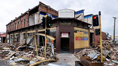
Images for Earthquake aftershocks; more images...


Photograph by Neil Macbeth 112
Images, UC QuakeStudies
Mayor Bob Parker entering the Christchurch Art Gallery after an aftershock hit during one of their briefings. A pile of shattered glass is in the main doorway. The Christchurch Art Gallery served as the headquarters for Civil Defence after the 22 February 2011 earthquake.
Photograph by Neil Macbeth 167
Images, UC QuakeStudies
A view looking south down Durham Street during the aftermath of the 22 February 2011 earthquake. On the left are the ruins of the historic stone Provincial Council Legislative Chamber. The building's roof and walls have already collapsed, as has the scaffolding which was erected to repair it after the 4 September 2010 earthquake. An aftershock has caused masonry to dislodge from the building, sending dust into the air.
Photograph by Neil Macbeth 168
Images, UC QuakeStudies
A view looking south down Durham Street during the aftermath of the 22 February 2011 earthquake. On the left are the ruins of the historic stone Provincial Council Legislative Chamber. The building's roof and walls have already collapsed, as has the scaffolding which was erected to repair it after the 4 September 2010 earthquake. An aftershock has caused masonry to dislodge from the building, sending dust into the air.
NZ Raw blog post 4 September 2010 'Christchurch Earthquake Photos'
Articles, UC QuakeStudies
A post on the NZ Raw blog written by Mark Lincoln on 4 September 2010. Mark says, "This is the first [blog post] I wrote on 4th Sept. I always remember an announcer on the radio having the first on-air interview with Geonet/EQC (obviously only 1 or 2 staff members at that stage!). The announcer asked if the aftershocks would carry on for much longer and the Geonet guy said they could carry on for a few weeks. Radio announcer seemed shocked".
Mark Lincoln Photograph 022
Images, UC QuakeStudies
A view looking west down Tuam Street across the High Street intersection. Road cones line the street. The photographer comments, "This was taken shortly after the 4th September earthquake. Police allowed us free access past the cordon and simply advised us to watch out for falling masonry. The access situation was much different after the February aftershock".
Natalie Kerschner WEMO Photograph 026
Images, UC QuakeStudies
A photograph of the earthquake damage to the a gable of the Cranmer Courts on the corner of Kilmore and Montreal Street. Wooden bracing has been used to hold the rest of the stones together, and neon tape has been wrapped around the other gables to help keep them secure during aftershocks.
Natalie Kerschner WEMO Photograph 028
Images, UC QuakeStudies
A photograph of the earthquake damage to the a gable of the Cranmer Courts on the corner of Kilmore and Montreal Street. Wooden bracing has been used to hold the rest of the stones together, and neon tape has been wrapped around the other gables to help keep them secure during aftershocks.
Implications of the Canterbury earthquake sequence for Adelaide, South Aus…
Research papers, The University of Auckland Library
The city of Christchurch has experienced over 10,000 aftershocks since the 4th of September 2010 earthquake of which approximately 50 have been greater than magnitude 5. The damage caused to URM buildings in Christchurch over this sequence of earthquakes has been well documented. Due to the similarity in age and construction of URM buildings in Adelaide, South Australia and Christchurch (they are sister cities, of similar age and heritage), an investigation was conducted to learn lessons for Adelaide based on the Christchurch experience. To this end, the number of URM buildings in the central business districts of both cities, the extent of seismic strengthening that exists in both cities, and the relative earthquake hazards for both cities were considered. This paper will report on these findings and recommend strategies that the city of Adelaide could consider to significantly reduce the seismic risk posed by URM buildings in future earthquake
Mark Lincoln Photograph 023
Images, UC QuakeStudies
Damaged buildings on Manchester Street, seen from the Tuam Street intersection. Police emergency tape cordons off the street. The photographer comments, "This was taken shortly after the 4th September earthquake. Police allowed us free access past the cordon and simply advised us to watch out for falling masonry. The access situation was much different after the February aftershock".
WEMO ERT Team Set 3 - April 2011 - Photograph 02
Images, UC QuakeStudies
A photograph of the photocopy template for the Christchurch City Council's yellow sticker. The sticker was used by the Civil Defence after the 2010 and 2011 earthquakes to indicate that a building had been inspected and that structural damage or other safety hazards had been found. The sticker states that there should be no entry to the building, 'except on essential business'. It also states that 'earthquake aftershocks present danger' and that people who enter must do so at their own risk.
Mark Lincoln Photograph 021
Images, UC QuakeStudies
A police officer talks to the driver of a NZ Post truck at a cordon across Tuam Street. Military personnel stand nearby. The photographer comments, "this was taken shortly after the 4th September earthquake. Police allowed us free access past the cordon and simply advised us to watch out for falling masonry. The access situation was much different after the February aftershock".
Mark Lincoln Photograph 025
Images, UC QuakeStudies
People walk along Tuam Street carrying bags and boxes. Brick dust covers the street where fallen bricks have been cleared, and on the left emergency tapes cordons off Manchester Street. The photographer comments, "This was taken shortly after the 4th September earthquake. Police allowed us free access past the cordon and simply advised us to watch out for falling masonry. The access situation was much different after the February aftershock".
Unexpected faults: Managing entomology collections through the 2010/11 Can…
Research papers, Lincoln University
On 4 September 2010, a 7.1 magnitude earthquake struck near Darfield, 40 kilometres west of Christchurch, New Zealand. The quake caused significant damage to land and buildings nearby, with damage extending to Christchurch city. On 22 February 2011, a 6.3 magnitude earthquake struck Christchurch, causing extensive and significant damage across the city and with the loss of 185 lives. Years on from these events, occasional large aftershocks continue to shake the region. Two main entomological collections were situated within close proximity to the 2010/11 Canterbury earthquakes. The Lincoln University Entomology Research Collection, which is housed on the 5th floor of a 7 storey building, was 27.5 km from the 2010 Darfield earthquake epicentre. The Canterbury Museum Entomology Collection, which is housed in the basement of a multi-storeyed heritage building, was 10 km from the 2011 Christchurch earthquake epicentre. We discuss the impacts of the earthquakes on these collections, the causes of the damage to the specimens and facilities, and subsequent efforts that were made to prevent further damage in the event of future seismic events. We also discuss the wider need for preparedness against the risks posed by natural disasters and other catastrophic events.
Earthquake response #1: Enquiry, research, design and community projects, …
Research papers, Lincoln University
The September and February earthquakes were terrifying and devastating. In February, 185 people were killed (this number excludes post earthquake related deaths) and several thousand injured. Damage to infrastructure above and below ground in and around Christchurch was widespread and it will take many years and billions of dollars to rebuild. The ongoing effects of the big quakes and aftershocks are numerous, with the deepest impact being on those who lost family and friends, their livelihoods and homes. What did Cantabrians do during the days, weeks and months of uncertainty and how have we responded? Many grieved, some left, some stayed, some arrived, many shovelled (liquefaction left thousands of tons of silt to be removed from homes and streets), and some used their expertise or knowledge to help in the recovery. This book highlights just some of the projects staff and students from The Faculty of Environment, Society and Design have been involved in from September 2010 to October 2012. The work is ongoing and the plan is to publish another book to document progress and new projects.
Mark Lincoln Photograph 026
Images, UC QuakeStudies
Two men carry backpacks and shopping bags along Tuam Street, stepping over emergency tape that lies across the road. Brick dust covers the street where fallen bricks have been cleared. The photographer comments, "Two members of our office carrying gear through the cordon. This was taken shortly after the 4th September earthquake. Police allowed us free access past the cordon and simply advised us to watch out for falling masonry. The access situation was much different after the February aftershock".
Performance-based seismic assessment of an historic high-rise masonry buil…
Research papers, The University of Auckland Library
The Manchester Courts building was a heritage building located in central Christchurch (New Zealand) that was damaged in the Mw 7.1 Darfield earthquake on 4 September 2010 and subsequently demolished as a risk reduction exercise. Because the building was heritage listed, the decision to demolish the building resulted in strong objections from heritage supporters who were of the opinion that the building had sufficient residual strength to survive possible aftershock earthquakes. On 22 February 2011 Christchurch was struck by a severe aftershock, leading to the question of whether building demolition had proven to be the correct risk reduction strategy. Finite element analysis was used to undertake a performance-based assessment, validating the accuracy of the model using the damage observed in the building before its collapse. In addition, soil-structure interaction was introduced into the research due to the comparatively low shear wave velocity of the soil. The demolition of a landmark heritage building was a tragedy that Christchurch will never recover from, but the decision was made considering safety, societal, economic and psychological aspects in order to protect the city and its citizens. The analytical results suggest that the Manchester Courts building would have collapsed during the 2011 Christchurch earthquake, and that the collapse of the building would have resulted in significant fatalities
People in Disasters Conference - Understanding Immediate Human Behaviour t…
Videos, UC QuakeStudies
A video of a presentation by Professor David Johnston during the fourth plenary of the 2016 People in Disasters Conference. Johnston is a Senior Scientist at GNS Science and Director of the Joint Centre for Disaster Research in the School of Psychology at Massey University. The presentation is titled, "Understanding Immediate Human Behaviour to the 2010-2011 Canterbury Earthquake Sequence, Implications for injury prevention and risk communication".The abstract for the presentation reads as follows: The 2010 and 2011 Canterbury earthquake sequences have given us a unique opportunity to better understand human behaviour during and immediately after an earthquake. On 4 September 2010, a magnitude 7.1 earthquake occurred near Darfield in the Canterbury region of New Zealand. There were no deaths, but several thousand people sustained injuries and sought medical assistance. Less than 6 months later, a magnitude 6.2 earthquake occurred under Christchurch City at 12:51 p.m. on 22 February 2011. A total of 182 people were killed in the first 24 hours and over 7,000 people injured overall. To reduce earthquake casualties in future events, it is important to understand how people behaved during and immediately after the shaking, and how their behaviour exposed them to risk of death or injury. Most previous studies have relied on an analysis of medical records and/or reflective interviews and questionnaire studies. In Canterbury we were able to combine a range of methods to explore earthquake shaking behaviours and the causes of injuries. In New Zealand, the Accident Compensation Corporation (a national health payment scheme run by the government) allowed researchers to access injury data from over 9,500 people from the Darfield (4 September 2010) and Christchurch (22 February 2011 ) earthquakes. The total injury burden was analysed for demography, context of injury, causes of injury, and injury type. From the injury data inferences into human behaviour were derived. We were able to classify the injury context as direct (immediate shaking of the primary earthquake or aftershocks causing unavoidable injuries), and secondary (cause of injury after shaking ceased). A second study examined people's immediate responses to earthquakes in Christchurch New Zealand and compared responses to the 2011 earthquake in Hitachi, Japan. A further study has developed a systematic process and coding scheme to analyse earthquake video footage of human behaviour during strong earthquake shaking. From these studies a number of recommendations for injury prevention and risk communication can be made. In general, improved building codes, strengthening buildings, and securing fittings will reduce future earthquake deaths and injuries. However, the high rate of injuries incurred from undertaking an inappropriate action (e.g. moving around) during or immediately after an earthquake suggests that further education is needed to promote appropriate actions during and after earthquakes. In New Zealand - as in US and worldwide - public education efforts such as the 'Shakeout' exercise are trying to address the behavioural aspects of injury prevention.
Mark Lincoln Photograph 034
Images, UC QuakeStudies
People walk and drive along Manchester Street shortly after the 22 February earthquake. Bricks from collapsed buildings litter the road. The photographer comments, "Just after the aftershock settled on Tuesday afternoon, myself and colleagues fled our Tuam Street office to absolute devastation outside. We couldn't see more than a block in either direction due to the clouds of dust that had arisen from buildings that had just collapsed ... From here, we picked up our vehicles from the CCC car park and headed out to get out of the chaos to a position where we could check on loved ones. Heading first along Manchester Street, buildings that were already heavily damaged were now completely written off".
Mark Lincoln Photograph 039
Images, UC QuakeStudies
Heavy traffic at the corner of Moorhouse Avenue and Manchester Street as people attempt to leave the city centre shortly after the 22 February earthquake. The photographer comments, "Just after the aftershock settled on Tuesday afternoon, myself and colleagues fled our Tuam Street office to absolute devastation outside. We couldn't see more than a block in either direction due to the clouds of dust that had arisen from buildings that had just collapsed ... From here, we picked up our vehicles from the CCC car park and headed out to get out of the chaos to a position where we could check on loved ones ... As we got to Moorhouse Avenue, we found we had to quickly drive underneath [the Colombo Street overbridge]and carry on down to Brougham Street as the bridge was being closed at that moment. From Brougham, we headed back up towards Madras. The traffic lights were out and the intersection was chaos. Over the next couple of hours, we continued crawling through heavy traffic. Impressively, everyone was very orderly despite the feeling of panic and the continuing aftershocks. We chatted to others in other vehicles to exchange news and stopped to speak to a lady that had broken down following water in the engine after having driven hrough floods".
BeckerFraserPhotos March 2011 photograph 227
Images, UC QuakeStudies
A yellow sticker on the door of a house in Worcester Street reading, "Restricted use. No entry except on essential business. Warning: This building has been damaged and its structural safety is questionable. Earthquake aftershocks present danger. Enter only at own risk. Subsequent events may result in increased damage and danger, changing this assessment. Reinspection may be required. The damage is as described below: partial collapse of longitudinal walls". Following on from this are the specific conditions that must be complied with to enable entry into the property, the inspector's identification details, and the date and time the building was inspected. At the bottom the form reads, "Do not remove this placard. Placed by order of the territorial authority Christchurch City Council".
Mark Lincoln Photograph 032
Images, UC QuakeStudies
Dust rises from fallen buildings on Tuam Street shortly after the 22 February earthquake. The photographer comments, "Just after the aftershock settled on Tuesday afternoon, myself and colleagues fled our Tuam Street office to absolute devastation outside. We couldn't see more than a block in either direction due to the clouds of dust that had arisen from buildings that had just collapsed. Above is looking along Tuam Street to the corner of Manchester Street where a number of buildings have just collapsed. This is 1pm and the sky was previously reasonably clear - this is all dust. From here, we picked up our vehicles from the CCC car park and headed out to get out of the chaos to a position where we could check on loved ones".
Mark Lincoln Photograph 036
Images, UC QuakeStudies
People walk down Colombo Street past collapsed buildings shortly after the 22 February earthquake. The photographer comments, "Just after the aftershock settled on Tuesday afternoon, myself and colleagues fled our Tuam Street office to absolute devastation outside. We couldn't see more than a block in either direction due to the clouds of dust that had arisen from buildings that had just collapsed ... From here, we picked up our vehicles from the CCC car park and headed out to get out of the chaos to a position where we could check on loved ones. Heading first along Manchester Street, buildings that were already heavily damaged were now completely written off. We couldn't get much further down Manchester Street so eventually made it to Colombo Street".
Mark Lincoln Photograph 035
Images, UC QuakeStudies
People gather at the corner of Colombo and St Asaph Streets shortly after the 22 February earthquake. A building has collapsed, and bricks and rubble litter the street. The photographer comments, "Just after the aftershock settled on Tuesday afternoon, myself and colleagues fled our Tuam Street office to absolute devastation outside. We couldn't see more than a block in either direction due to the clouds of dust that had arisen from buildings that had just collapsed ... From here, we picked up our vehicles from the CCC car park and headed out to get out of the chaos to a position where we could check on loved ones. Heading first along Manchester Street, buildings that were already heavily damaged were now completely written off. We couldn't get much further down Manchester Street so eventually made it to Colombo Street".
WEMO ERT Set 4 - March 2011 - Photograph 11
Images, UC QuakeStudies
A photograph of a sign taped to a window. The sign includes a bullet pointed list of humorous observations about Christchurch following the February 2011 earthquake. The sign reads, "You know you're from Christchurch when: you use the term 'liquefaction' and 'seismic design' in casual conversation; digging a hole and shitting in your garden is no longer weird; your mayor describes the city as munted. If he means FUBARed, you agree; weaving through car size potholes on the street is no longer weird; a shower is heaven; you have a preference of which kind of silt you'd rather shovel, dry or wet; you see tanks...driving around town; you are always noting what you are under; due to frequent aftershocks during the night, you sleep like a baby - every 10 minutes you wake up and shit yourself".
Reinforcing Memory: Embracing a Neurodivergent Perspective to Stitch Chris…
Research papers, The University of Auckland Library
The seismic tremor that shook Christchurch on February 22, 2011, not only shattered buildings but also the spirit of the city’s residents. Amidst the ruins, this design-focused thesis unravels two intertwining narratives, each essential to the city’s resurrection. At its core, this thesis probes the preservation of Christchurch’s memory and character, meticulously chronicling the lost heritage architecture and the subsequent urban metamorphosis. Beyond bricks and mortar, it also confronts the silent aftershocks - the pervasive mental health challenges stemming from personal losses and the disfigured cityscape. As a native of Christchurch, intimately connected to its fabric, my lens reflects not just on the architectural reconstruction but also on the emotional reconstruction. My experience as an autistic individual, a recently discovered facet of my identity, infuses this design journey with a distinct prism through which I perceive and interact with the world. The colourful sketches that drive the design process aren’t mere illustrations but manifestations of my interpretation of spaces and concepts, evoking joy and vitality—a testament to embracing diversity in design. Drawing parallels between healing my own traumas with my colourful and joyful neurodivergent worldview, I’ve woven this concept into proposals aimed at healing the city through whimsy, joy, and vibrant colours. Personal experiences during and post-earthquakes profoundly shape my design proposals. Having navigated the labyrinth of my own mental health amid the altered cityscape, I seek avenues for reconciliation, both personal and communal. The vibrant sketches and designs presented in this thesis encapsulate this vision—a fusion of vivid, unconventional interpretations and a dedication to preserving the essence of the original cityscape while still encouraging movement into the future