Search
found 2011 results
Images for CEISMIC; more images...


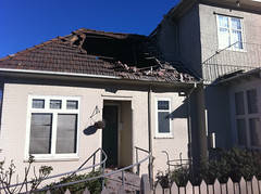
20110224-DSC_0467.jpg
Images, eqnz.chch.2010
None
SCIRT critical risks poster
Articles, UC QuakeStudies
A poster which illustrates each of SCIRT's eight critical risks.
SCIRT asset assessment request process
Articles, UC QuakeStudies
A diagram which illustrates SCIRT's asset assessment request process.
Example of PDAT - Calibration Balance
Articles, UC QuakeStudies
A diagram which shows outputs from PDAT calibration/validation (with explanations).
The genesis of SCIRT - new era in disaster recovery
Articles, UC QuakeStudies
A document which describes the formation of SCIRT.
Well-grounded solution to soggy sites
Articles, UC QuakeStudies
A document which describes best practice for dewatering guidelines.
22 February Earthquake - Photograph 73
Images, UC QuakeStudies
The damaged Carlton Hotel. The parapet and part of the upper storey has collapsed.
Canterbury Cultural Recovery Centre Photograph 001
Images, UC QuakeStudies
A photograph of the Canterbury Cultural Recovery Centre's main floor.
Canterbury Cultural Recovery Centre Photograph 006
Images, UC QuakeStudies
A photograph of the Canterbury Cultural Recovery Centre's main floor.
SCIRT Webmap User Guide
Articles, UC QuakeStudies
A document which explains how to use the SCIRT GIS Viewer.
Henry Africa's Demolition - Photograph 20
Images, UC QuakeStudies
The partially-demolished Henry Africa's building cordoned off with safety fencing and road cones.
Henry Africa's Demolition - Photograph 19
Images, UC QuakeStudies
The partially-demolished Henry Africa's building cordoned off with safety fencing and road cones.
Christchurch City
Images, eqnz.chch.2010
Helicopter Flight over Christchurch New Zealand
Latimer Square
Images, eqnz.chch.2010
Helicopter Flight over Christchurch New Zealand
Cathedral Square
Images, eqnz.chch.2010
Helicopter Flight over Christchurch New Zealand
Catholic Basilica
Images, eqnz.chch.2010
Helicopter Flight over Christchurch New Zealand
Cathedral Square
Images, eqnz.chch.2010
Helicopter Flight over Christchurch New Zealand
Cathedral Square
Images, eqnz.chch.2010
Helicopter Flight over Christchurch New Zealand
Cathedral Square
Images, eqnz.chch.2010
Helicopter Flight over Christchurch New Zealand
Christchurch Cathedral
Images, eqnz.chch.2010
Helicopter Flight over Christchurch New Zealand
Cathedral Square
Images, eqnz.chch.2010
Helicopter Flight over Christchurch New Zealand
Hagley Park
Images, eqnz.chch.2010
Helicopter Flight over Christchurch New Zealand
Aftermath Canterbury Earthquake
Images, eqnz.chch.2010
Oxford Terrace Baptist Church in Christchurch - propped up following Canterbury Earthquake
22 February Earthquake - Photograph 62
Images, UC QuakeStudies
Flooding and liquefaction on the corner of Edward Avenue and Geraldine Street in St Albans.
SCIRT Women in Construction advertisements
Articles, UC QuakeStudies
A series of SCIRT advertisements which feature images of women in construction.
22 February Earthquake - Photograph 74
Images, UC QuakeStudies
A portacabin and tent being used as a temporary studio by the One News team.
SCIRT short course training materials
Other, UC QuakeStudies
A zip file containing some of SCIRT's short course training materials.
Predicting Earthquake Damage to Gravity Pipe Networks
Articles, UC QuakeStudies
A conference paper about the Pipe Damage Assessment Tool (PDAT).
12d Model SCIRT Standards
Articles, UC QuakeStudies
A document which sets out the 12d standards at SCIRT.
What to rebuild, where and when
Articles, UC QuakeStudies
A presentation given at the New Zealand Geospatial Research Conference 2015.