Search
found 93 results
Images for 2010-2011 Christchurch earthquakes; more images...


X Marks the Spot
Images, eqnz.chch.2010
What I found on a walk around the city Christchurch November 20, 2013 New Zealand. www.isaactheatreroyal.co.nz/ en.wikipedia.org/wiki/2011_Christchurch_earthquake
Sensitivity of predicted liquefaction-induced lateral displacements from t…
Research papers, University of Canterbury Library
The 2010 Darfield and 2011 Christchurch Earthquakes triggered extensive liquefaction-induced lateral spreading proximate to streams and rivers in the Christchurch area, causing significant damage to structures and lifelines. A case study in central Christchurch is presented and compares field observations with predicted displacements from the widely adopted empirical model of Youd et al. (2002). Cone penetration testing (CPT), with measured soil gradation indices (fines content and median grain size) on typical fluvial deposits along the Avon River were used to determine the required geotechnical parameters for the model input. The method presented attempts to enable the adoption of the extensive post-quake CPT test records in place of the lower quality and less available Standard Penetration Test (SPT) data required by the original Youd model. The results indicate some agreement between the Youd model predictions and the field observations, while the majority of computed displacements error on the side of over-prediction by more than a factor of two. A sensitivity analysis was performed with respect to the uncertainties used as model input, illustrating the model’s high sensitivity to the input parameters, with median grain size and fines content among the most influential, and suggesting that the use of CPT data to quantify these parameters may lead to variable results.
A comparison of ground motions and first-hand experience of the 2011 Mw6.3…
Research papers, University of Canterbury Library
This poster provides a comparison between the strong ground motions observed in the 22 February 2011 Mw6.3 Christchurch earthquake with those observed in Tokyo during the 11 March 2011 Mw9.0 Tohoku earthquake. The destuction resulting from both of these events has been well documented, although tsunami was the principal cause of damage in the latter event, and less attention has been devoted to the impact of earthquake-induced ground motions. Despite Tokyo being located over 100km from the nearest part of the causative rupture, the ground motions observed from the Tohoku earthquake were significant enough to cause structural damage and also significant liquefaction to loose reclaimed soils in Tokyo Bay. The author was fortunate enough (from the perspective of an earthquake engineer) to experience first-hand both of these events. Following the Tohoku event, the athor conducted various ground motion analyses and reconniassance of the Urayasu region in Tokyo Bay affected by liquefaction in collaboration with Prof. Kenji Ishihara. This conference is therefore a fitting opportunity in which to discuss some of authors insights obtained as a result of this first hand knowledge. Figure 1 illustrates the ground motions recorded in the Christchurch CBD in the 22 February 2011 and 4 September 2010 earthquakes, with that recorded in Tokyo Bay in the 11 March 2011 Tohoku earthquake. It is evident that these three ground motions vary widely in their amplitude and duration. The CBGS ground motion from the 22 February 2011 event has a very large amplitude (nearly 0.6g) and short duration (approx. 10s of intense shaking), as a result of the causal Mw6.3 rupture at short distance (Rrup=4km). The CBGS ground motion from the 4 September 2010 earthquake has a longer duration (approx. 30s of intense shaking), but reduced acceleration amplitude, as a result of the causal Mw7.1 rupture at a short-to-moderate distance (Rrup=14km). Finally, the Urayasu ground motion in Tokyo bay during the 11 March 2011 Tohoku earthquake exhibits an acceleration amplitude similar to the 4 September 2010 CBGS ground motion, but a significantly larger duration (approx 150s of intense shaking). Clearly, these three different ground motions will affect structures and soils in different ways depending on the vibration characteristics of the structures/soil, and the potential for strength and stiffness degradation due to cumulative effects. Figure 2 provides a comparison between the arias intensities of the several ground motion records from the three different events. It can be seen that the arias intensities of the ground motions in the Christchurch CBD from the 22 February 2011 earthquake (which is on average AI=2.5m/s) is approximately twice that from the 4 September 2010 earthquake (average AI≈1.25). This is consistent with a factor of approximately 1.6 obtained by Cubrinovski et al. (2011) using the stress-based (i.e.PGA-MSF) approach of liquefaction triggering. It can also be seen that the arias intensity of the ground motions recorded in Tokyo during the 2011 Tohoku earthquake are larger than ground motions in the Christchurch CBD from the 4 September 2011 earthquake, but smaller than those of the 22 February 2011 earthquake. Based on the arias intensity liquefaction triggering approach it can therefore be concluded that the ground motion severity, in terms of liquefaction potential, for the Tokyo ground motions is between those ground motions in Christchurch CBD from the 4 September 2010 and 22 February 2011 events.
Nisbet, Alastair, 1958- :[West east]. 10 May 2013
Images, Alexander Turnbull Library
A signpost pointing 'West' and 'East'. The sign pointing West is intact; that indicating East is broken and barely hanging on to the post. Refers to the condition of Christchurch City after the earthquakes of 2010 and 2011; the western wealthier suburbs were less damaged than the poorer Eastern suburbs. Also, progress on repair and rehabilitation of eastern housing had been slow. The redesign of the city centre seemed to be a western suburb priority which ignored the poverty and misery of living conditions on the east. Quantity: 1 digital cartoon(s).
Doyle, Martin, 1956- :'Hold tight, Kiwi - this will shock the living crap …
Images, Alexander Turnbull Library
Commentary from the cartoonist 'The Earthquake Commission's leak of 83,000 files is like a storyline from Alfred Hitchcock: : a loon attempts to shock a nation that has already been rendered braindead from previous shocks.Note: EQC is ued here as an 'echo' of the term ECT [electro convulsive therapy...ie shock treatment].' In March 2013, there was a massive leak of of some 83,000 EQC files relating to individual claims relating to the Christchurch earthquakes. Quantity: 1 digital cartoon(s).
Sensitivity of predicted liquefaction-induced lateral displacements from t…
Research papers, University of Canterbury Library
Liquefaction-induced lateral spreading in Christchurch and surrounding suburbs during the recent Canterbury Earthquake Sequence (2010-2011) caused significant damage to structures and lifelines located in close proximity to streams and rivers. Simplified methods used in current engineering practice for predicting lateral ground displacements exhibit a high degree of epistemic uncertainty, but provide ‘order of magnitude’ estimates to appraise the hazard. We wish to compare model predictions to field measurements in order to assess the model’s capabilities and limitations with respect to Christchurch conditions. The analysis presented focuses on the widely-used empirical model of Youd et al. (2002), developed based on multi-linear regression (MLR) of case history data from lateral spreading occurrence in Japan and the US. Two issues arising from the application of this model to Christchurch were considered: • Small data set of Standard Penetration Test (SPT) and soil gradation indices (fines content FC, and mean grain size, D50) required for input. We attempt to use widely available CPT data with site specific correlations to FC and D50. • Uncertainty associated with the model input parameters and their influence on predicted displacements. This has been investigated for a specific location through a sensitivity analysis.
The impacts of the Canterbury earthquakes on educational inequalities and …
Research papers, University of Canterbury Library
During 2010 and 2011, major earthquakes caused widespread damage and the deaths of 185 people in the city of Christchurch. Damaged school buildings resulted in state intervention which required amendment of the Education Act of 1989, and the development of ‘site sharing agreements’ in undamaged schools to cater for the needs of students whose schools had closed. An effective plan was also developed for student assessment through establishing an earthquake impaired derived grade process. Previous research into traditional explanations of educational inequalities in the United Kingdom, the United States of America, and New Zealand were reviewed through various processes within three educational inputs: the student, the school and the state. Research into the impacts of urban natural disasters on education and education inequalities found literature on post disaster education systems but nothing could be found that included performance data. The impacts of the Canterbury earthquakes on educational inequalities and achievement were analysed over 2009-2012. The baseline year was 2009, the year before the first earthquake, while 2012 is seen as the recovery year as no schools closed due to seismic events and there was no state intervention into the education of the region. National Certificate of Educational Achievement (NCEA) results levels 1-3 from thirty-four secondary schools in the greater Christchurch region were graphed and analysed. Regression analysis indicates; in 2009, educational inequalities existed with a strong positive relationship between a school’s decile rating and NCEA achievement. When schools were grouped into decile rankings (1-10) and their 2010 NCEA levels 1-3 results were compared with the previous year, the percentage of change indicates an overall lower NCEA achievement in 2010 across all deciles, but particularly in lower decile schools. By contrast, when 2011 NCEA results were compared with those of 2009, as a percentage of change, lower decile schools fared better. Non site sharing schools also achieved higher results than site sharing schools. State interventions, had however contributed towards student’s achieving national examinations and entry to university in 2011. When NCEA results for 2012 were compared to 2009 educational inequalities still exist, however in 2012 the positive relationship between decile rating and achievement is marginally weaker than in 2009. Human ethics approval was required to survey one Christchurch secondary school community of students (aged between 12 and 18), teachers and staff, parents and caregivers during October 2011. Participation was voluntary and without incentives, 154 completed questionnaires were received. The Canterbury earthquakes and aftershocks changed the lives of the research participants. This school community was displaced to another school due to the Christchurch earthquake on 22 February 2011. Research results are grouped under four geographical perspectives; spatial impacts, socio-economic impacts, displacement, and health and wellbeing. Further research possibilities include researching the lag effects from the Canterbury earthquakes on school age children.
Fairfax Video, January 2013 (1)
Videos, UC QuakeStudies
A video of journalist Charlie Gates introducing the 2014 World Buskers Festival. Gates visits former festival venues in the Christchurch central city and the new performance venues for the 2014 festival, to show how the city has changed since the 2010 and 2011 earthquakes.
The influence of near-fault motions on liquefaction triggering during the …
Research papers, University of Canterbury Library
The objective of this study is to examine the influence of near-fault motions on liquefaction triggering in Christchurch and neighboring towns during the 2010-2011 Canterbury earthquake sequence (CES). The CES began with the 4 September 2010, Mw7.1 Darfield earthquake and included up to ten events that triggered liquefaction. However, most notably, widespread liquefaction was induced by the Darfield earthquake and the Mw6.2, 22 February 2011 Christchurch earthquake. Of particular relevance to this study is the forward directivity effects that were prevalent in the motions recorded during the Darfield earthquake, and to a much lesser extent, during the Christchurch earthquake. A 2D variant of the Richart-Newmark fatigue theory was used to compute the equivalent number of cycles (neq) for the ground motions, where volumetric strain was used as the damage metric. This study is unique because it considers the contribution and phasing of both the fault-normal and fault-parallel components of motion on neq and the magnitude scaling factor (MSF). It was found that when the fault-normal and fault-parallel motions were treated individually, the former yielded a lower neq than the latter. Additionally, when the combined effects of fault-normal and fault-parallel components were considered, it was found that the MSF were higher than those commonly used. This implies that motions containing near-fault effects are less demanding on the soil than motions that do not. This may be one of several factors that resulted in less severe liquefaction occurring during the Darfield earthquake than the Christchurch earthquake.
Fairfax Video, August 2013 (5)
Videos, UC QuakeStudies
A video about the Christchurch Pops Choir which is performing at the Christchurch Arts Festival. The video includes interviews with artistic director Luke Di Somma and president Lee Harris. Di Somma and Harris talk about starting the choir after the 2010 and 2011 Canterbury earthquakes, and singing pop music. The video also includes footage of the choir singing as part of a flash mob at the Christchurch International Airport.
ADA Mesh Cities: Network, Space and Memory in the Transitional City
Research papers, University of Canterbury Library
In the aftermath of the 2010 and 2011 earthquakes, Christchurch, New Zealand is framed as a ‘transi- tional’ city, moving from its demolished past to a speculative future. The ADA Mesh Cities project asks what role media art and networks may play in the transitional city, and the practices of remembering, and reimagining space.
IRD building and 185 white chairs
Images, eqnz.chch.2010
20130403_2911_G12-10 IRD building and 185 white chairs Corner of Cashel and Madras streets, with the relatively new (built 2007) Inland Revenue Building and the white chair memorial to the 185 lives lost as a result of the 22/02/11 earthquake. The chairs sit on the site of the now demolished St Pauls Pacific Chuch and is diagonally across the i...
20130123_1662_1D3-35 Canterbury substation (Day 23/365)
Images, eqnz.chch.2010
The electrical supply substation built into the Lion Breweries Canterbury Draught brewery in St Asaph Street, Christchurch. Now the whole complex is being demolished due to earthquake damage.
The old Odeon Theatre
Images, eqnz.chch.2010
20131228_6797_1D3-58 The old Odeon Theatre The back of the old Odeon movie theatre, that was for about 15-20 years a New Life Christian Centre. This is earthquake damage, although the roof was lifted off in 2011. I don't know whether this is a building that they want to save or still awaiting demolition. The smaller building to the immediate...
20131231_8485_EOS M-22 Quake City exhibit
Images, eqnz.chch.2010
Another city walk around, this time with my brother-in-law from Auckland. Also went to the Quake City exhibition in the city organised by the Canterbury Museum. First fine day for a while.
20131231_8484_EOS M-22 Quake City exhibit
Images, eqnz.chch.2010
20131231_8484_EOS M-22 Quake City exhibit Another city walk around, this time with my brother-in-law from Auckland. Also went to the Quake City exhibition in the city organised by the Canterbury Museum. First fine day for a while. #4502
20131231_8503_EOS M-22 From Cashel Street
Images, eqnz.chch.2010
20131231_8503_EOS M-22 From Cashel Street Another city walk around, this time with my brother-in-law from Auckland. Also went to the Quake City exhibition in the city organised by the Canterbury Museum. First fine day for a while. #4504
An inventory of community-led and non-governmental organisations and initi…
Research Papers, Lincoln University
The impact of the Canterbury earthquake sequence of 2010-12 and its aftermath has been enormous. This inventory lists some of the thousands of community-led groups and initiatives across the region that have developed or evolved as a result of the quake. This inventory is the third such inventory to have been produced. The Christchurch Earthquake Activity Inventory was released by Landcare Research in May 2011, three months after the devastating 22 February 2011 earthquake. The second inventory, entitled An Inventory of Community-led Recovery Initiatives in Canterbury, was collated by Bailey Peryman and Dr Suzanne Vallance (Lincoln University) approximately one year after the February earthquake. The research for this third inventory was undertaken over a four month period from June to September 2013, and was conducted primarily through online searches.This research was undertaken with funding support from the Natural Hazards Platform and GNS, New Zealand.
20131231_8511_EOS M-22 Forsyth Barr building for sale, under the archway
Images, eqnz.chch.2010
20131231_8511_EOS M-22 Forsyth Barr building for sale, under the archway Another city walk around, this time with my brother-in-law from Auckland. Also went to the Quake City exhibition in the city organised by the Canterbury Museum. First fine day for a while. #4507
20130901_2869_1D3-150 Wilson City!
Images, eqnz.chch.2010
As buildings are demolished as a result of the earthquake in 2011, Wilson Carparking are waiting to pounce on each bit of vacant land. Someone suggested about a year ago that the city be renamed "Wilson" as that name appears more in the central city than Christchurch does! In the background the CERES NZ nibbler attacks the support structure fo...
Topophilia and topophobia in the post-earthquake landscape of Christchurch…
Research Papers, Lincoln University
Earthquakes rupture not only the objective realm of the physical landscape, but also the subjective landscape of emotions. Using the concepts of topophilia and topophobia developed by Yi-Fu Tuan as theories of love and fear of place, this paper investigates the impact of Christchurch’s earthquakes of 2010 and 2011 on relationships with the city’s landscape. Published accounts of the earthquakes in newspapers from around New Zealand are examined for evidence of how people responded to the situation, in particular their shifting relationship with familiar landscapes. The reports illustrate how residents and visitors reacted to the actual and perceived changes to their surroundings, grappling with how a familiar place had become alien and often startling. The extreme nature of the event and the death toll of 185 heightened perceptions of the landscape, and even the most taken-for-granted elements of the landscape became amplified in significance. Enhanced understanding of the landscape of emotions is a vital component of wellbeing. Through recognising that the impact of disasters and perceived threats to familiar places has a profound emotional effect, the significance of sense of place to wellbeing can be appreciated.
20131231_8509_EOS M-22 Forsyth Barr building with remains of PWC just behi…
Images, eqnz.chch.2010
20131231_8509_EOS M-22 Forsyth Barr building with remains of PWC just behind the green fence (across river) Another city walk around, this time with my brother-in-law from Auckland. Also went to the Quake City exhibition in the city organised by the Canterbury Museum. First fine day for a while. #4506
20131231_8504_EOS M-22 Looking up Cashel Street
Images, eqnz.chch.2010
20131231_8504_EOS M-22 Looking up Cashel Street Another city walk around, this time with my brother-in-law from Auckland. Also went to the Quake City exhibition in the city organised by the Canterbury Museum. First fine day for a while. For 36 years I worked in a now gone building where that red car is parked (on the left). and would have wa...
20131231_8513_EOS M-22 The chocolate double decker
Images, eqnz.chch.2010
20131231_8513_EOS M-22 The chocolate double decker Another city walk around, this time with my brother-in-law from Auckland. Also went to the Quake City exhibition in the city organised by the Canterbury Museum. First fine day for a while. This bus is used as a chocolate restaurant, and is parked next to the Pallet Pavilion on the site of th...
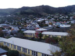
20130511_1535_EOS M-22 Captain Cook (Day 131/365)
Images, eqnz.chch.2010
The statue of Captain Cook looks over an empty Victoria Square with autumn leaves lying around. This used to be a very tidy and busy area, but is now nearly all fenced off. Pedestrian access to this section was established about five or six months ago.
The undrained cyclic strength of undisturbed and reconstituted Christchurc…
Research papers, University of Canterbury Library
This paper presents insights from recent advanced laboratory testing of undisturbed and reconstituted specimens of Christchurch silty-sands. The purpose of the testing was to establish the cyclic strength of silty-sands from sites in the Central Business District (CBD), where liquefaction was observed in 4 September 2010, 22 February 2011, and 13 June 2011. Similar overall strengths were obtained from undisturbed and reconstituted tests prepared at similar densities, albeit with higher variability for the reconstituted specimens. Reconstituted specimens exhibited distinctly different response in terms of lower compressibility during initial loading cycles, and exhibited a more brittle response when large strains were mobilised, particularly for samples with high fines content. Given the lower variability in natural sample response and the possibility of age-related strength to be significant for sites not subjected to earthquakes, high quality undisturbed samples are recommended over the use of reconstituted specimens to establish the cyclic strength of natural sands.
20130901_2862_1D3-175 7:26am
Images, eqnz.chch.2010
Demolition of the support structure for NZ Breweries smokestack in Christchurch. CERES NZ's nibbler is at work, the pipe stack having been removed yesterday (Saturday). I retuned three hours later to see what progress had been made and it was GONE! See next photo. Damage to complex was from the 22/02/20011 earthquake.
Swimming in Christchurch: how the industry was affected by the earthquakes
Research Papers, Lincoln University
Throughout 2010 and 2011, the city of Christchurch, New Zealand, suffered a series of devastating earthquakes that caused serious damage to the city. This study examines the effect these earthquakes have had on the sport of swimming in Christchurch. It specifically focuses on three different aspects of the swimming industry: indoor competitive swimming, open water swimming and learning to swim. It reports on the industry prior to the earthquakes before examining the developments subsequent to the shakes. The effects on both facilities and participation numbers were examined. Results showed that many indoor swimming facilities were lost which had significant flow-on effects. In addition, many beaches were out of bounds and almost half of the schools in Canterbury lost the use of their own swimming pools. In terms of participation numbers, results showed that while there was a decrease in the number of indoor competitive swimmers, Canterbury clubs were still highly competitive and their rankings at events either remained similar or bettered during and after the period of the earthquakes. On the other hand, an increase in the number of participants was seen in swimming lessons as temporary pools were constructed and subsidies were offered to cover transport and lesson costs. Open water swimming, however, seems to have been relatively unaffected by the earthquakes.This report was made possible through Lincoln University’s Summer Scholarship programme. The authors would also like to acknowledge those anonymous interviewees who provided some valuable insight into the swimming industry in Christchurch.
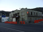
20130511_1538_EOS M-22 The Last National Bank?
Images, eqnz.chch.2010
I think all the National Banks in the country have been either closed or rebranded ANZ, but this one on the corner of Colombo and Armagh Streets is still inside the CBD red zone and has yet to be touched. I have heard that this building is staying so whether it becomes an ANZ or not time will tell. This was one of the top five busiest pedest...
20130915_3524_1D3-55 The Chalice and the remains
Images, eqnz.chch.2010
None