
Search
found 3460 results
Images for 2011 Christchurch earthquake; more images...
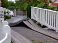


Architecture Via Aceh
Research papers, Victoria University of Wellington
There are many swaths of land that are deemed unsuitable to build on and occupy. These places, however, are rarely within an established city. The Canterbury earthquakes of 2010 and 2011 left areas in central Christchurch with such significant land damage that it is unlikely to be re-inhabited for a considerable period of time. These areas are commonly known as the ‘Red Zone’.This thesis explores redevelop in on volatile land through innovative solutions found and adapted from the traditional Indonesian construction techniques. Currently, Indonesia’s vernacular architecture sits on the verge of extinction after a cultural shift towards the masonry bungalow forced a rapid decline in their occupation and construction. The 2004 Indian Ocean earthquake and tsunami illustrated the bungalows’ poor performance in the face of catastrophic seismic activity, being outperformed by the traditional structures. This has been particularly evident in the Rumah Aceh construction of the Aceh province in Northern Sumatra. Within a New Zealand context an adaptation and modernisation of the Rumah Aceh construction will generate an architectural response not currently accepted under the scope of NZS 3604:2011; the standards most recent revision following the Canterbury earthquake of 2010 concerning timber-based seismic performance. This architectural exploration will further address light timber structures, their components, sustainability and seismic resilience. Improving new builds’ durability as New Zealand moves away from the previously promoted bungalow model that extends beyond residential and into all aspects of New Zealand built environment.
Investigating the Antecedents of Teacher Burnout and its Impact on Turnove…
Research papers, University of Canterbury Library
This study sought to investigate employee burnout within a post-disaster context by exploring teachers’ burnout perceptions and workplace attitudes in the aftermath of the 2010-2011 Christchurch earthquakes. The study hypothesised that burnout dimensions (emotional exhaustion and cynicism) would be related with the extent to which individuals and schools were impacted by the earthquakes, and with the quality of school support for staff and students (i.e., personal disaster impact, school disaster impact and school responsiveness to the disaster), with perceptions of role conflict and role overload, and with turnover intentions. Additionally, a Teacher Burnout Model was proposed whereby emotional exhaustion and cynicism were hypothesised to mediate the relationships between the independent variables (i.e., the disaster-related and role-related variables) and turnover intentions. 125 primary, intermediate and secondary school teachers from the city of Christchurch completed an online survey. Results revealed that high role overload, high role conflict, high school disaster impact, and schools’ ineffective disaster coping responses, were associated with increased levels of emotional exhaustion and cynicism. Although greater impact of earthquakes on teachers’ personal lives was related to higher levels of emotional exhaustion, results revealed a non-significant relationship between personal disaster impact and cynicism. In the Teacher Burnout Model, the relationships between both role stress variables and turnover intentions were mediated by perceptions of emotional exhaustion. This study contributes novel findings to the burnout literature, and provides implications for schools and organisations operating within a disaster context.
Relationship between observed liquefaction at Kaiapoi following the 2010 D…
Research papers, The University of Auckland Library
The Darfield earthquake caused widespread damage in the Canterbury region of New Zealand, with the majority of damage resulting from liquefaction and lateral spreading. One of the worst hit locations was the small town of Kaiapoi north of Christchurch, an area that has experienced liquefaction during past events and has been identified as highly susceptible to liquefaction. The low lying town sits on the banks of the Kaiapoi River, once a branch of the Waimakariri, a large braided river transporting gravelly sediment. The Waimakariri has been extensively modified both by natural and human processes, consequently many areas in and around the town were once former river channels.
Hubbard, James, 1949- : "And to show we're not neglecting priorities in th…
Images, Alexander Turnbull Library
Surrounded by mud and puddles in Christchurch Prime Minister John Key puts his arm round co-leader of the Maori Party Pita Sharples and smiles happily; behind them is a brand new plastic portaloo. On the ground lies a newspaper with a headline that reads 'Govt. to fund $2m giant RWC plastic waka'. Pita Sharples says 'and to show we're not neglecting our priorities in these austere times, Christchurch will get a new plastic portaloo!' Context - The government has hit back at criticism over a $2 million venue centre in the shape of a waka for the Rugby World Cup (RWC), defending the cost as necessary to host a world-class event. Co-leader of the Maori Party Pita Sharples says the waka will promote Maori culture during the Rugby World Cup and at other events (like the America's Cup). Labour Party MP Shane Jones asks "How can Dr Sharples and Prime Minister John Key actually believe that this expensive indulgence is a positive advertisement for Maori? The truth is they don't but they're both working together in a desperate effort to keep the Maori Party afloat. Quantity: 1 digital cartoon(s).
Safe Dust
Images, UC QuakeStudies
A digitally manipulated image of printer's type, spelling out "Safe Dust". The photographer comments, "After the September 2010 Christchurch earthquake liquefaction poured out of the ground mostly in the East of Christchurch. This silt, which was a form of sand was declared safe and would not harm gardens if it was spread around in moderation. After the February 2011 quake as a result of even more liquefaction and the sewers being ruptured, the liquefaction was declared as toxic. People clearing it up should wear a mask, boots and gloves especially when it had dried up and become dusty. This just so happens to be the words found on an old printing press".
Decision support framework for post-earthquake restoration of sewerage pip…
Research papers, University of Canterbury Library
Sewerage systems convey sewage, or wastewater, from residential or commercial buildings through complex reticulation networks to treatment plants. During seismic events both transient ground motion and permanent ground deformation can induce physical damage to sewerage system components, limiting or impeding the operability of the whole system. The malfunction of municipal sewerage systems can result in the pollution of nearby waterways through discharge of untreated sewage, pose a public health threat by preventing the use of appropriate sanitation facilities, and cause serious inconvenience for rescuers and residents. Christchurch, the second largest city in New Zealand, was seriously affected by the Canterbury Earthquake Sequence (CES) in 2010-2011. The CES imposed widespread damage to the Christchurch sewerage system (CSS), causing a significant loss of functionality and serviceability to the system. The Christchurch City Council (CCC) relied heavily on temporary sewerage services for several months following the CES. The temporary services were supported by use of chemical and portable toilets to supplement the damaged wastewater system. The rebuild delivery agency -Stronger Christchurch Infrastructure Rebuild Team (SCIRT) was created to be responsible for repair of 85 % of the damaged horizontal infrastructure (i.e., water, wastewater, stormwater systems, and roads) in Christchurch. Numerous initiatives to create platforms/tools aiming to, on the one hand, support the understanding, management and mitigation of seismic risk for infrastructure prior to disasters, and on the other hand, to support the decision-making for post-disaster reconstruction and recovery, have been promoted worldwide. Despite this, the CES in New Zealand highlighted that none of the existing platforms/tools are either accessible and/or readable or usable by emergency managers and decision makers for restoring the CSS. Furthermore, the majority of existing tools have a sole focus on the engineering perspective, while the holistic process of formulating recovery decisions is based on system-wide approach, where a variety of factors in addition to technical considerations are involved. Lastly, there is a paucity of studies focused on the tools and frameworks for supporting decision-making specifically on sewerage system restoration after earthquakes. This thesis develops a decision support framework for sewerage pipe and system restoration after earthquakes, building on the experience and learning of the organisations involved in recovering the CSS following the CES in 2010-2011. The proposed decision support framework includes three modules: 1) Physical Damage Module (PDM); 2) Functional Impact Module (FIM); 3) Pipeline Restoration Module (PRM). The PDM provides seismic fragility matrices and functions for sewer gravity and pressure pipelines for predicting earthquake-induced physical damage, categorised by pipe materials and liquefaction zones. The FIM demonstrates a set of performance indicators that are categorised in five domains: structural, hydraulic, environmental, social and economic domains. These performance indicators are used to assess loss of wastewater system service and the induced functional impacts in three different phases: emergency response, short-term recovery and long-term restoration. Based on the knowledge of the physical and functional status-quo of the sewerage systems post-earthquake captured through the PDM and FIM, the PRM estimates restoration time of sewer networks by use of restoration models developed using a Random Forest technique and graphically represented in terms of restoration curves. The development of a decision support framework for sewer recovery after earthquakes enables decision makers to assess physical damage, evaluate functional impacts relating to hydraulic, environmental, structural, economic and social contexts, and to predict restoration time of sewerage systems. Furthermore, the decision support framework can be potentially employed to underpin system maintenance and upgrade by guiding system rehabilitation and to monitor system behaviours during business-as-usual time. In conjunction with expert judgement and best practices, this framework can be moreover applied to assist asset managers in targeting the inclusion of system resilience as part of asset maintenance programmes.
System response of liquefiable deposits : insights from advanced analyses …
Research papers, University of Canterbury Library
Advanced seismic effective-stress analysis is used to scrutinize the liquefaction performance of 55 well-documented case-history sites from Christchurch. The performance of these sites during the 2010-2011 Canterbury earthquake sequence varied significantly, from no liquefaction manifestation at the ground surface (in any of the major events) to severe liquefaction manifestation in multiple events. For the majority of the 55 sites, the simplified liquefaction evaluation procedures, which are conventionally used in engineering practice, could not explain these dramatic differences in the manifestation. Detailed geotechnical characterization and subsequent examination of the soil profile characteristics of the 55 sites identified some similarities but also important differences between sites that manifested liquefaction in the two major events of the sequence (YY-sites) and sites that did not manifest liquefaction in either event (NN-sites). In particular, while the YY-sites and NN-sites are shown to have practically identical critical layer characteristics, they have significant differences with regard to their deposit characteristics including the thickness and vertical continuity of their critical zones and liquefiable materials. A CPT-based effective stress analysis procedure is developed and implemented for the analyses of the 55 case history sites. Key features of this procedure are that, on the one hand, it can be fully automated in a programming environment and, on the other hand, it is directly equivalent (in the definition of cyclic resistance and required input data) to the CPT-based simplified liquefaction evaluation procedures. These features facilitate significantly the application of effective-stress analysis for simple 1D free-field soil-column problems and also provide a basis for rigorous comparisons of the outcomes of effective-stress analyses and simplified procedures. Input motions for the analyses are derived using selected (reference) recordings from the two major events of the 2010-2011 Canterbury earthquake sequence. A step-by-step procedure for the selection of representative reference motions for each site and their subsequent treatment (i.e. deconvolution and scaling) is presented. The focus of the proposed procedure is to address key aspects of spatial variability of ground motion in the near-source region of an earthquake including extended-source effects, path effects, and variation in the deeper regional geology.
The Week in Review week ending Friday 6 January 2012
Audio, Radio New Zealand
A review of the week's news including: Continuing industrial trouble at Ports Of Auckland, the National Road Policing manager Paula Rose on holiday road toll figures, Southland faces drought conditions, researchers come up with a solution that could lower the cost of rebuilding the earthquake devastated Christchurch CBD, a 24 year old woman with autism wins a 2011 attitude award for raising awareness of the condition, New Zealand Tasman Sea rowers hope to finally make some progress and how they celebrate New year at the bottom of the World.
The Panel with Lynda Hallinan and Stephen Franks (Part 1)
Audio, Radio New Zealand
The Prime Minister Jacinda Ardern took a detour on the way to meeting with Joko Widodo to accept a petition against oil exploration. A law which prevents charges being laid over the collapse of Christchurch's CTV buildin gin the 2011 earthquake could be repealled soon. The president of the Crime Prevention Group Sunny Kaushal updates what if anything has improved for shop owners in the face of violent robberies. Eight million tonnes of plastic goes into the world's oceans each year. Is New Zealand phasing out supermarket bags worth the effort?
“We’re looking out through a window to a field of weeds and sand and stone…
Research papers, University of Canterbury Library
This paper explores the scope of small-scale radio to create an auditory geography of place. It focuses on the short term art radio project The Stadium Broadcast, which was staged in November 2014 in an earthquake-damaged sports stadium in Christchurch, New Zealand. Thousands of buildings and homes in Christchurch have been demolished since the Februrary 22, 2011 earthquake, and while Lancaster Park sports stadium is still standing, it has been unused since that date and its future remains uncertain. The Stadium Broadcast constructed a radio memorial to the Park’s 130 year history through archival recordings, the memories of local people, observation of its current state, and a performed site-specificity. The Stadium Broadcast reflected on the spatiality of radio sounds and transmissions, memory, post-disaster transitionality, and the im-permanence of place.
ChCh quake experience helps family isolated in Spain
Audio, Radio New Zealand
A family who lived through the 2010 and 2011 Christchurch earthquakes is now in isolation in Spain because of the Covid-19 virus. Spain is currently the fourth most affected country in the world, with more than 2000 new cases reported in the past 48 hours. More than 600 people have died, 90 of which have been reported in the past 24 hours. Yuri Bacas Hosaka, who grew up in Madrid says the family's quake experiences helped prepare them for what they're experiencing right now. Indira asked her how she and her family are coping
Evan Coster - helping hand
Audio, Radio New Zealand
There are many tales of generosity beginning in emerge in Christchurch. Evan Coster from Rangiora was working in Harvey Norman when the earthquake struck on Tuesday. He doesn't know if he has a job to go back to and with time on his hands wanted to do something useful. He started visiting local businesses in Rangiora such as Warehouse, Countdown, New World and service stations for donations of cups, coffee, sugar and milk. Then he rallied friends and family together and started delivering refreshments to emergency workers in all of the cordons in the CBD.
The closest home to Monday's quake epicentre
Audio, Radio New Zealand
When the 6.3 magnitude earthquake struck Christchurch at 2:20 on Monday afternoon Barry Ross was outside his home at Godley Head on the Port Hills, where is he is the Department of Conservation caretaker. Barry's house is thought to be the closest to the epicentre that day and such was the force of the quake he was thrown to the ground and some of the cliff nearby fell away. He lost power and water for a few days but now he's back home, clearing up and determined to get on with life.
20130915_3538_1D3-47 Cardboard Cathedral
Images, eqnz.chch.2010
None
This was a Two Storey House
Images, UC QuakeStudies
People stand in front of a damaged house in New Brighton. The upper storey at the front of the house has collapsed onto the floor below. The photographer comments, "This house at 158 Marine Parade, New Brighton, Christchurch was owned by the man leaning on the fence. He lived next door and his daughter lived here. During the earthquake the 2nd storey stayed mainly whole, but the 1st collapsed. Luckily the daughter was in the top storey. She was rescued from the building by neighbours, by climbing out of the window and down a ladder. Another piece of luck is that most of the belongings were stored in boxes in the garage at the front. Though the garage also collapsed the boxes appear intact. The owner had tried to sell it previously without success".
Two Coffees and a Muffin to Takeaway
Images, UC QuakeStudies
Two cardboard coffee cups in a takeaway tray sit on a wooden counter. The photographer comments, "What is the story of these coffees and that sad muffin? Were these an order when the earthquake struck Christchurch on 22 February 2011? Were these a workman's and a colleague's having a quick coffee break when a later aftershock caused them to leave everything behind when they fled the red zoned building, or were they just forgotten when the building was cleared out and abandoned?".
Advanced Soil Sampling of Silty Sands in Christchurch
Research papers, University of Canterbury Library
Current research in geotechnical engineering at the University of Canterbury includes a number of laboratory testing programmes focussed on understanding the behaviour of natural soil deposits in Christchurch during the 2010-2011 Canterbury Earthquake Sequence. Many soils found in Christchurch are sands or silty sands with little to no plasticity, making them very difficult to sample using established methods. The gel-push sampling methodology, developed by Kiso-Jiban Consultants in Japan, was developed to address some of the deficiencies of existing sampling techniques and has been deployed on two projects in Christchurch. Gel push sampling is carried out with a range of samplers which are modified versions of existing technology, and the University of Canterbury has acquired three versions of the tools (GP-S, GP-Tr, GP-D). Soil samples are extracted from the bottom of a freshly drilled borehole and are captured within a liner barrel, close to 1m in length. A lubricating polymer gel coats the outside of the soil sample as it enters the liner barrel. The frictional rubbing which normally occurs on the sides of the soil samples using existing techniques is eliminated by the presence of the polymer gel. The operation of the gel-push samplers is significantly more complicated than conventional push-tube samplers, and in the initial trials a number of operational difficulties were encountered, requiring changes to the sampling procedures. Despite these issues, a number of high quality soil samples were obtained on both projects using the GP-S sampler to capture silty soil. Attempts were made to obtain clean sands using a different gel-push sampler (GP-TR) in the Red Zone. The laboratory testing of these sands indicated that they were being significantly disturbed during the sampling and/or transportation procedures. While it remains too early to draw definitive conclusions regarding the performance of the gel-push samplers, the methodology has provided some promising results. Further trialling of the tools are required to refine operating procedures understand the full range of soil conditions which can be successfully sampled using the tools. In parallel with the gel-push trials, a Dames and Moore fixed-piston sampler has been used by our research partners from Berkeley to obtain soil samples at a number of sites within Christchurch. This sampler features relatively short (50cm), thin-walled liner barrels which is advanced into the ground under the action of hydraulic pressure. By reducing the overall length of the soil being captured, the disturbance to the soil as it enters the liner barrel is significantly reduced. The Dames and Moore sampler is significantly easier to operate than the gel-push sampler, and past experience has shown it to be successful in soft, plastic materials (i.e. clays and silty clays). The cyclic resistance of one silty clay obtained using both the gel-push and Dames & Moore samplers has been found to be very similar, and ongoing research aims to establish whether similar results are obtained for different soil types, including silty materials and clean sands.
High-resolution surficial soil velocity models in the Canterbury, New Zeal…
Research papers, University of Canterbury Library
This presentation summarizes the development of high-resolution surficial soil velocity models in the Canterbury, New Zealand basin. Shallow (<30m) shear wave velocities were primarily computed based on a combination of a large database of over 15,000 cone penetration test (CPT) logs in and around Christchurch, and a recently-developed Christchurch-specific empirical correlation between soil shear wave velocity and CPT. Large active-source testing at 22 locations and ambient-wavefield surface wave and H/V testing at over 80 locations were utilized in combination with 1700 water well logs to constrain the inter-bedded stratigraphy and velocity of Quaternary sediments up to depths of several hundred meters. Finally, seismic reflection profiles and the ambient-wavefield surface wave data provide constraint on velocities from several hundred meters to several kilometres. At all depths, the high resolution data illustrates the complexity of the soil conditions in the region, and the developed 3D models are presently being used in broadband ground motion simulations to further interpret the observed strong ground motions in the 2010-2011 Canterbury earthquake sequence.
Monotonic and cyclic bond behaviour of deformed bars in reinforced concret…
Research papers, University of Canterbury Library
A major lesson from the 2011 Christchurch earthquake was the apparent lack of ductility of some lightly reinforced concrete (RC) wall structures. In particular, the structural behaviour of the critical wall in the Gallery Apartments building demonstrated that the inelastic deformation capacity of a structure, as well as potentially brittle failure of the reinforcement, is dependent on the level of bond deterioration between reinforcement and surrounding concrete that occurs under seismic loading. This paper presents the findings of an experimental study on bond behaviour between deformed reinforcing bars and the surrounding concrete. Bond strength and relative bond slip was evaluated using 75 pull-out tests under monotonic and cyclic loading. Variations of the experiments include the loading rate, loading history, concrete strength (25 to 70 MPa), concrete age, cover thickness, bar diameter (16 and 20 mm), embedded length, and the position of the embedded bond region within the specimen (deep within or close to free surface). Select test results are presented with inferred implications for RC structures.
101 demolitions : how a disaster shed light on life in nineteenth century …
Research papers, University of Canterbury Library
On 22 February 2011, Ōtautahi Christchurch was struck by a devastating earthquake. The city was changed forever: lives were lost, buildings destroyed and much of the city’s infrastructure needed to be repaired or replaced. One of the unexpected outcomes of the process of recovery was the volume of archaeological work that was carried out in the city, including the substantial amount of buildings archaeology that was undertaken (that is, recording standing buildings prior to and during their demolition, using archaeological techniques). Amongst the numerous buildings recorded in this way were 101 houses from across the city (but concentrated in those areas hit hardest by the earthquakes), built between 1850 and 1900. This work yielded a wealth of data about what houses in the city looked like in the nineteenth century. It is this data that forms the core of my thesis, providing an opportunity to examine the question of what life was like in nineteenth century Christchurch through these houses and the people who built them. Christchurch was founded in 1850 by European settlers, most of whom were English. These people came to New Zealand to build a better life for themselves and their families. For many of them, this ‘better life’ included the possibility of owning their own home and, in some instances, building that house (or at least, commissioning its construction). The buildings archaeology data collected following the Canterbury earthquakes enabled a detailed analysis of what houses in the city looked like in the nineteenth century – their form, and both their external and internal appearance – and how this changed as the century progressed. A detailed examination of the lives of those who built 21 of the houses enabled me to understand why each house looked the way it did, and how the interplay of class, budget and family size and expectations (amongst other factors) shaped each house. It is through these life stories that more about life in Christchurch in the nineteenth century was revealed. These are stories of men and women, of success and failure, of businesses and bankruptcies. There are themes that run through the stories: class, appearances, death, religion, gender, improvement. Just as importantly, though, they reveal the everyday experiences of people as they set about building a new city. Thus, through the archaeology of the houses and the history of the people who built them, an earthquake has revealed more about life in nineteenth century Christchurch, as well as providing the means for a deeper understanding of the city’s domestic architecture.
Economics of disaster recovery and earthquake insurance: Five essays on Ne…
Research papers, Victoria University of Wellington
The Canterbury earthquake sequence (2010-2011) was the most devastating catastrophe in New Zealand‘s modern history. Fortunately, in 2011 New Zealand had a high insurance penetration ratio, with more than 95% of residences being insured for these earthquakes. This dissertation sheds light on the functions of disaster insurance schemes and their role in economic recovery post-earthquakes. The first chapter describes the demand and supply for earthquake insurance and provides insights about different public-private partnership earthquake insurance schemes around the world. In the second chapter, we concentrate on three public earthquake insurance schemes in California, Japan, and New Zealand. The chapter examines what would have been the outcome had the system of insurance in Christchurch been different in the aftermath of the Canterbury earthquake sequence (CES). We focus on the California Earthquake Authority insurance program, and the Japanese Earthquake Reinsurance scheme. Overall, the aggregate cost of the earthquake to the New Zealand public insurer (the Earthquake Commission) was USD 6.2 billion. If a similar-sized disaster event had occurred in Japan and California, homeowners would have received only around USD 1.6 billion and USD 0.7 billion from the Japanese and Californian schemes, respectively. We further describe the spatial and distributive aspects of these scenarios and discuss some of the policy questions that emerge from this comparison. The third chapter measures the longer-term effect of the CES on the local economy, using night-time light intensity measured from space, and focus on the role of insurance payments for damaged residential property during the local recovery process. Uniquely for this event, more than 95% of residential housing units were covered by insurance and almost all incurred some damage. However, insurance payments were staggered over 5 years, enabling us to identify their local impact. We find that night-time luminosity can capture the process of recovery; and that insurance payments contributed significantly to the process of local economic recovery after the earthquake. Yet, delayed payments were less affective in assisting recovery and cash settlement of claims were more effective than insurance-managed repairs. After the Christchurch earthquakes, the government declared about 8000 houses as Red Zoned, prohibiting further developments in these properties, and offering the owners to buy them out. The government provided two options for owners: the first was full payment for both land and dwelling at the 2007 property evaluation, the second was payment for land, and the rest to be paid by the owner‘s insurance. Most people chose the second option. Using data from LINZ combined with data from Stats NZ, the fourth chapter empirically investigates what led people to choose this second option, and how peer effect influenced the homeowners‘ choices. Due to climate change, public disclosure of coastal hazard information through maps and property reports have been used more frequently by local government. This is expected to raise awareness about disaster risks in local community and help potential property owners to make informed locational decision. However, media outlets and business sector argue that public hazard disclosure will cause a negative effect on property value. Despite this opposition, some district councils in New Zealand have attempted to implement improved disclosure. Kapiti Coast district in the Wellington region serves as a case study for this research. In the fifth chapter, we utilize the residential property sale data and coastal hazard maps from the local district council. This study employs a difference-in-difference hedonic property price approach to examine the effect of hazard disclosure on coastal property values. We also apply spatial hedonic regression methods, controlling for coastal amenities, as our robustness check. Our findings suggest that hazard designation has a statistically and economically insignificant impact on property values. Overall, the risk perception about coastal hazards should be more emphasized in communities.
Post-quake recreational opportunities in the Avon River and the Avon-Heath…
Research papers, University of Canterbury Library
The Avon River and the Avon-Heathcote Estuary/Ihutai are features of the urban environment of Christchurch City and are popular for recreational and tourist activities. These include punting, rowing, organized yachting, water skiing, shoreline walking, bird watching, recreational fishing and aesthetic appreciation. The Canterbury earthquakes of 2010 and 2011 significantly affected the estuarine and river environments, affecting both the valued urban recreation resources and infrastructure. The aim of the research is to evaluate recreational opportunities using a questionnaire, assess levels of public participation in recreation between winter 2014 and summer 2014-2015 and evaluate the quality of recreational resources. The objective is to determine the main factors influencing recreational uses before and after the February 2011 earthquake and to identify future options for promoting recreational activities. Resource evaluation includes water quality, wildlife values, habitats, riparian strip and the availability of facilities and infrastructure. High levels of recreational participation usually occurred at locations that provided many facilities along with their suitability for family activities, scenic beauty, relaxation, amenities and their proximity to residences. Some locations included more land-based activities, while some included more water-based activities. There were greater opportunities for recreation in summer compared to winter. Activities that were negatively affected by the earthquake such as rowing, kayaking and sailing have resumed. But activities at some places may be limited due to the lack of proper tracks, jetty, public toilets and other facilities and infrastructure. Also, some locations had high levels of bacterial pollution, excessive growth of aquatic plants and a low number of amenity values. These problems need to be solved to facilitate recreational uses. In recovering from the earthquake, the enhancement of recreation in the river and the Estuary will lead to a better quality of life and the improved well-being and psychological health of Christchurch residents. It was concluded that the Avon River and the Avon-Heathcote Estuary/Ihutai continue to provide various opportunities of recreation for users.
Question Time for 18 May 2011
Audio, Radio New Zealand
Questions to Ministers 1. Hon PHIL GOFF to the Prime Minister: In stating that "this Government introduced a balanced package of tax cuts" was he saying that his tax changes and the tax system are fair to all New Zealanders? 2. LOUISE UPSTON to the Minister of Finance: What will be the main objectives of Budget 2011 tomorrow? 3. Hon ANNETTE KING to the Prime Minister: When he said "in most cases the tax switch more than compensated people for the increase in GST", in which cases hadn't people been fully compensated? 4. JOHN BOSCAWEN to the Prime Minister: Does he stand by the statement he made in his post-Cabinet press conference on Monday that "Everyone needs to understand that what Don Brash is talking about is hardcore"; if so why? 5. Hon DAVID CUNLIFFE to the Minister of Finance: What is the total impact on the operating balance, over the forecast period, of the fiscal impact of the tax changes in Budget 2010 according to page 70 of the 2010 Budget and Economic Fiscal Update, and how does he reconcile that with the Prime Minister's statement in the House yesterday that "National's tax plan 2010…was fiscally neutral"? 6. ALLAN PEACHEY to the Minister of Corrections: What reports has she received about the first year of container units being used in New Zealand prisons? 7. RAHUI KATENE to the Minister for Communications and Information Technology: What was the motivation behind the decision to remove regulatory forbearance from the Telecommunications (TSO, Broadband, and Other Matters) Amendment Bill? 8. JACINDA ARDERN to the Minister for Canterbury Earthquake Recovery: Does he stand by the Prime Minister's statement in relation to Christchurch that "it looks like the residential rebuild alone will require up to 12,500 full-time workers", if not, how many full-time workers does he believe will now be needed? 9. Hon TAU HENARE to the Minister for Social Development and Employment: What recent announcements has she made to support community social services? 10. CLARE CURRAN to the Minister for Communications and Information Technology: What is the best estimate of the additional cost to the Crown of the change he announced to the ultrafast broadband network this morning? 11. TIM MACINDOE to the Minister of Housing: What recent announcements has he made regarding the Government's Housing Innovation Fund? 12. GARETH HUGHES to the Acting Minister of Energy and Resources: What is her response to the statement of leading scientist and NASA director Dr James Hansen, currently touring New Zealand, that "coal is the single greatest threat to civilisation and all life on our planet" and we should leave it in the ground?
Review of the impact of the February 22nd earthquake on the Canterbury hea…
Research papers, University of Canterbury Library
The magnitude 6.2 Christchurch earthquake struck the city of Christchurch at 12:51pm on February 22, 2011. The earthquake caused 186 fatalities, a large number of injuries, and resulted in widespread damage to the built environment, including significant disruption to lifeline networks and health care facilities. Critical facilities, such as public and private hospitals, government, non-government and private emergency services, physicians’ offices, clinics and others were severely impacted by this seismic event. Despite these challenges many systems were able to adapt and cope. This thesis presents the physical and functional impact of the Christchurch earthquake on the regional public healthcare system by analysing how it adapted to respond to the emergency and continued to provide health services. Firstly, it assesses the seismic performance of the facilities, mechanical and medical equipment, building contents, internal services and back-up resources. Secondly, it investigates the reduction of functionality for clinical and non-clinical services, induced by the structural and non-structural damage. Thirdly it assesses the impact on single facilities and the redundancy of the health system as a whole following damage to the road, power, water, and wastewater networks. Finally, it assesses the healthcare network's ability to operate under reduced and surged conditions. The effectiveness of a variety of seismic vulnerability preparedness and reduction methods are critically reviewed by comparing the observed performances with the predicted outcomes of the seismic vulnerability and disaster preparedness models. Original methodology is proposed in the thesis which was generated by adapting and building on existing methods. The methodology can be used to predict the geographical distribution of functional loss, the residual capacity and the patient transfer travel time for hospital networks following earthquakes. The methodology is used to define the factors which contributed to the overall resilence of the Canterbury hospital network and the areas which decreased the resilence. The results show that the factors which contributed to the resilence, as well as the factors which caused damage and functionality loss were difficult to foresee and plan for. The non-structural damage to utilities and suspended ceilings was far more disruptive to the provision of healthcare than the minor structural damage to buildings. The physical damage to the healthcare network reduced the capacity, which has further strained a health care system already under pressure. Providing the already high rate of occupancy prior to the Christchurch earthquake the Canterbury healthcare network has still provided adequate healthcare to the community.
Student housing in a post-disaster context : controlling mobility and recr…
Research papers, University of Canterbury Library
This thesis examines how 18 University of Canterbury students based in Christchurch experienced housing insecurity during the three years after a series of major earthquakes from late 2010 and throughout 2011. I adopted a qualitative exploratory approach to gather students’ accounts and examine their experiences which were analysed using constructivist grounded theory methods. Three core categories were identified from the data: mobility, recreating security, and loss. Mobility included the effects of relocation and dislocation, as well as how the students searched for stability. Recreating security required a renewed sense of belonging and also addressed the need to feel physically safe. Lastly, loss included the loss of material possessions and also the loss of voice and political representation. The theory that emerged from these findings is that the extent to which students were able to control their mobility largely explained their experiences of housing insecurity. When students experienced a loss of control over their mobility they effectively addressed this by being resourceful and drawing on existing forms of capital. This resourcefulness generated a new form of capital, here called security capital, which represents a conceptual contribution to existing debates on students’ experiences of homelessness in a disaster context.
Development of an expanded earthquake and ground motion catalogue for New …
Research papers, University of Canterbury Library
In the last two decades, New Zealand (NZ) has experienced significant earthquakes, including the 2010 M 7.2 Darfield, 2011 M 6.2 Christchurch, and 2016 M 7.8 Kaikōura events. Amongst these large events, tens of thousands of smaller earthquakes have occurred. While previous event and ground-motion databases have analyzed these events, many events below M 4 have gone undetected. The goal of this study is to expand on previous databases, particularly for small magnitude (M<4) and low-amplitude ground motions. This new database enables a greater understanding of regional variations within NZ and contributes to the validity of internationally developed ground-motion models. The database includes event locations and magnitude estimates with uncertainty considerations, and tectonic type assessed in a hierarchical manner. Ground motions are extracted from the GeoNet FDSN server and assessed for quality using a neural network classification approach. A deep neural network approach is also utilized for picking P and S phases for determination of event hypocentres. Relative hypocentres are further improved by double-difference relocation and will contribute toward developing shallow (< 50 km) seismic tomography models. Analysis of the resulting database is compared with previous studies for discussion of implications toward national hazard prediction models.
Are athletes on the right track? The effect of availability of an all-weat…
Research papers, University of Canterbury Library
In February of 2011, an earthquake destroyed the only all-weather athletics track in the city of Christchurch (New Zealand). The track has yet to be replaced, and so since the loss of the track, local Christchurch athletes have only had a grass track for training and preparation for championship events. This paper considers what effect the loss of the training facility has had on the performance of athletes from Christchurch at national championship events. Not surprisingly, the paper finds that there has been a deterioration in the performance in events that are heavily dependent upon the all-weather surface. However, somewhat more surprisingly, the loss of the track appears to have caused a significant improvement in the performance of Christchurch athletes in events that, while on the standard athletics program, are not heavily track dependent.
In situ conditions affecting the ductility capacity of lightly reinforced …
Research papers, University of Canterbury Library
Following the 2010-2011 Canterbury (New Zealand) earthquake sequence, lightly reinforced wall structures in the Christchurch central business district were observed to form undesirable crack patterns in the plastic hinge region, while yield penetration either side of cracks and into development zones was less than predicted using empirical expressions. To some extent this structural behaviour was unexpected and has therefore demonstrated that there may be less confidence in the seismic performance of conventionally designed reinforced concrete (RC) structures than previously anticipated. This paper provides an observation-based comparison between the behaviour of RC structural components in laboratory testing and the unexpected structural behaviour of some case study buildings in Christchurch that formed concentrated inelastic deformations. The unexpected behaviour and poor overall seismic performance of ‘real’ buildings (compared to the behaviour of laboratory test specimens) was due to the localization of peak inelastic strains, which in some cases has arguably led to: (i) significantly less ductility capacity; (ii) less hysteretic energy dissipation; and (iii) the fracture of the longitudinal reinforcement. These observations have raised concerns about whether lightly reinforced wall structures can satisfy the performance objective of “Life Safety” at the Ultimate Limit State. The significance of these issues and potential consequences has prompted a review of potential problems with the testing conditions and procedures that are commonly used in seismic experimentations on RC structures. This paper attempts to revisit the principles of RC mechanics, in particular, the influence of loading history, concrete tensile strength, and the quantity of longitudinal reinforcement on the performance of real RC structures. Consideration of these issues in future research on the seismic performance of RC might improve the current confidence levels in newly designed conventional RC structures.
How important is the CERA recovery strategy to Canterbury refugees?
Research papers, University of Canterbury Library
For the people of Christchurch and its wider environs of Canterbury in New Zealand, the 4th of September 2010 earthquake and the subsequent aftershocks were daunting. To then experience a more deadly earthquake five months later on the 22nd of February 2011 was, for the majority, overwhelming. A total of 185 people were killed and the earthquake and continuing aftershocks caused widespread damage to properties, especially in the central city and eastern suburbs. A growing body of literature consistently documents the negative impact of experiencing natural disasters on existing psychological disorders. As well, several studies have identified positive coping strategies which can be used in response to adversities, including reliance on spiritual and cultural beliefs as well as developing resilience and social support. The lifetime prevalence of severe mental health disorders such as posttraumatic stress disorder (PTSD) occurring as a result of experiencing natural disasters in the general population is low. However, members of refugee communities who were among those affected by these earthquakes, as well as having a past history of experiencing traumatic events, were likely to have an increased vulnerability. The current study was undertaken to investigate the relevance to Canterbury refugee communities of the recent Canterbury Earthquake Recovery Authority (CERA) draft recovery strategy for Christchurch post-earthquakes. This was accomplished by interviewing key informants who worked closely with refugee communities. These participants were drawn from different agencies in Christchurch including Refugee Resettlement Services, the Canterbury Refugee Council, CERA, and health promotion and primary healthcare organisations, in order to obtain the views of people who have comprehensive knowledge of refugee communities as well as expertise in local mainstream services. The findings from the semi-structured interviews were analysed using qualitative thematic analysis to identify common themes raised by the participants. The key informants described CERA’s draft recovery strategy as a significant document which highlighted the key aspects of recovery post disaster. Many key informants identified concerns regarding the practicality of the draft recovery strategy. For the refugee communities, some of those concerns included the short consultation period for the implementation phase of the draft recovery strategy, and issues surrounding communication and collaboration between refugee agencies involved in the recovery. This study draws attention to the importance of communication and collaboration during recovery, especially in the social reconstruction phase following a disaster, for all citizens but most especially for refugee communities.
Cracks in the Veneer
Images, UC QuakeStudies
Large cracks run through the brick cladding of this house in Wainoni. The photographer comments, "During the numerous earthquakes in Christchurch the land which ran alongside the Avon river on Avonside Drive slumped towards the waterway. Houses which were wooden framed and had an external brick veneer started to sink into the liquefied soil. This caused the brick walls to crack, but the houses' occupants though shook up were saved by the wooden framework from the houses collapsing on them".