Search
found 316 results
Images for tectonic; more images...


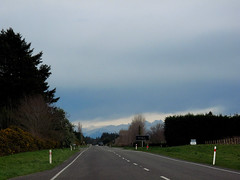
IMG_2271
Images, eqnz.chch.2010
Hehehe ..... did the surveyors get the road setout wrong? This previously straight road is now kinked across this previously unknown faultline along which the Saturday 4 September 2010 magnitude 7.1 earthquake originated.
IMG_2272
Images, eqnz.chch.2010
Hehehe ..... did the surveyors get the road setout wrong? This previously straight road is now kinked across this previously unknown faultline along which the Saturday 4 September 2010 magnitude 7.1 earthquake originated.
IMG_2274
Images, eqnz.chch.2010
The farmers in this area swore that this road was straight when they were returning from the pub on Friday 3 September 2010, the night before the magnitude 7.1 earthquake struck.
IMG_2273
Images, eqnz.chch.2010
The farmers in this area swore that this road was straight when they were returning from the pub on Friday 3 September 2010, the night before the magnitude 7.1 earthquake struck.
Geotechnical Aspects of the 2010 Darfield (Canterbury) Earthquake
Research papers, University of Canterbury Library
On 4 September 2010, a magnitude Mw 7.1 earthquake struck the Canterbury region on the South Island of New Zealand. The epicentre of the earthquake was located in the Darfield area about 40 km west of the city of Christchurch. Extensive damage was inflicted to lifelines and residential houses due to widespread liquefaction and lateral spreading in areas close to major streams, rivers and wetlands throughout Christchurch and Kaiapoi. Unreinforced masonry buildings also suffered extensive damage throughout the region. Despite the severe damage to infrastructure and residential houses, fortunately, no deaths occurred and only two injuries were reported in this earthquake. From an engineering viewpoint, one may argue that the most significant aspects of the 2010 Darfield Earthquake were geotechnical in nature, with liquefaction and lateral spreading being the principal culprits for the inflicted damage. Following the earthquake, an intensive geotechnical reconnaissance was conducted to capture evidence and perishable data from this event. This paper summarizes the observations and preliminary findings from this early reconnaissance work.
IMG_2320
Images, eqnz.chch.2010
The St John The Evangelist Catholic Church in Leeston was cordoned off due to damage suffered during the magnitude 7.1 earthquake that struck mid-Canterbury on Saturday 4 September 2010.
IMG_2317
Images, eqnz.chch.2010
The St John The Evangelist Catholic Church in Leeston was cordoned off due to damage suffered during the magnitude 7.1 earthquake that struck mid-Canterbury on Saturday 4 September 2010.
IMG_2269
Images, eqnz.chch.2010
The farmer swore that his fence was erected in a straingt line, but mother nature had other ideas! Aftermath of the Saturday 4 September 2010 magnitude 7.1 earthquake at the previously unknown faultline along which the quake originated.
IMG_2268
Images, eqnz.chch.2010
The farmer swore that his hedge was planted in a straingt line, but mother nature had other ideas! Aftermath of the Saturday 4 September 2010 magnitude 7.1 earthquake at the previously unknown faultline along which the quake originated.
IMG_2318
Images, eqnz.chch.2010
The magnitude 7.1 earthquake that struck mid-Canterbury on Saturday 4 September 2010 broke the tip of the spire of the St John The Evangelist Catholic Church in Leeston
IMG_2270
Images, eqnz.chch.2010
The farmer swore that his fence was erected in a straingt line, but mother nature had other ideas! Aftermath of the Saturday 4 September 2010 magnitude 7.1 earthquake at the previously unknown faultline along which the quake originated.
IMG_2267
Images, eqnz.chch.2010
The farmer swore that his fence and hedge were in a straingt line, but mother nature had other ideas! Aftermath of the Saturday 4 September 2010 magnitude 7.1 earthquake at the previously unknown faultline along which the quake originated.
IMG_2232
Images, eqnz.chch.2010
The ground slipped laterally at this previously unknown faultline across Highfield Road in mid-Canterbury, resulting in a relative displacement of at least 2 metres and the magnitude 7.1 earthquake on Saturday 4 September 2010. Note the now misaligned fence posts, hedge and road.
IMG_2395
Images, eqnz.chch.2010
Cracks have ripped through external columns of this 7 storey building (corner of Hereford Street / Manchester Street), and efforts are being made to shore up and strengthen it to save it from demolition after it suffered structural damage in the magnitude 7.1 earthquake that struck Christchurch on Saturday 4 September 2010.
IMG_2396
Images, eqnz.chch.2010
Cracks have ripped through external columns of this 7 storey building (corner of Hereford Street / Manchester Street), and efforts are being made to shore up and strengthen it to save it from demolition after it suffered structural damage in the magnitude 7.1 earthquake that struck Christchurch on Saturday 4 September 2010.
IMG_2394
Images, eqnz.chch.2010
Cracks have ripped through external columns of this 7 storey building (corner of Hereford Street / Manchester Street), and efforts are being made to shore up and strengthen it to save it from demolition after it suffered structural damage in the magnitude 7.1 earthquake that struck Christchurch on Saturday 4 September 2010.