Search
found 367 results
Images for tectonic; more images...

IMG_2441
Images, eqnz.chch.2010
The faultline cuts across Telegraph Road, leaving a kink in its originally straight alignment; aftermath of the magnitude 7.1 earthquake in mid-Canterbury on Saturday 4 September 2010.
IMG_2434
Images, eqnz.chch.2010
This originally straight farm fence has been laterally displaced at least 2 metres where it crosses the previously unknown faultline from which the Saturday 4 September 2010 earthquake originated.
IMG_2436
Images, eqnz.chch.2010
This originally straight farm fence has been laterally displaced at least 2 metres where it crosses the previously unknown faultline from which the Saturday 4 September 2010 earthquake originated.
IMG_2438
Images, eqnz.chch.2010
The faultline cuts across Telegraph Road, leaving a kink in its originally straight alignment; aftermath of the magnitude 7.1 earthquake in mid-Canterbury on Saturday 4 September 2010.
IMG_2444
Images, eqnz.chch.2010
The faultline cuts across Telegraph Road, leaving a kink in its originally straight alignment; aftermath of the magnitude 7.1 earthquake in mid-Canterbury on Saturday 4 September 2010.
IMG_2423
Images, eqnz.chch.2010
This originally straight farm fence has been laterally displaced at least 2 metres where it crosses the previously unknown faultline from which the Saturday 4 September 2010 earthquake originated.
IMG_2428
Images, eqnz.chch.2010
This originally straight farm fence has been laterally displaced at least 2 metres where it crosses the previously unknown faultline from which the Saturday 4 September 2010 earthquake originated.
IMG_2247
Images, eqnz.chch.2010
This originally straight farm fence has been laterally displaced at least 3 metres where it crosses the previously unknown faultline from which the Saturday 4 September 2010 earthquake originated.
IMG_2433
Images, eqnz.chch.2010
This originally straight farm fence has been laterally displaced at least 2 metres where it crosses the previously unknown faultline from which the Saturday 4 September 2010 earthquake originated.
IMG_2316
Images, eqnz.chch.2010
Collapsed silos at David Bell Daffodil Farm in Leeston; aftermath of the magnitude 7.1 earthquake that struck mid-Canterbury on Saturday 4 September 2010.
IMG_2442
Images, eqnz.chch.2010
The faultline cuts across Telegraph Road, leaving a kink in its originally straight alignment; aftermath of the magnitude 7.1 earthquake in mid-Canterbury on Saturday 4 September 2010.
IMG_2439
Images, eqnz.chch.2010
The faultline cuts across Telegraph Road, leaving a kink in its originally straight alignment; aftermath of the magnitude 7.1 earthquake in mid-Canterbury on Saturday 4 September 2010.
IMG_2392
Images, eqnz.chch.2010
Efforts are being made to shore up and strengthen this building (corner of Hereford Street / Manchester Street) to save it from demolition after it suffered structural damage in the magnitude 7.1 earthquake that struck Christchurch on Saturday 4 September 2010.
IMG_2426
Images, eqnz.chch.2010
This originally straight farm fence has been laterally displaced at least 2 metres where it crosses the previously unknown faultline from which the Saturday 4 September 2010 earthquake originated.
IMG_2431
Images, eqnz.chch.2010
This originally straight farm fence has been laterally displaced at least 2 metres where it crosses the previously unknown faultline from which the Saturday 4 September 2010 earthquake originated.
IMG_2422
Images, eqnz.chch.2010
Looking along this previously unknown faultline that runs through this paddock, note how the ground had heaved and subsided; magnitude 7.1 earthquake in mid-Canterbury on Saturday 4 September 2010.
IMG_2440
Images, eqnz.chch.2010
The faultline cuts across Telegraph Road, leaving a kink in its originally straight alignment; aftermath of the magnitude 7.1 earthquake in mid-Canterbury on Saturday 4 September 2010.
IMG_2154
Images, eqnz.chch.2010
Falling gable of the Anglican Community of the Sacred Name building left a gaping hole in the roof in the magnitude 7.1 earthquake that hit Christchurch on 4 September 2010. The chimney would have toppled as well had it not been braced.
IMG_2399
Images, eqnz.chch.2010
Steel frames are being used to shore the unstable facade of the St John the Baptist Church at Latimer Square while the building is being repaired and strengthened following the magnitude 7.1 earthquake that struck Christchurch on Saturday 4 September 2010.
IMG_2319
Images, eqnz.chch.2010
Damage to the St John The Evangelist Catholic Church in Leeston suffered during the magnitude 7.1 earthquake that struck mid-Canterbury on Saturday 4 September 2010.
IMG_2271
Images, eqnz.chch.2010
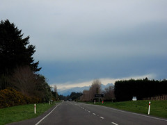
Hehehe ..... did the surveyors get the road setout wrong? This previously straight road is now kinked across this previously unknown faultline along which the Saturday 4 September 2010 magnitude 7.1 earthquake originated.
IMG_2272
Images, eqnz.chch.2010
Hehehe ..... did the surveyors get the road setout wrong? This previously straight road is now kinked across this previously unknown faultline along which the Saturday 4 September 2010 magnitude 7.1 earthquake originated.
IMG_2274
Images, eqnz.chch.2010
The farmers in this area swore that this road was straight when they were returning from the pub on Friday 3 September 2010, the night before the magnitude 7.1 earthquake struck.
IMG_2273
Images, eqnz.chch.2010
The farmers in this area swore that this road was straight when they were returning from the pub on Friday 3 September 2010, the night before the magnitude 7.1 earthquake struck.
Geotechnical Aspects of the 2010 Darfield (Canterbury) Earthquake
Research papers, University of Canterbury Library
On 4 September 2010, a magnitude Mw 7.1 earthquake struck the Canterbury region on the South Island of New Zealand. The epicentre of the earthquake was located in the Darfield area about 40 km west of the city of Christchurch. Extensive damage was inflicted to lifelines and residential houses due to widespread liquefaction and lateral spreading in areas close to major streams, rivers and wetlands throughout Christchurch and Kaiapoi. Unreinforced masonry buildings also suffered extensive damage throughout the region. Despite the severe damage to infrastructure and residential houses, fortunately, no deaths occurred and only two injuries were reported in this earthquake. From an engineering viewpoint, one may argue that the most significant aspects of the 2010 Darfield Earthquake were geotechnical in nature, with liquefaction and lateral spreading being the principal culprits for the inflicted damage. Following the earthquake, an intensive geotechnical reconnaissance was conducted to capture evidence and perishable data from this event. This paper summarizes the observations and preliminary findings from this early reconnaissance work.
IMG_2320
Images, eqnz.chch.2010
The St John The Evangelist Catholic Church in Leeston was cordoned off due to damage suffered during the magnitude 7.1 earthquake that struck mid-Canterbury on Saturday 4 September 2010.
IMG_2317
Images, eqnz.chch.2010
The St John The Evangelist Catholic Church in Leeston was cordoned off due to damage suffered during the magnitude 7.1 earthquake that struck mid-Canterbury on Saturday 4 September 2010.
IMG_2269
Images, eqnz.chch.2010
The farmer swore that his fence was erected in a straingt line, but mother nature had other ideas! Aftermath of the Saturday 4 September 2010 magnitude 7.1 earthquake at the previously unknown faultline along which the quake originated.
IMG_2268
Images, eqnz.chch.2010
The farmer swore that his hedge was planted in a straingt line, but mother nature had other ideas! Aftermath of the Saturday 4 September 2010 magnitude 7.1 earthquake at the previously unknown faultline along which the quake originated.
IMG_2318
Images, eqnz.chch.2010
The magnitude 7.1 earthquake that struck mid-Canterbury on Saturday 4 September 2010 broke the tip of the spire of the St John The Evangelist Catholic Church in Leeston