
Search
found 3460 results
Images for 2011 Christchurch earthquake; more images...


Getting Ready to Run
Images, UC QuakeStudies
A digitally manipulated image of a mannequin. The photographer comments, "During the Christchurch earthquake on 22 February 2011 a lot of people were seriously injured or killed because they run out of buildings. Falling masonry from the exterior of the buildings hit them, but if they had remained inside they would have probably been perfectly safe".
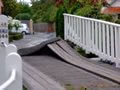
ADA Mesh Cities: Network, Space and Memory in the Transitional City
Research papers, University of Canterbury Library
In the aftermath of the 2010 and 2011 earthquakes, Christchurch, New Zealand is framed as a ‘transi- tional’ city, moving from its demolished past to a speculative future. The ADA Mesh Cities project asks what role media art and networks may play in the transitional city, and the practices of remembering, and reimagining space.
Twice Fallen
Images, UC QuakeStudies
A digitally manipulated image of a fallen headstone. The photographer comments, "Since the September 2010 earthquake in Christchurch, New Zealand a lot of the headstones have fallen, but sadly a lot have not been resurrected to their former places".
In-situ lateral load test performance of Christchurch houses
Research papers, The University of Auckland Library
There is very little research on total house strength that includes contributions of non-structural elements. This testing programme provides inclusive stiffness and response data for five houses of varying ages. These light timber framed houses in Christchurch, New Zealand had minor earthquake damage from the 2011 earthquakes and were lateral load tested on site to determine their strength and/or stiffness, and to identify damage thresholds. Dynamic characteristics including natural periods, which ranged from 0.14 to 0.29s were also investigated. Two houses were quasi-statically loaded up to approximately 130kN above the foundation in one direction. Another unidirectional test was undertaken on a slab-on-grade two-storey house, which was also snapback tested. Two other houses were tested using cyclic quasi-static loading, and between cycles snapback tests were undertaken to identify the natural period of each house, including foundation and damage effects. A more detailed dynamic analysis on one of the houses provided important information on seismic safety levels of post-quake houses with respect to different hazard levels in the Christchurch area. While compared to New Zealand Building Standards all tested houses had an excess of strength, damage is a significant consideration in earthquake resilience and was observed in all of the houses. http://www.aees.org.au/downloads/conference-papers/2015-2/
Hubbard, James, 1949- :Wishing you support, hope, love and happier times a…
Images, Alexander Turnbull Library
Shows a Christmas card from the cartoonist to the 'sick, bereaved, and the people of Christchurch, Pike River & Nelson'. Refers to the Canterbury earthquakes that have caused death, misery and uncertainty for many in the region, the Pike River mining tragedy and floods in the Nelson region. Quantity: 1 digital cartoon(s).
When River Banks Move
Images, UC QuakeStudies
The damaged Snell Place footbridge. A crack is visible at the apex of the span. The photographer comments, "Before the Christchurch earthquakes this bridge used to be just just 9 feet at high tide above the River Avon. Now with the ends pushed together it has probably moved up another 9 feet".
The Panel with Duncan Webb and Islay McLeod (Part 1)
Audio, Radio New Zealand
Topics - A magnitude 4.7 earthquake that rattled Wellington early this morning was the second to hit the capital in less than a week. Your ideas for economic measures to stimulate Christchurch's recovery continue to flow in.
Remembering the 22nd February 2011
Images, UC QuakeStudies
Graffiti on a wooden wall depicts a child pointing at a site across the street and reads "I remember when the Kazbah was over there." The photographer comments, "A local street artist has commemorated Christchurch's deadliest earthquake. The anniversary is tomorrow. Where the photograph was taken was the site of the Ozone Hotel, which has now gone as well. For some of us who live and work in the East of Christchurch the earthquake was not what happened in the City as we were almost unaware of it. We had no water, toilets and most of all no electricity for weeks. For myself petrol was low and with tales of all the petrol stations on our side of town being damaged we could not take the chance of venturing out on severely damaged roads to find no petrol and the possibility of not getting home. We walked around and saw the damage that was local to us. TJ's Kazbah was one that stood out. A building that had a beauty with its round tower standing proud and always looked well kept - it was now collapsed. Its tower, which was once pointing towards the sky was laying on its side. It had kept its shape, but had a lightning shaped crack through it. The one thing that kept us feeling almost normal through the coming weeks was The Press our daily paper still being delivered even though the Press building and staff had suffered so badly themselves.
Examining the spatial and temporal patterns of crime in pre- and post-eart…
Research papers, University of Canterbury Library
The 2010-2011 Canterbury Earthquakes brought devastation to the city of Christchurch and has irrevocably affected the lives of the city’s residents. Years after the conclusion of these earthquakes, Christchurch and its residents are well on the path to recovery. Crime has proven an ongoing topic of discussion throughout this period, with news reports of increased burglary and arson in areas left largely abandoned by earthquake damage, and a rise in violent crime in suburban areas of Christchurch. Following the body of research that has considered the reaction of crime to natural disasters, this research has sought to comprehensively examine and understand the effects that the Canterbury Earthquakes had on crime. Examining Christchurch-wide offending, crime rates fell over the study period (July 2008 to June 2013), with the exception of domestic violence. Aside from a momentary increase in burglary in the days immediately following the Christchurch Earthquake, crime rates (as of 2013) have remained largely below pre-earthquake levels. Using Dual Kernel Density Estimation Analysis, a distinct spatial change in pre-earthquake crime hotspots was observed. These changes included an enormous decrease in central city offences, a rise in burglary in the eastern suburbs, and an increase in assault in areas outside of the central city. Logistic regression analysis, using a time-compensated dependent variable, identified a number of statistically-significant relationships between per CAU crime rate change and factors measuring socio-demographic characteristics, community cohesion, and the severity of disaster effects. The significance of these findings was discussed using elements of Social Disorganisation Theory, Routine Activity Theory, and Strain Theory. Consistent with past findings, social order was largely maintained following the Canterbury Earthquakes, with suggestion that increased collective efficacy and therapeutic communities had a negative influence on crime in the post-earthquake period. Areas of increased burglary and assault were associated with large population decreases, suggesting a link with the dissolution of communities and the removal of their inherent informal guardianship. Though observed, the increase in domestic violence was not associated with most neighbourhood-level variables. Trends in crime after the Canterbury Earthquakes were largely consistent with past research, and the media’s portrayal.
Estimated seismic performance of a standard NZS3101:2006 RC office buildin…
Research papers, University of Canterbury Library
This paper discusses the seismic performance of the standard RC office building in Christchurch that is given as a structural design example in NZS3101, the concrete structures seismic standard in New Zealand. Firstly the push-over analysis was carried out to evaluate the lateral load carrying capacity of the RC building and then to compare that carrying capacity with the Japanese standard law. The estimated figures showed that the carrying capacity of the New Zealand standard RC office building of NZS3101:2006 was about one third of Japanese demanded carrying capacity. Secondly, time history analysis of the multi-mass system was performed to estimate the maximum response story drift angle using recorded ground motions. Finally, a three-dimensional analysis was carried out to estimate the response of the building to the 22nd February, 2011 Canterbury earthquake. The following outcomes were obtained. 1) The fundamental period of the example RC building is more than twice that of Japanese simplified calculation, 2) The example building’s maximum storey drift angle reached 2.5% under the recorded ground motions. The main purpose of this work is to provide background information of seismic design practice for the reconstruction of Christchurch.
Willburn Furniture and Restoration Needs Restoring
Images, UC QuakeStudies
A digitally manipulated image of furniture and machinery. The photographer comments, "This furniture restoration company got caught in the middle of the Christchurch earthquake and lost a whole wall. After constant exposure to the elements everything now needs a bit of restoration. They are now working in a different part of Christchurch, but their past can still be seen".
Full-scale Static and Dynamic Testing of Timber Frame Houses Damaged in th…
Research papers, University of Canterbury Library
Very little research exists on total house seismic performance. This testing programme provides stiffness and response data for five houses of varying ages including contributions of non-structural elements. These light timber framed houses in Christchurch, New Zealand had minor earthquake damage from the 2011 earthquakes and were lateral load tested on site to determine their strength and stiffness, and preliminary damage thresholds. Dynamic characteristics were also investigated. Various loading schemes were utilised including quasi-static loading above the foundation, unidirectional loading through the floor diaphragm, cyclic quasi-static loading and snapback tests. Dynamic analysis on two houses provided the seismic safety levels of post-quake houses with respect to local hazard levels. Compared with New Zealand Building Standards all the tested houses had an excess of strength, damage is a significant consideration in earthquake resilience and was observed in all of the houses. A full size house laboratory test is proposed.
Christchurch 'superhero' seeks funding to boost work
Audio, Radio New Zealand
Christchurch has its own social superhero and he's gone cap in hand to the council for funding. The self-styled lycra-clad superhero, known only at 'Flat Man', has been dropping care packages to people since the 2011 Canterbury earthquake. He also wants to be able to help schoolkids and anxious and stressed residents through their troubles. And to do this, he's now asking the Christchurch City Council for funding. He joins us now, and says "a cape is a must".
The preparedness and response of the population of Lyttelton, New Zealand,…
Research papers, University of Canterbury Library
Small, tight-knit communities, are complex to manage from outside during a disaster. The township of Lyttelton, New Zealand, and the communities of Corsair Bay, Cass Bay, and Rapaki to the east, are especially more so difficult due to the terrain that encloses them, which caused them to be cut-off from Christchurch, the largest city in the South Island, barely 10 km away, after the Mw 7.1 Darfield Earthquake and subsequent Canterbury Earthquake Sequence. Lyttelton has a very strong and deep-rooted community spirit that draws people to want to be a part of Lyttelton life. It is predominantly residential on the slopes, with retail space, service and light industry nestled near the harbour. It has heritage buildings stretching back to the very foundation of Canterbury yet hosts the largest, modern deep-water port for the region. This study contains two surveys: one circulated shortly before the Darfield Earthquake and one circulated in July 2011, after the Christchurch and Sumner Earthquakes. An analytical comparison of the participants’ household preparedness for disaster before the Darfield Earthquake and after the Christchurch and Sumner Earthquakes was performed. A population spatiotemporal distribution map was produced that shows the population in three-hourly increments over a week to inform exposure to vulnerability to natural hazards. The study went on to analyse the responses of the participants in the immediate period following the Chrsitchurch and Sumner Earthquakes, including their homeward and subsequent journeys, and the decision to evacuate or stay in their homes. Possible predictors to a decision to evacuate some or all members of the household were tested. The study also asked participants’ views on the events since September 2010 for analysis.
Manu Korihi News for 3 October 2011
Audio, Radio New Zealand
Ngai Tahu's property portfolio has taken a direct hit from the Christchurch earthquake - losing value and suffering damage; A Northland iwi says a decade long battle to protect a large ancient burial cave on Karikari peninsular north east of Kaitaia, has taken its toll on several hapu; A lecturer specialising in Maori criminal law is question the timing of a Maori Party co-leader's attack on the justice system; The Housing Minister, Phil Heatley, says a project to build three three bedroomed houses and two kaumatua flats on the Chatham Islands, will go some way to easing a housing issue for Maori residents.
Manu Korihi News for 3 October 2011
Audio, Radio New Zealand
A Northland iwi chair says a decade long battle against American owned Carrington Farms and the Far North District Council, has been financially and mentally taxing; A lecturer specialising in Maori criminal law is question the timing of a Maori Party co-leader's attack on the justice system; Ngai Tahu's property portfolio has taken a direct hit from the Christchurch earthquake - losing value and suffering damage; The Housing Minister says a project to build three three bedroomed houses and two kaumatua flats on the Chatham Islands, is a great example of iwi wanting to meet the needs of its people.
Sense of placelessness on the Christchurch periphery post-earthquake
Research Papers, Lincoln University
Following the 2010 and 2011 earthquakes Christchurch is undergoing extensive development on the periphery of the city. This has been driven in part by the large numbers of people who have lost their homes. Prior to the earthquakes, Christchurch was already experiencing placeless subdivisions and now these are being rolled out rapidly thanks to the efficiency of a formula that has been embraced by the Council, developers and the public alike. However, sprawling subdivisions have a number of issues including inefficient land use, limited housing types, high dependence on motor vehicles and low levels of resilience and no sense of place. Sense of place is of particular interest due to its glaring absence from new subdivisions and its growing importance in the literature. Research shows that sense of place has benefits to our feeling of belonging, well-being, and self-identity, particularly following a disaster. It improves the resilience and sustainability of our living environment and fosters a connection to the landscape thereby making us better placed to respond to future changes. Despite these benefits, current planning models such as new urbanism and transit-oriented design tend to give sense of place a low priority and as a result it can get lost. Given these issues, the focus of this research is “can landscape driven sense of place drive subdivision design without compromising on other urban planning criteria to produce subdivisions that address the issues of sprawl, as well as achieving the benefits associated with a strong sense of place that can improve our overall quality of life?” Answering this question required a thorough review of current urban planning and sense of place literature. This was used to critique existing subdivisions to gain a thorough understanding of the issues. The outcomes of this led to extensive design exploration which showed that, not only is it possible to design a subdivision with sense of place as the key driver but by doing this, the other urban planning criteria become easier to achieve.
Alternate Seating Arrangements
Images, UC QuakeStudies
Damaged seating in the QEII stadium. The photographer comments, "This is the QEII stadium in Christchurch. During the 22 February earthquake the stadium was severely damaged and looks like it will be demolished. Anyone in Bay 3 would have no need of the toilet after this happened".
The Shaken Suburbs: The changing sense of home and creating a new home aft…
Research papers, University of Canterbury Library
The 2010 and 2011 earthquakes in the region of Canterbury, New Zealand caused widespread damage and the deaths of 185 people. Suburbs on the eastern side of Christchurch and in the satellite town of Kaiapoi, 20 kilometres north of Christchurch, were badly damaged by liquefaction. The Canterbury Earthquake Recovery Authority (CERA), a government organisation set up in the wake of the earthquakes, began to systematically zone all residential land in 2011. Based on the possibility for land remediation, 7860 houses in Christchurch and Kaiapoi were zoned red. Those who were in this zone were compensated and had to buy or build elsewhere. The other zone examined within this research – that of TC3 – lies within the green zone. Residents, in this zone, were able to stay in their houses but land was moderately damaged and required site-specific geotechnical investigations. This research sought to understand how residents’ senses of home were impacted by a disaster and the response efforts. Focusing on the TC3 and red zone of the eastern suburbs and the satellite town of Kaiapoi, this study interviewed 29 residents within these zones. The concept of home was explored with the respondents at three scales: home as a household; home as a community; and home as a city. There was a large amount of resistance to the zoning process and the handling of claims by insurance companies and the Earthquake Commission (EQC) after the earthquakes. Lack of transparency and communication, as well as extremely slow timelines were all documented as failings of these agencies. This research seeks to understand how participant’s sense of home changed on an individual level and how it was impacted by outside agencies. Homemaking techniques were also focused on showing that a changed sense of home will impact on how a person interacts with a space.
Early disaster recovery: a guide for communities
Research Papers, Lincoln University
On September the 4th 2010 and February 22nd 2011 the Canterbury region of New Zealand was shaken by two massive earthquakes. This paper is set broadly within the civil defence and emergency management literature and informed by recent work on community participation and social capital in the building of resilient cities. Work in this area indicates a need to recognise both the formal institutional response to the earthquakes as well as the substantive role communities play in their own recovery. The range of factors that facilitate or hinder community involvement also needs to be better understood. This paper interrogates the assumption that recovery agencies and officials are both willing and able to engage communities who are themselves willing and able to be engaged in accordance with recovery best practice. Case studies of three community groups – CanCERN, Greening the Rubble and Gap Filler – illustrate some of the difficulties associated with becoming a community during the disaster recovery phase. Based on my own observations and experiences, combined with data from approximately 50 in-depth interviews with Christchurch residents and representatives from community groups, the Christchurch City Council, the Earthquake Commission and so on, this paper outlines some practical strategies emerging communities may use in the early disaster recovery phase that then strengthens their ability to ‘participate’ in the recovery process.
Fairfax Video, March 2014 (1)
Videos, UC QuakeStudies
A video of an interview with Alison Naylor about her flooded house on Francis Avenue. Naylor talks about the lack of communication from the Christchurch City Council. She says that the flooding is worse than the liquefaction from the 2010 and 2011 Canterbury earthquakes.
Photograph number UC 11-0372-46
Images, UC QuakeStudies
Silver Award recipients, Peter Jakowetz (second to the left) and Jason Pemberton (middle). Peter is from Christchurch and Jason was originally USA, then Hamilton. Pictured here with Vice-Chancellor Dr Rod Carr, Prime Minister John Key and Minister for Canterbury Earthquake Recovery Gerry Brownlee.
Tourists forced to stay in marae, arts centre in Wellington
Audio, Radio New Zealand
Hundreds of tourists have spent the night in makeshift accommodation in Wellington after fleeing earthquake hit Christchurch. The tourists were flown to the capital by the Royal New Zealand Airforce, many without passports, money and belongings left behind in hotels.
Rangiora Express
Audio, Radio New Zealand
One of the great community initiative's in Canterbury is the Rangiora Earthquake Express - where urgent help is still needed. These Rangiora volunteers have been up and running for sometime now, with daily runs into the Christchurch suburbs most desperately in need of water and other essential supplies.
Lyttelton port hopes to have core services back within week
Audio, Radio New Zealand
Lyttelton Port is still only operating at 40 percent of its full capacity, nine days after the Christchurch earthquake, but the Port company says its core services are all working and within a week it will be almost at full strength.
Jacquelyn Greenbank - Knitted & Knotted
Audio, Radio New Zealand
Intricate and imaginative are the knits which are pearled and planed away in an exhibition at the Dowse in Lower Hutt. Artist and Christchurch earthquake refugee Jacquelyn Greenbank talks to Lynn about her wonderful and whimsical contribution from her new home in Tauranga.
The Unswept Leaves of Chancery Lane
Images, UC QuakeStudies
A view down Chancery Lane through cordon fencing. A sign reading "No Entry" is posted on the fence, and fallen leaves have accumulated around the fence and buildings. The photographer comments, "Chancery Lane in the Christchurch CBD red zone looks like it has had no one through at all since the February earthquake".
Scott of the Antarctic
Images, UC QuakeStudies
A digitally manipulated image of the damaged statue of Scott which was removed from its original site beside Worcester Boulevard for safekeeping. The photographer comments, "During the February 2011 earthquake in Christchurch, New Zealand the statue of Robert Falcon Scott broke across the ankles and most of the statue came crashing to the ground. To commemorate a 100 years of association with Antarctica Christchurch council has laid out for viewing the statue in a prostrate position. I was lucky to encounter the statue before it was put into its glass display enclosure".
Christchurch Cathedral restoration cost jumps $51m
Audio, Radio New Zealand
The company running the restoration of Christchurch's Anglican Cathedral is confident it will be able to raise the extra $51 million still needed to finish the job, and says potential large donors are already being approached here and overseas. The building has sat derelict since the 2011 earthquake and now the cost to fix it has soared from an original estimate of $104 million to $154 million. Some Cantabrians are finding the price hard to justify. The director of the restoration project Keith Paterson speaks to Corin Dann.
Hymns on Sunday, 20 February 2022
Audio, Radio New Zealand
In this week’s programme we’re featuring evening hymns, and you can hear a setting of Psalm 23 – it’ll be the third in our series so far. We’re also commemorating the Feast Day of German theologian Martin Luther, and the 11th anniversary of the 2011 Christchurch earthquake.