Search
Images for house; more images...
Christchurch Earthquake 002
Images, eqnz.chch.2010
Fitzgerald Ave
20131110_8305_EOS M-27 Empty and overgrown (Day 314/365)
Images, eqnz.chch.2010
A house, one of the few still remaining in the Dallington Red Zone (Avonside Drive, Dallington). The area is "red zoned" due to land damage from earthquakes (mainly the February 22nd 2011 6.4 magnitude quake).
20130524_7208_1D3-50 Earthquake damage to a Hulverstone Drive "red zone" h…
Images, eqnz.chch.2010
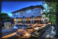
Awaiting demolition. Blue pipes are water supply to anyone still living on Hulverstone Drive.
Christchurch Earthquake 025
Images, eqnz.chch.2010
Kilmore St and Barbadoes St Intersection
Christchurch Earthquake 020
Images, eqnz.chch.2010
Kilmore St and Barbadoes St Intersection
Christchurch Earthquake 023
Images, eqnz.chch.2010
Kilmore St and Barbadoes St Intersection
Christchurch Earthquake 021
Images, eqnz.chch.2010
Kilmore St and Barbadoes St Intersection
Christchurch Earthquake 024
Images, eqnz.chch.2010
Kilmore St and Barbadoes St Intersection
Christchurch Earthquake 008
Images, eqnz.chch.2010
Fitzgerald Ave
Christchurch Earthquake 022
Images, eqnz.chch.2010
Kilmore St and Barbadoes St Intersection
Christchurch Earthquake 019
Images, eqnz.chch.2010
Kilmore St and Barbadoes St Intersection
Christchurch Earthquake 018
Images, eqnz.chch.2010
Kilmore St and Barbadoes St Intersection
Ground movement Pacific Park - Christchurch earthquake
Images, eqnz.chch.2010
20100905_3336_1D3-24 Ground movement Pacific Park - Christchurch earthquake A house in Pacific Park (Bexley) that borders the Bexley Wetlands. Land moved towards the wetlands and the closer to wetlands the more severe the damage. #382
It has started!
Images, eqnz.chch.2010
20140521_1080_1D3-24 It has started! Removal of the double-glazed windows is underway at my "red zone" house, now owned by the Government of New Zealand. Sold to CERA (the government agency) in October 2012 and has remained empty since, despite having little damage, apart from the tilt to the front from the land damage that occurred during the...
20130112_2568_G12-06 Why the land is zoned red! (012/365)
Images, eqnz.chch.2010
Water from the river at high tide crosses Evans Avenue and enters a now abandoned "red zone" house via the garage. Next door (to the left) is the garage containing a car that was destroyed by fire last week (see earlier photos).
Christchurch Earthquake 005
Images, eqnz.chch.2010
St Marys Church
Christchurch Earthquake 006
Images, eqnz.chch.2010
St Marys Church
20130328_1148_EOS M-49 T-Rex may have visited
Images, eqnz.chch.2010
The seismic survey truck T-Rex (from University of Texas) was in Bexley and Pacific Park a few days ago and may have left this calling card on the front lawn of my old "red zone" house. Obviously the geotechs will know what it means.
wairoa street red zone
Images, eqnz.chch.2010
one of Christchurch's abandoned suburbs. The land moved - bricks and block walls everywhere collapsed - two multi story buildings folded - 184 people died. Wooden framed houses largely stayed up, many concrete slabs cracked, power poles leaned in liquid ground, surface bubbled, services ruptured .... damage to the cbd still gets the most cover...
Canterbury Earthquake 2011
Images, eqnz.chch.2010
Iroquois Flying Over Our House (02.03.2011) Woolston Christchurch Canterbury New Zealand © 2011 Phil Le Cren Photo Taken With: Canon EOS 1000D + Canon EF/EF-S lenses + 10.1 effective megapixels + 2.5-inch TFT color LCD monitor + Eye-level pentamirror SLR + Live View shooting. + EOS Built-in Sensor cleaning system + ...
X Marks the Spot
Images, eqnz.chch.2010
What I found on a walk around the city Christchurch November 20, 2013 New Zealand. www.isaactheatreroyal.co.nz/ en.wikipedia.org/wiki/2011_Christchurch_earthquake
ChCh quake
Images, eqnz.chch.2010
The Christchurch Methodist Church van takes a hit from the falling gable end of the church.
20130524_7206_1D3-75 Vandalism to a vacant and yet to be demolished house.…
Images, eqnz.chch.2010
None
Canterbury Earthquake 2011
Images, eqnz.chch.2010
Our House - Liquefaction (22.02.2011) Woolston Christchurch Canterbury New Zealand © 2011 Phil Le Cren Photo Taken With: Canon EOS 1000D + Canon EF/EF-S lenses + 10.1 effective megapixels + 2.5-inch TFT color LCD monitor + Eye-level pentamirror SLR + Live View shooting. + EOS Built-in Sensor cleaning system + Wide-a...
20130207_2231_1D3-165 Sumner and "container alley"
Images, eqnz.chch.2010
Nearly 80 40 foot containers (most two high) protect Wakefield Avenue in Sumner from further rock falls. Behind these (to the left) are houses, church, bowling club, RSA (Returned Servicemens Association) and other community buildings that have been isolated now for nearly two years now. On the right upper third boundary (just behind two stand a...
Old Post Office Window with Watercolour Effect
Images, eqnz.chch.2010
The Old Lyttelton Post Office, opened in 1874, showing damage after a series of earthquakes hit Christchurch and Lyttelton over the last 9 months. In the shadow of a broken house, Down a deserted street, Propt walls, cold hearths, and phantom stairs, And the silence of dead feet — Locked wildly in one another's arms I saw two lovers meet. ...
Christchurch Earthquake - Last Days For Manchester Courts
Images, eqnz.chch.2010
Manchester Courts, a seven-storey building on the corner of Hereford and Manchester Streets, is a category one historic place built in 1905-1906 that up until the 7.1 earthquake, housed offices. News of the scheduled demolition provoked an emotional response from the people of Christchurch. UPDATE 14 October 2010: A group of residents is campaig...
Christchurch Earthquake - Manchester Courts, Last Days
Images, eqnz.chch.2010
Manchester Courts, a seven-storey building on the corner of Hereford and Manchester Streets, is a category one historic place built in 1905-1906 that up until the 7.1 earthquake, housed offices. News of the scheduled demolition provoked an emotional response from the people of Christchurch. UPDATE 14 October 2010: A group of residents is campaig...
20141005_2502_1D3-40 CTV site
Images, eqnz.chch.2010
The sign reads: The CTV Building was headquarters of Canterbury Television (CTV) and also housed King’s Education language School, a medical clinic, Hair Consultants, Relationship Services and a nursing school. On February 22nd 2011 the building collapsed as a result of a major earthquake. Sadly, 115 people who were in the building lost their l...
20130611_7558_EOS M-22 Cut in half and onto the truck (Day 162/365)
Images, eqnz.chch.2010
19 Velsheda Street, Pacific Park, Bexley is about to be trucked out.


