
Search
found 316 results
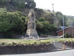
Images for 22 February 2011 earthquake; more images...


Digital Photograph: Earthquake Damage to Lyttelton Roman Catholic and Diss…
Images, Canterbury Museum
One landscape colour digital photograph taken on 30 June 2011 showing signs warning of the danger posed by unstable headstones in Lyttelton Roman Catholic and Dissenters (Public) Cemeteries in Reserve Terrace. Several toppled headstones and collapsed grave surrounds are visible in the photograph. Looking east from the main gate. The Lyttelton c...
Digital Photograph: Flyers in the Window of the Lyttelton Information Cent…
Images, Canterbury Museum
One portrait colour digital photograph taken on 19 November 2011 showing the flyers in the window of the Lyttelton Information Centre on Oxford Street. The building was closed from 22 February 2011 until April 2013 due to the danger posed by the neighbouring building and then while repairs were scheduled and carried out. The flyers provided a sn...
Hard Hat: SCIRT
Images, Canterbury Museum
One white hard hat with a SCIRT logo at the front.
High Viz Vest: SCIRT
Images, Canterbury Museum
One orange High Viz vest with a SCIRT logo on the front.
Digital Photograph: Former Convent of Our Lady of Mercy, Exeter Street, an…
Images, Canterbury Museum
One landscape colour digital photograph taken on 30 June 2011 showing earthquake damage to the former Convent of Our Lady of Mercy and to the Catholic Church of St Joseph the Worker. Photograph taken from St. Davids Street The sense of loss felt when confronted with the collapse or demolition of an historic building is compounded when that bui...
Digital Photograph: Mitre Hotel
Images, Canterbury Museum
One landscape colour digital photograph taken on 26 May 2013 on the corner of Norwich Quay and Canterbury Street, Lyttelton. The photograph shows the Mitre Hotel surrounded by temporary fencing. Three years after the 2010-2011 earthquakes there are still many uncertainties about which buildings can or will be retained. These buildings, or parts...
Digital Photograph: Lyttelton Main School
Images, Canterbury Museum
One landscape colour digital photograph taken on 26 May 2013 of Lyttelton Main School. The photograph is taken from St Davids Street looking northwest. One of the broader consequences of the 2010-2011 Canterbury earthquakes has been the Ministry of Education’s Shaping Education – Future Direction Review of Schools in the Greater Christchurch Ar...
Power Cable Section
Images, Canterbury Museum
One section of new power cable with black rubber casing and one end cut; manufacturer's mark reads 'General Cable NZ X-90 Electrical Cable 600/1000V'. Example of new power cables that needed to be laid following the 22 February earthquake. High voltage power cables in Christchurch are located underground, meaning that the areas which experience...
Book: All Fall Down, Christchurch’s Lost Chimneys
Images, Canterbury Museum
Multicolour softcover book titled "All Fall Down, Christchurch’s Lost Chimneys" by Geoffrey Rice with a title and a full colour photograph depicting a broken chimney on the spine and front cover; published by the Canterbury University Press, University of Canterbury, Christchurch, 2011. Geoffrey Rice, retired Professor of History from the Unive...
Digital Photograph: North side of London Street, Lyttelton
Images, Canterbury Museum
One landscape colour digital photograph taken on 19 November 2011 showing part of the north side of London Street. The properties visible in the photograph are (from left to right) Tommy Changs Café, Canterbury Street, site of theatre erected for the Loons Circus Theatre Company production of Macbeth (being dismantled), Lyttel Arthouse (closed),...
Digital Photograph: North side of London Street, Lyttelton
Images, Canterbury Museum
One landscape colour digital photograph taken on 19 November 2011 showing buildings on London Street. Visible in the photograph (left to right) are Bells Pharmacy - relocated into a converted house with law firm MacTodd on the upper floor, Portico (gift shop), Tommy Changs Cafe, and the edge of the Lyttelton Petanque Club Gap Filler initiative. ...
Digital Photograph: Corner of London and Canterbury Streets, Lyttelton
Images, Canterbury Museum
One landscape colour digital photograph taken on 19 November 2011 showing the site of the Albion Hotel/ Ground Delicatessen. After the demolition of the building the site was used for a Gap Filler initiative called the Lyttelton Petanque Club. The photograph shows the temporary furniture, landscaping and public Petanque court. The site formerl...
Digital Photograph: North side of London Street, Lyttelton
Images, Canterbury Museum
One landscape colour digital photograph taken on 19 November 2011 showing part of the north side of London Street. The properties visible from left to right are: Himalaya Design (obscured), Coffee Culture (downstairs), J Voyce and Co Ships Providore (upstairs), empty shop, and Lyttel Piko Organic and Wholefoods The Lyttelton streetscape has cha...
Digital Photograph: North side of London Street, Lyttelton
Images, Canterbury Museum
One landscape colour digital photograph taken on 19 November 2011 showing part of the north side of London Street. The properties visible from left to right are: part of Lyttel Piko Organic and Wholefoods, Satchmo Café Pizzabar, Milly May and Snoclothes New Zealand. The empty section was formerly occupied by No. 6 Cafe. The Lyttelton streetsc...
Digital Photograph: Looking east from Norwich Quay, Lyttelton
Images, Canterbury Museum
One landscape colour digital photograph taken on 19 November 2011 looking east from Norwich Quay from approximately the base of Canterbury Street. Visible in the photograph are the partially deconstructed former Lyttelton Harbour Board Offices, the Holcim Cement Silos, the Oxford Street Railway Overbridge, Lyttelton Port of Christchurch's storag...
Digital Photograph: Shadbolt House, Norwich Quay, Lyttelton
Images, Canterbury Museum
One portrait colour digital photograph taken on 19 November 2011 showing Shadbolt House prior to its demolition. Architect Lyttelton's tallest building before its demolition was built in 1961 as the offices of the Lyttelton Harbour Board. At the time it was demolished the building was known as Shadbolt House and was owned by Independent Fisherie...
Digital Photograph: Earthquake damage to searchlight emplacements, Godley …
Images, Canterbury Museum
One landscape colour digital photograph taken on 26 May 2013 showing the southern cliffs of Godley Head. Taken from the middle of the shipping channel. Some earthquake damage to the cliffs is visible. There were several major rock falls along the coastal cliffs near Christchurch and Lyttelton Harbour. At Godley Head these caused damage to the W...
Borehole Sediment Samples: Canterbury Museum
Images, Canterbury Museum
Eight white corflute boxes of sediment samples from the borehole drilled adjacent to the Canterbury Museum Rolleston Avenue facade following the 22 February 2011 earthquake. Project number 52160, Bore hole BH02 These sediment samples are from machine drilled borings taken from the land near the Rolleston Avenue facade of Canterbury Museum. The ...
Award: Canstruction Christchurch
Images, Canterbury Museum
One glass trophy presented to SCIRT IST to mark winning the Jurors Favourite Category in the 2014 Canstruction Christchurch competition.
Digital Photograph: Lyttelton Ambulance Station, north side of London Stre…
Images, Canterbury Museum
One landscape colour digital photograph taken on 19 November 2011 showing buildings on London Street. Visible in the photograph (left to right) are Lyttelton Ambulance Station and Bells Pharmacy - relocated into a converted house with law firm MacTodd on the upper floor. Discussions have been held between Lyttelton Police, St John Ambulance and...
Digital Photograph: Grubb Cottage, London Street, Lyttelton
Images, Canterbury Museum
One landscape colour digital photograph taken on 19 November 2011 showing Grubb Cottage on London Street. The rear portion of this building was built in 1851 and is regarded as one of the oldest buildings in Canterbury. It was sold in 2006 to the Christchurch City Council and vested in the Grubb Cottage Heritage Trust. In August 2013 the buildi...
Digital Photograph: Corner of London and Canterbury Streets, Lyttelton
Images, Canterbury Museum
One landscape colour digital photograph taken on 19 November 2011 showing the corner of London and Canterbury Streets. Visible in the photograph (left to right) are the Lyttelton Library, Freemans Dining Room, Ray White Real Estate and Min Sargison Real Estate on London Street. The photograph is looking to the southeast. The site of the Timebal...
Digital Photograph: Temporary Artwork on the corner of London and Canterbu…
Images, Canterbury Museum
One landscape colour digital photograph taken on 19 November 2011 showing a temporary artwork on the site of the Albion Hotel/ Ground Delicatessen. After the demolition of the building the site was used for a Gap Filler initiative called the Lyttelton Petanque Club. The photograph shows a temporary artwork created from used bricks, probably from...
Digital Photograph: The Loons (Lyttelton Working Mens' Club), Canterbury S…
Images, Canterbury Museum
One landscape colour digital photograph taken on 19 November 2011 showing temporary propping of the Lyttelton Working Mens' Club/ The Loons. Built in 1909 the building has had a variety of uses including a garage and the Lyttelton Waterside Workers Social Club. More recently the Lyttelton Working Mens' Club has provided rehearsal and performanc...
Digital Photograph: Lyttelton Sea Foods, Norwich Quay, Lyttelton
Images, Canterbury Museum
One landscape colour digital photograph taken on 19 November 2011 showing the temporary premises of Lyttelton Sea Foods in a relocatable building on Norwich Quay. The building is located on the site of the Lyttelton Hotel. Also visible in the photograph are (left to right) the side of Shadbolt House, the rear of the Pacifica Building which was t...
Digital Photograph: Lyttelton Bakery, corner Norwich Quay and Canterbury S…
Images, Canterbury Museum
One landscape colour digital photograph taken on 19 November 2011 showing the temporary premises of Lyttelton Bakery in a relocatable building on Norwich Quay. The building is located on the site of the Royal Hotel. Also visible in the photograph are (left to right up Canterbury Street) Lyttelton Service Station, Samo, Lyttelton Telephone Exchan...
Digital Photograph: Artwork on the Site of the Harbourlight Theatre, Londo…
Images, Canterbury Museum
One portrait colour digital photograph taken on 23 July 2011 showing the artwork by Trent Hiles erected on the site of the Harbourlight Theatre on London Street. The artwork presents part of James K Baxter's poem 'High Country Weather' using the international code of signal flags. The artwork was installed as a Gap Filler project. The artwork r...
Digital Photograph: Demolition of former Library and Fire Station, corner …
Images, Canterbury Museum
One landscape colour digital photograph taken on 6 September 2011 showing the demolition of 2 Sumner Road, the former library and fire station. This building was a private residence at the time of its demolition. Photograph taken looking north on Oxford Street. Also visible in the photograph are the Lyttelton Information Centre, an entrance to ...
Digital Photograph: National Memorial Service
Images, Canterbury Museum
One landscape colour digital photograph taken on 18 March 2011 showing the crowd gathered in Hagley Park for the National Memorial Service. On 18 March 2011, the National Christchurch Memorial Service was held as an official remembrance to those who lost their lives during the 6.3 magnitude earthquake on 22 February 2011. As well as being atten...
Digital Photograph: Godley Head
Images, Canterbury Museum
One landscape colour digital photograph taken on 26 May 2013 showing the southern cliffs of Godley Head, taken from the middle of the shipping channel. Some earthquake damage to the cliffs is visible. There were several major rock falls along the coastal cliffs near Christchurch and Lyttelton Harbour. At Godley Head these caused damage to the ...