
A photograph of University of Canterbury Geology staff and students using ground penetrating radar (GPR) to survey land on the Greendale fault line.

A photograph of University of Canterbury Geology student Matt Cockcroft using ground penetrating radar (GPR) to survey land on the Greendale fault line.

A photograph of University of Canterbury Geology staff and students using ground penetrating radar (GPR) to survey land on the Greendale fault line.
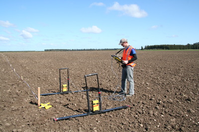
A photograph of University of Canterbury Geology student Matt Cockcroft using ground penetrating radar (GPR) to survey land on the Greendale fault line.

A photograph of University of Canterbury Geology students Zach Whitman and Dewiyani Bealing using ground penetrating radar equipment to survey land on the Greendale fault line.
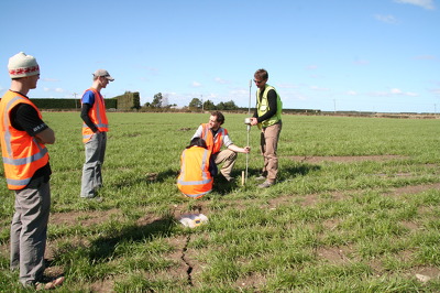
A photograph of University of Canterbury Geology staff and students using a dynamic cone penetrometer to measure soil strength of a paddock on the Greendale fault line.

A photograph of University of Canterbury Geology students using ground penetrating radar equipment to survey land on the Greendale fault line. From left: Matt Cockcroft, Zach Whitman and Dewiyani Bealing.

A photograph of University of Canterbury Geology students using ground penetrating radar equipment to survey land on the Greendale fault line. From left: Matt Cockcroft, Zach Whitman and Dewiyani Bealing.

A photograph of University of Canterbury Geology students using ground penetrating radar equipment to survey land on the Greendale fault line. From left: Matt Cockcroft, Zach Whitman and Dewiyani Bealing.

A photograph of University of Canterbury Geology staff and students using ground penetrating radar (GPR) to survey land on the Greendale fault line. From left: Thomas Wilson, Zach Whitman and Matt Cockcroft.

A photograph of University of Canterbury Geology staff and students using ground penetrating radar (GPR) to survey land on the Greendale faultline. From left: Thomas Wilson, Dewiyani Bealing, Zach Whitman and Matt Cockcroft.

The result of the magnitude 7.1 Christchurch earthquake at 4.35am on September 4th 2010.
Taken from Dallington Terrace looking towards Avonside Drive. This pumping station used to be level. When the tide is in that flax bush on the bend appears to be growing from the middle of the river, suggesting the land has slumped about a meter.

20100904_3309_1D3-24 Christchurch earthquake
Wairoa Street
Another web site used this image (with a link to this Flickr page), so the view count sky rocketed.
CERA (Canterbury Earthquake Recovery Authority)/Tonkin & Taylor also used this image on page 13 of a Land Damage presentation on 23/06/11. This was also released as a PDF. A few mo...

The north end of the bridge on Gayhurst Road. During the earthquake, the bridge was forced about 15 centimetres towards the river, the land falling away under the road. Fencing has been placed around the footpath, and the road filled and resealed so that it can still be used by traffic.