
A map of Christchurch soils.
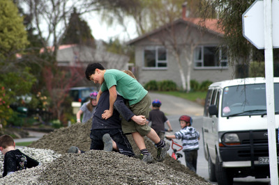
Children playing on a pile of gravel in a residential area following the September earthquake.

A photograph of a wire fence at the border of 406 Oxford Terrace. 406 Oxford Terrace is the former site of Donna Allfrey's house which was demolished after her land was zoned Red. In front of the fence, gravel has been spread over the ground.

A photograph of a wire fence that has been placed at the border of 406 Oxford Terrace. 406 Oxford Terrace is the former site of Donna Allfrey's house which was demolished after her land was zoned Red. Behind the fence, gravel has been spread over the ground.

An elaborate graffiti tag sprayed on a wall beside a demolition site on Tuam Street. A collection of abandoned objects lie on the site. The photographer comments, "Graffiti spotted in the Christchurch earthquake red zone. What I liked was the odd mixture of bits and bobs around it".

According to the sign it can take about 30 minutes to walk from the entry point (near the small statue) to the centre and out again. What you can do with a few thousand old bricks and gravel. See next photo for more detail.

According to the sign it can take about 30 minutes to walk from the entry point (here) to the centre and out again. That is without stepping across the gaps between bricks. What you can do with a few thousand old bricks and gravel!

Prior to the earthquakes (mainly the February 22 2011 event) this park bench was at track level. Shortly after the February quake someone in the council did the sums and realised that the area near the Avon River had dropped between a metre and 1.4m (about 4 foot), so a rush job by contractors shifted in many tonnes of rock and gravel to raise a...