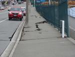
A photograph of repaired cracks on Governors Bay Road.

A photograph of repaired cracks on Governors Bay Road.

A photograph of repaired cracks on Governors Bay Road.

A photograph of cracks in the ground near Governors Bay Road.

A photograph of cracks in the ground near Governors Bay Road.

A photograph of cracks in the ground near Governors Bay Road.

A photograph of cracks in the ground near Governors Bay Road.

A photograph of cracks in the ground near Governors Bay Road.

A photograph captioned by Paul Corliss, "Port Hills Road factories, post drill and glue of cracks".

A photograph captioned by Paul Corliss, "Port Hills Road factories, post drill and glue of cracks".

A photograph captioned by Paul Corliss, "Port Hills Road factories, post drill and glue of cracks".

A photograph captioned by Paul Corliss, "Port Hills Road factories, post drill and glue of cracks".

A photograph captioned by Paul Corliss, "Port Hills Road factories, post drill and glue of cracks".

A photograph captioned by Paul Corliss, "Port Hills Road factories, post drill and glue of cracks".

A photograph captioned by Paul Corliss, "Port Hills Road factories, post drill and glue of cracks".

A photograph of a picnic table near Governors Bay Road. The concrete pad underneath has cracked.

A photograph of a picnic table near Governors Bay Road. The concrete pad underneath has cracked.

A photograph of a crack in the concrete pad underneath a picnic table near Governors Bay Road.

A photograph of a concrete pad under a picnic table near Governors Bay Road. The concrete has shifted in the ground.

A view down Papanui Road to Victoria Street, with the Port Hills in the background. The road is closed at the intersection of Victoria Street and Bealey Avenue, and diggers are working beside a damaged building.

20130125_1749_1D3-400 Road Closed 1
The Lyttelton side of Evans Pass is closed (since the earthquake 23 months ago - 22/02/11). Prior to the road tunnel (through the Port Hills) opening in the early 1960s this was the main access road to the port of Lyttelton.
#3072

Liquefaction silt surrounding a power pole in Ferry Road, next to a cut-out of a smiling and waving David Carter, National MP for the Port Hills electorate.

Liquefaction silt surrounding a power pole in Ferry Road, next to a cut-out of a smiling and waving David Carter, National MP for the Port Hills electorate.

A digitally manipulated image of a excavator claw tangled with reinforcing cable, with a damaged concrete building in the background. The photographer comments, "The monster destroying the earthquake broken buildings close to the Lyttelton tunnel".

A photograph of staff from Abseil Access in the car park outside their office on Quakers Quay in Woolston. The staff are standing next to a trailer full of rocks which they have gathered from the Port Hills. The rocks will be painted and used to define the boundaries of Rock on Eastside, an outdoor lounge and art space on the corner of Linwood Avenue and Aldwins Road.

One landscape colour digital photograph taken on 25 February 2011 showing earthquake damage to the road, footpath and retaining wall on Norwich Quay. The photograph is taken from below the intersection of Norwich Quay and Canterbury Street looking east along Norwich Quay. Unlike most areas of Christchurch, land damage on the Port Hills was due ...

There are occasional sewerage spills into the Avon River while all the sewer and road repairs are carried out. This rock wall was level and well above high tide level prior to the eathquakes. All the houses that can been seen here (except for those on the distant Port Hills) are in the suburban "red zone" and are still to be demolished.