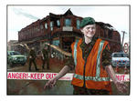
Oil and mixed media (ground up bricks and mortar and cordon tape) painting of an army woman (Private Rachel Crins of the 2nd Canterbury NMWC Battalion) behind a cordon restricting access to building damage from September 4, 2010 Canterbury earthquake.

The September Canterbury earthquake. These pictures were taken of Colombo Street in Sydenham. A lot of masonry in this area has been damaged/fallen down.
Ascot TV. This has relocated further south on Colombo Street. Apparently their building on Cranford Street was also severely damaged.
Note: these photos were taken on a cellphone; mind the qu...

The September Canterbury earthquake. These pictures were taken of Colombo Street in Sydenham. A lot of masonry in this area has been damaged/fallen down.
Angus Donaldson copy service. This has moved down the road on Colombo Street. It is now sharing the premises with Penny Lane Records.
Note: these photos were taken on a cellphone; mind the qu...

Aftermath of September 4th Earthquake in Canterbury (area covers Christchurch City) NZ. Damage to bridge on Spencerville Road crossing the Lower Styx river.

Canterbury Brewery, St Asaph Street, Christchurch.
File reference:
CCL-2012-02-20-CanterburyBrewery-February-2012 DSC_144.JPG
From the collection of Christchurch City Libraries.

Canterbury Brewery, St Asaph Street, Christchurch.
File reference:
CCL-2012-02-20-CanterburyBrewery-February-2012 DSC_147.JPG
From the collection of Christchurch City Libraries.

Canterbury Brewery, St Asaph Street, Christchurch.
File reference:
CCL-2012-02-20-CanterburyBrewery-February-2012 DSC_142.JPG
From the collection of Christchurch City Libraries.

Canterbury Brewery, St Asaph Street, Christchurch.
File reference:
CCL-2012-02-20-CanterburyBrewery-February-2012 DSC_146.JPG
From the collection of Christchurch City Libraries.

Canterbury Brewery, St Asaph Street, Christchurch.
File reference:
CCL-2012-02-20-CanterburyBrewery-February-2012 DSC_143.JPG
From the collection of Christchurch City Libraries.

Canterbury Brewery, St Asaph Street, Christchurch.
File reference:
CCL-2012-02-20-CanterburyBrewery-February-2012 DSC_145.JPG
From the collection of Christchurch City Libraries.

Canterbury Earthquake 04/09/10
Christchurch
New Zealand

Canterbury Earthquake 04/09/10
Christchurch
New Zealand

Canterbury Earthquake 04/09/10
Christchurch
New Zealand

Canterbury Earthquake 04/09/10
Christchurch
New Zealand

Canterbury Earthquake 04/09/10
Christchurch
New Zealand

Canterbury Earthquake 04/09/10
Christchurch
New Zealand

Canterbury Earthquake 04/09/10
Christchurch
New Zealand

Canterbury Earthquake 04/09/10
Christchurch
New Zealand

Canterbury Earthquake 04/09/10
Christchurch
New Zealand

Canterbury Earthquake 04/09/10
Christchurch
New Zealand

Canterbury Earthquake 04/09/10
Christchurch
New Zealand

Canterbury Earthquake 04/09/10
Christchurch
New Zealand

Canterbury Earthquake 04/09/10
Christchurch
New Zealand

Canterbury Earthquake 04/09/10
Christchurch
New Zealand
Canterbury Earthquake 04/09/10
Christchurch
New Zealand

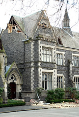
One landscape colour digital photograph taken on 3 March 2011 showing earthquake damage to the Lyttelton Times Building on Gladstone Quay. Also visible on the left of the photograph is the side of the adjoining British Hotel. Three years after the 2010-2011 earthquakes there are still many uncertainties about which buildings can or will be ret...

Damage from the Christchurch 7.1 earthquake on 4th Sept 2010

A photograph of SPCA Wellington vehicles parked on the intersection of Lichfield and Manchester Streets after the 22 February 2011 earthquake. In the background, the earthquake damage to the Tower Chambers building can be seen.

Soft cover 57 page publication detailing the experience and rescue of Ann Bodkin from the Pyne Gould Corporation building following the 22 February 2011 earthquake. Account of her experiences of being trapped post 22 February 2011 earthquake.
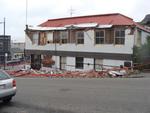
One landscape colour digital photograph taken on 25 February 2011 showing earthquake damage to the premises of Ground Delicatessen on the corner of Canterbury and London Streets. The photograph shows the building's Canterbury Street façade. This building was initially built around 1864 as the Albion Hotel. After many modifications and changes ...