
A photograph of earthquake damage to a road in Christchurch. A hole has been filled with gravel, and a road cone placed on top. In the background, cracks and liquefaction can be seen.

PWS-2011-01-19-DSC7418
Innes Road Shops Mairehau
PWS-2010-09-18-DSC2462

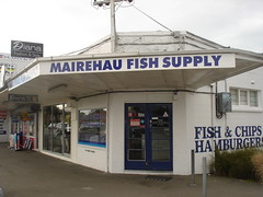
Innes Road Shops Mairehau
PWS-2010-09-18-DSC2463

A damaged road island on Avonside Drive. Paving stones have been removed and stacked on the island. A road cone sits at the end.

Damage to River Road in Richmond. The road surface is badly cracked and slumped, and liquefaction silt covers part of the road. The photographer comments, "Liquefaction in River Rd. This is minor compared to many streets in town".

A photograph of damaged buildings on Gladstone Quay and Norwich Quay.

A photograph of damage to the former Lyttelton Borough Council Chambers.

A photograph of damaged buildings on Gladstone Quay and Norwich Quay.

A photograph of the earthquake damage to St Paul's Church on Gayhurst Road. The tiles towards the back of the building have lifted.

A photograph of the earthquake damage to St Paul's Church on Gayhurst Road. The tiles towards the back of the building have lifted.

A photograph of a damaged building. The photograph is captioned by Paul Corliss, "Norwich Quay, Lyttelton".

Damage to a block of flats, with silt from liquefaction around the footpath, and road cones outside the property. The fence has been spray painted with the words "All units damaged. Keep out".

Damage to a block of flats, with silt from liquefaction around the footpath, and road cones outside the property. The fence has been spray painted with the words "All units damaged. Keep out".

Havent really posted any of my images of the quake damage was taking a look through tonight and came across this which i quite enjoyed.

Post February 22 Earthquake Damage
PWS-2011-03-09-DSC9956

Post February 22 Earthquake Damage
PWS-2011-03-09-DSC9955

Post February 22 Earthquake Damage
PWS-2011-03-09-DSC9954

Damage to the A and T Burt building on Ferry Road in Woolston. Masonry has collapsed from the top section of the building's front wall, exposing its ceiling.

A view down Robson Avenue in Avonside showing damage to the road surface and the footpath that has resulted from the 4 September 2010 earthquake.

A view down Robson Avenue in Avonside showing damage to the road surface and the footpath that has resulted from the 4 September 2010 earthquake.

Cars driving over the damaged Gayhurst Road Bridge. The approach to the bridge has been re-sealed, but gaps at the sides of the road show the relative movement of bridge and land.

Cars driving over the damaged Gayhurst Road Bridge. The approach to the bridge has been re-sealed, but gaps at the sides of the road show the relative movement of bridge and land.

A damaged road surface filled in with gravel. In the background is a cemetery.

A damaged dairy on the corner of Edgeware Road and Barbadoes Street. Part of the brick facade has fallen, collapsing the awnings. Bricks litter the road.

A photograph of damaged fencing in a paddock next to Highfield Road in Darfield.

A photograph of damaged fencing in a paddock next to Highfield Road in Darfield.

A photograph of damage to Highfield Road, showing the tar stretched across a crack.

A photograph of soil uplift and damaged fencing next to Highfield Road in Darfield.

A photograph of soil uplift and damaged fencing next to Highfield Road in Darfield.