
Photograph captioned by Fairfax, "Aerial pics of the fault line which ruptured causing Saturday's 7.1 earthquake".

Photograph captioned by Fairfax, "Aerial pics of the fault line which ruptured causing Saturday's 7.1 earthquake".

Photograph captioned by Fairfax, "Aerial pics of the fault line which ruptured causing Saturday's 7.1 earthquake".

Photograph captioned by Fairfax, "Aerial pictures of earthquake damage in Christchurch. Corner of Victoria Street and Bealey Avenue".

Photograph captioned by Fairfax, "Aerial pictures of earthquake damage in Christchurch. Victoria Street".

Photograph captioned by Fairfax, "Aerial pictures of earthquake damage in Christchurch. Cranford Street".

Photograph captioned by Fairfax, "Aerial pictures of earthquake damage in Christchurch. Cranford Street".

Photograph captioned by Fairfax, "Aerial pictures of earthquake damage in Christchurch".

Photograph captioned by Fairfax, "Aerial pictures of earthquake damage in Christchurch. Victoria Street".

Photograph captioned by Fairfax, "Aerial pics of the fault line which ruptured causing Saturday's 7.1 earthquake".

Photograph captioned by Fairfax, "Earthquake in Christchurch".

Photograph captioned by Fairfax, "Earthquake in Christchurch. Corner of Manchester Street and Worcester Street".

A graph comparing changes property values across Christchurch suburbs.

Photograph captioned by Fairfax, "Aerial pics of the fault line which ruptured causing Saturday's 7.1 earthquake".

Photograph captioned by Fairfax, "Earthquake in Christchurch. Aerial view of earthquake damage in Christchurch".

Photograph captioned by Fairfax, "Aerial pics of the fault line which ruptured causing Saturday's 7.1 earthquake".

Photograph captioned by Fairfax, "Aerial pictures of earthquake damage in Christchurch. Victoria Street".

Photograph captioned by Fairfax, "Aerial pics of the fault line which ruptured causing Saturday's 7.1 earthquake".

Paul Nicholls from Digital Media Group DMG with his creation Christchurch earthquake Map. Website: www.christchurchquakemap.co.nz.

Paul Nicholls from Digital Media Group DMG with his creation Christchurch earthquake Map. Website: www.christchurchquakemap.co.nz.

Members of the University of Canterbury's Digital Media Group in their temporary office in the NZi3 Building.

Paul Nicholls from Digital Media Group DMG with his creation Christchurch earthquake Map. Website: www.christchurchquakemap.co.nz.

Mayor Bob Parker being interviewed by the media in the foyer of the Christchurch Art Gallery, the temporary headquarters of Civil Defence after the 22 February 2011 earthquake.

Mayor Bob Parker being interviewed by the media in the foyer of the Christchurch Art Gallery, the temporary headquarters for Civil Defence after the 22 February 2011 earthquake.

Mayor Bob Parker being interviewed by the media in the foyer of the Christchurch Art Gallery, the temporary headquarters for Civil Defence after the 22 February 2011 earthquake.

Mayor Bob Parker being interviewed by the media in the foyer of the Christchurch Art Gallery, the temporary headquarters for Civil Defence after the 22 February 2011 earthquake.

Mayor Bob Parker being interviewed by the media in the foyer of the Christchurch Art Gallery, the temporary headquarters for Civil Defence after the 22 February 2011 earthquake.

Mayor Bob Parker being interviewed by the media in the foyer of the Christchurch Art Gallery, the temporary headquarters for Civil Defence after the 22 February 2011 earthquake.

A member of the University of Canterbury's Digital Media Group in their temporary office in the NZi3 Building.
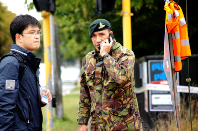
A soldier outside the cordon around the CBD talks on a portable telephone, while a media reporter waits for entry.