
A photograph of the earthquake damage to 90 Lichfield Street.

A compliation of aerial photographs of the CBD Red Zone.

A photograph of a cleared site on Madras Street.

Two stone roof points lie on the lawn beside the Cranmer Centre.

A photograph of the earthquake damage to 194 Hereford Street.

A photograph of the earthquake damage to 127 Worcester Street.

Damage in a stairwell inside a house in St Albans.

Graphs comparing residential property prices across Christchurch and New Zealand.

The Mushroom Building in the College of Engineering being demolished.

A photograph of the earthquake damage to the Whitcoulls Building.

Damage to the Nurse Maude Building in the city centre.

A photograph of the earthquake damage to 772 Colombo Street.

A photograph of details of 386-400 Colombo Street.

Ceiling damage inside the Starbucks in Cashel Mall.

Detail of an apartment complex that has been cordoned off.

Workers adding ceiling panels to the space under the library.

A map showing the revised route for the Santa Parade.

A truck dumps rubbish.

A photograph of a demolition site on Gloucester Street.

A photograph of the earthquake damage to 115 Lichfield Street.

A photograph of the earthquake damage to 116 Lichfield Street.

A photograph captioned by Paul Corliss, "Mount Pleasant Yacht Club".

Graphs comparing residential property prices across Christchurch and New Zealand.

A photograph of the earthquake damage to 217 Tuam Street.

Detail of damage to the Cathedral of the Blessed Sacrament.
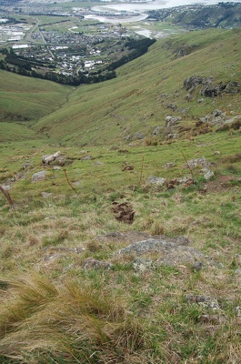
A photograph of a gully in the Port Hills.
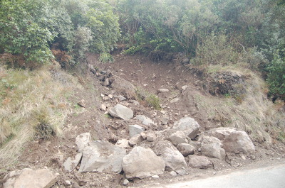
A photograph of recent rockfall in the Port Hills.

A photograph of the Strange's Building on High Street.

A photograph captioned by Paul Corliss, "Porritt Park".

A photograph of a damaged building on Tuam Street.