None

Laura Young and I tying down tarps over the hole in the roof. We did what we could to tie it down with tension and weigh it down with bricks tied to the tarps. Why? Because gale-force winds are predicted for tomorrow (Sunday) and rain on Tuesday.

These were scattered across the park.

None

None

The magnitude 7.1 Christchurch earthquake broke off an enormous chunk of Castle Rock in the Port Hills which has tumbled down towards the Lyttelton tunnel.
View from Morgan's Valley (-43.578037° 172.714828°).

Pws-2010-09-04-dsc01754

A view 4 weeks after the 7.1 magnitude earthquake in Christchurch.
St Johns Church corner of Hereford Street and Latimer Square.
Given a bit of a HDR process to add some of what I was "feeling" at the time.

Band Together - Concert for Canterbury
www.bandtogetherforcanterbury.co.nz
23rd October 2010
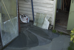
Free concrete in Hagley Park following the 4th September 2010 earthquake

Shop Damage
Ferry Road
Woolston
Christchurch
Canterbury
New Zealand
© 2010 Phil Le Cren
Photo Taken With:
Canon EOS 1000D
+ Canon EF/EF-S lenses
+ 10.1 effective megapixels
+ 2.5-inch TFT color LCD monitor
+ Eye-level pentamirror SLR
+ Live View shooting.
+ EOS Built-in Sensor cleaning system
+ Wide-area 7 point AF with center ...

Buildings in Riccarton damaged in the earthquake.

None

None

None

None

Christchurch Earthquake Aftermath
PWS-2010-09-08-DSC01949

Christchurch Earthquake Aftermath
PWS-2010-09-19-DSC02598

Christchurch Earthquake Aftermath
PWS-2010-09-11-DSC02212

Colombo Street between Moorhouse and Brougham.

Brickwork is visible under the road

Demolition (Deconstruction) of the partially pancaked multi story car park above the old Smith City building. Taken from the Moorhouse-Colombo Street flyover.

Sadly the Chapel has been badly damaged in the magnitude 6.3 earthquake that hit Christchurch 22 February 2011 - see photo at www.flickr.com/photos/geofftrotter/5570195671/in/photostr...
The Rose Historic Chapel formerly St Mary’s Convent Chapel is the sole su...

Taken soon after the 6.3 magnatude quake hit Christchurch 22 February 2011. Done in HDR to capture some of the "feeling" of what I felt.

The CTV collapse is the worst and most devastating, from what I saw of the CBD yesterday.

Photo taken Jan 2011 as the church is demolished.

Another hole has appeared in the street where a building has been demolished. Selwyn Dealers next door sensibly moved all their stock away from the adjoining wall just in case.

Pws-2010-12-27-dsc6443

Pws-2010-12-27-dsc6373

None

None
